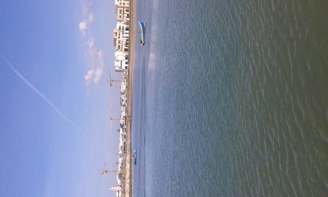
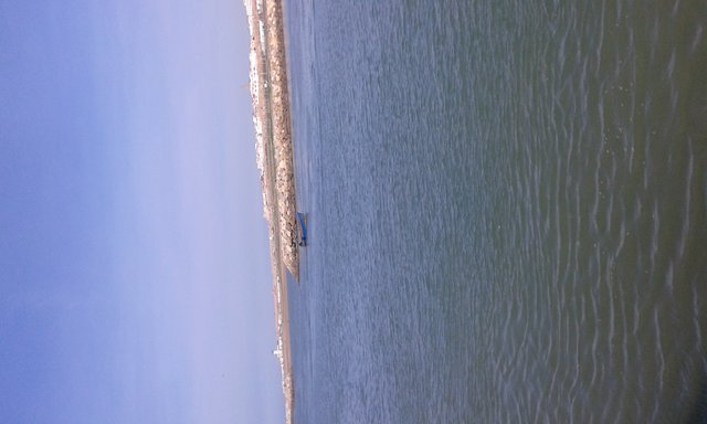
{{Abu rakrak}} river in morocco
It is a river of 240 kilometers, originating from the Mediterranean Atlas (Mount Metorzakan, Khemisset province); one of the most important tributaries of Wadi Kru (which originates from the province of Khenifra), its two subdivisions, Wad Akkrash and Wadi Kribila . The river flows into the Atlantic Ocean, at the level of the cities of Rabat and Salé.
The river discharge rate is 23 cubic meters per second, while its water basin covers an area of 10,000 square kilometers, and its annual water resources amount to 674 million cubic meters annually. 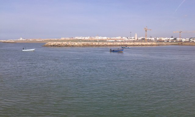
Historically:
The earliest traces of human presence in the Buraqqur basin date back to 165,000 years, according to the remains of the human species discovered in 1934 at the sites of Al-Kubaybat and Dar Al-Qayed Belaroussi. Archaeological research in the cave of Dar al-Sultan, southwest of Rabat, indicates a human presence in the region between the Atari and Neolithic periods.
Since the fourth century BC, the Phoenicians built the site of Salé, which became an important commercial center, similar to the rest of the Phoenician (and later Carthaginian) sites that flourished in the Moroccan Atlantic coast. Sala was a commercial center for the marketing of agricultural products such as wool, leather and wheat. In the Roman period, the river Bourqur formed the southern border of the Roman Empire and was built on the southern side of the city of Salé Cologne (Shala), which was one of the most important Roman cities in Moritania, during the second century AD
In the ninth century AD, the site of Shala became the capital of the Emirate of Beni Yafran. From the 11th and 12th centuries, the capital of Buraqqur became an important commercial, military and strategic place, and it was built along the successive states of Morocco. In the eleventh century, the Almoravids built the Odea Kasbah, on the southern bank. The reconstruction of the two banks in the Almohad era continued, which was known as the construction of the Old Mosque (Rabat) and the Great Mosque (Salé), and the development and defensive fortification of the river port, to serve as a main base for military campaigns towards Andalusia.
In the Marinian era, the estuary was known as the important engineering construction, beginning in 1269, especially in Salé and Shala, where the river was connected to an inland port, through a water channel that penetrates the Maraisa Gate in Salé. Marin.
In the 17th century, Buraq was associated with the boom in maritime piracy, which reached its peak during the period of the Republic of Burjurk (1627-1668). This phase was characterized by a significant change in the demographic structure of the two shores of the two shores, following the resort of a large number of Moriskis expelled from Andalusia to the region, and also the prosperity of urban and economic thanks to the proceeds of piracy.
Etymology:
In the Roman era, the river was known as the Sala River, meaning the salty river. It was named Wadi Sala in the tracts and kingdoms of al-Bakri, and in Ibn Huql and Ibn 'Adhari, while al-Idrisi called it a short picnic. As for the current name, Borrera, it emerged from the thirteenth century AD, and historians are more likely to represent it as amazigh in the sense of gravel.