Theory Ancients Roads - From Atlantis to Lemuria
Hi my friends, I want to share my theory about Atlantis and Lemuria using Google Earth/Google Maps and the last Earth Pole Shift. Please enjoy and give me feedbacks.
Ancients Roads
From Atlantis to Lemuria
- Introduction
- Maps and possible locatioins
- Gathering Clues
- Where to start?
- Following Anchients Roads
- Back on track
- Going Back
- Found more Roads
- Welcome to Lemuria
- Last day
- New World Rise
Introduction
Almost everyone already heard the Myth of Atlantis, a mystic Island that sunk into the ocean.
Lemuria is another mystic place known as the lost Pacific continent.
Let’s consider that these places are not a myth. If Atlantis and Lemuria really existed where it was located and what caused its extinction?
One of the very first mentions to Atlantis remote to the philosopher Plato, mentioning that Atlantis was a very powerful and high developed society unlike any other nation of the known world that conquer lands at Europe and Africa more than 9000 years before his time.
We can find all around Earth a lot of Megalithic temples and structures that until today no one could explain how it was build, like America, Asia and Egypt Pyramids, Machu Picchu, India Temples and some underwater structures and huge statues.
If an ancient society had technology to build this huge temples and a global natural disaster occurred, this structures should left some traces at the ocean.
Maps and possible locations
Starting this journey to decipher this mystery let’s consider the possible locations using old maps.
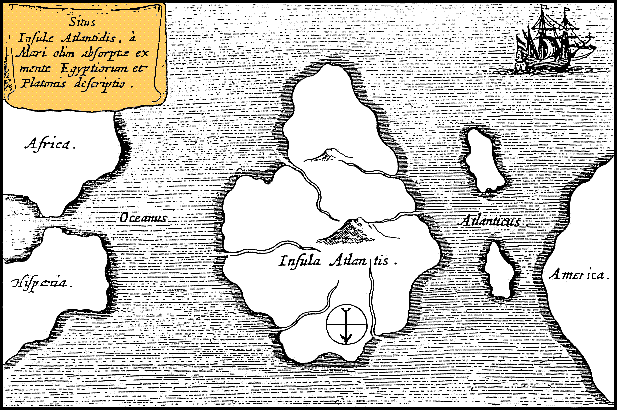
According to this ancient map, it shows Atlantis was between America and Africa. Several writes have speculated that Antarctica is the site of Atlantis while others proposed that Caribbean locations and areas in the Pacific.
Others ancients maps show Lemuria been a large continent at the Pacific Ocean, between Oriental Africa and Australia, a place that nowadays have only few islands.
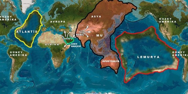
According to the map, Lemuria should be a very large land continent, how it’s possible such a large continent disappear without leaving any clue? The Earth had to suffer a huge catastrophic event.
Gathering Clues
Considering that Atlantis was a very developed society, they should have built structures as houses, buildings and others structures around the world. We know that around the globe we have a lot of constructions that no one can explain how it was build.
Places like Africa, Peru, Asia and many others places have this kind of structures that is very hard to define how it was build.
Underwater cities were also discovery, usually with very large statues and temples. The Pyramids of Yonaguni-Jima, located off coast of Japan within 250 feet from sea floor. Dwarka, located Gulf of Cambay - India, situated 131 feet beneath ocean surface. Cleopatra’s Palace, Alexandria in Egypt, believed that cast into the sea by an earthquake over 1500 years ago.
Considering this clues, to find the true about Atlantis, we must look for large structures beneath ocean surface.
Where to start?
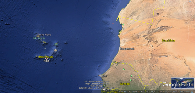
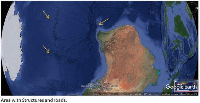
Maps show Atlantis should be located between America and Africa, let’s start searching that region.
Analyzing next map, we can see some islands far from the continent. Let’s move west and see if we can identify something.
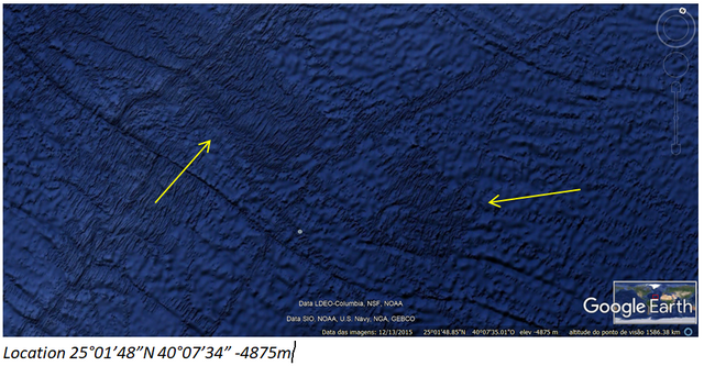
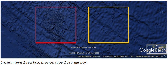
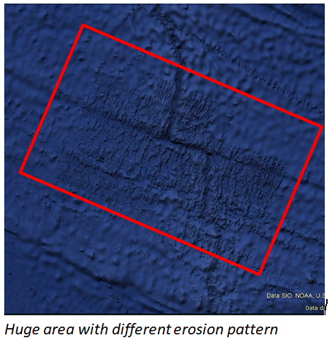
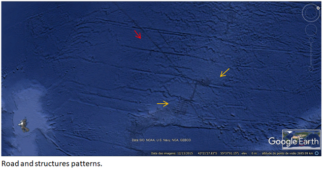
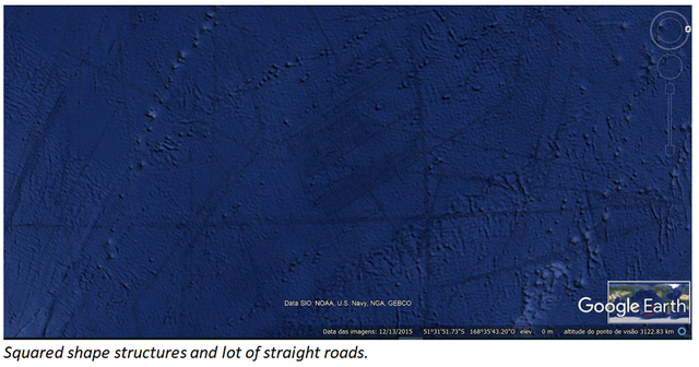
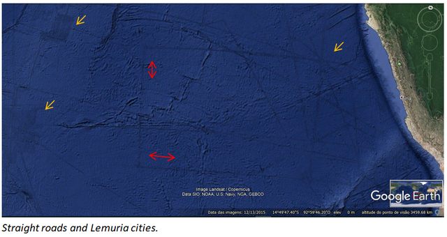
Using this satellite picture and NOAA US Navy data, we can notice different kind of erosion and some marks and lines.
Two different pattern of the erosion (point in yellow) caught my attention and seems that some straight lines point in different directions. As usually nature don’t make straight lines let’s follow it.
Following Roads
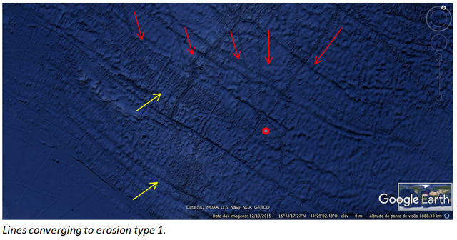
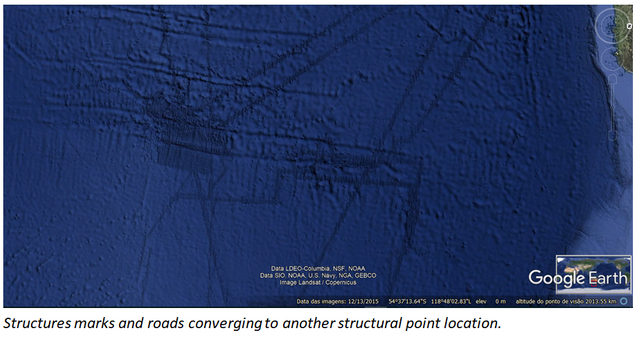
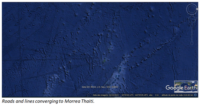
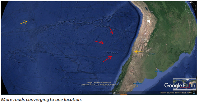
Moving south from our last location and following one of the straight lines, you can notice that more lines start to convert to the same point (point in red).

Seems that these roads convert to nowhere (red dot), but we still can see more lines and more squared shapes erosion that is different patter form its surrounds.
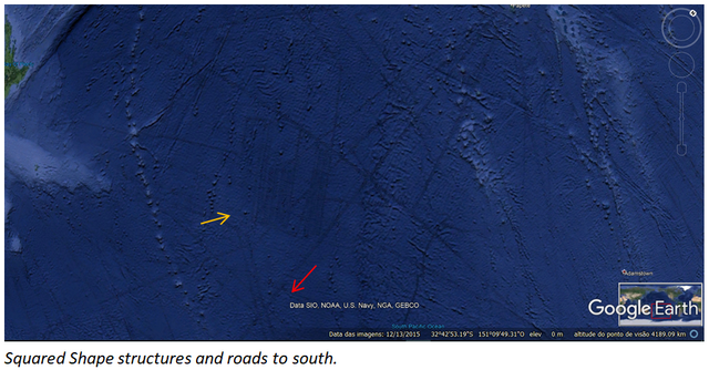
Increasing altitude so we can see all this area and see if we can get another direction we can notice that erosion made a great job at this region, craving lot of canyons marks and undefined landscape.
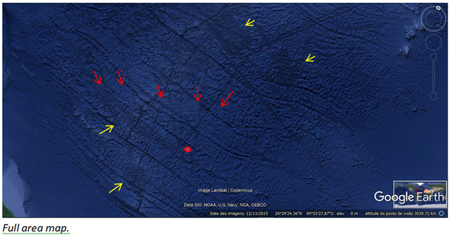
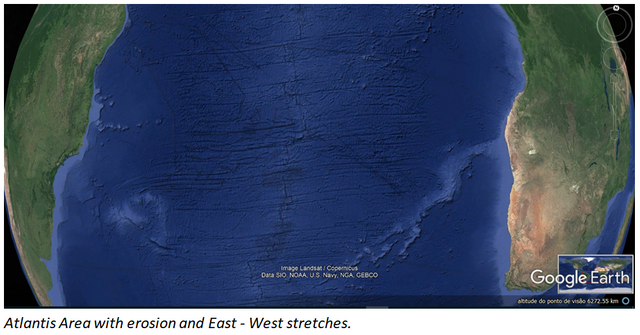
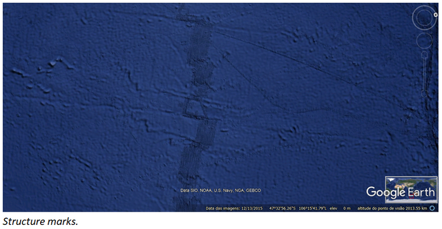
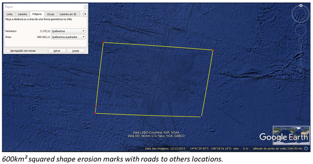
Moving south we can see a pattern of erosion but look that, others type 1 erosion.
Calculating this type 1 erosion area, we get more than 152.000 km². This area is larger than New York State.
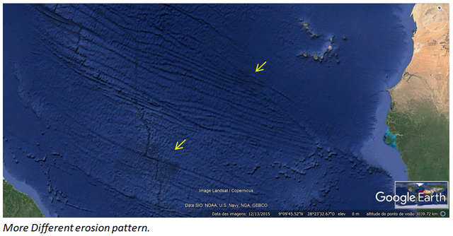
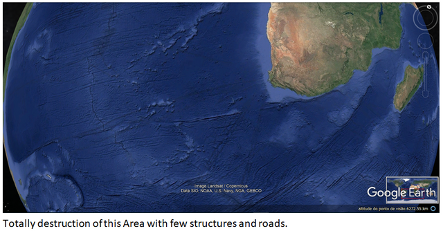
As we continue moving south, this type 1 erosion and pattersn continue appearing until South Africa.
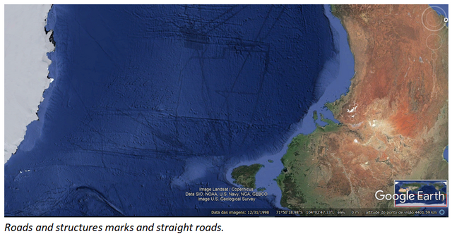
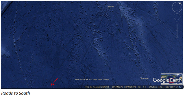
Arriving at South Africa, seems like that we lost track of that road, but wait, maybe it change direction. Let’s now move west and see if we can track it back.
Back on track
We can see more roads converging to another point location.
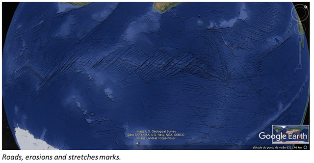
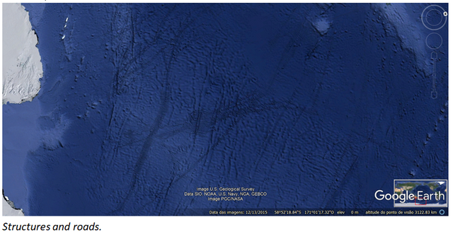
Let’s zoom in and see if we can identify more type 1 patters. What is that? Does not look like type 1 pattern, its different this time and seems that it’s not aligned. Maybe an earthquake moves it along the time.
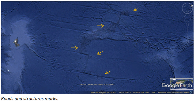
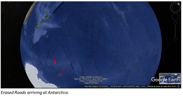
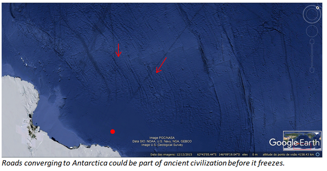
Some lines point to Antarctica and something is missing at conversion point. But Australia appears. Let’s check the other side of Australia.
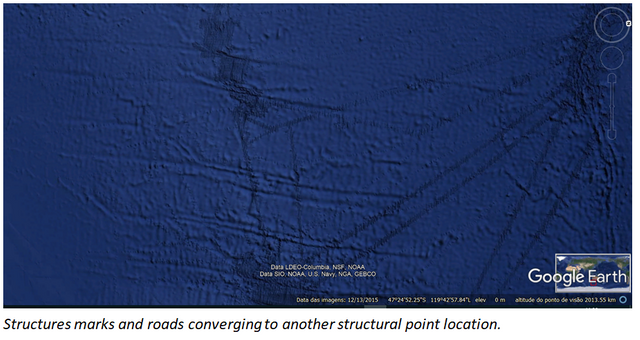
More Roads
As this last road didn’t take us to any other type of patter, let’s go back and see if we can find a new way and continue this journey.
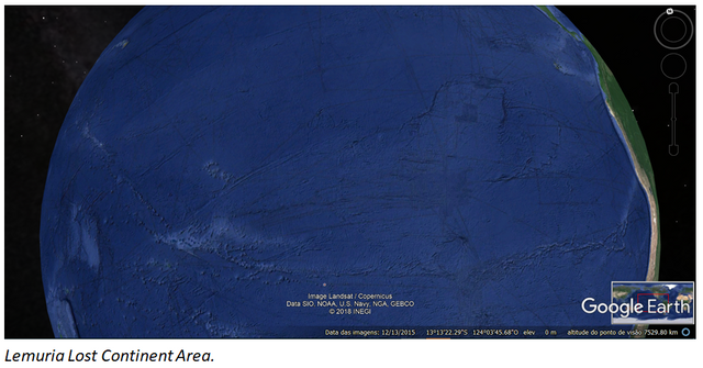
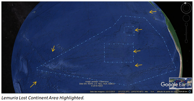
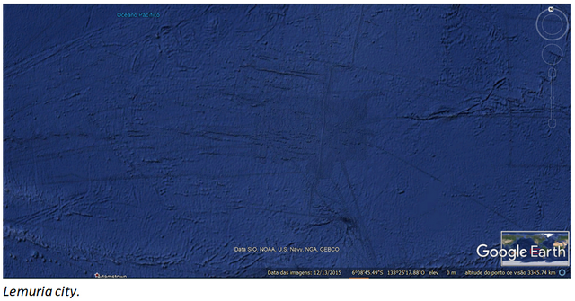
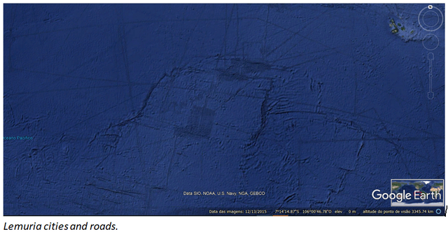
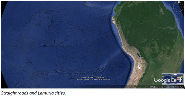
Welcome to Lemuria
Lemuria was a huge continent, looks like we found it.
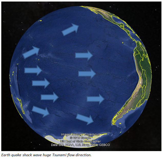
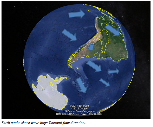
Last Day
What could have happen to Earth to make such a big disaster to vanish from earth Atlantis and Lemuria?
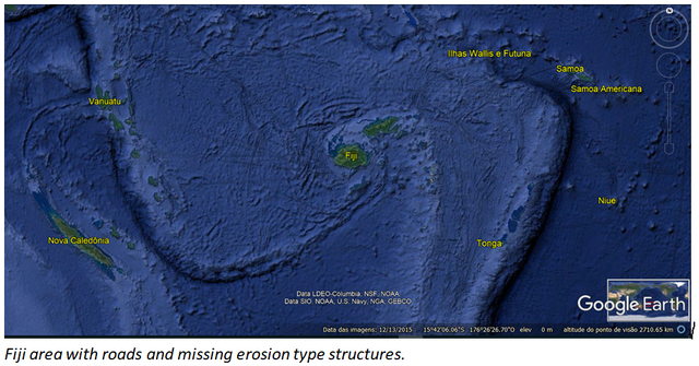
Let’s check out Fiji region. Fiji land formation looks like a spiral, and have a large land displacement.
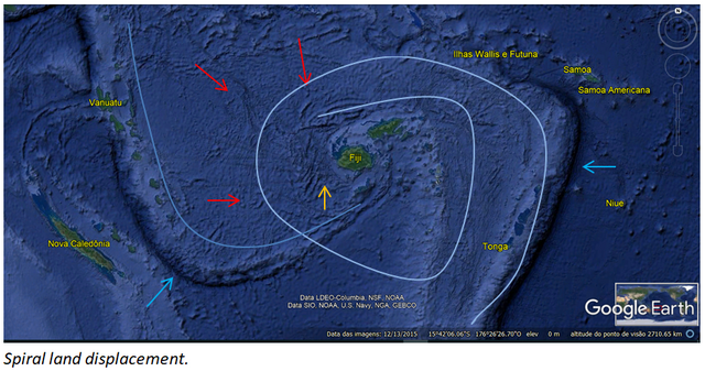
If this was a center of an earthquake it could have made very large damage around, and it’s very near Lemuria. But how it could affect also Atlantis, very far away from here?
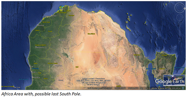
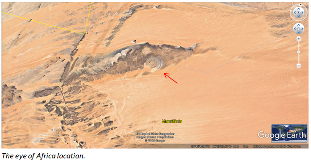
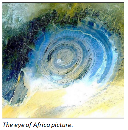
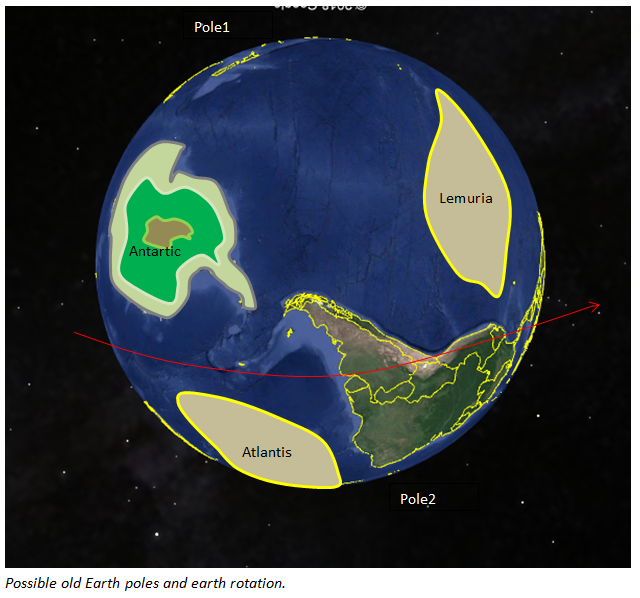
If it’s not only an earthquake and a bigger event was the cause of this? My theory is that this was during last Earth Pole Shift. Getting Fiji position and see its antipode location we arrive at Mali, Africa. We can’t see any different landmark that could lead us to it, but it’s very near from Mauritania, a place that have a very interesting spot, the eye of Africa, an elliptical dome with 25miles (40 km) diameter.
This could start a sequence of events on Earth that start spinning in different direction making the whole globe under earthquakes and one big Tsunami. A huge catastrophic event that vanished Lemuria and Atlantis Island forever, and also change the world to the way we know now.
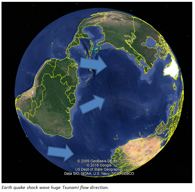
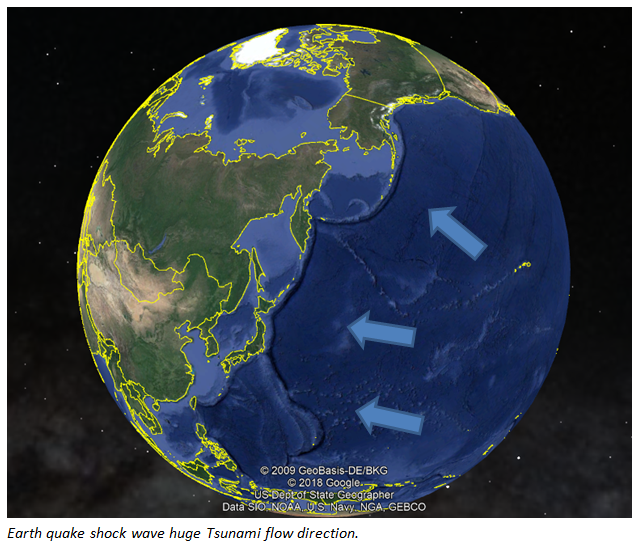
New World Rise
When the Earth start spinning the way it is today, the centripetal force make the old poles to stretch, and new south pole and north pole freeze. This could explain all that stripes we see in equator region from East to West.
What do you think about this theory? Write your suggestion and others ideas.
Credits: Google Images, Google Earth Images, NOAA US Navy Data.