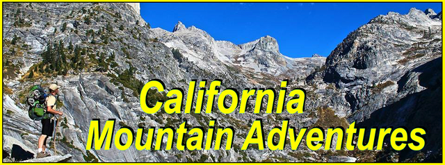
My California - The Southern Desert Divide

For this weeks Show Us Your California contest by @socalsteemit I head up into the San Jacinto mountains for a three day backpacking trip on...
The Desert Divide!!

On this trip I joined my mom and my uncle for the first few days of a longer trip that they had planned along the Pacific Crest Trail(PCT). Last year my uncles wife unfortunately lost her long fight with cancer. She died on her 70th birthday and for her 70th year she had wanted to hike 70 miles on the PCT. And so my uncle wanted to honor her wish by carrying her ashes for those 70 miles. So him and my mom planned this trip and distributed her ashes in certain spots along the trail as they went. The full trip was 8 days, but I was able to join them for the first three, doing the section known as the southern Desert Divide. The Desert Divide is essentially the southern half of the San Jacinto mountains and it runs north/south with peaks ranging from 6800' to 7800' that divide the inland valleys from the low desert, as the name implies. I had hiked the northern part of the Desert Divide with a friend years ago, but had never hiked the southern portion, so I was really excited to get to check it out!
We started at the Fobes trailhead and hiked up the trail above Fobes ranch to Fobes saddle which is essentially the mid-point of the divide. From the saddle we headed south on the PCT. In this section we ran into a bunch of overgrown brush and down trees. We had been warned about this but luckily most of the obstacles were actually north of the saddle so what we had to go through wasn't too bad. Once we got through all that the trail climbed up eventually topping out at Palm View peak(7,123'). The actual peak was a little ways off the trail and required some more brush and log obstacles, and unfortunately the peak didn't really have a great view as the name would have you think. But it was still cool to check it out and my uncle left some ashes there. From Palm View peak the trail headed down, first though pine/fir forest then through open areas of manzanita. Along the way there was a cool rock outcrop which I decided to stop and climb up. The view there was better than the peak, but unfortunately it was a hazy/overcast day down below us so the view still wasn't as great as it could have been. From there I dropped the last bit down the trail to the junction with the Cedar Springs trail. We took the Cedar Springs trail and headed down the east side of the divide. After about a mile of steep up and down rollercoasting trail we arrived at the springs. Cedar springs is aptly named as there is a great fresh water spring with a bunch of huge cedar trees all around it. Also it's a great spot to camp so we dropped our packs and picked out a good spot to setup camp. There was another hiker there when we got there and we talked with him for a bit before he went and setup his camp not far from ours. After camp was setup we filled our water at the springs and then spent a little time checking out the area. I found a deer skeleton which I'm guessing was the victim of a mountain lion and I also found a cool rock outcrop that had some nice views and I hung out on it as the sun started to set. After that we made our dinner, relaxed for a bit, and then headed to bed for the night.

My uncle, me, and my mom, at the trailhead

On the Fobes trail overlooking Fobes ranch and Garner valley

My uncle with his huge "bear size" pack hiking up the Fobes trail

Trail junction sign at Fobes saddle

Views from Fobes saddle

Hazy views from the trail


More obstacles

Views of the northern Desert Divide

Approaching Palm View peak

More views from the trail

At the top of Palm View peak, with no palms and no views

Views from the rock outcrop

Trail junction sign at the Cedar Springs trail

Quick break at the trail junction

Arriving at Cedar springs

Setting up camp

Cedar Springs

Me at camp


Views south from the rock outcrop

Views east from the rock outcrop

Overlooking Cedar Springs from the rock outcrop
In the morning we woke up to a beautiful sunrise. We had some breakfast and then packed up camp and headed out. We headed back up the steep mile of the Cedar Springs trail to the trail junction. And then continued south on the PCT. The trail climbed up onto Little Desert peak(6868') coming very close to the actual summit. So we made the easy jaunt over to the top and signed in the peak register. Our first and easiest of three peaks for the day. Next up was Pyramid peak(7035') which was the tallest and also had the best views. But the climb up was very steep and fairly difficult to navigate. My uncle opted to rest at the trail while mom and I made the climb. It was tough, but totally worth it! After climbing Pyramid peak we re-joined with my uncle and continued down the PCT to our third and final summit, Lion Peak(6868'). As we approached it, it looked like it was going to be fairly difficult to navigate. But it ended up actually being easier than Pyramid although just as steep. The views from Lion peak were not quite as good as Pyramid, but it also wasn't super windy like it was on Pyramid so we opted to take our lunch break there on the summit. After lunch we left some ashes and then headed back down to the PCT and continued on our way south. After a couple miles we arrived at the trail junction with the Live Oak canyon trail and the Tunnel Spring trail. We dropped our packs at the junction, grabbed all our empty water containers and then headed down the trail to Tunnel Springs. Which wasn't far, but was very steep and rocky. The springs did't have a ton of flow, but it was enough for us to fill up. And as the name suggests the spring was coming from a source inside a small tunnel. Once water was filled up we made the climb back up to the PCT. As we got there it started raining. Luckily not too hard though and I found it quite pleasant. We hiked a couple miles down the trail and the rain eventually stopped and we arrived at our destination for the day. A really nice camping spot where an old mining road crossed with the PCT. We setup our camp and then I headed a little ways up the old road to the old mining site. I explored around the site and it wasn't all that interesting really, except for one small area I found that had a bunch of small quartz crystals lying all around the ground. I checked a bunch of them out and found a couple nice small ones to throw in my pocket. Then I headed back down to camp and made some dinner and enjoyed a really beautiful sunset.

Sunrise

Leaving Cedar Springs

The view on the way out the Cedar springs trail

Views from Little Desert Peak

Signing the Little Desert peak register

Hiking south on the PCT

View north from Pyramid peak

Summit selfie

Me on Pyramid Peak

View south from Pyramid peak

Mom signing the peak register

Hiking back down Pyramid peak

Devils Rockpile

Approaching Lion peak

Starting our climb up Lion peak

Arriving at the summit of Lion peak

View looking west from Lion peak

Overlooking the top of Live Oak canyon

Hiking down to Tunnel springs

Filling up our water at Tunnel springs


Back on the PCT, in the rain

Overlooking Tunnel springs from the PCT

Views from the trail

Getting camp setup

Sitting in my tent, admiring the little cactus garden

Exploring down the old mining road


Some of the liitle quartz crystals

Sunset
On day 3 we woke up, made breakfast, packed up camp, and got back on the trail early. The trail started out contouring along the hillside above Gold Shot creek and then cut in and out of a bunch of small side canyons and in and out of a bunch of big boulders and interesting rock formations. Eventually we arrived at the trailhead at highway 74. We had lunch at the small cafe just down the road and my mom and uncle resupplied their packs and then they headed back out on the trail to finish their 70 mile journey and I loaded up my truck and headed home. I really enjoyed this trip and was really stoked to get to hike a section of the PCT that I'd never done before!

Heading out from camp

Hiking past huge boulders

Rock formations

More rock formations

More rock formations

More rock formations

The end in sight

Views looking back at the peaks of the Desert Divide

Trail sign at the trailhead

Hiking down highway 74 to the cafe
And so until next time...
I hope you have enjoyed this glimpse into
My California!!


#SoCalSteemit is building and supporting the Steemit community of Southern California. If you are from SoCal and are into creating quality content here on Steemit, we'd love for you to follow us @SoCalSteemit and join our group on Discord
Amazing hike! So cool to honor your uncles wife’s goal and spread ashes on the hike. Great pics and great adventure! 😃