Chin State Of Myanmar
Chin State Capital: Hakha
State Population: 0.47 million
Languages: Tedim and Lai
Religions: Christianity, Theravada Buddhism
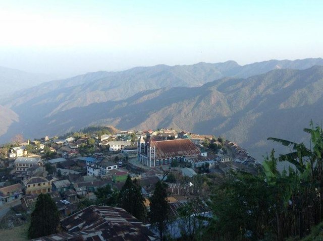
FALAM
Falam is the capital of Falam District, Nothern Chin Sate. It is built on the slope of a mountain range, in multiple steps. The city is quite clean, tidy and living standard is quite high. There is a good place to learn and visit to Chin Chief’s Traditional House about 24 km from Falam.
Moreover Lailu Cave is very popular place for Public Park Center. Beautiful sceneries of Falam Township are remarkable for those who love natural scenic beauty. Rieh (Rih) lake is also located in Falam. 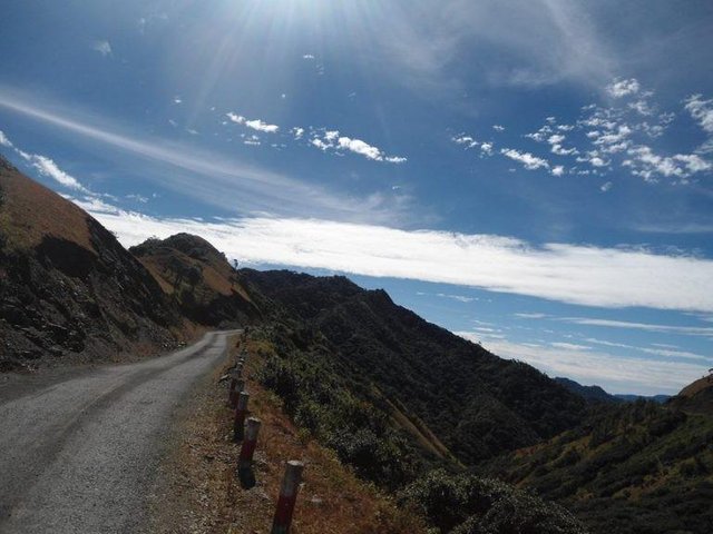
THANTLANG
Thantlang township is located 40km from Hakaha. Thantlang sits between the Vuichip and Marau Mountains. Thantlang’s borders extend to Mizoram’s edge in India. The city’s water flows is from the nearby Buhva and Lahva rivers. Paddy fields dot Lahva’s banks, regularly plowed by local farmers in June and harvested by the end of October. 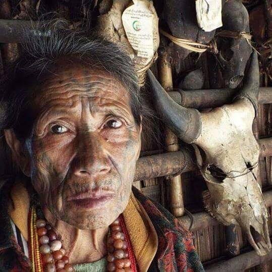
TEDIM
Tedim is the largest administrative town of Tedim Township and located in the northern of the Chin Sate. The name “Tedim” was derived from a pool up in the hills that used to twinkle in the sunlight, therefore it was called “Te (bright,shine)” and dim (twinkling, sparkling) in the local Zomi language. The major tribe of Tedim is Zomi. There are dams, caves, peaks and other attractions, including Leupa Mual, the Twin Fairy Hill and historic sites. 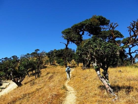
HAKHA
Hakha is situated in Northern Chin State. It is situated on the slope of a large mountain, at 1890 m above sea level and built in U shape. The cloud cover most of the lower parts of the city in the rainy season and winter, so the city looks like it is built on the clouds. It is quite cold and very windy during the winter. The whole city is foggy in the morning and in the evening. The best time to visit Hakha is in summer.
Matupi
The main roads from Matupi are the one that goes to Mindat is 102 miles long and the other one goes to Hakha is 173 miles long. Both roads leading to Matupi are not well-praved roads. There is beautiful scenery along the roads. Matupi is extremely amiable and affectionately beautiful. It is home to several tribes. Matupi has much to be explored. The virgin environments of the Matupi are breathtakingly charming
.Mindat
Mindat, the most easiest reach town in Chin Hills, is beautiful, peaceful, tranquil town and situated in southern part of Chin Hills. It is situated at 1482 m above sea level and trading hub for southern Chin State. Tall pine tree line the approaching road while distant mountain shadow the town. Then there will be small, beautiful wooden houses with scenic backdrop along the main road.
Local people still wear Chin dress and carry Chin baskets and knives while some men carry locally made shot guns on the streets. Many women dress beautiful Chin necklaces while some old women still wear enormous Chin traditional earrings.
Kanpetlet
Kanpetlet, a small town probably the smallest town in Chin State, is in the southern Chin State. It is built on the slope of the mountain with large mountains overshadowing. The scene from the town is very beautiful, especially before the sunset. During winter, the mountains are covered in thick fog, transforming the whole town into a small paradise.
Kanpetlet is still unspoiled by the modern world and a very good place to observe the Chin traditional way of life. People are still living in the same way hundreds of years ago. This is also a very nice place to do trekking. In near Kanpetlet, there has Mount Victoria National Park. It is better to use Kanpetlet as base camp to watch birds and butterflies (especially beautiful in this area).
The town is just about 80km away from Mindat, and only 19 km away from Saw, Yaw region.
done. I want to visit there. Thank!
Thanks bro
ok
thanks
Good
Beautiful photos. FOllowing and upvoted!
Beautiful
thanks