Florence Edges Closer To Wilmington NC Gusts Over 100 MPH
HURRICANE FLORENCE POUNDING NORTH CAROLINA GUSTS OVER 100 MPH
LOCATION...34.0N 76.8W
ABOUT 50 MI...80 KM S OF MOREHEAD CITY NORTH CAROLINA
ABOUT 60 MI...95 KM ESE OF WILMINGTON NORTH CAROLINA
MAXIMUM SUSTAINED WINDS...90 MPH...150 KM/H
PRESENT MOVEMENT...NW OR 305 DEGREES AT 6 MPH...9 KM/H
MINIMUM CENTRAL PRESSURE...956 MB...28.23 INCHES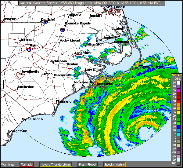
ABOUT 50 MI...80 KM S OF MOREHEAD CITY NORTH CAROLINA
ABOUT 60 MI...95 KM ESE OF WILMINGTON NORTH CAROLINA
MAXIMUM SUSTAINED WINDS...90 MPH...150 KM/H
PRESENT MOVEMENT...NW OR 305 DEGREES AT 6 MPH...9 KM/H
MINIMUM CENTRAL PRESSURE...956 MB...28.23 INCHES

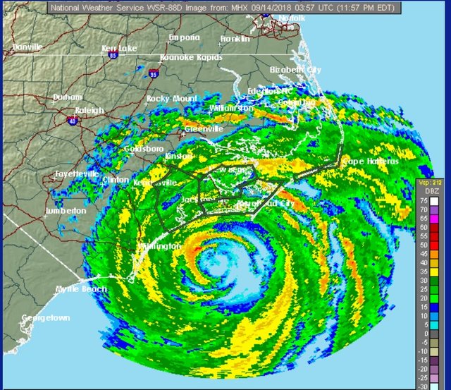
Hurricane Florence is closing in on Wilmington North Carolina. The radar above in real time shows the eye nearing the coast. Numerous reports of wind gusts of 70 to 80 mph are being reported along the coast with gusts over 100 mph reported at Cape Lookout North Carolina along with several other locations.
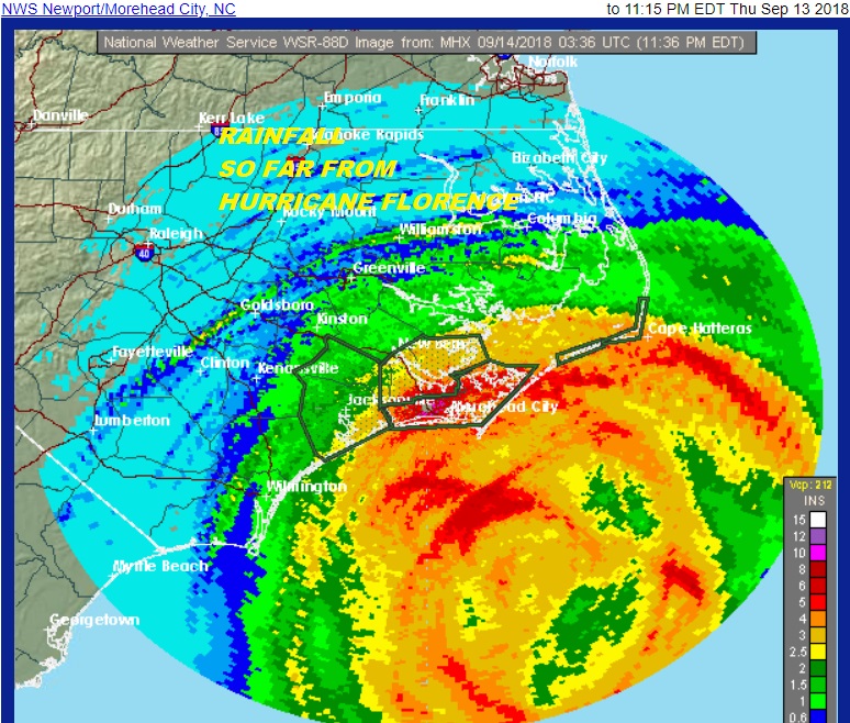
The dark reds on the map above show 8 inches of rain or more has already fallen over parts of the outer banks. Storm surge flooding on the back bays of Pamlico Sound have been significant and the flooding will continue into Friday. Florence is crawling westward at 6 mph as the slowing continues. The center will barely reach the coast and then turn westward and then west southwestward as hurricane conditions spread down the coast into South Carolina. Everything so far regarding the track remains on course. The storm's top winds have eased to 90 mph however the wind field has expanded and hurricane force winds extend outward as much as 90 miles from the center. Rainfall amounts are likely to double and triple these amounts in many areas with the hurricane moving so slowly.
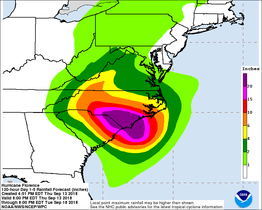
The longer rainge outlook for Florence is for it to move inland somewhere near the North Carolina South Carolina border and then move northwest into the northwestern part of the state but that may take until late Saturday for it to get there. Afterwards it will turn northward into the Central Appalachians and bring heavy rains into the mountains and shift into Western North Carolina and Western Virginia over the weekend.


Our weather here on the other hand remains relatively tranquil though humid with another day of lots of clouds for Friday though downpours should be minimal as they were on Thursday with highs in the 70s. Over the weekend look for some sunshine on Saturday and mostly sunny skies on Sunday with highs in the 70s to near 80 both days. At least the last weekend of summer goes out on a good note.

Florence will move north and northeastward and it looks like we will get some remnant rains beginning late Monday or Monday evening as some shower begin to move in. At first they will be scattered but if the low tracks east of the mountains we could see significant rains here late Monday night and Tuesday until the remnant low passes by and moves away Tuesday night. Models continue to argue over how far west the storm tracks and so far the GFS models seems to take it west of the Appalachians. If this is the case then the rain should be manageable however the European for days has insisted on a track east of the mountains in which case we would be looking at the possibility of several inches of rain. This puzzle probably won't be solved until the weekend at the earliest.
Please note that with regards to any tropical storms or hurricanes, should a storm be threatening, please consult your local National Weather Service office or your local government officials about what action you should be taking to protect life and property.
FIOS1NEWS NEW JERSEY
LATEST JOESTRADAMUS ON THE LONG RANGE
Posted from my blog with SteemPress : http://www.meteorologistjoecioffi.com/index.php/2018/09/14/florence-edges-closer-to-wilmington-nc-gusts-over-100-mph/