Florence Barely Inland Rain Unrelenting Good Weekend Here

HURRICANE FLORENCE BARELY ONSHORE UNRELENTING FLOODING RAINS
LOCATION...34.0N 78.4W
ABOUT 35 MI...55 KM WSW OF WILMINGTON NORTH CAROLINA
ABOUT 35 MI...55 KM ENE OF MYRTLE BEACH SOUTH CAROLINA
MAXIMUM SUSTAINED WINDS...75 MPH...120 KM/H
PRESENT MOVEMENT...W OR 270 DEGREES AT 5 MPH...7 KM/H
MINIMUM CENTRAL PRESSURE...968 MB...28.58 INCHES
ABOUT 35 MI...55 KM WSW OF WILMINGTON NORTH CAROLINA
ABOUT 35 MI...55 KM ENE OF MYRTLE BEACH SOUTH CAROLINA
MAXIMUM SUSTAINED WINDS...75 MPH...120 KM/H
PRESENT MOVEMENT...W OR 270 DEGREES AT 5 MPH...7 KM/H
MINIMUM CENTRAL PRESSURE...968 MB...28.58 INCHES
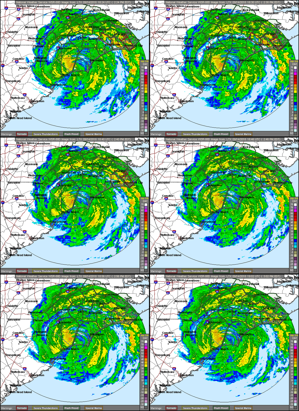
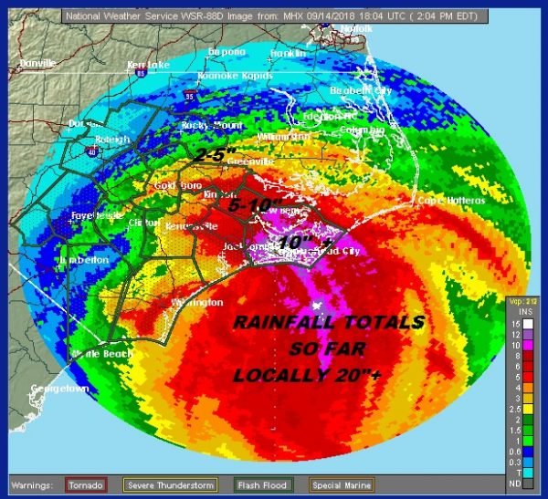
Hurricane Florence continues it's very slow march inland in Southeast North Carolina as the center nears the South Carolina border. Strongest sustained winds are down to 75 mph but gusts much higher continue to rage. Rain is the issue going forward with unrelenting heavy downpours forecast to continue in many areas well into Saturday and gradually spread inland. Rainfall amounts continue to pile up
While Florence is continuing to inch inland our weather is beginning to show some signs of slow improvement. We do see lots of clouds and humid conditions overhead but there have been some peaks of sun in a few places especially along the coast. To the northeast dry is beginning to move southwestward as a strong high builds in Northern New England. While we will see clouds hanging tough overnight the weekend is looking good overall. Other than an odd spot shower the radars here locally remain quiet and will stay that way into Monday. Temperatures are mostly in the 70s and most lows tonight will be in the 60s.
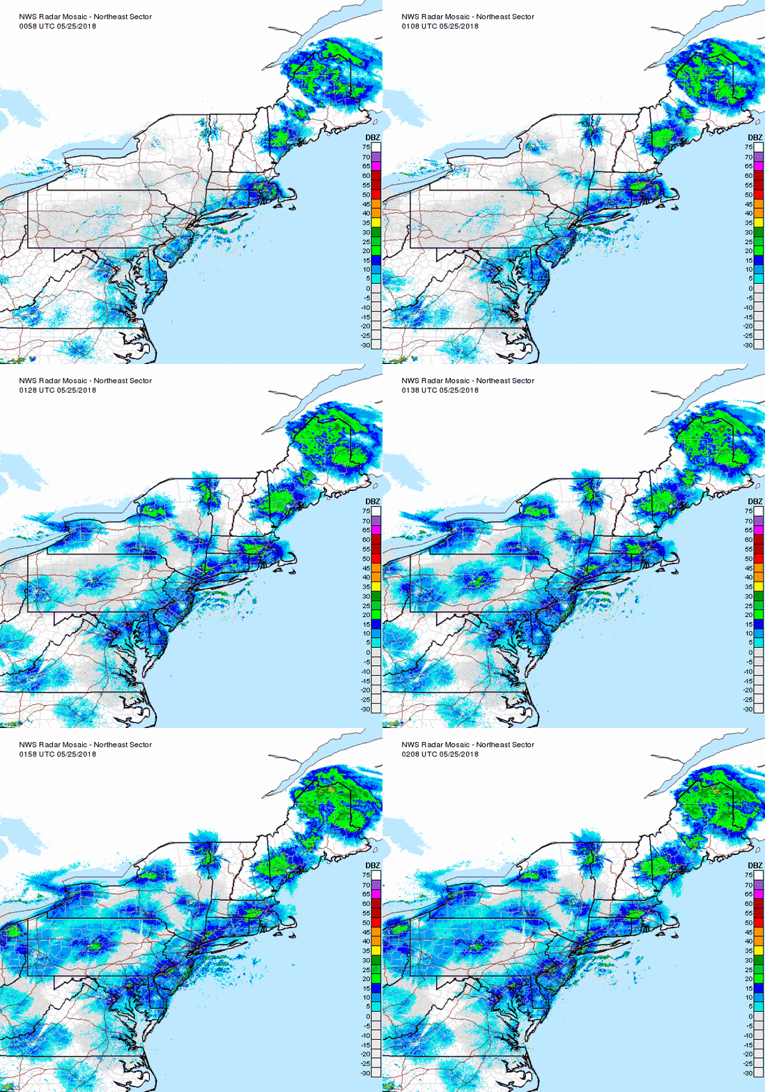
The weekend is looking good with clouds giving way to developing sunshine on Saturday with highs in the 70s to near 80. It will be somewhat humid but not oppressively so. Sunday will be mostly sunny with highs in the upper 70s and lower 80s. No rain is forecast through the weekend.
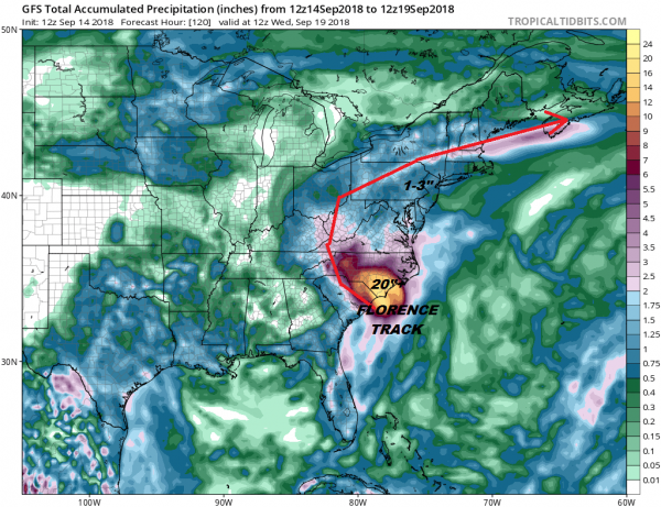
Clouds will increase on Monday and the map above shows the GFS rainfall forecast from the remnants of Hurricane Florence. Some lead scattered shower will arrive Monday night. The GFS model is coming closer to the European model's more southern track of the remants of Florence. The GFS would allow for 1 to 3 inches of rain with some variability. The European's rain amounts are higher is it tracks the remnant low into Central Pennsylvania Tuesday morning and very close to NYC Tuesday evening. The heaviest rain would come and go rather quickly with the bulk of it falling during the day on Tuesday. This will likely cause some local flooding issues and we will be monitoring this closely over the weekend.
Please note that with regards to any tropical storms or hurricanes, should a storm be threatening, please consult your local National Weather Service office or your local government officials about what action you should be taking to protect life and property.
FIOS1NEWS NEW JERSEY
LATEST JOESTRADAMUS ON THE LONG RANGE
Posted from my blog with SteemPress : http://www.meteorologistjoecioffi.com/index.php/2018/09/14/florence-barely-inland-rain-unrelenting-good-weekend-here/
