Explore California: Mount Rubidoux, Riverside CA
Living in Southern California means you are never short on hiking locations, or the perfect weather to do these hikes in.
A short, 3-4 mile, easy hike in Riverside for all levels is to summit Mount Rubidoux.
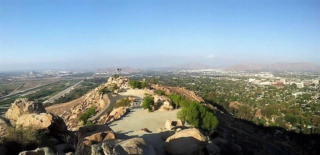
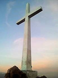
As you can see from the photo above, the views are spectacular from the top: this was taken from the Cross, looking over to the other side and the American Flag.
But first, here is a little history on the park and it's monuments: In 1906 Frank Miller, owner of the Mission Inn, along with Henry E. Huntington and Charles M. Loring, formed the Huntington Park Association and purchased the property with the intent to build a road to the summit and develop the mountain as a park to benefit the city of Riverside.
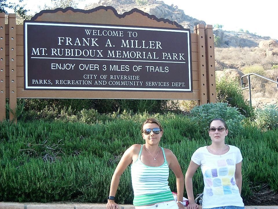
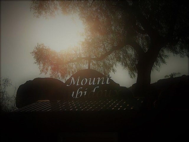
As it is a short hike we decided to get the best views and go to see the sun set from the top. At the start of the park is the above sign.
On December 13, 1925, the Testimonial Peace Tower was dedicated to Miller.
This is a photograph of the plaque on the tower:
![199217_10151068627307462_1163836558_n[1].jpg](https://steemitimages.com/640x0/https://steemitimages.com/DQmQGVrBAtwTXkhhn7mrFAsV9BmfFkfSCnqNKk9ieiWDgJq/199217_10151068627307462_1163836558_n%5B1%5D.jpg)
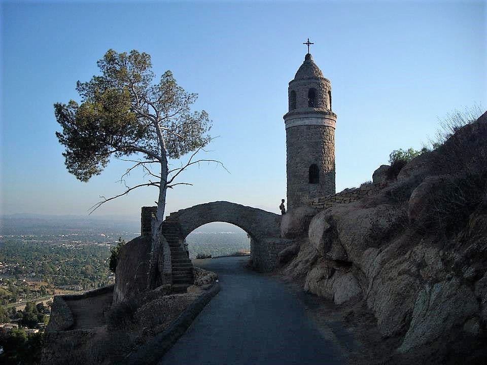
As we where almost at the top, we came across this beautiful stone bridge and tower:
The bridge is a replica of a noted bridge in Alcántara, Spain.
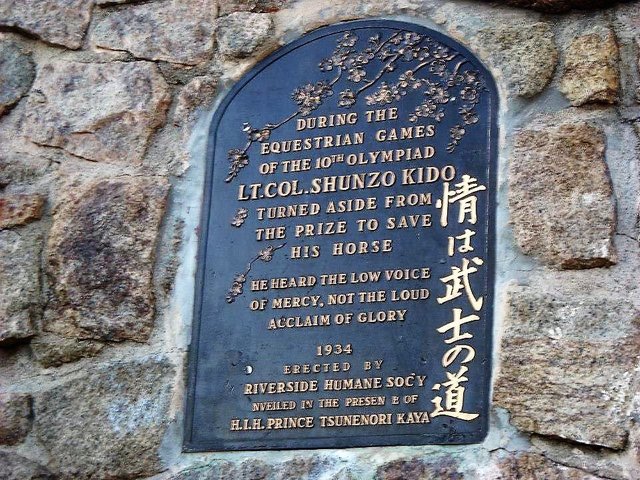
There is this memorial plaque:
A plaque for 1932 Olympic equestrian Shunzo Kido was placed on the bridge in 1934 honoring his sacrifice of an Olympic medal in order to save his horse, Kyu Gun, from lameness
At the top of Mount Rubidoux are the Flag pictured above and on the other side, a large white cross.
The first memorial marker on the mountain, the cross and tablet at the summit honoring Father Junipero Serra, was dedicated on April 26, 1907:
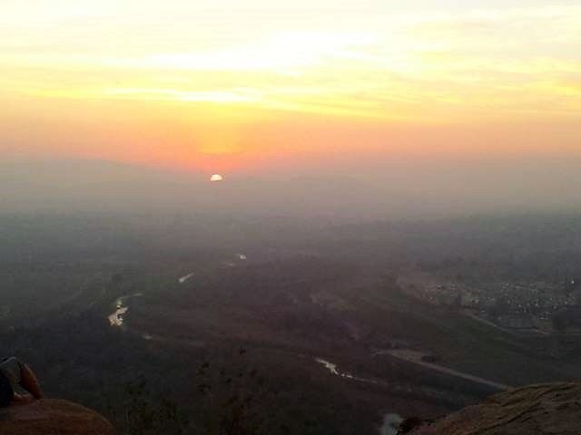
But the most interesting fact I discovered, when researching the monuments I'd seen, was that the sunset here was inspirational:
A sunset over Mount Rubidoux, in 1909, was the occasion for Carrie Jacobs-Bond to compose her famous song "A Perfect Day" which for many years was played each day as the last tune on the Mission Inn's carillon.
There are two paved paths leading to the top. One route is longer but less of an incline, while the shorter path take you straight up to the top, with a steady incline and switchbacks.
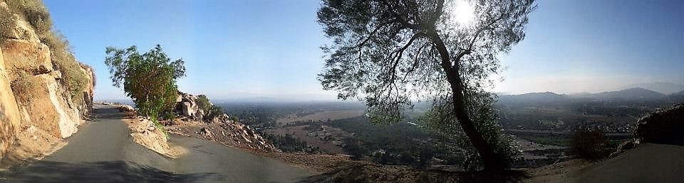
The views from the top truly are amazing. You can see over the whole of Riverside:
There are plenty of friendly people here from fellow hikers, to boulder climbers, and people on mountain bikes.
I did this hike with my friend, Kara, who has a sever fear of heights. She was determined to get to the top, even though she had cut of blood flow to my hand by holding my arm so tight as she climbed the steps. The guys at the top realized she was conquering her fear and gave her words of support to keep her climbing, and we all hugged it out when she reached the top!
![531767_10151311950652462_376085216_n[1].jpg](https://steemitimages.com/DQmQucje8qBW8wzA51WNagA6VXHSLs9JrPrWqR5JgUwdAxb/531767_10151311950652462_376085216_n%5B1%5D.jpg)
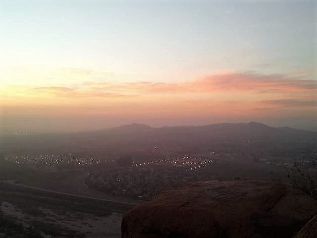
Being here at sunset is spectacular:
And it's well maintained, a sign told me "The Friends of Mt. Rubidoux" a non-profit organization take care of this park.
Thanks for reading. Till next time :-D
All photographs are my own.
!steemitworldmap 33.984048 lat -117.4316652 long ´Mount Rubidoux, Riverside, California´ D3SCR
It is nice to see my old hood is looking so well maintained! I have photos from back in high school of us Goths frolicking there. When Matt and I first got together, we rented a house just below Mt. Rubidoux on University St. Thanks for the trip down memory lane ;)
Sorry for the delayed reply, had a lot on my plate lately. Glad it brought back good memories for you. We should do a little meet up here!
Congratulations, Your Post Has Been Added To The Steemit Worldmap!
Author link: http://steemitworldmap.com?author=beckymeep
Post link: http://steemitworldmap.com?post=explore-california-mount-rubidoux-riverside-ca
Want to have your post on the map too?