Achievement 2 : Travelling to the Sabet Hill
Today I would like to share you when I was travelling for took some picture. Yesterday after I already suffered from fever, I was invited with my friend for riding to Jantho – Lamno street on Saturday, September 2nd, 2023.
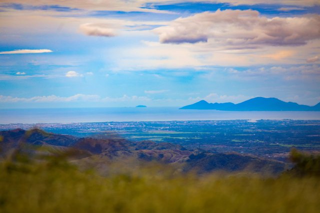
The view of Banda Aceh city and Sabang surrounded by Melacca strait. Photo was taken by me @rafael118
We went to the top of Sabet hill which located in Aceh Jaya district, Aceh Province, Indonesia. Sabet Peak is above an altitude of about 1,500 meters above sea level bordering Aceh Besar and Aceh Jaya regencies.
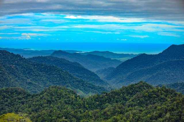
View of Hindian Ocean which located in Aceh Jaya district. This view can be seen in the top of Sabet peak. Photo was taken by me @rafael118
Standing on the top of Sabet hill, the eyes are free to highlight all corners of the wind. From the northern end, you can see the cities of Banda Aceh and Aceh Besar surrounded by the blue expanse of the Malacca Strait.
Turning around to the East, the cluster of hills stretches like a formidable fortress where Mount Batee Meucica appears to be its peak. To the south, a vast expanse of the Indian Ocean like a blue tapestry surrounded the city of Lamno, Aceh Jaya Regency. The wind is roaring, sometimes breezy, often also blowing. Feels good. Wisps of mist billowed from all directions. Visibility is increasingly limited. Even though the hour hand still shows 15.16 PM.
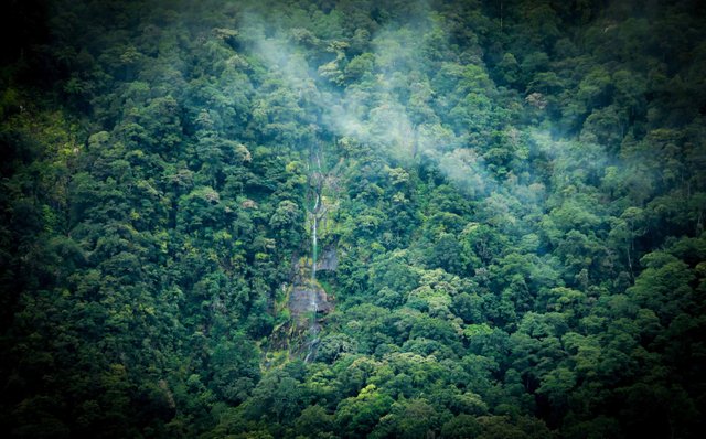
Montala waterfall which located in Batee Meucica mountain. Photo was taken by me @rafael118
To get to this peak, visitors will initially be treated to a stretch of grassland or savanna. Access can be reached through the countryside in the Indrapuri mobile reservoir area or can be reached through the countryside in the Jantho area. In every crevice of the hill, waterfalls are easy to find in a number of corners. Along the way, our two-wheeler travelled at moderate speed, snaking over the paspal road that divides the Jantho – Lamno hills. Precisely in Gampong Siron Krueng, Indrapuri District, Aceh Besar, the expanse of savanna stretches like a green tapestry.
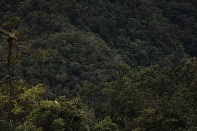
The hornbill was seen in the Sabe peak jungle. Photo was taken by me @raafel118
This savanna is only overgrown with grass and weeds as high as approximately 50 centimeters. Some parts look like they've started to turn yellow somewhat. On the left, the slopes of the mountains look steep and airy without trees.
"We have arrived at the foot of the Batee Meucica Mountains. Let's take a break while hunting first," said Mustajib, one of the travel bloggers from Aceh Besar.
Without waiting so long, we immediately seized this best moment. Located about 60 KM from the city of Banda Aceh, the Batee Meucica mountains present an alluring natural charm. The mountains with an altitude of 1,140 meters above sea level are located between Aceh Besar and Aceh Jaya regencies.
**Former GAM Team Training Base
Mustajib said that this area was a training ground for the Gajah Keng Army, a special forces unit of the Free Aceh Movement (GAM) in Aceh Rayeuk region. This is because the location is still beautiful and has not been touched by development until the end of 2012.
After Aceh was peaceful, this location began to open with the opening of the Jantho - Lamno road. This is because this road is an alternative route for residents, especially passers-by from the West – South coast who want to travel to the North and East Aceh regions, and vice versa.
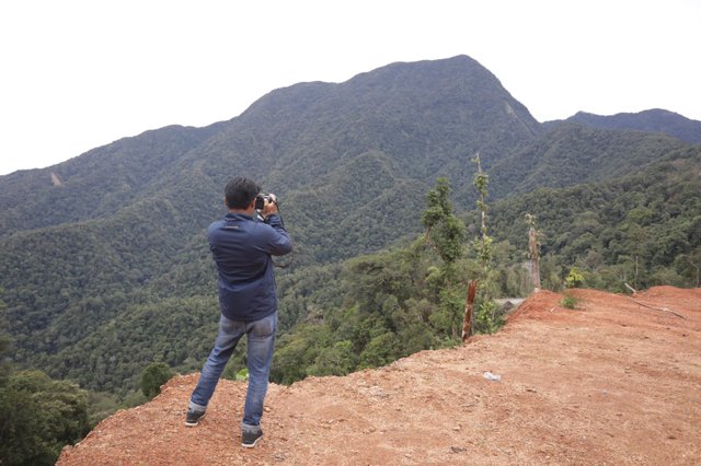
My friend, Mustajib who was takeen a picture of Sabet hill. For knowing his pictures, Please folllow his instagram @cekmus. Photo was taken by me @rafael118
"If you want to camp, it is recommended that under 10 people. Women are still not allowed to camp here because it is based on gampong rules here," Mustajib said.
For knowing, the Aceh Provincial Government has built the Jantho road, Aceh Besar Regency, to Lamno, Aceh Jaya Regency. This road cuts through the Ulu Masen protected forest. Until now, the Ministry has also issued a number of requirements such as, the Aceh Government must monitor the threat of forest destruction due to illegal logging. Also, do not cut down trees in forest areas with a radius or distance of 200 meters from the edge and left right of the river and 50 meters from the left and right banks of tributaries. []
Thank you very much for the beautiful photos of the natural landscape of your region. I wish you success.
your welcome @tetiev, hopefully we can keep sharing knowledge each other. Thank you