ALERT IRMA: Latest data from the National Hurricane Center
Route planned for the next five days, satellite images and probability of hurricane winds.
At least two people died in the French territories of San Martin and San Bartolomé, in the Antilles, due to the effects of Hurricane Irma.
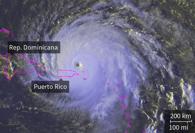
The powerful hurricane, which continues as Category 5, arrived on Wednesday afternoon northeast of the territory of Puerto Rico with winds of 170 kilometers per hour.
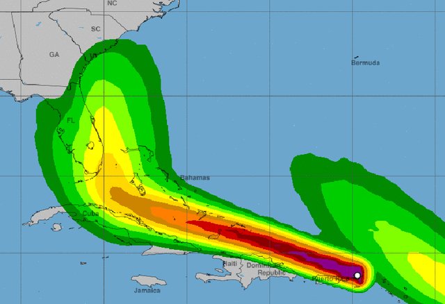
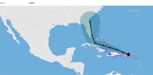
On Thursday he will move to the north of the Dominican Republic, then head for the Bahamas, northern Cuba and arrive in Florida at the end of the week.
Irma is "extremely dangerous", according to the NHC, and has already reached maximum sustained winds of up to 298 km / h.
The hurricane is the second most powerful recorded in history in the Atlantic, only behind Allen, which in 1980 exceeded 300 km / h.
In addition, Tropical Storm José gained strength and became a hurricane on his way to the Caribbean on Wednesday. With winds of 120 km / h, it is located 1,675 kilometers east of the small Antilles.
According to the CNH, by Friday it could reach category 3 although at present does not represent a risk for any territory.
Also in the southwest Gulf of Mexico was formed Hurricane Katia and an alert is in effect for the coast of the Mexican state of Veracruz. With maximum winds of 120km / h, the center added, it is expected to be able to charge for the next 48 hours.
Thanks for the support!
Insta: @jeremydils
This post recieved an upvote from minnowpond. If you would like to recieve upvotes from minnowpond on all your posts, simply FOLLOW @minnowpond