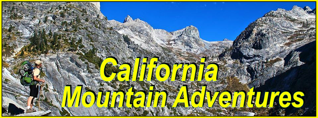
My California - The Day Creek Project Part 3

For this weeks Show Us Your California contest by @socalsteemit I head up into the San Gabriel mountains once again for another trip to...
Day Creek!!

If you've been following my recent posts you know that I've been working on a trail rehabilitation project on the eastern end of the San Gabriel mountains. Unfortunately the access to the area around upper Day creek had become inaccessible due to overgrown brush. And since no one ever goes there, including the forest service, no one cared about it. But it's an area that I really love and I wasn't going to let it go without a fight. And so I've been doing lots of hard work to get the trail back in shape. And so on this trip I headed back up there once again. Back up the long dirt road. Passed San Sevaine and Joe Elliot camp to the trailhead at the end of the road. On the last trip I had gotten the trail passable and was finally able to get to the creek, but there was still lots of trail work to do. So this time I tried to get up there early. Because not only did I want to get a lot of work done I also wanted time to do some exploring. Unfortunately just the drive up the dirt road takes about 2.5 hours so getting there early isn't easy. But I wasted no time and got up to the trailhead and headed down the trail. I hiked down to an area that still needed a lot of work and started chopping away at the brush. After a few hours of work I decided to stop and head down to camp so I could get there with enough time for some exploring, but as I headed through some of the areas of trail that I had previously chopped. I found that a lot of the branches I had chopped had fallen back onto the trail. In the really thick areas it was hard to find places to put the chopped branches so a lot of them just got tossed up on the sides of the trail and there must have been a hard wind that blew them back down onto the trail. So this time I took the extra time and dragged all the fallen branches a few hundred feet up the trail to an open area where they could be properly tossed off the side of the mountain. This took me quite awhile so unfortunately I arrived to camp quite a bit later than I wanted and so I didn't have time to explore. But that was fine because I was staying a second night and so I still had a full day for exploration. So instead I just got my camp setup, got some water from the creek, collected wood, got my campfire setup, and then just relaxed and enjoyed a nice first evening at camp.

Back at the gate for the Cucamonga truck trail

Passing by 'Texas Hill'

Driving through San Sevaine flats

Views from Buck Point

Back on the trail

Views from the trail

Crossing the avalanche rock chute

Getting camp setup

Camp

City lights

Campfire
The next morning I woke up early. It had been a pretty cold night and when I got up I found that my water bucket had a 1/2 inch layer of ice on top. I broke the ice, filled some water, made some breakfast, and got ready for a day of exploring. My main goal for the day was to try scouting out a route for climbing Cucamonga peak. I had two different routes that I'd been looking at. Route 1 was a scree slope that lead up onto Smith ridge, but the problem with it was a huge field of thick buckthorn at the base. So, wanting to avoid that I had been looking at a 2nd option which looked much steeper and more technical, but avoided the buckthorn. So I decided on trying the 2nd route. This route started a little ways up the canyon from camp so first I had to rock hop up the canyon bottom to the first fork(the southern fork). From there I started climbing up the ridge on the east side of the fork. From looking at it I knew it was gonna be really steep, but as I was climbing it was much steeper even than what I had imagined. And the dirt and rock was loose making it quite treacherous. There was even a few points where I thought that it might possibly be my last day alive. But I summoned my inner mountain goat powers and pushed my way up the ridge. Despite how difficult and dangerous it was, as I got higher the views got more and more incredible! But also in the back of my mind I was just really hoping I would be able to at least get to the top of the scree slope from route 1 so that I could take that route back because going back down the way I went up was not something I really wanted to attempt. At one point I got up to where I could see over to the scree slope and unfortunately between the ridge I was on and the scree was a ton of thick brush. So I continued climbing up the ridge. Luckily only having to deal with minimal brush. But eventually I got to some cliffs where I had to do some technical climbing which made me a little nervous, but I handled it fine. But then I got to a point with another set of cliffs with some huge exposure and I was getting fairly exhausted so I didn't want to risk it. So I decided to pick the best line I could see through the brush and push my way though and get over to the scree slope. I climbed up and across the slope. Still ascending with aspirations of potentially scouting further up the ridge. I decided to climb up onto one of the rock outcrops near the top of the scree slopes to take a rest, have a snack, and asses my plan. And although it was tempting to continue further I was feeling pretty worn out already and the route ahead was not looking easy. Also I didn't know how difficult the decent would be since I was going down a different route. And unfortunately what I did know was that it was going to include lots of bushwhacking. So after a nice long break at the rock outcrop I opted to start my decent of the scree slopes.

Sunrise

Morning at camp

Rock hopping up the canyon

Starting up the ridge

Incredible views while climbing

First view across at the scree slopes(on the left)

Overlooking the canyon


I headed down the scree. It was steep and challenging, but much less dangerous than the other route. As I was making my way down a large shiny rock started to catch my eye. And as I got closer I realized it wasn't a rock, but rather it was wreckage from an airplane crash. After the trip I told my friend Ryan about it and he did some research and we are pretty sure it was a Cessna 182B that crashed there on new years eve back in 1994. Which you can read all about here - https://planecrashmap.com/plane/ca/N2569G/. When I first realized what it was I was both surprised and excited and I took lots of pictures of the wreckage. There were pieces spread all over the hillside many of which were getting buried under the falling rocks coming down the scree slopes. From the wreckage I continued down the scree and eventually reached the massive field of buckthorn that I had originally wanted to avoid. I couldn't see any way around it and so I just had to push my way right through the thick of it. It was absolutely brutal. A true sufferfest. But eventually I got through it and made my way down onto the old road. From there it was a short walk back over to the creek and then back to camp.

Checking out the plane wreckage

The engine and propeller


Pushing through the buckthorn

On the old road

Back at the creek
Back at camp I rested for a bit. But with still plenty of time left in the day I decided to spend the rest of the afternoon exploring up one of the forks(the northern fork) of the canyon above camp. So once again I headed up the canyon rock hopping along the creek. At the split in the canyon I left the creek and headed up the dry fork. I had thought that I would run into impassable cliffs fairly quick, but as I climbed further I realized that I was able to go quite far up the fork becoming completely surrounded by the massive cliffs. There was some technical climbing required, but nothing too difficult. Eventually I got to a split in the fork with the left fork having impassable cliffs. The right fork was still climbable, but with everything I had done all morning I was feeling pretty tired so I decided to stop at the split and save the rest for another day and another adventure when I can give a full day to it and try to see how far I can get. I sat and rested for a bit there at the split and at some point I started hearing rocks being knocked down the huge cliff faces. My guess was that it was bighorn sheep, but unfortunately I wasn't able to actually see them. After hanging out there for awhile I headed back down the fork to the creek and then back down the creek and back to camp for another nice and peaceful, albeit cold, night.

Rock hopping along the creek

Heading up the dry northern fork

Getting up into the cliffs

Looking down the fork

Getting to the split

Hanging out

Views from the split

Back down at the creek

Evening views
In the morning I woke up and made breakfast, got camp all packed up, and hit the trail. On the way out I did a bunch more trail work. Widening a bunch of tight areas and chopping through areas that I had previously bypassed. And although there is still work to do, I am really happy with it. It's finally getting good enough that I feel like I could bring someone else along on the trail without them hating me for buckthorn sufferfest. Which currently is the plan. Next weekend my friend Ryan and I are planning to go back for an overnighter. I'm really looking forward to showing him how awesome this relatively unknown area is, as well as of course showing off all my hard work that I did on the trail!

All packed up and ready to leave

Back to the trail work

On the trail


Views from the trail

Back at the trailhead

Driving through San Sevaine flats on the way down the mountain
And so until next time...
I hope you have enjoyed this glimpse into
My California!!


#SoCalSteemit is building and supporting the Steemit community of Southern California. If you are from SoCal and are into creating quality content here on Steemit, we'd love for you to follow us @SoCalSteemit and join our group on Discord
Great adventure! Nice work on the trail and good find on the plane. Sounds like it was a bit dangerous so glad you made it through! 😎