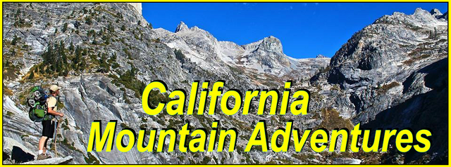
My California - Banner Peak

For this weeks Show Us Your California contest by @socalsteemit I head up to the Eastern Sierra for a six day backpacking trip to...
Banner Peak!!

Last September my mom had planned a backpacking trip with myself and a couple of her friends on the Tahoe Rim Trail, but unfortunately when it came time for the trip the trail was closed due to some really bad wildfires in the area. Instead of cancelling the trip my mom came up with a back up plan in the Eastern Sierra near Mammoth starting at Walker Lake and ending at Reds Meadows with a day to climb Banner Peak along the way.
We drove to the trailhead above Walker lake and started down the trail. The trail dropped down to the lake skirting the southwest shore before starting the long steep climb up Bloody canyon. Due to some health issues I was a bit out of shape and the climb was pretty tough for me. I was even questioning myself and thinking of possibly turning around. But I kept climbing up the canyon. Up passed the Sardine lakes to Mono pass. And after a short break at the pass we headed the last couple miles up to Parker Pass lake where we made our first camp on the northeastern shore of the lake.

Walker lake

The Ansel Adams Wilderness boundary

Looking down Bloody canyon

Climbing up Bloody canyon

Upper Sardine lake

Summit lake at Mono pass

Parker Pass lake
The next morning we packed up camp, left the lake, and headed up to Parker pass passing a group of deer on the way. The pass is not far from the lake and we quickly made our way over it and then across the upper part of the Parker creek drainage before starting the climb up the many switchbacks to Koip Peak pass. The climb was tough, but I was feeling much better than the first day and I handled it fine. From the pass we decided to do some peak bagging. My mom and her friend Ann climbed Koip peak and Kuna peak while I opted to head the other way and bagged Parker peak and Mt. Wood. Although there were no wildfires in the immediate area the smoke from the fires burning both to the north in Tahoe and to the southwest in Kings Canyon made it a bit smokey which unfortunately limited the views from the peaks quite a bit.

Looking north from Parker Pass

Crossing Parker creek

Climbing the switchbacks up to Koip Peak pass

Koip Peak pass

Views from Parker peak

Views from Mt. Wood

Overlooking Alger lakes
After our peak bagging excursion we headed back down to the pass and then made the long decent down to the Alger lakes where we made our second camp. In the evening before dinner I tried a bit of trout fishing in the lakes, but unfortunately I didn't have any luck.

Arriving at Alger lakes

Our camp at Alger lakes
The next morning we left Alger lakes and headed over Gem pass and down and around the west side of Gem lake passing Billy lake and Rush creek. From there it was more uphill. Up through the Clark lakes and over Agnew pass. Then meeting with the Pacific Crest trail(PCT) which we followed up to our destination at Thousand Island lake. We hiked out along the north shore of the lake and found a great spot to camp about a mile and a half out. We wanted to camp at the far end of the lake to get us as close as we could for our climb up to Banner peak the next day.

Alger lakes

Leaving Alger lakes

Views from Gem pass

Overlooking Gem lake

Billy lake

Clark lakes

Arriving at Thousand Island lake
The next day was the big day. We got up early, left our camp setup, and headed cross country up towards North Glacier pass. The climb up to the pass wasn't too hard, but once again it was becoming quite smokey out. So we stopped on the south side of the pass overlooking Lake Catherine and my mom and her friend Ann decided it was too smokey for them so they decided to head back to camp. Despite the smoke I didn't want to pass up the opportunity so I decided to continue on...
I made my way around the east side of the lake, which took some technical route finding and a little bit of easy class 3 climbing. Once around the lake I got into the huge glacier filled chute that leads up to Ritter-Banner saddle. Getting into the chute was super sketchy as all the rock was super loose. Every step moved. A lot. At one point I thought I might even be screwed and might fall, but I summoned my inner mountain goat skills and made it into the chute alive. In the chute it was still pretty sketchy though. The glacier was covered in huge sun cups and had several large and very deep crevasses. I tried climbing along the edge of the glacier but the loose rock on the edges was not worth it and it was also quite dangerous as there were many rockfalls happening all around me from both sides of the chute. So I decided to stay out on the glacier and endure the extremely tiring sun cups and avoid the potentially deadly crevasses. I was quite relieved when I got to the top of the glacier and from there it was a short rock scramble up to Ritter-Banner saddle which sits between the two massive peaks. From the saddle I headed north towards Banner. The climb was mostly just a steep talus slope. In the last few hundred feet it got steeper and looser and the last 50 feet or so took some route finding and another bit of class 3 climbing. The peak actually has a few false summits and I had to climb most of them before getting to the one that was the actual high point which made it a bit more technical than it really needed to be. But that just added to the excitement. Although it was a pretty smokey day the views from the top were still absolutely amazing. And just being on the peak was euphoric and kinda surreal. On past trips I've looked at Banner many many times from many different angles. It has been calling me for years... and finally... I had made it!!

Entering the glacier chute

Climbing up along the edge of the glacier

Overlooking the glacier from Ritter-Banner saddle

Mt. Ritter from the top of Banner peak

Smokey views from Banner peak - Thousand Island lake on the left and Garnet lake on the right
I signed the peak register and hung out enjoying the views for awhile. Eventually it was time to head back. Back down to Ritter-Banner saddle, down the sun cup and crevasse covered glacier, around Lake Catherine, over North Glacier pass, and back down to our camp on the north shore of Thousand Island lake. Once again I tried some fishing in the evening before dinner, but once again I had no luck.

Me looking overly excited about all these horrible sun cups

One of many crevasses

Lake Catherine

The waterfall at Lake Catherine

Banner and Ritter from North Glacier pass

Back at Thousand Island lake looking up at Banner
The next morning we woke up to a beautiful sunrise. We had breakfast and packed up our camp and then headed out. We headed southbound on the John Muir trail(JMT) passed Emerald and Ruby lakes to Garnet lake. Unfortunately when we met at Garnet lake we realized that my moms friend Vicky had made a wrong turn at the last junction and ended up taking the trail down to the north shore of the lake instead of following the JMT. It took some time, but luckily everything eventually worked out and we were able to reunite with Vicky and continue on. And since Garnet lake is such a gorgeous place I really didn't mind spending the extra time there at all.

Sunrise

Leaving Thousand Island lake

Emerald lake

Garnet lake
From Garnet lake we climbed up over a ridge and then down to Shadow creek and Shadow lake. And then up again for one more climb to Rosalie lake where we made our final camp of the trip. And once again, after setting up camp, I tried some evening trout fishing... but this time I hooked it up and caught some beautiful rainbow trout!

Leaving Garnet lake

Shadow lake

Filling up water at Rosalie lake

Rosalie lake

Rainbow trout

Another Rainbow trout
On the final day we woke up to another beautiful morning. We packed up our camp and continued southbound on the JMT passed Gladys lake and the Trinity lakes, dropping down to Johnston meadow and Minaret creek, eventually reaching the trailhead at Reds Meadows where this incredible trip came to it's end.

Just above our camp in the morning

Trinity lakes

Johnston meadow

The San Joaquin river flowing through Reds Meadows

Stopping at Little Hot Creek for a post trip soak before heading home
And so until next time...
I hope you have enjoyed this glimpse into
My California!!


#SoCalSteemit is building and supporting the Steemit community of Southern California. If you are from SoCal and are into creating quality content here on Steemit, we'd love for you to follow us @SoCalSteemit and join our group on Discord
Amazing backpacking trip! Those crevices are scary man! Nice job on the trout too! 😎
This post have been up-voted by the Steem Travelers Community!