Map of San Felipe de Yaracuy - Venezuela before the 18th century
The forms of navigation have evolved as never before in the universal history, however the forms of navigation and representation of maps were not very precise, without counting on technologies like the airplane they improved substantially the cartography in the world and with the appearance of the satellite the mapping is much more precise. Today social tools such as Google maps or Google earth are free and available to any individual who wishes to navigate the globe and search in detail for any destination.
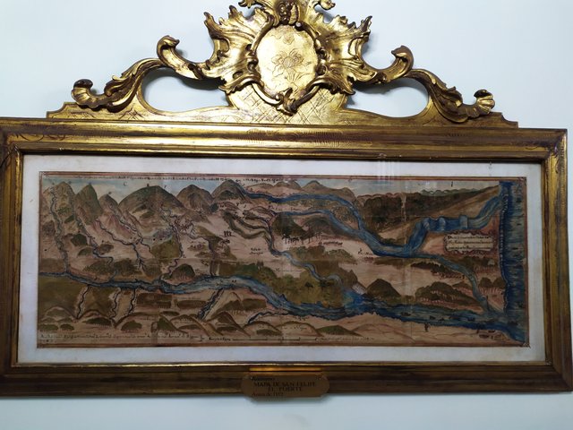
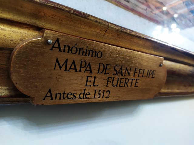
A few weeks ago, while visiting the Foreign Trade Library, I found in a beautiful painting a map from before 1812 made by a cartographer of unknown identity. The site is the city of San Felipe de Yaracuy a city that was founded in 1729 by the invading Spanish Juan de Villegas.
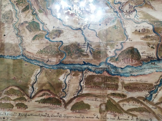
For the Spanish empire it was necessary to have control of each territory and take advantage of the productivity of the land, for that reason it was necessary to make maps to identify where certain mineral deposits were located, zones of cultivation, rivers, lakes, zones of cattle exploitation, with this they assured to maintain a rhythm of production based on the African and aboriginal slavery that allowed to have wide margins of profit since they did not have to pay for the work.
The map that you see in the graphs is of before 1812 and probably it is one of so many that they made during a period of 80 years, if we compared the present map of the city stops being very precise the one made by the Spaniards, in addition the map of before 1812 served for commercial and military purposes with it they assured production and to have knowledge on the land in case some rebellion arose.
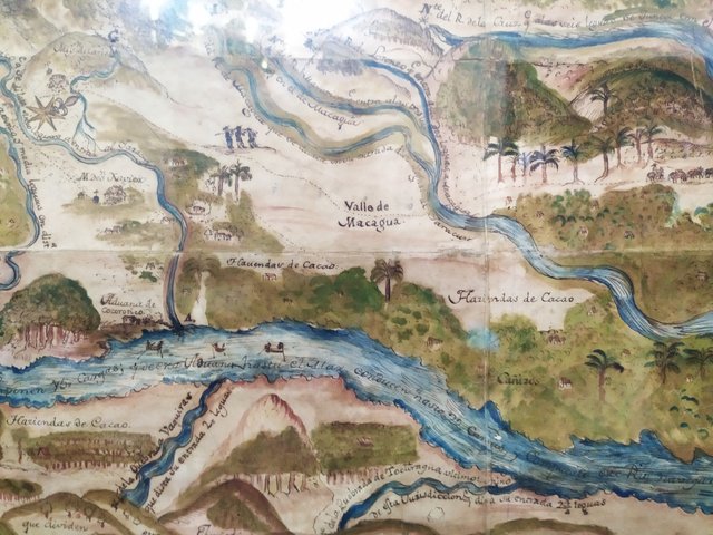
As far as the technique used to compose and design this type of maps, long walks were made outside the limits that were going to be represented in the map, then they were drawn in sketches by areas where the perspective allowed to have vision of valleys and mountains, then the main rivers were bordered and the route was drawn with its curvature or straightness, for that reason we can appreciate aerial views as in perspective these techniques were inherited from El Greco.
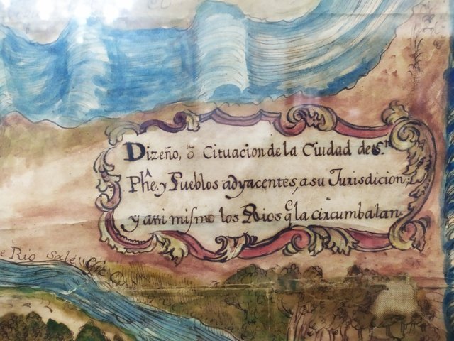
The material used to elaborate this map was a fine parchment of sheepskin treated to last in time, using colored inks with a pen to give detail and realism to the drawings captured in the map.
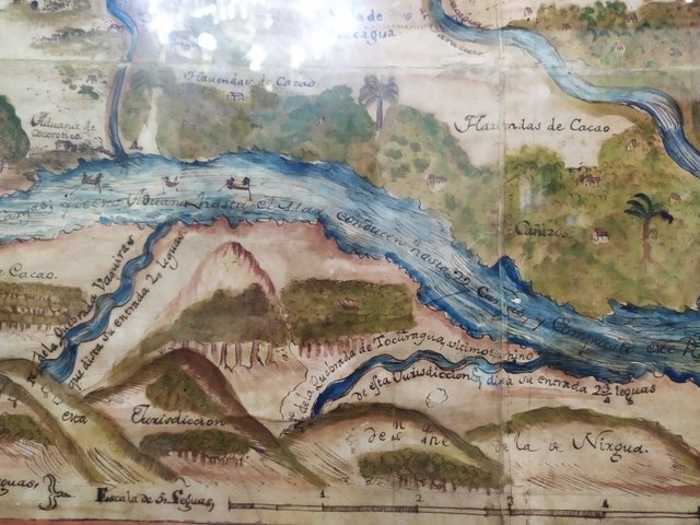
The city of San Felipe had great agricultural potential being cocoa the main item that was grown to be marketed in Europe, this was followed by tobacco which is still grown in the region to prepare cigars.
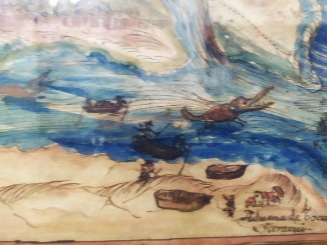
The current map is very different from the one obtained by satellites but it served to guide and manage geopolitical knowledge of the region and its surroundings.
ATTENTION: part of the proceeds of this publication will go to the special fund for the workshop Puppets in the community PROJECT and STEEMON SHOW
To read all about this project and find out how you can support it, visit it at Fundition.io by simply clicking on the link: Puppets in the community PROJECT and be sure to check out steemit's profile @arrozymangophoto
Thanks for reading
Special recognition:
@r2cornell
@mariusfebruary
@gtg
@xpilar
@reflektor
@hingsten
@bippe
@canadian-coconut
@steemitasclub
You can also support this project with your delegation
https://mobile.twitter.com/IvanMontti/status/1233094017098887169
Tweet