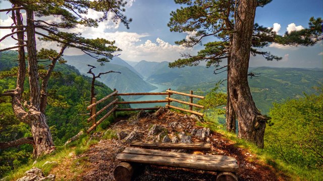
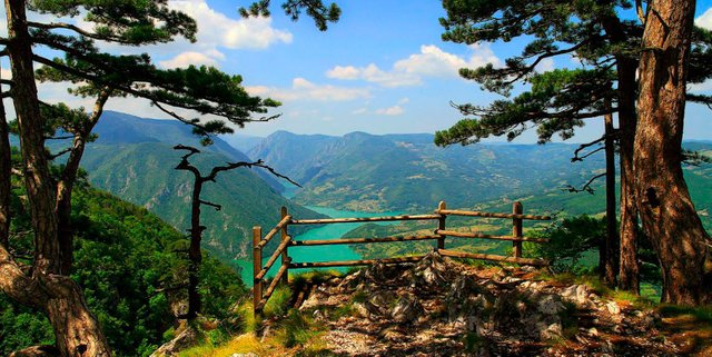
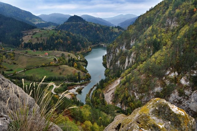
Beautiful mountain Tara in Serbia
Hello friends today i will show you beautiful mountain Tara. In Serbian language this mountain called Tara
The area of Tara was declared a National Park on July 13, 1981, on a total area of 24,991.82 ha.
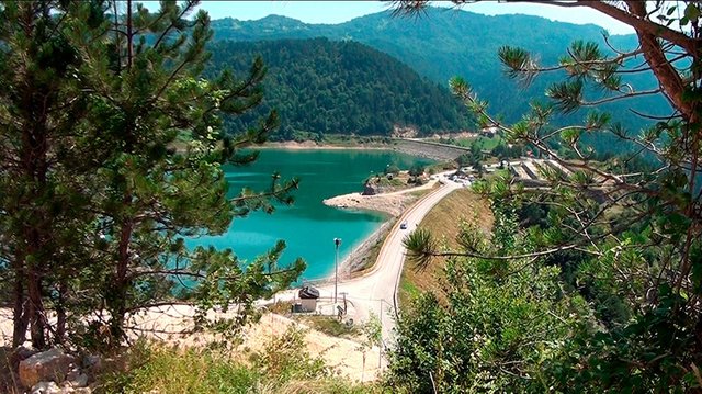
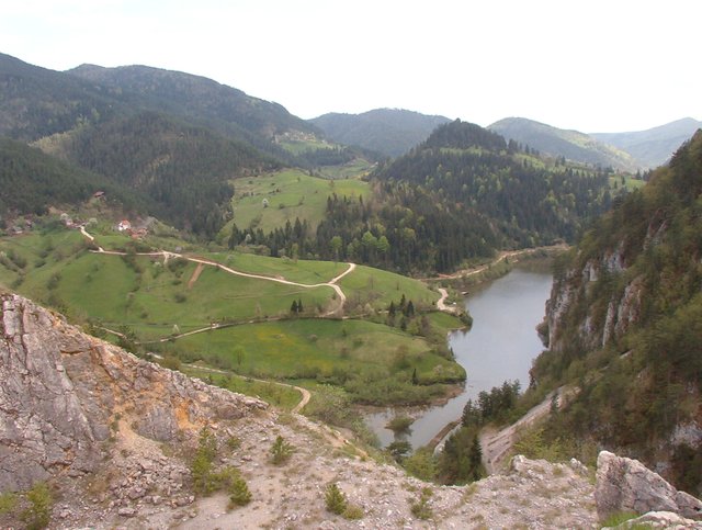
Mount Tara represents the surface of the Dinaric direction of extension. It belongs to the part of the Starovlaška mountains (Starovlaška-raška visija). It is located in the extreme west of Serbia, covering the area limited by the elbow flow of the Drina between Visegrad and Bajina Basta. The mountain Zvijezda is located in the narrowest part of the massif, which is naturally separated from Tara by the Gorge of Derventa. In terms of altitude, Tara belongs to the medium-high mountains, whose average altitude is 1,000 - 1,200 meters. The highest peak is Kozji rid - 1,591 meters.
Tara in a narrower sense - Ravna Tara - part of the massif with Kaludjerski bare and limestone plateau between the following rivers: Drina, Rača, Konjska reka, Beli Rzav and Derventa (top Zborište 1,544 meters above sea level).
Crni vrh - between the dry border of Serbia and Bosnia and between the villages of Zaovine and Rastiste. It is in connection with Ravni Tara on the Čemerište pass, and with Zvezda on the Predov Krst saddle (the top of Kozija Rid is 1,591 meters above sea level).
Zvijezda - in the triangle between the villages of Rastište and Jagoštica and the canyon part of the Drina (peak Veliki kraj 1,444 meters above sea level).
With these parts, the unique physical-geographical area consists of Veliki Stolac (1,675 meters above sea level), which is in Bosnia and at the same time the highest peak in the entire area.
Based on many years of studies and research in this area, and in order to protect the exceptional natural values that it possesses, the Assembly of Serbia declared the area of Tara a National Park in 1981 by a special law.
Mount Tara is a well-known traditional summer and winter recreational area. Favorable climatic conditions, a large number of sunny days, average altitude of about 1000 meters above sea level.
Below the northern slopes of Tara lies the town of Bajina Basta.
Mount Tara has been studied by many scientists. The first was Josif Pančić, who in 1875 discovered an endemic species of conifers on this mountain, called Pančić's spruce. The famous mountaineer Dr. Kuno Vidrić, who hiked almost all the important mountains of Europe, spent most of his time on Tara, marking hiking trails and collecting material for several books about this beautiful mountain.
Its beautiful thank you for sharing with us those beautiful scenes and keep posting the mountain in Healthy Trends
Thanks you @creativemaster
Great, another tourist destination. It looks beautiful