My Photography at Arabian Ocean
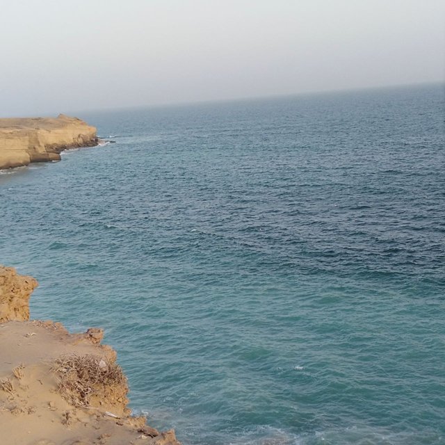
This is my new post in this community which is new for me. I liked this community so I subscribed to it so much. It is my first post and I shared my amazing picture which I captured on the Arabian Sea. It is a very nice and amazing picture and I liked it so much.
یہ اس کمیونٹی میں میری نئی پوسٹ ہے جو میرے لئے نئی ہے۔ مجھے یہ برادری پسند آئی لہذا میں نے اس میں بہت زیادہ سبسکرائب کیا۔ یہ میری پہلی پوسٹ ہے اور میں نے اپنی حیرت انگیز تصویر شیئر کی ہے جس کو میں نے بحیرہ عرب پر لیا تھا۔ یہ ایک بہت عمدہ اور حیرت انگیز تصویر ہے اور مجھے یہ بہت پسند آیا۔
The harbour is a seaport with harbours where ships docked and unloaded and unloaded passengers. Ports are located along the coast and have close contact with the sea. There are various types of ports that include ports, dry ports connected by road or rail, fishing ports and inland ports connected to the river or canal. The harbour differs from the harbour in that the harbours provide safe harbours for ships and other vessels, and ports are quite different from the commercial waters consisting of barns, harbours, and landmarks that carry land and sea to carry cargo and passenger goods.
Ports are important transport hubs that provide equipment to transport goods from local markets to international markets. Reports are considered important in supporting the economic life of any country. The ports not only serve the purpose of asset management but also bring about local economic prosperity. The country's economy is heavily dependent on trade and commodities that are provided by ports that act as domestic and international trade routes.
بندرگاہ بندرگاہوں والا ایک بندرگاہ ہے جہاں جہازوں پر ڈاکڈ اور ان لوڈ اور مسافروں کو اتارا جاتا ہے۔ بندرگاہیں ساحل کے ساتھ واقع ہیں اور سمندر سے قریبی رابطہ رکھتے ہیں۔ یہاں بندرگاہوں کی متعدد قسمیں ہیں جن میں بندرگاہیں ، سڑک یا ریل سے منسلک خشک بندرگاہیں ، ماہی گیری بندرگاہیں اور دریا یا نہر سے جڑے ہوئے اندرون ملک بندرگاہیں شامل ہیں۔ بندرگاہ بندرگاہ سے بندرگاہوں سے مختلف ہے جس میں بندرگاہ بحری جہازوں اور دیگر برتنوں کے لئے محفوظ بندرگاہ فراہم کرتے ہیں ، اور بندرگاہیں تجارتی پانیوں سے بالکل مختلف ہیں جن میں بارن ، بندرگاہوں ، اور نشانیوں پر مشتمل تجارتی پانی ہے جو سامان اور مسافروں کا سامان لے جانے کے لئے زمین اور سمندر کو لے جاتا ہے۔ بندرگاہیں اہم نقل و حمل کے مرکز ہیں جو مقامی مارکیٹوں سے بین الاقوامی منڈیوں تک سامان پہنچانے کے لئے سامان مہیا کرتی ہیں۔ کسی بھی ملک کی معاشی زندگی کو سہارا دینے کے لئے رپورٹس کو اہم سمجھا جاتا ہے۔ بندرگاہیں نہ صرف اثاثوں کے انتظام کے مقصد کو پورا کرتی ہیں بلکہ مقامی معاشی خوشحالی بھی لاتی ہیں۔ ملکی معیشت تجارت اور اجناس پر بہت زیادہ انحصار کرتی ہے جو بندرگاہوں کے ذریعہ فراہم کی جاتی ہے جو ملکی اور بین الاقوامی تجارتی راستوں کی حیثیت سے کام کرتی ہے۔
Developed countries and modern ports such as Singapore and Dubai enjoy better trading and transportation systems in terms of many economic benefits. In addition, industrial development is closely linked to ports as industries require a cheaper and safer way to export finished goods and import raw materials. Here is the role of ports that enhance global economic activity by increasing international trade capacity and connecting diverse maritime economies.
ترقی یافتہ ممالک اور جدید بندرگاہیں جیسے سنگاپور اور دبئی بہت سارے معاشی فوائد کے لحاظ سے بہتر تجارتی اور نقل و حمل کے نظام سے لطف اندوز ہوتے ہیں۔ اس کے علاوہ ، صنعتی ترقی بندرگاہوں سے بہت قریب سے منسلک ہے کیونکہ صنعتوں کو تیار سامان برآمد کرنے اور خام مال کی درآمد کے لئے ایک سستا اور محفوظ طریقہ درکار ہوتا ہے۔ یہاں بندرگاہوں کا کردار ہے جو عالمی تجارتی صلاحیت کو بڑھا کر اور متنوع سمندری معیشتوں کو جوڑ کر عالمی معاشی سرگرمی کو بڑھا رہے ہیں۔
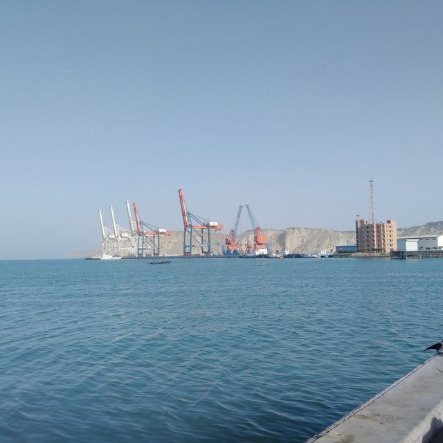
In addition, ports also create jobs for local people and add infrastructure development to areas that add more jobs and businesses. Therefore, ports play a vital role in the nation's economic growth. Pakistan is blessed with 1046 km of coastline along the Arabian Sea. The coast is divided by the coast of Makran stretching more than 800 kilometres and Sindh Coast reaching 246 kilometres. Pakistan, so far, has developed three major ports, Karachi port, Gwadar port and Muhammad Bin Qasim's port. The port of Muhammad Bin Qasim or Port Qasim is one of the oldest ports in Pakistan and the harbour of Karachi is the busiest place.
اس کے علاوہ ، بندرگاہیں مقامی لوگوں کے لئے ملازمتیں بھی پیدا کرتی ہیں اور ان علاقوں میں بنیادی ڈھانچے کی ترقی کو شامل کرتی ہیں جو زیادہ ملازمتوں اور کاروباروں کو شامل کرتے ہیں۔ لہذا ، بندرگاہیں قوم کی معاشی نمو میں ایک اہم کردار ادا کرتی ہیں۔ بحیرہ عرب کے ساتھ ساتھ 1046 کلومیٹر ساحلی پٹی پاکستان کو نصیب ہوتی ہے۔ ساحل مکران کے ساحل سے منقسم ہے اور 800 کلومیٹر سے زیادہ کا فاصلہ طے کرتا ہے اور سندھ کا ساحل 246 کلو میٹر تک پہنچ جاتا ہے۔ پاکستان نے اب تک تین بڑی بندرگاہوں ، کراچی بندرگاہ ، گوادر بندرگاہ اور محمد بن قاسم کی بندرگاہ تیار کی ہے۔ محمد بن قاسم یا پورٹ قاسم کی بندرگاہ پاکستان کی قدیم ترین بندرگاہوں میں سے ایک ہے اور کراچی کا بندرگاہ انتہائی مصروف ترین مقام ہے۔
The Gwadar port with an important geostrategic site was recently established by Pakistan in partnership with China. Gwadar Harbor is one of the deepest ports in the world and can accommodate up to 40 feet [16 m] of cargo. Pakistani geography is strategically important in terms of its interactions with various regions including Western China, Afghanistan and Central Asia Republicans such as Turkmenistan, Tajikistan, Kazakhstan and Uzbekistan. Therefore, all the ports mentioned above bear the importance of land. These ports have their own management units. However, the Department of Maritime Affairs being the central management authority is mandated to facilitate and regulate the development of the port and shipping sector in Pakistan. In terms of administrative power, these ports fall under the jurisdiction of the High Courts of Sindh and Baluchistan as a result of the Admiralty Jurisdiction of the High Court Ordinance, 1980. Karachi Harbor is one of the largest ports in South Asia and the busiest port in Pakistan.
ایک اہم جیوسٹریٹجک سائٹ کے ساتھ گوادر بندرگاہ حال ہی میں پاکستان نے چین کے ساتھ شراکت میں قائم کیا تھا۔ گوادر ہاربر دنیا کی گہری بندرگاہوں میں سے ایک ہے اور اس میں 16 فٹ لمبا کارگو شامل ہے۔ پاکستانی جغرافیہ مغربی چین ، افغانستان اور وسطی ایشیا ریپبلکن جیسے ترکمنستان ، تاجکستان ، قازقستان اور ازبیکستان سمیت مختلف خطوں کے ساتھ اس کے باہمی رابطوں کے لحاظ سے اسٹریٹجک لحاظ سے اہم ہے۔ لہذا ، مذکورہ بالا تمام بندرگاہوں میں زمین کی اہمیت ہے۔ ان بندرگاہوں کی اپنی انتظامی اکائییں ہیں۔ تاہم ، محکمہ میری ٹائم افیئر سینٹرل مینجمنٹ اتھارٹی ہونے کی حیثیت سے پاکستان میں بندرگاہ اور جہاز رانی کے شعبے کی ترقی کو سہولیات اور ان کو منظم کرنے کا پابند ہے۔ انتظامی طاقت کے لحاظ سے ، یہ بندرگاہیں ہائی کورٹ آرڈیننس ، 1980 کے ایڈمرلٹی دائرہ اختیار کے نتیجے میں سندھ اور بلوچستان کی اعلی عدالتوں کے دائرہ اختیار میں آتی ہیں۔ کراچی ہاربر جنوبی ایشیاء کی ایک سب سے بڑی بندرگاہ ہے اور مصروف ترین بندرگاہ ہے۔ پاکستان میں
The port is considered Pakistan's economic hub of about 60% of the nation's goods. Karachi Port is a deep natural harbour with an 11.5 km longboat and a 12.2-meter deep approach. The port has 30 dry goods and 3 water cargo handling facilities, including a state-of-the-art private storage facility - Karachi International Container Terminal (KICT). The port handles approximately 26 million tons of goods annually including 14 million tons of liquid and 12 million tons of dry goods. Currently, about 1600 ships visit Karachi Port every year and the settlement is about 45%, indicating that there is enough power in the port to carry a lot of cargo.
بندرگاہ کو پاکستان کا تقریبا 60 فیصد مال کا اقتصادی مرکز سمجھا جاتا ہے۔ کراچی پورٹ گہرا قدرتی بندرگاہ ہے جس میں 11.5 کلومیٹر لمبی کشتی اور 12.2 میٹر گہرائی تکلیف ہے۔ اس بندرگاہ میں 30 خشک سامان اور 3 واٹر کارگو ہینڈلنگ کی سہولیات موجود ہیں ، جس میں ایک جدید نجی اسٹوریج کی سہولت شامل ہے۔ کراچی انٹرنیشنل کنٹینر ٹرمینل (کے آئی سی ٹی)۔ یہ بندرگاہ سالانہ تقریبا 26 ملین ٹن سامان سنبھالتی ہے جس میں 14 ملین ٹن مائع اور 12 ملین ٹن خشک سامان شامل ہے۔ فی الحال ، ہر سال تقریبا 1600 بحری جہاز کراچی پورٹ جاتے ہیں اور اس میں تصفی. تقریبا 45 فیصد ہے ، جس سے یہ ظاہر ہوتا ہے کہ بندرگاہ میں کافی سامان لے جانے کے لئے کافی طاقت موجود ہے۔
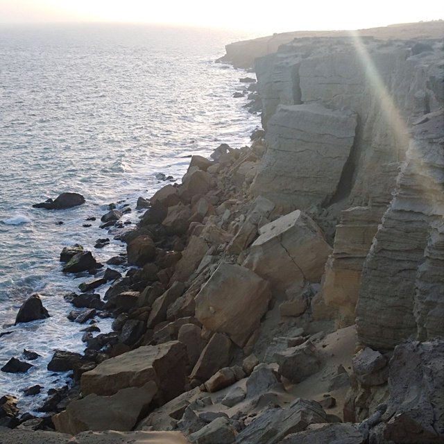
A beautiful view of the beautiful and beautiful sea. It’s so amazing and I took this camera for my mobile phone photo form. You may know that the water cycle describes the earth's water flow, so be aware that the chart and table below represent the Earth's water present at the same time. If you look back at a thousand or a million years, these numbers will no doubt vary. Note that the world's total water supply is about 332.5 cubic miles, more than 96 per cent of which is saline. Also, in total saltwater, more than 68 per cent are trapped in ice and glaciers.
خوبصورت اور خوبصورت سمندر کا ایک خوبصورت نظارہ۔ یہ بہت حیرت انگیز ہے اور میں نے یہ کیمرہ اپنے موبائل فون فوٹو فارم کے ل لیا۔ آپ کو معلوم ہوگا کہ پانی کا چکر زمین کے پانی کے بہاؤ کو بیان کرتا ہے ، لہذا یہ خیال رکھیں کہ نیچے دیئے گئے چارٹ اور ٹیبل ایک ہی وقت میں موجود زمین کے پانی کی نمائندگی کرتے ہیں۔ اگر آپ ایک ہزار یا دس لاکھ سالوں پر غور کریں تو ، اس میں کوئی شک نہیں کہ ان کی تعداد مختلف ہوگی۔ نوٹ کریں کہ دنیا کی پانی کی فراہمی تقریبا 33 332.5 مکعب میل ہے ، جس میں سے 96 فیصد نمکین ہے۔ نیز ، کھارے پانی میں ، 68 فیصد سے زیادہ برف اور گلیشیروں میں پھنسے ہیں۔
An additional 30 per cent of groundwater is fresh. New surface water sources, such as rivers and lakes, occupy only 22,300 cubic miles. This is 1/150 of the total water percentage. However, rivers and lakes are great sources for people to use every day. Wetlands have a warmer climate than inland areas. Winters are hot and summers cool. This is because the land near the sea is affected by the temperature of the seawater. The seawater temperature is moderate and stable. Why? There are two main reasons. Water slows down and cools down, then cools down. As a result, the sea is neither as hot nor as cold as the land.
زمینی پانی کا 30 فیصد اضافی تازہ ہے۔ ندیوں اور جھیلوں جیسے سطح کے پانی کے نئے ذرائع ، صرف 22،300 مکعب میل پر قابض ہیں۔ یہ پانی کی کل فیصد کا 1/150 ہے۔ تاہم ، ندیوں اور جھیلیں لوگوں کو ہر روز استعمال کرنے کے ل great زبردست ذریعہ ہیں۔ آبی علاقوں میں اندرون علاقوں کے مقابلے میں گرم آب و ہوا ہوتی ہے۔ سردیوں میں گرمی اور گرمیاں ٹھنڈی ہوتی ہیں۔ اس کی وجہ یہ ہے کہ سمندر کے قریب کی زمین سمندری پانی کے درجہ حرارت سے متاثر ہوتی ہے۔ سمندری پانی کا درجہ حرارت معتدل اور مستحکم ہے۔ کیوں؟ اس کی دو اہم وجوہات ہیں۔ پانی سست ہوجاتا ہے اور ٹھنڈا ہوتا ہے ، پھر ٹھنڈا ہوتا ہے۔ اس کے نتیجے میں ، سمندر نہ تو اتنا گرم ہے اور نہ ہی زمین کی طرح ٹھنڈا۔
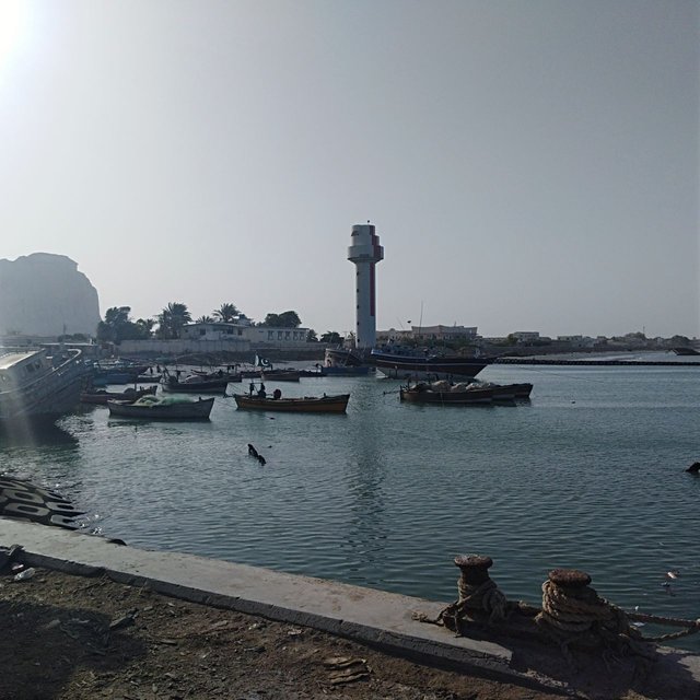
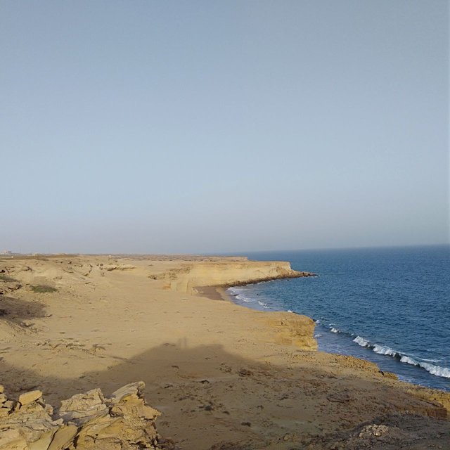
The Arabian Sea is located in the northwestern part of the Indian Ocean, between India, Oman, Pakistan and Yemen, and is located on Cape Guadafe in northeastern Somalia. The ocean connects the Persian Gulf with the Gulf of Oman and the Strait of Hormuz. To the southwest, the Gulf of Aden is connected to the Red Sea. The main ports in the Arabian Sea are Karachi in Pakistan and Mumbai in India.
بحیرہ عرب بحر ہند کے شمال مغربی حص ،ے میں ، ہندوستان ، عمان ، پاکستان اور یمن کے درمیان واقع ہے ، اور شمال مشرقی صومالیہ میں کیپ گوادیف پر واقع ہے۔ یہ بحیرہ خلیج فارس کو خلیج عمان اور آبنائے ہرمز سے جوڑتا ہے۔ جنوب مغرب میں ، خلیج عدن بحیرہ احمر سے منسلک ہے۔ بحیرہ عرب کی اہم بندرگاہیں پاکستان میں کراچی اور بھارت میں ممبئی ہیں۔
Water flows through all the world's oceans. Warm water from the Equator mixes with cold water from poles. The combination of warm and cold water causes the water temperature to rise.
Even temperatures in the interior are low because of the ocean. Outside the oceans, it would be extremely hot all over the world. Temperatures can drop by hundreds of degrees below freezing in winter. In summer, lakes and the sea can become fertile! Life as we know it would not exist on Earth without oceans. Seawater is considered to extract the most important minerals for trade such as salt, bromine, and magnesium. Although about 60 precious metals have been found to be dissolved in seawater, the majority are in so many parts that commercial production is not profitable. In a few parts of the arid world, such as Ascension Island, Kuwait, and Israel, seawater is used as a source of freshwater
.یہاں تک کہ سمندر کی وجہ سے اندرونی اندر کا درجہ حرارت بھی کم ہے۔ سمندروں سے باہر ، پوری دنیا میں یہ انتہائی گرم ہوگا۔ موسم سرما میں درجہ حرارت انجماد سے سیکڑوں ڈگری تک گر سکتا ہے۔ گرمیوں میں ، جھیلیں اور سمندر زرخیز بن سکتے ہیں! جیسا کہ ہم جانتے ہیں کہ زندگی سمندروں کے بغیر زمین پر موجود نہیں ہوگی۔ سمندری پانی تجارت کے لئے انتہائی اہم معدنیات جیسے نمک ، برومین اور میگنیشیم نکالنے کے لئے سمجھا جاتا ہے۔ اگرچہ سمندری پانی میں تقریبا 60 60 قیمتی دھاتیں تحلیل کی گئی ہیں ، لیکن اکثریت اتنے حصوں میں ہے کہ تجارتی پیداوار منافع بخش نہیں ہے۔ بنجر دنیا کے چند حصوں جیسے ایسسنشن آئی لینڈ ، کویت اور اسرائیل میں ، سمندری پانی میٹھے پانی کے ذرائع کے طور پر استعمال ہوتا ہے۔
Your work is really good keep it up for more upvote keep struggle and tyr and tyr one day you achieve success
I like your post you have done a great job i like your way of working very much and have been trying to keep working very well said very nice post thank you