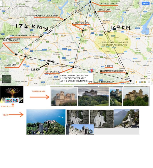
Line of sight geometry of early North Italy settlements
The map finds an alignemnt described with a triangle, of which the corners are mountain tops. There are equidistant point in the settlements and alignements over the triangle sides. The settlements belong to different civilisations or tribes. The 'Terramare' perhaps descending from Austria. The Golasecca in the Ticino Valley, The Valley of Susa, Mount Musine' with graffity and 'coppelle', a circle of monoliths in Cavaglia', important cities such as Turin, also Torrtona. The odd one out in the center of the chart is the site of Milano Expo 2015. This shows that the civilisations had aligned at the base of the mountains and faced toward the center of valley in the center. The valley was full of piaries and swamp, the hills provided shelter. There is another chart with a precise hexagonal distribution of places each located at about 100 - 102 km. Most surprisingly the modern planimetry of the cities involved, overlaps the geometry. Maps will be shown.