DACIA sacred geography like new phenomenon
Ancient Dacia is interesting topic , almost unknown for experts as well . Sacred geography of the south-western territory of pelasgian land , was described in few book about Hyperborean Dacia , Prehistoric Dacia etc . Unknown writes for common readers , whose names means nothing , left the basic information about sacred toponymies and deep analysis of Romanian folklore that ancient Dacia , was once , long ago , the sacred center of the Hyperborean tradition.!
Dacia was in close connection to polar Hyperborea , which was far more original than other indirect spiritual centers of traditional civilizations. Facts about Hyperborean Dacia are many , in many hidden stories about the mystery of the Danube delta which, according to Geticus, was the location of one of the main sanctuaries of Hyperborean Apollo. Oceanos Potamos –Istru –Danube was central river for vast pelasgian empire .
Danube delta with its cult center was placed to the Black Sea on the 45th parallel.
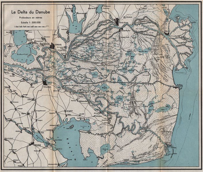
That belt divides the entire northern hemisphere in half. So , the cult center of Apollo in Dacia was located in the far north for the entire southern half of the northern hemisphere whose establishment has only recently become known to modern historians of civilization. The 45th parallel in general plays an extremely important parallel at which the center of the Apollonian cult of “Hyperborean Dacia” was located, what is also extremely important for researching , that the longitude of this place was 30 degrees east.
It can be said that this meridian, in its northern part, was the axis of the Slavs’ settlement. To its west were the Poles, Czechs, Slovenes, Serbs, Croats, Ukrainians, and Belarussians, countries with modern names and to its east were the Russians.Pelasgian empire was vast . In addition to the “extremely northern” location of Hyperborean Dacia in relation to the mediterranean world, the extreme South of its situation can also be considered in regards to the Slavo-Baltic-Scandinavian world . In fact, the mouth of the Danube was always the southern sacred-geographical pressure point of the “masses” of the Slavic, road to the north.
Hyperboran Dacia once formed part of Pelasgian empire the southernmost of the principalities.
Based on the above considerations, some kind of a dual, sacred-geographical map in which Geticus, Hyperborean Dacia serves as a common pole for two opposite circles could be outlined – for the southern, Mediterranean circle and for the northern, together with Baltic and Scandinavian elements . These circles were placed on 30th meridian of longitude to the east above and below the mouth of the Danube respectively. The most logical point to take opposite of the Danube delta at 30 degrees would be the intersection of this meridian with the northern polar circle “above” and the tropic of cancer ‘below” as these belts in turn quite naturally mark 14 degrees of the length of the meridian from the southern pole to the equator, that is, where the distance from Hyperborean Dacia to the pole and the equator and then back again is halved.
So , two circles, the northern one with its pole not far from the old city of Velikie Luki and the southern circle with its polar point in the Mediterranean Sea, whose distance is equal to place between Cyprus and Crete and the Nile Delta and the southern coast of Anatolia.

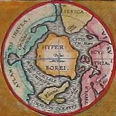
Another important testament in the form of medieval Scandinavian geographical maps which reflect the sacred picture of the world can confirm the sacred validity of the pattern we have drawn out. As a rule, these maps present circles where continents were symbolized by inscriptions rather than portrayed in shape, often bearing recurring graphic symbols when the map is oriented towards the east, towards the west, or, finally, in the case of a sharper northern orientation.
The labels on these maps clarify that these graphic signs symbolize the location of three bodies of water, the two sacred rivers – the Tanais (Dnieper) and the Geon (Nile) – and the Mediterranean Sea which includes the Black Sea and the Sea of Marmara.

It is crucial to note that the Tanais-Dnieper and the Geon-Nile actually flow in one way or another along the meridian at 30 degrees east longitude. The Dnieper flows from the North to the South, and the Nile from the South to the North. This parallelism between the two great sacred rivers gives us every reason to construct two circles of civilizations.
Recall the famous custom of Hyperboreans sending gifts to the temple of Apollo on the island of Delos.
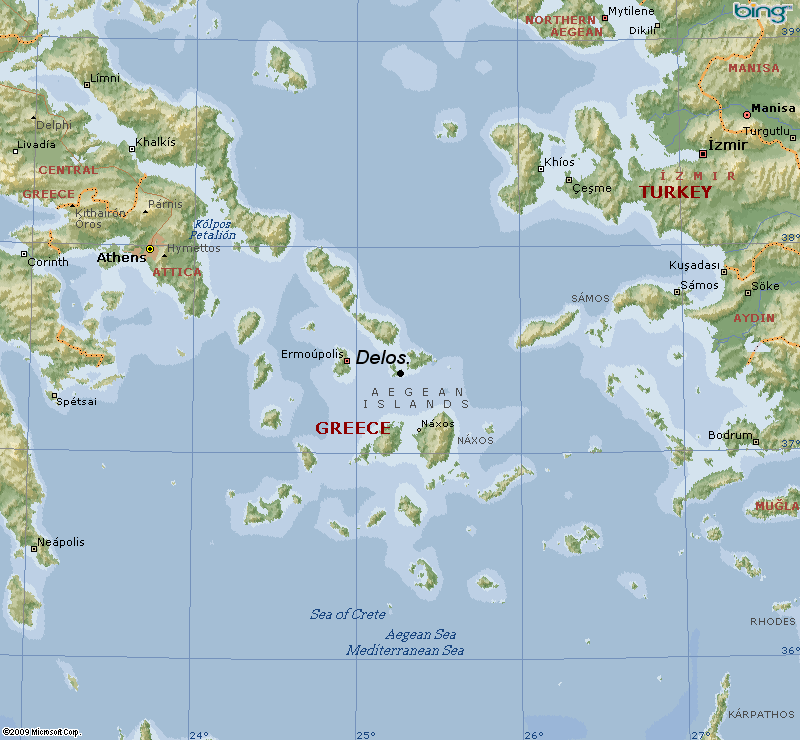
Delos can be approximately identified with the southern limit of the influence of northern, Hyperborean civilization where the spiritual radiation of the north circle “descended.” In addition, it is worth mentioning the “amber road,” from the Baltic to the Greece, along which the northern peoples carried mysterious “gold of the North”, later identified as amber, originally had an entirely different, purely initiatic meaning.
The entire northern circle was Hyperborean and polar symbolism .Besides many toponyms, a number of other factors suggest that Balto-Germanic lands adjoining it represented the center of a particular sacred-geographical energy whose traces we find in local folklore, myths.
As regards the southern, egyptian circle, its role is associated with Hyperborean Dacia for sake of the existence of the northern circle which further enhances it, acting as a reservoir for the sacred-geographical impulse covering this point along the ancient amber route, the path of the gold of the north.The centre for trade was river Po in Italy .
Considering the northern circle shows the particularity of its sacred-geographical composition. This circle must have a qualitative structure, and its sacred space must coincide with a temporal cycle. Obviously, the clearest and most impressive temporal cycle is the annual, or yearly cycle. It is immediately apparent that this circle is limited by two bodies of water to the north and the outh which have expressive symbolic names. In the north, there is the White Sea and in the south there is the Black Sea.
In this case the north has a positive, bright, solar coloration for mythological tales and legends in general. The south, conversely, has a negative, dark, or shadowy tint. The majority of conflicts in ancient history in ancient times were with precisely those residents of the southern steppes, such as the Huns, Cumans, Khazars, Tatars,etc. In the north, peace reigned more often than not. Proceeding from this particularity, it is logical to equate the north of our circle – the White Sea – with summer, and the south and the Black Sea with winter. In addition, it is important to stress that this line should not be considered one relating to climate, but rather towards “light” and “spiritual” analogies which are in fact specific to the Hyperborean tradition .

It is worth recalling the Greek myth of the birth of Apollo , his sister Artemis and their mother the goddess Leto . According to legend, the island on which they were born was located in the far North. It is impossible not to notice the phonetical correlation between the goddess Leto , with the same meaning in many languages today leto –summer , which denotes not only the season itself, but also the entire year or the whole annual cycle.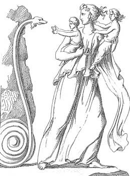
In fact, this northern-serpentine and Apollonian tale was noted in the sacred geography of the mouth of the Danube by Geticus in Hyperborean Dacia, where he pointed to the presence of an island with the name Serpent island in the Black Sea that was associated with the cult of Apollo in the delta itself , as the first Apollo’s cult centre .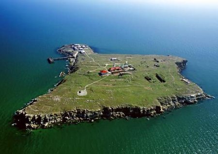
We should also recall the Greek legend of Hercules and the snake woman, the first ancestor of the Scythian kings.
According to this myth, this woman lived in the kingdom located at the mouth of the Dnieper where she guarded hidden treasures. The mouth of the Dnieper is in fact the point of the extreme South in sacred asian cosmography!
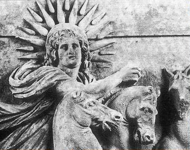
Symbolic figures into one which produces a hybrid image can be noted quite often among archaic peoples. Simultaneously, each symbol itself could have two opposite aspects , for example, Apollo was called the “patron saint of the wolves”, and wolves in general, while not losing their “winter solstice quality”, could act as “sources of the sun” or “life-giving darkness.” This is the case in Roman history and among the Turkic peoples. The werewolf-vampire is a figure associated with killing the sun, absorbing the sun, or drinking its blood (sunlight), at which point darkness overcomes light, and is also associated with the subsequent reemergence of the sun. It is striking that legends of vampires originated precisely west of the Danube delta , from that point of the winter solstice in the sacred sector, the sector characterized as the “darkest” or “most frightening” one over the course of the sun’s descent. It is also characteristic that symbolism of the wolf and dog continue to be quite widespread even when moving from this most southern point to the east, albeit they remain inferior to the image of the falcon or the Scythian falcon , the sun, having passed its critical points, begins to soar into the heavens of summer and towards the North, returning the heavenly reindeer.
This is the amazing coincidence between the name Baba Yaga and the Yagishni, are always present in action similar to Amazons in that they fight in a manly style against a hero. Interestingly enough, the location of the Amazons’ kingdom, the “women’s kingdom” in fairy tales, also corresponds to the south of the asian circle, the steppes, and the shore zone. This geographical peculiarity logically connects the idea of the “Kingdom of the Mother”, that is, primordial chaos, with the region in which light descends from the heavenly sphere to the earthly order for the summer half of the year and to the dark regions untouched and uncultivated by the influence of heaven and its organizing, potent element which resides in a free state during the winter part of the year.
What is most important of all is that it is possible to can see in all of this the intricate and native tales from ancient times , global view of sacred geography in sacred Homeland. This map is reflected in fairy tales, myths, legends .
In certain patterns, the birthing mothers have their hands and legs in the form of tree branches which refer to the symbolism of the World Tree from which, according to the North saga, the first humans were created . The first symbol for woman was the tree . It is important to note that ancient pelasgian civilization was predominantly “arboreal,” hardened in many of its manifestations during the Hyerborean, pre-stone age phase when worshiping the Tree was a direct reflection of the Axis in the material world connecting earth, people, and the spirit of heaven and extending to all aspects of life from the building to “arboreal writing” through “cuts” and woodcarving, etc. It is indicative that the very figure of the Birthing Mother of Light itself is always symmetrical as if she was split in half by an axis, the Axis of the World, which she herself actually represents.
Virgo Solar, or Lada, has her prototypes in ancient petroglyphs found on the territory of the asian north. Here is a schematized and extremely simplified depiction: here is visible between the Birthing Mother’s legs the newborn’s head, which is equivalent to the sun, the light of the world, that is born during the great feast of the winter solstice in the heart of winter.
When this New Year’s sun, the newborn-sun, or the solar hero begins to grow by leaps and bounds, sun disks made from sun-raised bread. It is extremely interesting to compare the figure of the Birthing Mother of Light to some embroidered calendars which both in Asia and among the Germanic peasants had a sort of sacred relationship to carved runic calendars. On embroidered calendars one sees two summer horns: a strange combination of cross-traits inside the final, 12th star- 12 months. Their unequal distribution gives us the number 66, the solar number in symbolism.
The year itself, presented in the form of a worm, has 73 divisions , 73 five-day weeks. This unique feature refers back to idea that the people of the primordial tradition measured the year in 5-day weeks corresponding to the five fingers on a hand . Pagan holidays were marked by social signs. The bottom features an inner star, the sign of the sun itself being born as in the figure of the Birthing Mother of Light at the moment of the winter solstice. it should be noted that Hyperborean Dacia, with its cult center of Nordic Apollo, corresponds with precisely the newborn sun of the winter solstice, the child of light, the solar hero, and the secret treasure.
Having outlined the sacred-geographical circle of Asia in general terms, we can once again turn to the Southern Egyptian circle with its center in the Mediterranean Sea. One is immediately struck by the fact that this circle encompasses all that might be called the Mediterranean cultural area including the Middle East, Egypt, Greece, Anatolia, Northern Mesopotamia, etc. The northern limit of the circle was Hyperborean Dacia. It is characteristic that this area is considered by modern historians to be the source of civilizations known to us, and it is from here that any fundamental civilizational principles , the origins of written language, mythology, religion, are supposed to be derived and used as reference points. In some sense, one can define this entire area as the sphere of “sacred-geographical Egypt”, as Egyptian cults and the sacred significance of the Nile are in many ways endowed with a special, original nature.
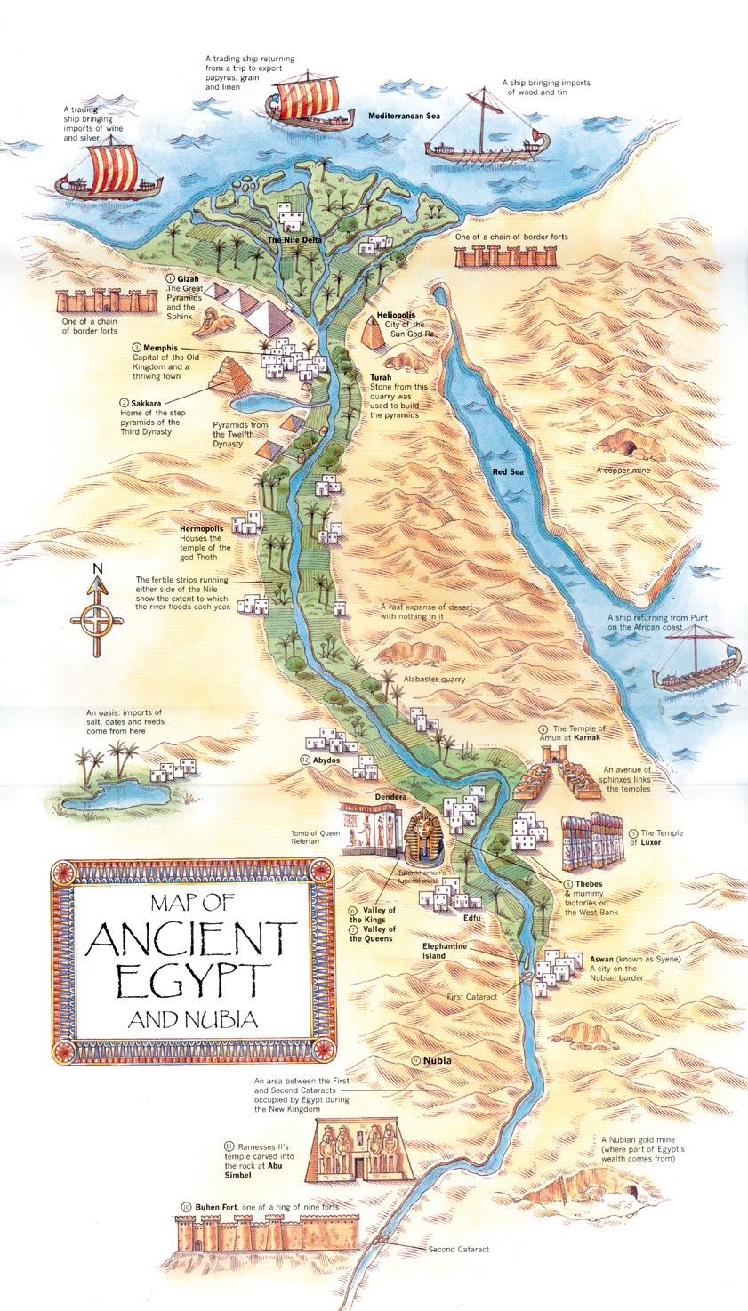
We can recall in particular that Scandinavian maps indicated only one graphic point for all the southern rivers, the Great Nile. It should be assumed that this sacred-geographical vision was peculiar to the ancient Mediterranean civilizations themselves for whom the northern peoples, the entire region of sacred circle, were associated most often of all with barbarity, primitiveness, danger . But , fundamental author claimed that Middle Eastern and particularly Egyptian sacred forms are post-Atlantic ones entirely remote from even the primordial tradition’s secondary branches. In regards to Egypt they thought that this tradition was a combination of western (Atlantic) and southern sacred influences .
This does not deny the authenticity of this traditional civilization, but it does assign it a subordinate, secondary position in the complex of tradition as a whole. Moreover , they emphasized the peculiarity of the Egyptian tradition as a tradition immanently cosmological which had lost much of the purity and clarity of Hyperborean, Apollonian metaphysics. Egyptian Heliopolis was a reflection, a substitute for the true, nordic, and Hyperborean Heliopolis .
Those who looked to Ancient Egypt as a traditional landmark risked reaching an outcome that is completely opposite to true initiation and spiritual realization. The Great Pyramid whose apex, was not lost over time but never actually existed seeing as how Egyptian initiates did not regard the mysterious, higher metaphysics of Hyperborea which in any normal case crowned the building of the sacred cosmos.
we want to see the maps :) Great Article!
My grandpa once said that one day people will wake up and press buttons to earn. That day is now!
[Presses button]
$9.17
32 382 hours ago by mindhunter 69 in steemit
Oh thanks its a beauty with the MAPS!!!!!!!