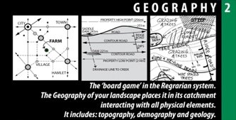
HOLISTIC REGENERATION - The Regrarians® Platform - Part 2 #Geography
Once we have a grasp of the climate of our project, we turn to geography.
Of course, it’s impossible not to be considering other aspects of our scale of permanency in the process, but our main focus here is geography. This isn’t just the lay of the land, but the lay of the marketing and demographics of the area.
As I looked around at the folks attending the workshop, it was apparent that work in every climate and on every continent has been accomplished or is underway by members of the group.
Some grew up from positions of privilege while others came from more challenging and, in some cases, heartbreaking backgrounds. Yet the common thread resounded – a need to make a regenerative change in an over-consumptive world largely dominated by human instigated degeneration.
For anyone who missed the last entry on climate, it represents what is generally enlightening and quite possibly a paradigm shift for those new to Regrarians, or at least holistic regeneration. Missing the “climate between the ears” is a mistake made all too often by both landowners and consultants alike.
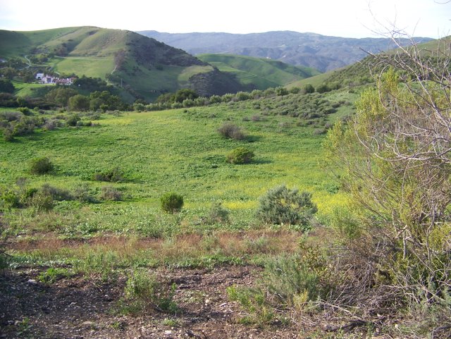
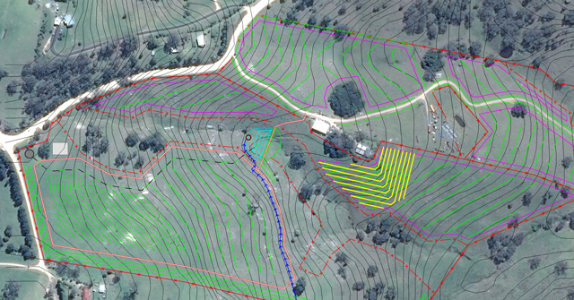
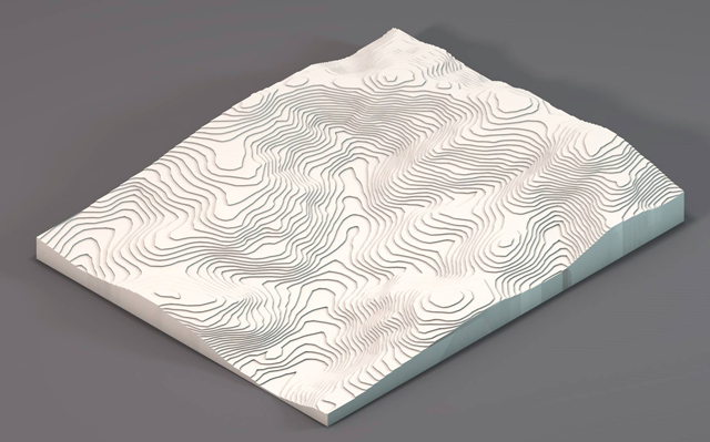
As we approach geography we get to really take a look at the lay of the land. Many tools are available to help with various maps, such as aerial photography and incredible topographical surveys using drone-mounted cameras.
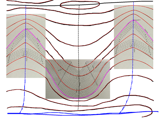
Two standouts for me personally relate to keyline and key points. Keyline isn’t just cuts on contour. It starts with an established contour guideline which on ridge you parallel up from or in a valley you parallel down from — resulting in a water flow that generally moves toward ridges, drifting away from the center of valleys. That’s a bit simplistic, but gets the point across somewhat.
Keypoints are the big eye openers, I think. Yet as the valley drops, one must be cognizant of the change in elevation of key points as well. This means that in just about any landscape, successive valley key points will drop in elevation as the valley drops. Otherwise, our swales will end up climbing the hill toward the ridges, sometimes impossibly so.
Darren J Doherty, Georgi Pavlov (HUMA Design), Geoscience Australia, GoogleEarth
The diagram above is my MapInfo-based rendition that Andrew turned into Fig. 2.35: Realistic application of Keyline geometry to agroforestry development and general farm layout at ‘Home Farm’ in the Geography chapter. You can see the way in which we’ve reduced gradients, not included the main primary valley in the patterning and so. This represents the shift from the theoretical to the realistic application of many of these Keyline patterns (Geography - Regrarians.org).
Sometimes the keypoint falls in an awkward place. Even if a property has some classic features, it almost always has some structure and nuance that makes finding keypoints difficult, or they may be so altered by features such as roads or old earthworks as to no longer be as readily recognizable.
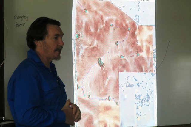
During this process, contour maps are printed (or on the computer) for assessment. After taking a good look at them, it's time to go out and really get the lay of the land.
Georgi Pavlov (HUMA Design), Geoscience Australia
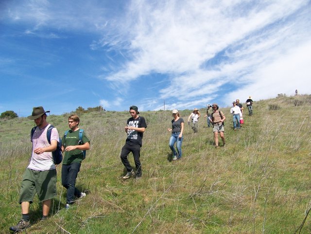
Some advisers will go out and just sit in strategic places on the land, watching and thinking. They're looking for clues as to what happens during the day. The goal is to understand the slopes, how they interact, how shadows move, what animals do, etc. As one then moves about, irregularities that won't show up on the land are sought.

Other features to be considered are erosive ones. Is the land being dried out by incisements? How are stock and game trails affecting the land? Are there headcuts that need to be healed? Without rightly examining and addressing these things, some of our work can become, at the very least, less effective. An unhealed incisement can drain the surrounding acreage of moisture, promoting desiccation. We discussed much of this in an earlier article on Watershed Restoration.
The man made influences are assessed here as well. Are roads in strategic locations? Do they promote or hinder our regenerative efforts? What about fencelines? Usually they're in a grid, which tends to hinder the most effective use of the land.
As part of this process, a more precise survey will be accomplished as well. We're not satisfied to merely look and see what we can see. Our goal is to maximize every nuance of the property, structuring our efforts so that every gradient, rock, plant, animal, fence, etc., conspire together to promote the healing and regenerative course of the land.
Ideally, we can hire a surveyor to come out and give us the details we're after. New companies are springing up using drones to get an accurate reading, providing incredible 3D imagery in some cases.
I think this is my favorite part of the process, maybe because I really want to grasp it. Water is cool too, which we'll tackle next time.
Feel free to contact me if you desire to discuss your project. If you're interested in hiring Darren, you can find details here.
Steemin' on,
Another Joe

- Water For Every Farm: Yeomans Keyline Plan
- The Challenge of Landscape by P.A. Yeomans
- The City Forest: The Keyline Plan for the Human Environment Revolution
- Custom Topographic Maps and Aerial Maps for the USA and Canada
- MapInfo Pro software
- SLM Partners
SLM Partners | Padua, Queensland (Australia) from SLM Partners on Vimeo.
~ Introduction - 1 Climate ~

Logo courtesy of @oecp85
Thanks for upvoting my riddle just now. Upvoted this content. Good day.
I can definitely see how drones have helped this whole process. What a huge amount of things to take into consideration, but you got to start it off right and not just jump into it blindly.
Yeah, some of the new technology for mapping is incredible. One is a flying wing that sort of porpoises, taking pictures at various angles. It gets amazing detail plus the topo/contour accuracy is incredible. For larger projects that someone plans on really dialing in, it's almost a must, IMO. For most of us, it's probably a bit cost prohibitive. I think I have a link to the service in one of the future articles. If not, perhaps I should look it up again.