Foragers - Make a map of your foraging spots with Google - The step by step of how to create your map.
"A picture is worth a thousand words"
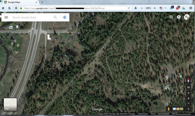
Every person who forages for food has places that produce on a regular basis. Remembering where those spots are from season to season and year to year can be a bit difficult, and notes are only so good. With technology as such that we have Google earth/maps and others, we can get quite close views of almost anywhere on the planet. I have used this to clip out the exact sized image I needed then added in color coding for each type of berry or fruit near my property, with a legend.

The step by step of how to create your map.
Find your property or the area you forage on your favorite maps site and zoom into the proper size to fit the area you forage. I use Google myself.
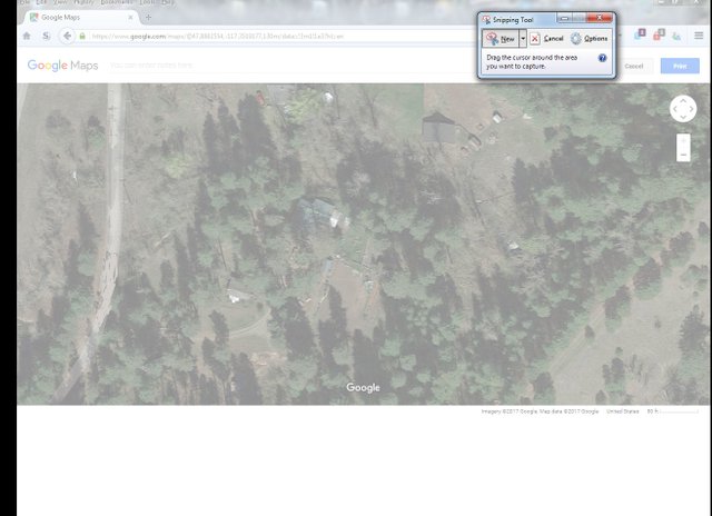
Once you have your sizing correct at the right zoom level, you will go to the menu on the search box in the upper left corner and go to print. ((Note- you can turn off labels under Satellite in the options menu to remove road labels))
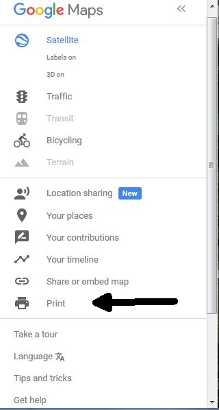
By choosing the print option it takes you to the print preview of the map and it has removed the search box and map icon.
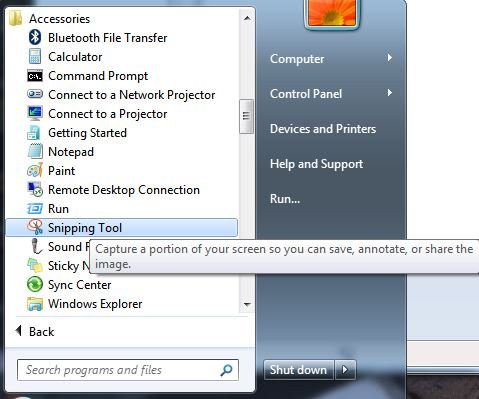
In Windows use the Snipping Tool.
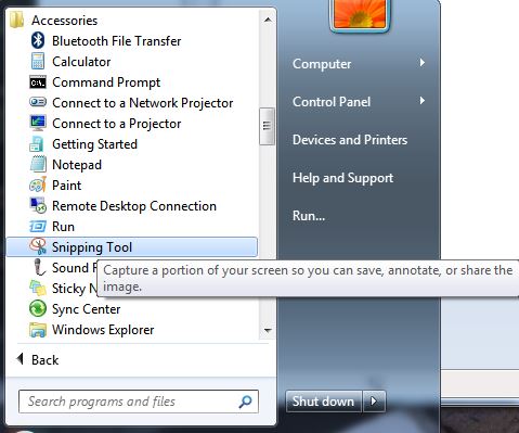
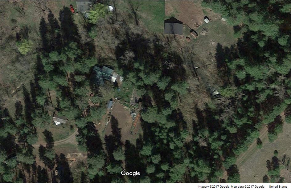
Using the Snipping Tool you will box select the area of the map you want to keep which will then allow you to save the clip.
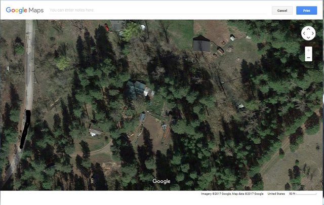
The clip after it is snipped.
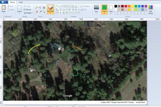
Now that you have saved the clip of the map, you can go into any paint program, like MS paint and color in the areas of each type of berry, fruit, weeds, etc. Be sure to make a legend to keep track of what color references what.
This is my final version again.
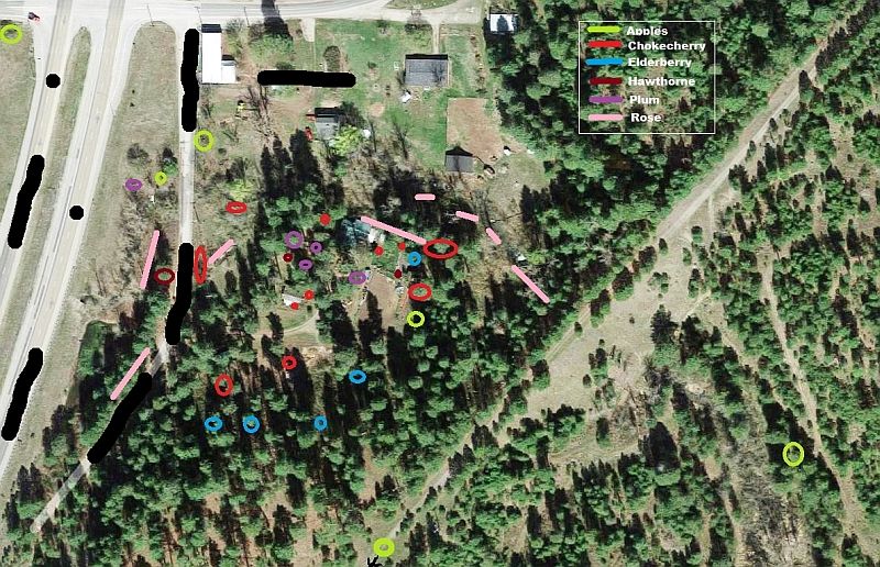


You can save yourself lots of trouble and heart ache each year by preparing a map to refer to. Save the file and you can go back and edit it to add or remove items as you find them or they no longer grow in an area.
Fleming Family Farm
FLEMING FAMILY FARM, LLC
Sustainable & Organic Methods | Heirloom Produce
All images are original works of Fleming Family Farm unless otherwise notated and credited.
If you find this post useful or entertaining, your support is greatly appreciated by upvoting, resteeming, & following!
THANK YOU!
![]()
Thanks for sharing. Just as food for thought, it's also becoming possible to share foraging spots with other foragers via shared maps, see some examples below:
https://fallingfruit.org/
http://wildfood.in/
Interesting links. I have a strong desire to always have a paper map available, but these sites are cool as they give me an idea of what's around. The fallingfruit site is crazy with all the identified trees they show in the cities.
It's an interesting concept the whole thing about publicly mapping wild edibles, because if it's not accompanied by a shared strong ethos and set of responsible harvesting principles then publicising information about the location of them on a public platform might also be seen as a potential threat to the survival of those populations. As in the original post, a map for private use has a strong application for the individual forager to keep track of their foraging spots, perhaps start to monitor and plan their harvesting. But releasing that into public domain might mean one irresponsible individual might go and collect them all, or perhaps a steady flow of foragers will diminish a certain population. Foragers are notoriously secretive about their foraging spots so it's interesting to know what are the opinions of foragers about such free-for-all sharing of plant location information. I'm not sure I've even quite made up my own mind about it!
Thanks for adding that information!
No worries. I absolutely LOVE maps. I love that you can map pretty much anything :)
I love foraging and I love this foraging map idea. Thanks very much for sharing. Happy foraging. Following you now. I have a friend in Spokane, small world =)
Spokane is a little big city. It has the air of a larger city but is topographically setup so that you don't realize how big it is when you are in various parts.
Thank you for this @flemingfarm. Most useful. I have always wondered how to do these maps on Google.
That's a nice idea to use Google for a foraging map! I've always just kept a small notebook and notes on existing maps. But whether the maps are old-fashioned or high-tech, they are so great for making the most of foraging finds from year to year!
I LOVE maps. I always have, so it is a natural extension for me to utilize them in many aspects of my life. I have taken notes on locations, but overgrowth and blow downs can really degrade the effectiveness of them so I started keeping map printouts, that way if need be I can always orienteer my way back.
I've generally used copies of USGS topographic maps, 1:24,000 or Forest Service maps. And sometimes a little flagging, tied discretely, like along fence lines for finding wild asparagus in the spring. Happy orienteering! :D
That's a great tip for any forager! After a few years, with a set of maps, your foraging will be like going to your local grocery store!
Exactly. I have 10 types of fruit and berries mapped so far. There are numerous types of edible plants all around my property so it ends up more my ability to identify than locate them. For instance I am looking out my window at bunches of lambs quarter in various stages of growth, Oregon grape fruiting, and Miner's lettuce blooming. Heck, I have Purslane growing as a weed in my garden...