Mount Everest satellite view- with a Funfact
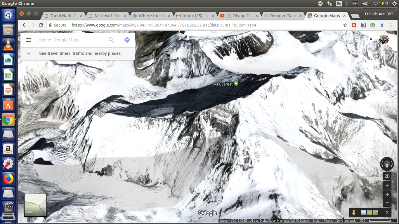
Have you ever wondered, How it will be to visit Mount Everest The highest peak of the world standing at a height of 8848 meters? I wondered the same and thought of doing it, but soon realized the unaffordability factor :) . Hence like all of you I visited Mount Everest Using Google maps!
I was astonished by its 3D view. Here I wanted to share this with you.
The Fun Fact:
Seeing the image I was shocked by a top view image. Do you guys know that mount Everest is shared along one of its pyramidal edge between two countries? Can You guess the two countries? Look in the image below for answer.