Developing the ingenuity of children | America (Part 3)
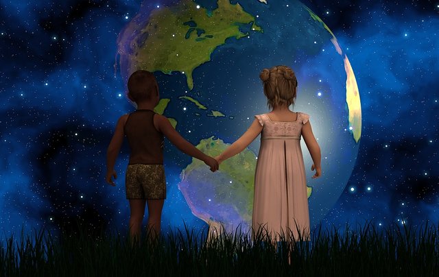

Hello, dear STEEMAINS! Welcome to our virtual classroom, Sometimes we are not aware of how education influences our lives, educating is an act of vital commitment to help build or save lives. Today I bring you a very important content for the development of any child. So I invite you to enjoy this class where we can clarify questions and doubts in children about America! A new world, as the Europeans called the American continent, because of its discovery.

AMERICA

A new world

The continent is conformed by 35 sovereign nations, in which they are: Antigua and Barbuda, Argentina, Bahamas, Barbados, Belize, Bolivia, Brazil. Canada, Chile, Colombia, Costa Rica, Cuba, Dominica, Ecuador, El Salvador, United States, Grenada, Guyana, Haiti, Guatemala, Honduras, Jamaica, Mexico, Nicaragua, Panama, Paraguay, Peru, Dominican Republic, Saint Kitts and Nevis , San Vicente, Santa Lucia, Suriname, Trinidad and Tobago, Uruguay and Venezuela. It is also accompanied by a Commonwealth and 24 independent territories.

From the territorial and physical point of view, it is possible to differentiate "three Americas":
From the territorial and physical point of view, it is possible to differentiate "three Americas":
CARIBBEAN
The Caribbean is located east of Central America and is comprised of the islands that make up the archipelagos of the Antilles, whose inhabitants are descended mostly from black slaves brought from Africa. And, it is located southeast of the Gulf of Mexico and the continental part of North America, east of Central America and north of South America. Some islands in the region have a relatively flat terrain of non-volcanic origin.

The Caribbean region comprises more than 700 islands, islets, reefs and cays, and is made up of countries (Antigua and Barbuda, Aruba, Bahamas, Barbados, Cuba, Dominica, Grenada, Guadeloupe, Haiti, Cayman Islands, Turks and Caicos Islands , Virgin Islands, Jamaica, Martinique, Puerto Rico, Dominican Republic, Saint Kitts and Nevis, Saint Vincent and the Grenadines, Saint Lucia, Trinidad and Tobago).

The Antillean archipelago, with a length of 3,000 km, is of mountainous relief. Many islands are of volcanic origin, and some of their peaks still show the activity of the subsoil. Some, like Cuba, is surrounded by reefs that make navigation very dangerous. In Cuba and Jamaica, some mountains reach 3,500 meters high. The rivers, in general, are of fast and short course.

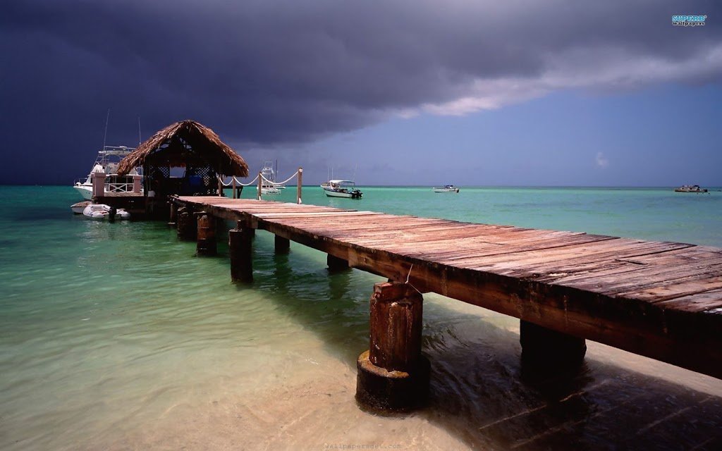
Its landscapes classified from Colon as "paradisiac", and especially its beaches, have made it the favorite place for tourism. Its climate, high temperatures, and abundant rainfall have allowed a lavish nature in resources, which has favored crops and human settlement.
Did you know that ... The most important productive sector that dominates daily life in the Caribbean is tourism?

Aruba
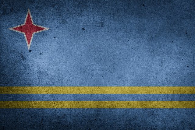
Official name of the country: Aruba (Country constituent of the Kingdom of the Netherlands).
Area: 193 km2.
Capital: Oranjestad.
Other important cities: Noord Barccadera, San Nicolas, Santa Cruz.
Official language: Dutch and Papiamento.
Currency: Florín.

Aruba is an island autonomous country of the Kingdom of the Netherlands, from January 1, 1986. It is one of the islands that is part of the whole of the Lesser Antilles, is located northwest of Venezuela and south of the Caribbean Sea. It has a total area of 193 km2 and has a population of approximately 110,000 inhabitants and is made up of the cities of Noord, Oranjestad, Barccadera, San Nicolas, Santa Cruz, Sabaneta and Ceru Colorado. Most of the population is descending of Spaniards and Dutch.
Most of the population speaks more than four languages (Dutch, Spanish, English, and Papiamento). Its official languages are Papiamento and Dutch, which are used in schools.

Did you know…?
Bahamas
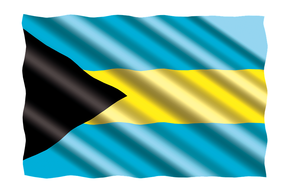
Official name of the country: Commonwealth of the Bahamas.
Area: 13,880 km2 .
Capital: Nassau.
Other important cities: Freeport, West End, Coopers Town, Marsh Harbor.
Official language: English.
Currency: Bahamian dollar (BSD).
)
It is one of the countries that form the Antilles or Islands of the Caribbean, its capital, and the most populated city is Nassau, located on the island of New Providence. It is formed by an archipelago of 24 inhabited islands, 700 uninhabited and more than 2,000 rocks and reefs. Located in the Atlantic Ocean, east of Florida (United States), north of Cuba and the other islands of the Caribbean Sea, west of the Turks and Caicos Islands. It is a nation member of the Commonwealth or British Commonwealth of Nations.
The Bahamas is divided into 31 districts: Acklins, Berry Islands, Bimini, Black Point, Exuma, Cat Island, Central Abaco, Central Andros, City of Freeport, Grand Bahama, Crooked Island, East Grand Bahama, Grand Cay, Abaco, Harbor Island, Eleuthera, Hope Town, Abaco, Inagua, Long Island, Mangrove Cay, Andros, Mayaguana, Moore's Island, Abaco, New Providence, North Abaco, North Andros, North Eleuthera, Ragged Island, Rum Cay, San Salvador, South Abaco, South Andros, South Eleuthera, Spanish Wells, Eleuthera, West Grand Bahama.

Did you know… The Bahamas became a colony of the British crown in 1718 when the British banned piracy?
Cuba

Official name of the country: Republic of Cuba.
Area: 110,681 km2.
Capital: Havana (founded in 1515 by order of Diego Velázquez).
Other important cities: Matanzas, Guantanamo, Santa Clara, Mariel.
Official language: Spanish.
Currency: Cuban peso.

Cuba is an island state located in the Caribbean Sea or the Caribbean Sea, in the Greater Antilles. It is constituted by the homonymous island (which is the largest in the Caribbean), by the Isle of Youth of 2,200 km2 and the archipelagos of Camarreos and Camagüey. With a very fertile flat territory; only a quarter is mountainous. There are numerous caverns, some of the great beauty. The coastal area (in general marshy) has abundant inlets and is bordered by coral reefs. The subsoil is rich in minerals (especially in nickel). In the last years, I seek to boost tourism.

Did you know…?
Curaçao

Official name of the country:Country of Curaçao
Area: 444 km2.
Capital: Willemstad.
Other important cities: Sint-Michiel, Grote Berg, Tera Kora, Lagun.
Official language: Dutch, Papiamento, and English.
Currency: Florin.

The country of Curaçao is an autonomous territory of the Kingdom of the Netherlands, it is located in the southern part of the Caribbean Sea just off the Venezuelan coast and very close to Bonaire and Aruba. It is made up of the cities of Willemstad, Westpunt, Barber, Soto, Sint Willibrordus, Sint-Michiel, Grote Berg, Tera Kora, Lagun. Formed by a plain, in the southwest, there is a rugged region that reaches maximum elevations of 365 meters. On the coast, irregular, there are several excellent natural harbors and its annual temperature averages approximately 27 ° C.

Did you know…? The city of Willemstad is the capital of the Netherlands Antilles? Its city and port were declared World Heritage by Unesco in 1997.
Haiti

Official name of the country:Republic of Haiti.
Area: 127,750 km2.
Capital: Port-au-Prince (founded in 1749).
Other important cities: Carrefour, Delmos, Cap. Haitien, Gonaïves, Les Cayes, Petionville, Port-de-paix.
Official language: French and Creole.
Currency: Gourde.
)
Haiti is located on the western part of the island of Hispaniola (whose eastern part belongs to the Dominican Republic) and includes other smaller islands, such as the Tortuga (which was a refuge for pirates in the seventeenth century). In its relief alternating mountain systems (which together occupy 60% of the territory, the depressions, and four important plains.) The climate is tropical, rainier in the North and cold in the mountains.

Did you know… Haiti was the first independent Latin American country, the first predominantly black population republic in the world and the first pre-Columbian empire in America?
Jamaica

Official name of the country:Jamaica.
Area: 10,990 km2.
Capital: Kingston (founded in 1692).
Other important cities: Spanish Town, Portmore, Montego Bay, May Pen.
Official language: English.
Currency: Jamaican Dollar.

Jamaica is an island state, located in the Caribbean Sea, in the Greater Antilles, south of Cuba. From east to west, the island is crossed by a chain of hills calcereas that most of the territory. To the east rises the Monte Azul massif with 2,292 meters high. In the west a limestone plateau is formed, covered with exuberant vegetation, from which numerous rivers flow down to the sea. The climate is tropical maritime, very humid and rainy, added to the beauty of their countries, attracts tourism.

Did you know…?
Puerto Rico

Official name of the country: Commonwealth of Puerto Rico (Commonwealth of Puerto Rico).
Area: 9,103 km2.
Capital: San Juan (founded in 1508 by Juan Ponce de León).
Other important cities: Bayamón, Ponce, Carolina, Trujillo, Alto, Vega Baja, Mayagüez, Arecibo, Guaynabo, Toa Baja, Caguas.
Official language: Spanish and English.
Currency: United States Dollar.
Officially Commonwealth of Puerto Rico. It is located in America, northeast of the Caribbean, east of the island of Hispaniola and west of the Virgin Islands. It is divided into seventy-eight municipalities; and its main cities are San Juan (capital), Bayamón, Carolina, Ponce, Caguas, Guaynabo, Arecibo, Toa Baja, Mayagüez and Trujillo Alto.

Did you know…?
Dominican Republic

Official name of the country: Dominican Republic.
Area: 48,730 km2.
Capital: Domingo (founded in 1496 by Bartolomé Colon).
Other important cities: Santiago de los Caballeros, La Vega, San Pedro de Macoris, La Romana, San Francisco de Macoris.
Official language: Spanish.
Currency: Dominican peso.

The Dominican Republic is a mountainous Territory, is located in Central America, occupies the eastern part of the island of Hispaniola, in the Center of the Greater Antilles. It has an area of 48,730 km2 with what is among the smallest countries, with an approximate population of 10,766,998 inhabitants, it is in position 86 of the population table, composed of 196 countries and has a population density of 221 inhabitants per Km2.

Did you know… Santo Domingo is the oldest of the cities founded by the Spanish conquerors in America and the first capital of the new world?
Trinidad and Tobago

Official name of the country: Republic of Trinidad and Tobago.
Area: 5,128 km2.
Capital: Port of Spain.
Other important cities: Arima, Chaguanas, Point Fortin, San Fernando. .
Official language: English.
Currency: Trinidadian dollar.

Trinidad and Tobago are located along the northeastern coast of Venezuela. Trinidad is located north of the mouth of the Orinoco River and is separated from the mainland by the Gulf of Paria. Tobago is located about 32 km northeast of Trinidad. This country is divided by 14 regions, on the part of the island of Trinidad are Couva-Tabaquite-Talparo, Diego Martín, Penal-Debe, Princes Town, Claro-Mayaro River, San Juan-Laventille, Sangre Grande, Siparia, Tunapuna-Piarco, Arima, Chaguanas, Point Fortin, San Fernando and Port of Spain. The island of Tobago has an autonomous government.
Did you know…?
CONCLUSION
- The region of the Caribbean or Antilles were the first lands in which Christopher Columbus landed, they received this name because the cartographers of the time cited an island called Antilia located in the western region of the Atlantic.
- Santo Domingo is the oldest of the cities founded by the Spanish conquerors in America and the first capital of the new world.
Thank you all for joining me in this fantastic and perfect exercise for the development of children, With this fun series of questions and answers, you can have a good time with the little ones in the house, help you in your physical and mental development, allowing you to expand his technique of concentration and observation to help them understand their environment. In addition, they provide us with the necessary knowledge and skills that allow us to protect ourselves against all adversities.

REFERENCES
- Caribbean.
- Aruba.
- Curaçao.
- Dominican Republic.
- Haiti. Spanish!
- Jamaica. Spanish!
- Puerto Rico.
- The Bahamas.
- Trinidad and Tobago. Spanish!

@steemiteducation "If we are alone in the Universe, it would surely be a terrible loss of space" - Carl Sagan

@saracampero
(promoting education)
I invite you to meet the family @ecotrain, where you will find wonderful people, talented and with an incredible human quality! Check out the #ecotrain hashtag to see more high quality items.........................................................

Supporting People Who Help
Make The World A Better Place
........................................................
........................................................


eSteem.app|GitHub|YouTube
Telegram|Discord
vote witness@good-karma
- Haiti. Spanish!

Yep, whenever most people say I love America, they're not pointing out which America since there are different Americas.
I learned something new about Trinidad and Tobago, so they have a natural asphalt spot...
Congratulations honey!! great job!
Thanks honey
i like eSteem app, good work
eSteem is the maximum!
In America and the Caribbean there are great sports players, especially baseball players! I congratulate you, I see that you try too hard to do your job!
That's true friend! Many famous players!
Hello friend, time without knowing about you, I see that you continue striving to transmit your educational knowledge, God bless you always.
Thanks your support! Blessing!1
How beautiful is Jamaica, ideal for vacations in tranquility, we must all know our world and transmit this knowledge to those who do not. Congratulations! By the way you've aroused curiosity in me, when you mentioned @esteem, apparently it's a great application.
eSteem is a practical and fast application. In addition to its founder and administrators are the maximum!, Join your discord group https://discord.gg/9cdhjc7. You can also download the application for pc from this site https://github.com/eSteemApp/esteem-surfer/releases... For more information, visit the page https://esteem.app/
I like Aruba, good article @saracampero
thanks for your vitsit girl!
Congratulations!!
Your post has been manually curated, by @sapphic's bot @vis4. I'd like to take the time to thank you for promoting diversity on the blockchain and making steem a more beautiful place.
If you would like to support me (@sapphic) with this project, please consider voting for my witness via steemconnect
thanks your support dear @vis4 and @sapphic's
Very nice places. Information that is very useful for tourist visits.
If you would like to support the educational community by delegating to @steemiteducation, please click on any of the following links. This will ensure that more teachers are supported on a daily basis.
100SP 200SP 300SP 400SP 500SP 750SP 1000SP 2000SP 3000SP 4000SP 5000SP 10,000SP 25,000SP