History and Charm of Mount Rinjani.
Facts & History Mt Rinjani
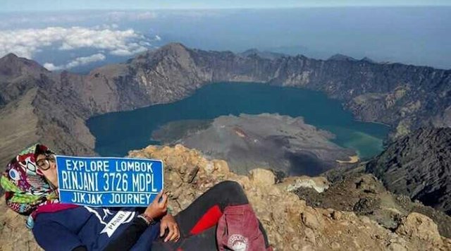
At 3,726 m, Rinjani is the second highest mountain in Indonesia, second only to Mount Kerinci in Sumatra, and dominates the relatively small island landscape of Lombok.
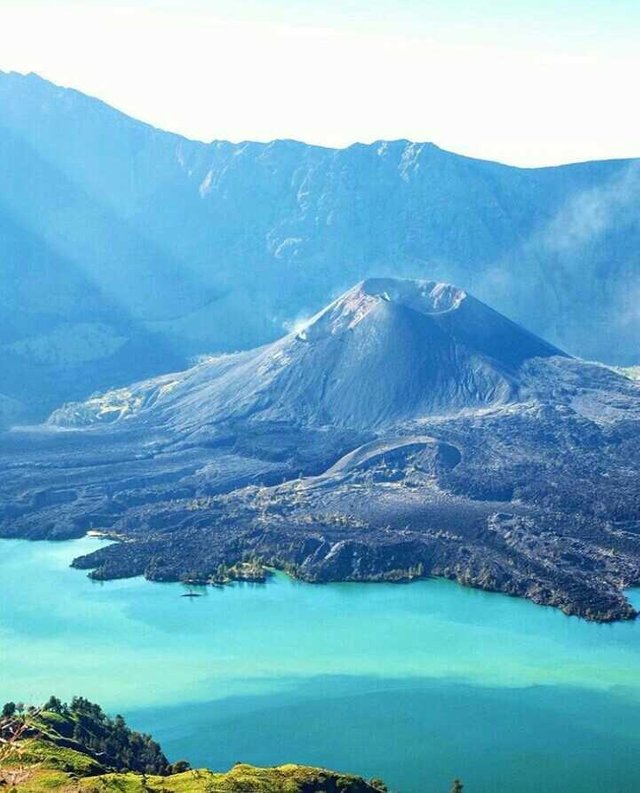
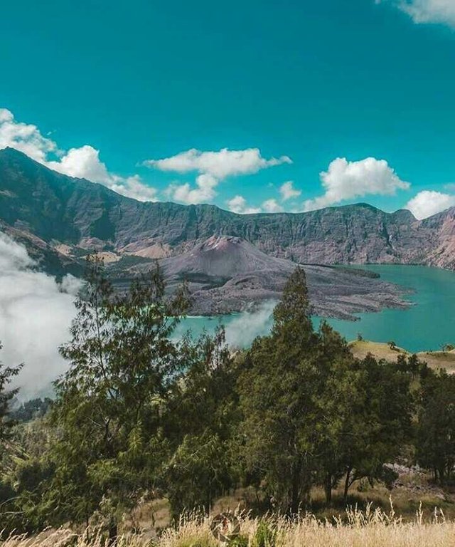
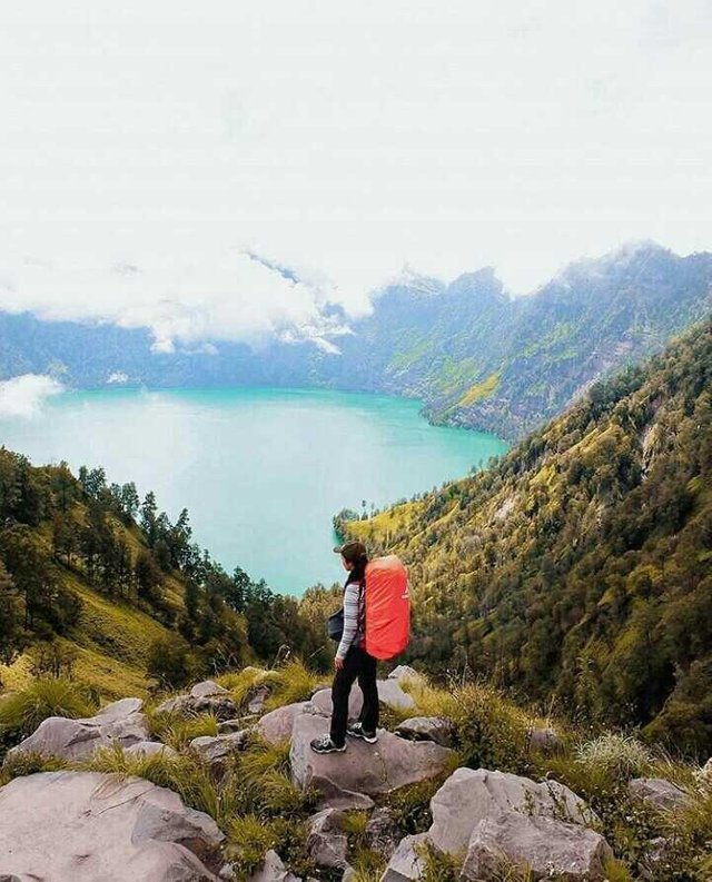
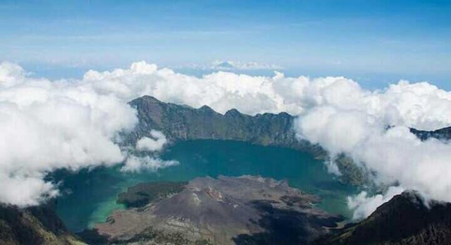
In this enormous 50 km² caldera there is a crater lake Segara Anak (Anak Laut). The eruption within the caldera has formed a new small cone called quite aptly, the New Mountain (New Mountain). Segara Anak has a natural hot spring bath.
The mountain and its satellites form the Gunung Rinjani National Park (Gunung Rinjani National Park) - officially 41,000 hectares within park boundaries and beyond 66,000 hectares of protected forest outside.
In 2008, the Indonesian government proposed to UNESCO that Mount Rinjani became one of the world's official geoparks. If this is approved by UNESCO, Mount Rinjani will be the first geological park in Indonesia.
History
The oldest recorded historical eruption was in 1847. Earlier that this was a very remote area, resulting in a lack of records.
There was a spate of activities from 1994 to 1995 that resulted in further growth of the New Mount cone crater, since it was renamed Mount Barujari (Finger Mountain).
On April 27, 2009 Mountain Barujari became active again with the activity continuing through May 2009. The climbing route of the peak was closed at that time when the eruption increased with a clump of smoke and ash as high as 8,000 m. Volcanic Explosion Index (VEI): 2 rating issued for activities between May and December 2009. The climb route was reopened on 14 September 2009 but the climbing route to the crater lake is still considered unsafe and remains closed.
In February 2010 observers at the Mount Rinjani Observation Post detected smoke clumps rising 100 m from the volcano. Activities in early 2010 centered on Mount Barujari. On May 1, 2010, a column of smoke was again observed rising from Rinjani erupting with an altitude of 1300-1600 meters with thick brown color and strong pressure. On May 5, 2010, the possibility of ash clouds rose to a height of 5.5 km (18,000 feet) and drifted as far as 150 km NW. Therefore the Center for Volcanology and Geological Hazard Mitigation suggests that intermittent activity can produce ash fur up to 1,500 m (5,000ft) above the caldera. Given this, the Volcanic Explorer Index rate is raised to 2 with the recommendation that no activity within a 4 km radius of the Mount Barujari eruption.
Recent Activity
Rinjani erupted three times further on May 23, 2010 with activity continuing until May 24, 2010. According to the official monitoring agent of the volcano, the ash from Mount Barujari reportedly rises up to 2 km into the atmosphere and damages the plant. Lava flows into the caldera lake, pushing the temperature up from 21 ° C to 35 ° C, while the smoke spreads 12 km. The volcano did not directly threaten the villagers during one of the eruption activities in early 2010 but access to some parts of the Mountain was officially closed or limited at some time.
LANDSCAPES
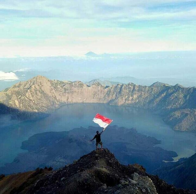
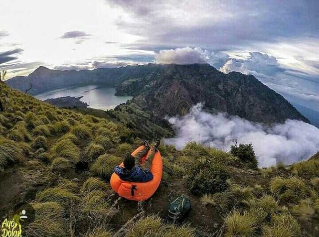
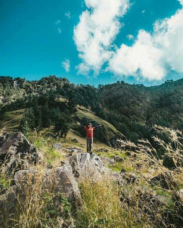
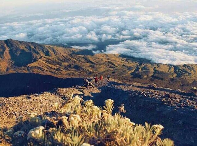
The lower and middle levels of the mountain are quite heavily forested. Above the tree line despite the slopes of the barren and rocky rugged and volcanic rocks. The view of the crater lake is quite a breath from the lips of the caldera, as the sun rises. From the absolute peak you can see Bali to the west and Sumbawa to the east.
Plants and Animals
Slopes of lower and middle elevation of dense forests with distinctive tropical species, including species that occupy the Wallacea transitional region between SE Asian and Australasian flora. The fig tree is mainly seen in the lower forest, as is the gigantic Guava Syzigium, with Engelhardia Bak Bakan being gnarled and scattering into prominence at higher altitudes. Casuarina wood (cypress) land takes over higher and this eventually gives way to the alpine flora above the trees.
Lombok is East of the Wallace Line and several species of birds with Australasian affinity are evident. These include residents of honey, cockatoos and green ornamental parrots, in addition to species whose heart to the West includes breasts, weavers and tailors. Bird life can be difficult to observe here because of the density of the forest, although if you have patience and practiced in mimicry many species can be tempted out of shelter - if you have free time and patience from your trekking partners.
The familiar long-gray monkeys (monkeys of the Balinese temple) are common up to the crater lips. Far more interesting are the rare ebony leaf monkeys that inhabit these forests and who call soft contact calls often provide a soothing background for birdsong. Deer deer and muntjacs are more often heard than seen.
HOW TO GET:
Most visitors arrive through the village of Senaru (600 m), on the north side of the mountain and thus closer to the main west coast resort areas including Senggigi. Another possible entry point is Sembalun Lawang (1,150 m), on the east side, which is closer to the summit.
Both villages are accessed from the north coast main road.
COST / PERMISSION / COST / TICKETS OF ACTIVATION
Entrance to the park costs Rp 150,000 per person. This fee is distributed as follows: 13% to park authorities, 62% for Rinjani ecotourism ascent (embarrassing because the line is full of detours dumped by guide and porter) and 25% for route maintenance trips etc.
WHAT SHOULD SEE IN THE PARK
Segara Anak, the crater lake and the hot springs of Aik Kalak, on the lips of the crater
The Mulang Pakelem. The annual Hindu ceremony in this crater lake comes from an 18th century invasion of Lombok by Balinese from the Karangasem kingdom and attracts hundreds of participants. The lake is sacred to Hindus and the sight of hundreds of Hindu pilgrims dressed in white sitting and praying here is an exhilarating experience.
Milk Cave (Milk Cave). One of the three famous caves (Milk Cave, Umbrella Cave, and Gua Manik) in Rinjani
WHY GUNUNG RINJANI
Crater Lake Segara Anak on Mount Rinjani. The new clear cone is the New Mountain.
Basic
At 3,726 m, Rinjani is the second highest volcano in Indonesia after Mount Kerinci in Sumatra. It is highly climbable by visitors with a high level of physical fitness. It is important to understand and respect this great mountain: unfortunately, visitors have died here for failing to follow reasonable procedures and making all necessary preparations.
Few actually make the very heavy effort it takes to reach the real peak but stop at the crater lip (approx 2,700 m) where the sight of crater lake is mind blowing. To make the 1,000 m climb to the top desperately requires a much higher level of fitness, not to mention the power of passion and sense of adventure.
Usually, a trip to the lips of the crater involves two days and one night on the mountain. Climbing again to the summit can be done only by camping one night but is often part of longer trips of 3-4 days and two or three nights.
The park entrance fee is currently Rp 150,000. Of this amount, 13% is allocated to Gunung Rinjani National Park, 62% for the Rinjani Trek Ecotourism Program and 25% to support the operation and maintenance program of the Rinjani Trek.
Do not try to do it yourself
Organized travel so far is the easiest, safest and most popular option but it is also very possible to make all your own arrangements and just rent equipment from one of the trekking centers on the mountain. The Rinjani Park Rules set the use of a certified guide so that people in the center at the start of the hike are not happy to let you climb Rinjani without. With lots of patience and explanation, you can sign a letter saying that you are responsible for yourself and not the organization. You will still pay an entrance fee, but it is by far the cheapest option to run on your own.
The Association of Licensed Mountains guides (HPI) certifies to Rinjani guides and porters but it must be understood that the required certification and training standards are not in the same rigorous place as is expected in many other countries. Serious accidents including casualties do occur on the Rinjani line when led by an accredited guide.
Proper climbing / climbing shoes are a plus but not necessarily, but should be a waterproof, windproof, and headlight jacket. If you are going to the top, use the pole (walking stick) to pass through the scree (top rock) at the top is also highly recommended. With 2,000m, you will feel like you are not in the tropics anymore like wet rises, hot air loses its temperature and may fall as rain. If inappropriate clothing becomes wet difficulty will be set as the air temperature to the peak is as low as 4 ° C, often with significant additional wind factor. You must prepare it accordingly.
Gallery

Nice post
Thanks brother.