Trail run at Blyde River Canyon South Africa
Blyde River Canyon - South Africa
I went for a little trail run on some of the hiking trails at Blyde River Canyon.
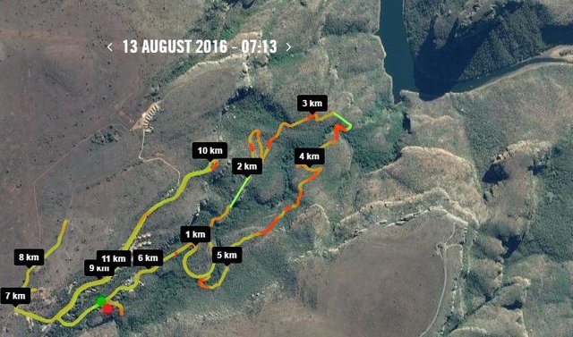
12km and just over 2 hours. Took it nice and slowly to take in the views and get some pictures.
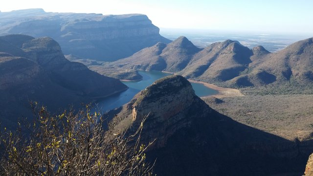
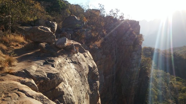
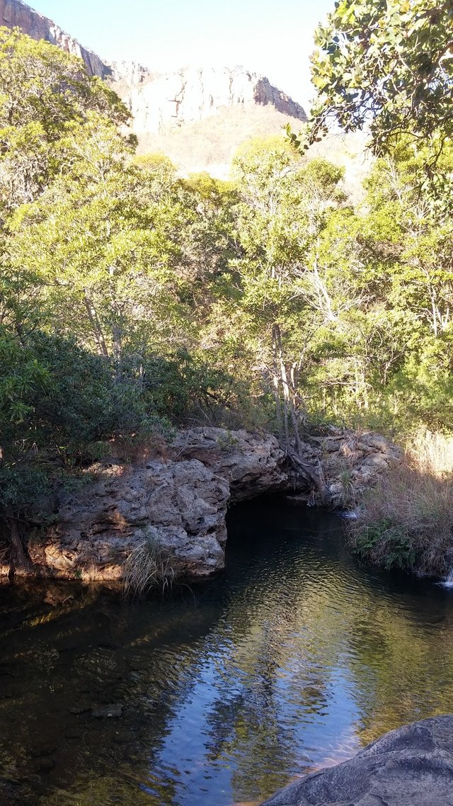
Started off at the lower look out point at Blyde River Canyon resort. The trail heads steeply down along the left side into the valley pictured below.
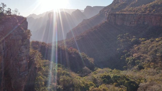
Beautiful sun rays streaming over the top of the far hills about 1km into the run. Nice easy going as it is mostly downhill.
Very strange noises coming from the bush down below. Sounded like someone playing a trumpet. I ended up deciding it must be a mating call of the antelope I came across later.
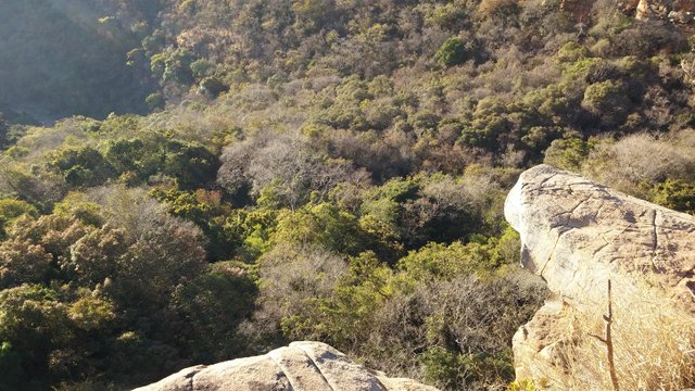
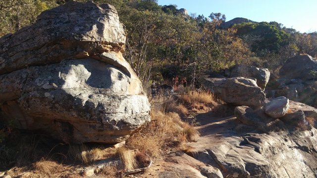
Trail runs along this cliff face for a while. Very nice place to sit and have a rest and drink
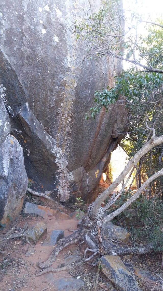
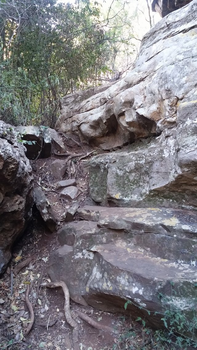
Heading very steeply down between a huge rock on the left and thick bush to the right
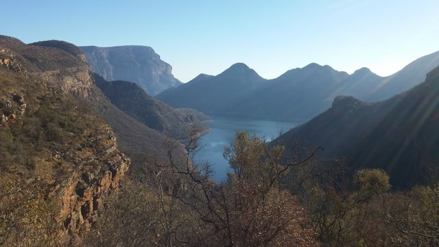
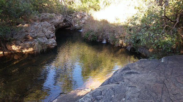
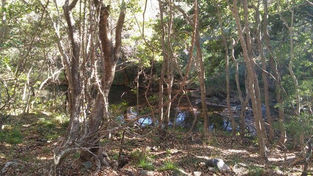
Been hoping all morning that the trail would cross the river at the bottom, and finally made it. Very refreshing to dip my head in the crystal clear cool water.
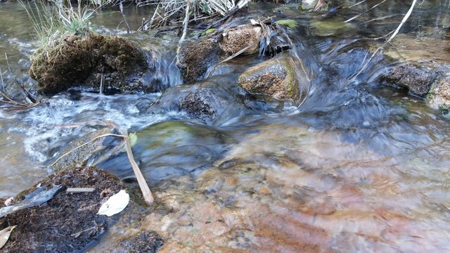
Had to cross back and forth over the river a few times before the uphill starts
After a nice rest at the river, the trail starts heading steeply upwards on the way back. Very tough going now! About 4km of uphill, cant even think about taking any more pictures.
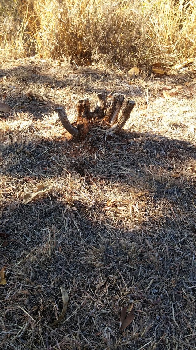
Zombie(hand) trying to come out of the ground right near the end.
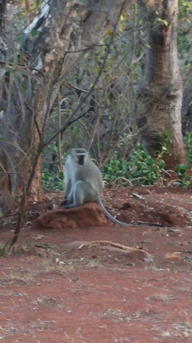
Also ran into a few antelope here. Unfortunately they were off in a hurry before I could get any pictures.
No shortage of baboons though
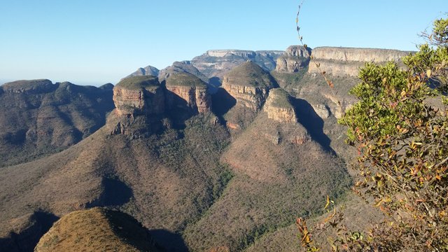
View of the 3 rondavels
Map of my trip from GPS watch
A bit about Blyde River Canyon from Wikipedia
The Blyde River Canyon is a significant natural feature of South Africa, located in Mpumalanga, and forming the northern part of the Drakensberg escarpment. It is 25 kilometres (16 mi) in length and is, on average, around 750 metres (2,461 ft) deep. The Blyderivierpoort Dam, when full, is at an altitude of 665 metres (2,182 ft). The canyon consists mostly of red sandstone. The highest point of the canyon, Mariepskop, is 1,944 metres (6,378 ft) above sea level, whilst its lowest point where the river leaves the canyon is slightly less than 561 metres (1,841 ft) above sea level. This means that by some measure the canyon is 1,383 metres (4,537 ft) deep.
Blyde River Canyon. The Three Rondavels are seen to the right of the center of this view.
While it is difficult to compare canyons world-wide, Blyde River Canyon is one of the largest canyons on Earth, and it may be the largest 'green canyon' due to its lush subtropical foliage. It has some of the deepest precipitous cliffs of any canyon on the planet. It is the second largest canyon in Africa, after the Fish River Canyon, and is known as one of the great wonders of nature on the continent.
Possibly the best view in the whole of the Blyde River Canyon is of the "Three Rondavels", huge, round rocks, thought to be reminiscent of the houses or huts of the indigenous people, known as rondavels. This canyon is part of the Panorama Route. This route starts at the town Graskop and includes God's Window, the Pinnacle and Bourke's Luck Potholes.
Thanks guys. Yes I do love the outdoors. Especially running in places like this! It is the most relaxing and peaceful thing.
Hey, see you like the outdoors. Fantastic photo's
nice article. i like the photos too. its relaxing to see that photos of a nature. upvoted