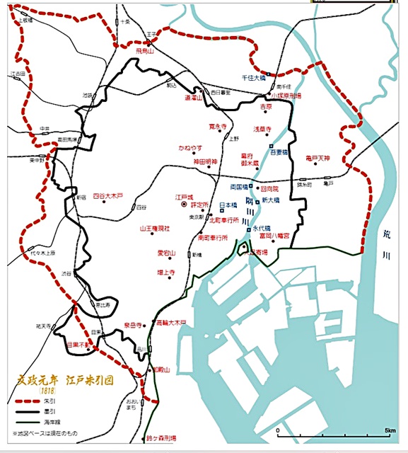
Edo in Tokyo-1 (東京の中の江戸-1) : For anybody interested in Japan & its history/culture (004E)
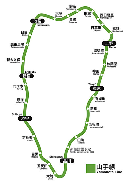
Edo in "Edo Peirod" is inside "Shuhiki(Red line) or Bokubiki(Black lne)"
as in the old map below, overlapping the range of the subway
"Ooedo" line which is long ellipse in east and west, rather than "Yamate"
line long in north and south.
江戸時代の江戸の範囲は、”朱引き・墨引き”と呼ばれる古地図の
範囲かと思われる。 現在の地下鉄大江戸線の範囲が比較的近いと
言われ、山手線範囲が南北に長い楕円に対して、東西に少し長い
楕円状の範囲と言えるかもしれない。
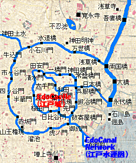
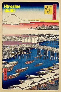
Making use of mainly Sumida river water, many canals were developed for
water transportation for activities of some 1.2 million population at that
time. River banks of Nihonbashi, Kyoubashi, Hacchobori and etcetra were
important points of the water network and economic activities, which were
close enough to Edo Castle (The Imperial Palace now) and became the key
area of the entire society.
隅田川等を利用して掘削の運河の水運が四方八方に巡らされて、
120万人と言われる江戸の人々の生活を支えていたようである。
日本橋・京橋・八丁堀の河岸は江戸城‐皇居にも近く、重要な
物資運搬の拠点として活用されていた。
The western side of Edo castle as Akasaka, Azabu, adding Shinjyuku, Shibuya
was called "Yamate" meaning rich and high class of the residence area of
waarriors. On the other hand, the eastern half as Chuuou, Koutou, Taitou,
Sumida-ku and so forth was considered "Shitamachi" where merchants and
normal public lived.
江戸全体の皇居辺りを境にして、西側半分、現在の赤坂・麻布~渋谷・
新宿は”山手”と言われて、高級住宅地、主に武士階級を中心とした地域
だったようです。 一方の東側、現在の中央区・江東区・台東区・
墨田区辺りは”下町”と呼ばれ、商業・庶民の場所だったようで、現在の
東京で”江戸の雰囲気”を残しているのは、東側の”下町”に多いように
思われます。
Mainly "Shitamachi" is the place where "Edo atomosphere" is still kept even
now, I think. From the nexe post, I would like to write each element of "Edo
admosphere" although they may be only my personal taste.
次回から、”江戸の雰囲気”を要素毎に取り上げてみたいと思います、
尤もそれらの要素は単に私の個人的な趣味での選別かもしれませんが・・・。