Where does the Nile River originate?
The Nile River:
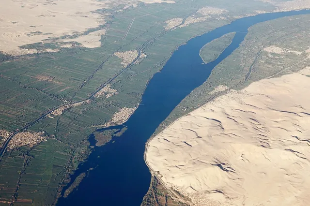
The Nile River: The name of the Nile is derived from the Greek word (Milos), which means valley or river valley, and the ancient Egyptians and Greeks called it Kim or Kimi, meaning the Black River because of the color of the black sediments that the river carries when it is in flood, and the Nile is the longest river in the world. The world was called the Gate of African Rivers, with a length of approximately 6,650 km and extending from the south of the equator and flowing north through northeastern Africa to pour into the Mediterranean Sea, which is bordered from the north with a total area of approximately 3.3 million square kilometers, and bordered to the east by hills The Red Sea and the Ethiopian plateau, and to the south the highlands in East Africa, and to the west, it is bordered by Chad and the Congo Basin, and the Nile River passes through ten countries: Tanzania, Burundi, Rwanda, the Democratic Republic of the Congo, Kenya, Uganda, South Sudan, Ethiopia, Sudan, and the cultivated part from Egypt. The Nile River basin covers about a tenth of the area of the African continent, which was the scene of the development of advanced civilizations in the ancient world, where the people who were among the first to develop the arts of agriculture and the use of the plow resided on the banks of the river.
The source of the Nile River:
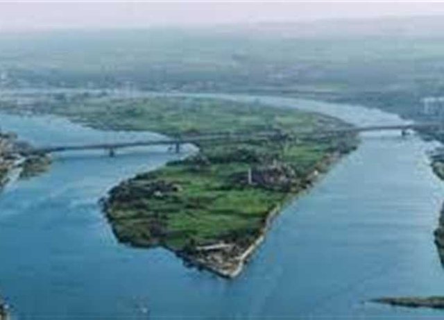
The Nile River stems mainly from two main sources: Lake Victoria, located on the borders of Uganda, Tanzania, and Kenya, which is the third Great Lakes in the world, and Lake Tana, located in Ethiopia, and in the following we will explain how water from both sources reaches the Nile: Lake Victoria: The journey of the Nile waters begins from Lake Victoria, located on the borders of Uganda, Tanzania, and Kenya, where Lake Victoria flows into the (Albert) Nile, which enters Sudanese territory to reach the Falls (Fula) in the city of Nimule, called Then in the sea of the mountain, and then the river enters the area of dense swamps and plant dams, after that, the river expands until it meets the Sobat River, which originates from the Abyssinia plateau. The White Nile continues on its path until it passes through the Sudanese capital, Khartoum, and then meets the Blue Nile, forming the course of the Nile River. It is worth noting that the White Nile feeds the Nile with a small percentage of water compared to the Blue Nile; Due to the evaporation of water in the area of plant dams and swamps. Lake Tana: Lake Tana is one of the largest lakes in Ethiopia, with an area of 3,000 square km. Where it flows in an area between the islands of Miriam and Shimano to form what is known as the Great Abay River or (the Blue Nile), which constitutes 85% of the water feeding the Nile, and the Blue Nile continues on its path until it reaches the Roseires Dam, covering a distance of 900 km and meeting The Blue Nile with the rivers Rahad and Dinder inside the territory of Sudan, after that it continues on its course until it meets the White Nile in the Muqrin area in Khartoum with a water level of 373 m. The confluence of the two rivers at that time is called the Nile. An artificial lake is located behind the High Dam, and in 1998 some parts of this lake separated in the Western Desert to form Lakes Toshka. After that, the river splits into two branches: the Damietta branch in the east, and the Rashid branch in the west, and each of the two branches eventually drains into the Mediterranean Sea.
Plant and animal life in the course of the Nile River:
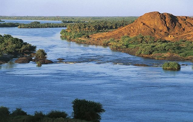
From its source to its estuary, the Nile Basin includes many plant and animal species. Tropical rainforests are found along the boundary between the Nile and the Congo and southwest Ethiopia, where heavy rains cause dense forests with a large variety of trees and tropical plants. Such as ebony, banana, rubber, bamboo, and coffee tree. There are also mixed grasslands (savannah), which are characterized by uneven growth of trees and herbs in parts of the Ethiopian plateau, south of the Ghazal River and near the plateau lake, and a mixture of thin bushes, thorny trees, and open pastures prevails. In the Sudanese plains, this bush includes papyrus leaves, tall herbs such as bamboo, cotton, a kind of ivy, and the thick-legged Nile rose that grows in South America, where this area becomes in the form of a swamp at the time of rain, and in the north of latitude 10° there is A belt of thorny savannah or orchard shrub, and to the north of this area the rainfall decreases and the vegetation comes out in the form of small thorny shrubs, mostly acacia, and in the north of Khartoum there are m A desert area with a few rotting bushes; Because of the lack of rainfall and irregularity, and weeds may be scattered along the drainage lines after rain, and there are some plants in green areas near the Nile as a result of irrigation and agriculture. On the other hand, there are many types of fish in the Nile River, such as the Nile perch, which may weigh more than 175 pounds, the bolt fish (a type of tilapia), and many types of catfish, in addition to the eel, the most widespread eel to the south of Khartoum and the eel Thistles spread in Lake Victoria.