Pros counter earth flat vs earth round, can anyone prove it?
Many people who have wasted time and energy to prove how the shape of the earth we live in today, in fact, it has been a very long time the people who discuss it, the pros and cons of flat earth or round earth as endless is discussed with heat with various evidence they show even up to now, it seems no one relents.
The easy way to work
Many things must be discussed one by one, be it the workings of commercial aviation from the most basic understanding, of course. First of all, an airline has a profit-making mission instead of trying to prove that the Earth is round or flat. Profit will be obtained either from the payment of air transport services, whether for passengers or cargo. Therefore, the main thing sought by airlines is the availability of air transport market on the route to be flown.

Singapore Airlines Airbus A380.wikipedia
Although the air transport market is abundant, if the political conditions do not support a route will not be able to operate. This politics is related to the relations between countries, either country of origin, destination, or passing the flight path. This set of regulations under this bilateral agreement is contained in the Freedoms of Air, which was the result of an agreement in the Convention on Civil Aviation in Chicago, the USA in 1944. An aviation pathway will be severely affected by international air regulations.
Surely every passenger wants to survive the goal, hence safety becomes a major factor after a flight gets the legality to operate. There are many preconditions to be met that the discussion can be summarized in more than one ledger of air safety. This article will only highlight one of them, which is related to airline selection rules. These rules are broadly divided into 2 (two) sets, namely Visual Flight Rules / VFR (Visual Flight Rules) and Instrument Flight Rules / IFR (Instrument Flight Rules).
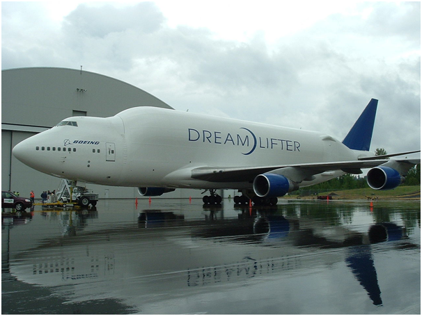
Still related to safety, a flight will only be possible if the distance is still within the range of the aircraft used. Usually, the larger the size of an aircraft will show the farther the range. This is why non-stop long-haul flights always use wide-body aircraft such as Boeing 777, Boeing 747, or Airbus A380.
Passenger and Cargo Markets
The calculation of the profitability of an airline is actually very complicated, but it simply follows the same formula as other types of business. As with any form of business in general, business profits are the result of the difference between operating income and operating costs. Operational costs arise from fuel combustion, land and airmanship, service, aircraft maintenance, fleet costs, and various other expenses. Operating revenues are the payout of passenger tickets, cargo delivery services, additional services, and others.
Revenue from passenger tickets is the largest component of the airline's operating revenues in general with cargo more often being its side income. Therefore, any airline in the world will design its aviation network primarily based on the number of existing passenger markets. If the direct route has a small passenger market, then, in general, the airline will combine it with other routes through a certain hub (link). Plain hubs are selected from among cities with a large enough passenger market.
The use of this hub is sometimes misunderstood by flat-earthers as the rationalization of the route shortening to fit within the flight range of a particular type of aircraft. For example when Qantas has no direct route between Sydney, Australia (SYD) to Santiago, Chile (SCL) using Los Angeles, United States (LAX) as a transit city. Similarly, the route to Sydney, Australia (SYD) to Johannesburg, South Africa (JNB) which at a certain time need to change planes in Perth, Australia (PER). For information, the record for the longest flight route since March 2, 2016, is held by Emirates with flight number EK 449 for Auckland route, New Zealand (AKL) to Dubai, United Arab Emirates (DXB). This flight spends 17 hours 25 minutes to cover a distance of 14,200 km using an Airbus A380.
Air Politics
There are 9 (nine) Freedoms of Air, but in this article will only be discussed First Freedom associated flight trajectory. First Freedom allows a flight to cross airspace (airspace) from a particular country. For example flights from the Filipina, the destination of the United Arab Emirates may cross India's airspace. Only First Freedom is not considering the politics between countries that crossed the flight path.
The shortest path between Seattle, USA (SEA) and Boston, USA (BOS) is through some Canadian airspace. There is no political tension between Canada and the United States, so neither country has First Freedom. It's just that if the flight is a domestic flight of the United States then the flight path will be slightly veered to avoid the Canadian airspace.
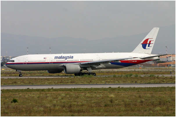
Shot Malaysia Airlines with flight number MH17 route Amsterdam, Netherlands (AMS) to Kuala Lumpur, Malaysia (KUL) in the airspace of Ukraine is the most fatal example of the impact of air politics. Prior to this incident, the Ukrainian airspace became the main choice of Malaysia Airlines and Singapore Airlines for routes connecting Western Europe with Southeast Asia. Soon after this incident, none of the intercontinental flights through the Ukrainian airspace.
Air Line Rules
As mentioned earlier there are 2 (two) sets of airway selection rules, namely Instrument Flight Rules (IFR) and Visual Flight Rules (VFR). These rules apply to create a flight plan from an airport of origin to the destination airport. This plan shall be prepared before the flight takes place and shall be followed during not in an emergency.
Visual Flight Rules (VFR)
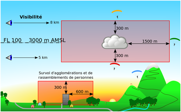
A VFR flight will require a fairly sunny weather condition so that the pilot can see where the plane is moving. Pilots must be able to avoid obstacles like mountains, hills, trees, buildings, and other aircraft that also fly in the same airspace. The VFR map shows only the position of the airports, the highest land heights, land contours, and airspace. Therefore the pilot can direct the plane straight to the destination as long as there is no obstacle in front of it.
Instrument Flight Rules (IFR)
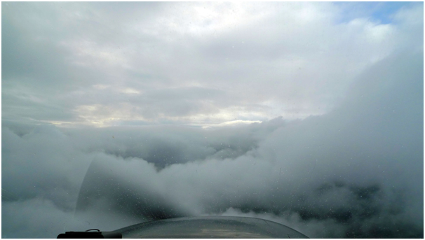
Flight using IFR is the most common in the modern aviation world. The IFR allows a flight to occur in a limited visibility condition as well as in cloud or smoke haze conditions. A flight with IFR will require supporting instruments both on land and on board. An IFR map will clearly show the complete flight paths with the code and the waypoints (path points). This map will also show the position of navigational aids (navigation aids) such as DME (Distance Measuring Equipment) and VOR (VHF Omnidirectional Range). Every IFR flight plan is required to adhere to the air routes contained in the IFR maps. This is why most commercial avi flights do not take the path that is really straight.
Usually, the passenger of the plane will feel the 2 times sharp turn with a long time lag on the choice of line no. 1 or 2 sharp turns with a short enough time lag on the selection of line no. 2. Both options of the path will result in nearly equal travel time so it will not affect the second flight scheduling.
Aircraft and Airport
A flight route is only possible if there is a plane capable of flying it. As mentioned earlier, the farther the distance the larger the plane. The problem is that not all airports in the world are capable of receiving large planes.
The aviation world is one of the most complex businesses today. Its flight routes are the result of a complex process involving market, political, safety and security elements, and so on. Therefore it is a bit too naive to use the aviation world as a means of proofing the Earth flat or round. Simply put, the existing flight routes will not prove the Earth is flat or round.
BEST REGARDS @the-mohicans
REFERENCE :
https://www.livescience.com/24310-flat-earth-belief.html
http://www.cobhamaviationservices.com/about/business-overview/commercial-aviation/
https://www.iaa.ie/commercial-aviation
https://transportgeography.org/?page_id=1765
http://www.economicsdiscussion.net/articles/air-transport-advantages-and-disadvantages/2179
https://www.unitingaviation.com/strategic-objective/economic-development/aviation-benefits-for-a-better-future/
https://www.historians.org/about-aha-and-membership/aha-history-and-archives/gi-roundtable-series/pamphlets/em-17-how-free-are-the-skyways-(1945)/what-are-the-five-freedoms-of-air-transport
https://en.wikipedia.org/wiki/Freedoms_of_the_air
https://www.reuters.com/article/airlines-iata-cargo/air-cargo-carriers-battle-competition-from-seas-passenger-planes-idUSL6N0OK1BY20140603
https://www.metabunk.org/flat-earth-theory-debunked-by-short-flights-qf27-qf28-from-australia-to-south-america.t6483/
https://www.freemaptools.com/how-far-is-it-between-boston_-usa-and-new-brunswick_-canada.htm
http://aviationknowledge.wikidot.com/aviation:visual-flight-rules
http://www.stephan-schwab.com/airtravel/vfr-ifr
Congratulations @the-mohicans! You have completed some achievement on Steemit and have been rewarded with new badge(s) :
Click on any badge to view your own Board of Honor on SteemitBoard.
For more information about SteemitBoard, click here
If you no longer want to receive notifications, reply to this comment with the word
STOP