My success creating contour map lines using a DJI drone & no prior experience!
I wouldn't have believed it was possible if I hadn't just done it, but using a basic app called Maps Made Easy and a DJI drone I was able to create a 3D map of a relatively large land mass following a road up the side of a hill in Sulawesi, Indonesia.
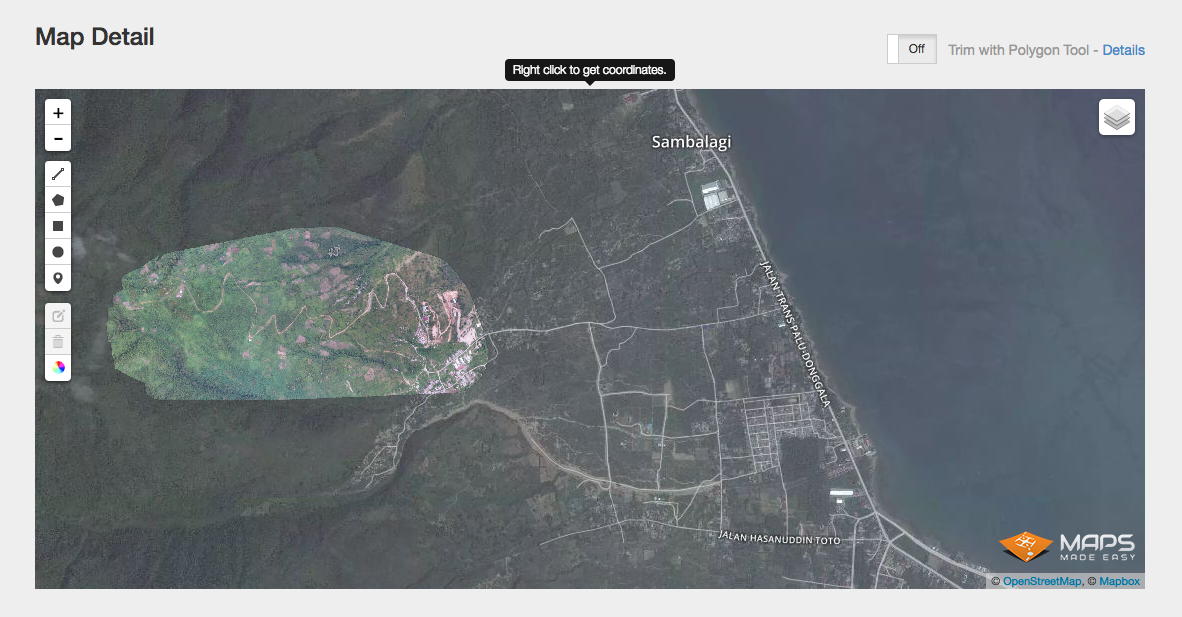
You can see above the highlighted area I covered with my drone. After flying up and down in lines, taking hundreds of photos.
This gives the developers much better resolution than Google Earth and also gives them a very accurate picture of the land they intend to build upon.
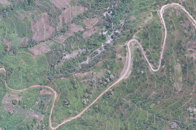
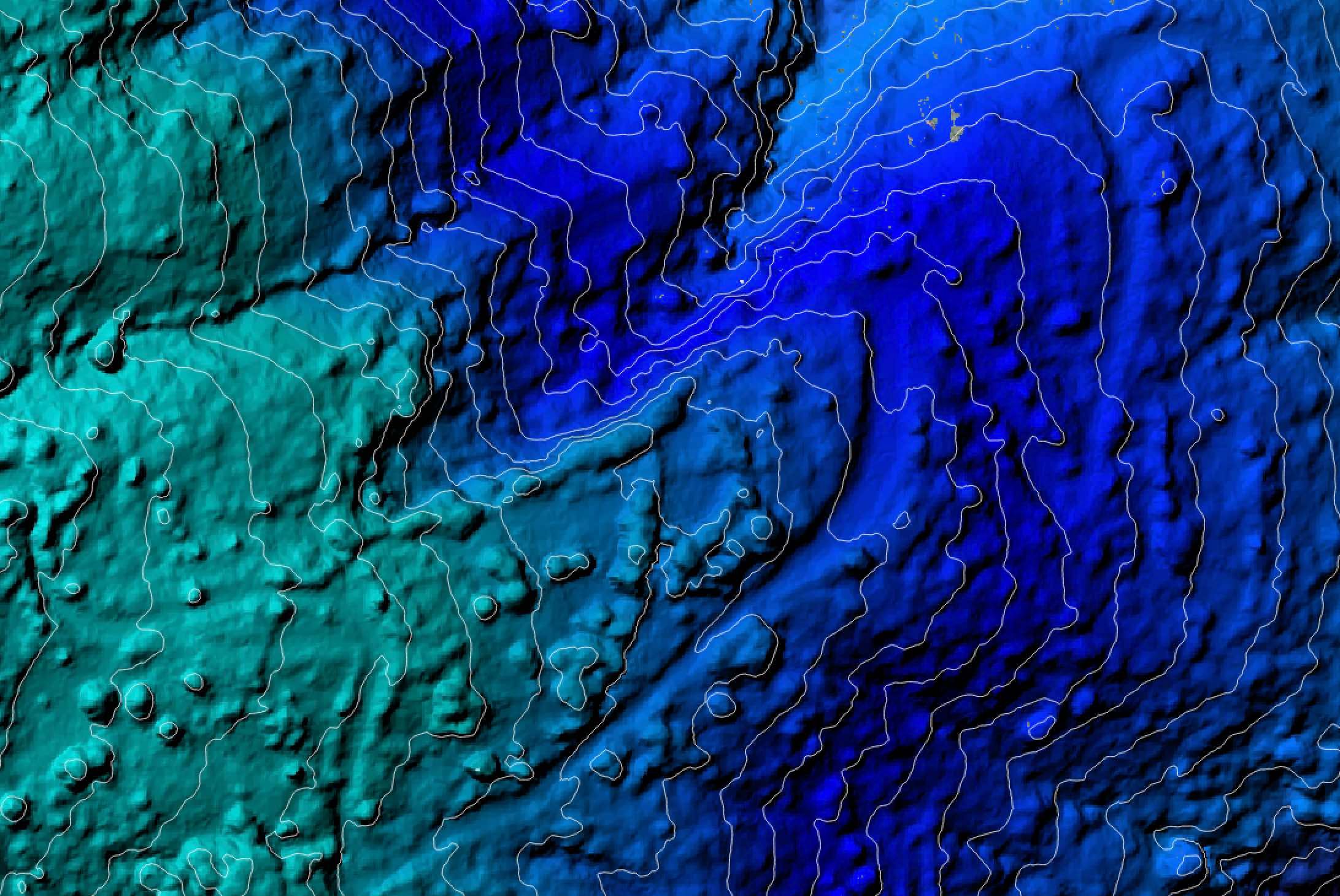
Here are two close up shots showing the contour lines I was able to create today (on my latest new software) at 10 Meter intervals. I can choose any number of meters between intervals.
The colour gradient contour map (which is the same area as the image above) helps us see clearly the steep drop off to the side of the road. Unlike the photo contour map.
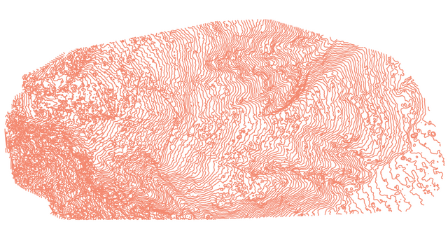
Here you can see the full mapped area with 5 meter contour lines and no background. There are loads of options to play with in this program.
I was also able to create a 3D map which opens in Photoshop. I can rotate and zoom in & out of this map retaining a high resolution.
So...today I delivered the full 3D map with all its contour line options to the client and he was very happy indeed. Which is great!
And now I have another skill.
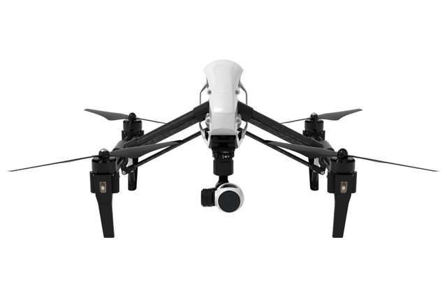
This my friends is the beautiful DJI Inspire 1 drone which help me achieve my latest goal. A wonderful piece of equipment. I won't be crashing it again!
So.... Happy days!
And by the way, I learned how to do all of this by watching a bunch of YouTube tutorials the night before the shoot :)

This is really cool man. I never knew something like this existed.
Me neither till a week ago! haha :)
nice sam :D
Thanks. It wasn't easy! I am actually not a technically minded person. Just a simple artist ;)
Wow, good job. Upvote and hope I will be again in Sulawesi
Many thanks. Let me know when you do. And we will have a steemit meet-up day in Sulawesi :)
Love to go diving in the north and want to see Rangepao again. But it is a long trip from Germany
Yes, a fair old distance from Germany. But then, I started out from the UK four years ago, with no money and all my possessions in a bag on my back. Yet here I am now in Bali, living aside a jungle in an eco community. With a partner and two kids. And a steemit generated income!
One simply needs to hold the intention :)
See you when you get here!
so true and a great story.
I traveled bali and gilis a few time. Last year for a month and sure next time we meet.
Fascinating! so good to learn new skills ant any age!!!
You know it! We never stop learning :)
This is awesome work @samstonehill! I've been looking into doing things like this for real estate developers and other applications. Amazing you were able to learn this the night before and produce some excellent results....following!
Many thanks. I am a persistent kind of person and once I decide I am going to do something, I tend to get it done.
Yes, it is an amazing tool I would not have been aware of if I hadn't been offered this job. And you can do it with any DJI drone.
Let me know if you start to use this tool and I will offer you any advice I can.
This post has been ranked within the top 50 most undervalued posts in the second half of May 31. We estimate that this post is undervalued by $18.86 as compared to a scenario in which every voter had an equal say.
See the full rankings and details in The Daily Tribune: May 31 - Part II. You can also read about some of our methodology, data analysis and technical details in our initial post.
If you are the author and would prefer not to receive these comments, simply reply "Stop" to this comment.
thanks for letting me know :)