Beauty of our country (Bangladesh)
Town
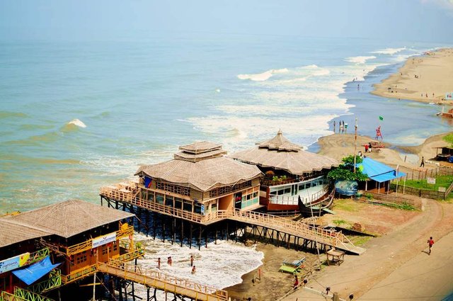
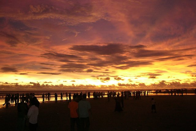
Cox's Bazar Town was constituted in 1869, eventually becoming a B-grade municipality in 1989. Located along the Bay of Bengal in South Eastern Bangladesh, Cox's Bazar Town is a health resort. But it is famous mostly for its long natural sandy beach. The municipality covers an area of 6.85 km2 (2.64 sq mi) with 27 mahallas and 9 wards and has a population of 51,918.Cox's Bazar is connected by road and air with Chittagong.
History
The greater Chittagong area, including Cox's Bazar, was under the rule of Arakan kings from the early 9th century until its conquest by the Mughals in 1666 AD.[8] When the Mughal Prince Shah Shuja was passing through the hilly terrain of the present-day Cox's Bazar on his way to Arakan, he was attracted to its scenic and captivating beauty. He commanded his forces to camp there. His retinue of one thousand palanquins stopped there for some time. A place named Dulahazara, meaning "one thousand palanquins," still exists in the area. After the Mughals, the place came under the control of the Tipras and the Arakanese, followed by the Portuguese and then the British.
The name Cox's Bazar originated from the name of a British East India Company officer, Captain Hiram Cox, who was appointed as the Superintendent of Palonki (today's Cox's Bazar) outpost. He succeeded Warren Hastings, who became the Governor of Bengal following the British East India Company Act in 1773. The Captain rehabilitated many refugees in the area, but died in 1799 before he could finish his work. To commemorate him, a market was established and named after him, called Cox's Bazar. Cox's Bazar then was first established in 1854 and became a municipality in 1869.
After the Sepoy Mutiny (Indian Rebellion of 1857) in 1857, the British East India Company was highly criticised and questioned on humanitarian grounds, specially for its opium trade monopoly over the Indian Sub-Continent. However, after its dissolution on 1 January 1874, all of the company's assets including its Armed Forces were acquired by the British Crown. After this historic take over, Cox's Bazar was declared a district of the Bengal Province under the British Crown.
Cox's Bazar Map from Series U542, US Army Map Service, 1955
After the end of British rule in 1947, Cox's Bazar became part of East Pakistan. Captain Advocate Fazlul Karim, the first chairman (after independence from the British) of Cox's Bazar Municipality, established the Tamarisk Forest along the beach. He wanted to attract tourists as well as to protect the beach from tsunami. He donated much of his father-in-law's and his own lands as sites for constructing a Public Library and a Town Hall. He was inspired to build Cox's Bazar as a tourist spot after seeing beaches of Bombay and Karachi, and was a resort pioneer in developing Cox's Bazar as a destination. He founded a Maternity Hospital, the Stadium and the drainage system by procuring grants from the Ford Foundation and Rockefeller Foundation through correspondence. T. H. Matthews, the principal of the Dacca Engineering College (1949~1954), was a friend who had helped him in these fundraising efforts. Engineer Chandi Charan Das was the government civil engineer who had worked on all these projects. In 1959 the municipality was turned into a town committee.
In 1961 the Geological Survey of Pakistan initiated investigation of radioactive minerals like monazite around the Cox's Bazar sea-beach area.
Cox's Bazar Bus Terminal
In 1971, Cox's Bazar wharf was used as a naval port by the Pakistan Navy's gunboats. This and the nearby airstrip of the Pakistan Air Force were the scene of intense shelling by the Indian Navy during the Bangladesh Liberation War. During the war, Pakistani soldiers killed many people in the town, including eminent lawyer Jnanendralal Chowdhury. The killing of two freedom fighters named Farhad and Subhash at Badar Mokam area is also recorded in history.
After the independence of Bangladesh, Cox's Bazar started to get administrative attention. In 1972 the town committee of Cox's Bazar was turned into a municipality. In 1975, The Government of Bangladesh established a pilot plant at Kalatali. Later, in 1984 Cox's Bazar subdivision was promoted to a district, and five years later (in 1989) the Cox's Bazar municipality was elevated to B-grade.In 1994 (jobs) the Marine Fisheries and Technology Station (MFTS) was established at Cox's Bazar. MFTS is a research station of Bangladesh Fisheries Research Institute (BFRI) headquartered in Mymensingh. The station covers a land area of four hectares and contains five laboratories.In April 2007 Bangladesh got connected to the submarine cable network as a member of the SEA-ME-WE-4 Consortium, as Cox's Bazar was selected as the landing station of the submarine cable.In September 2012 the municipality was the site of the Cox's Bazar and Ramu riots, where local Muslims attacked the Buddhist community over an alleged Quran desecration posted to Facebook.
very beautiful
Congratulations @sobujtalukdar74! You have completed some achievement on Steemit and have been rewarded with new badge(s) :
Click on any badge to view your own Board of Honor on SteemitBoard.
For more information about SteemitBoard, click here
If you no longer want to receive notifications, reply to this comment with the word
STOPgood post...please follow me. https://steemit.com/@sakib1122