Rain Moving Northward Overnight Weather Improves This Week

Rain Moving Northward Overnight Weather Improves This Week
<iframe style="border: none;" src="//rcm-na.amazon-adsystem.com/e/cm?o=1&p=12&l=ez&f=ifr&linkID=431c1e7be66bc52a4e7193969dcff192&t=meteorologisj-20&tracking_id=meteorologisj-20" width="300" height="250" frameborder="0" marginwidth="0" scrolling="no"></iframe>
Rain Moving Northward Overnight Weather Improves This Week
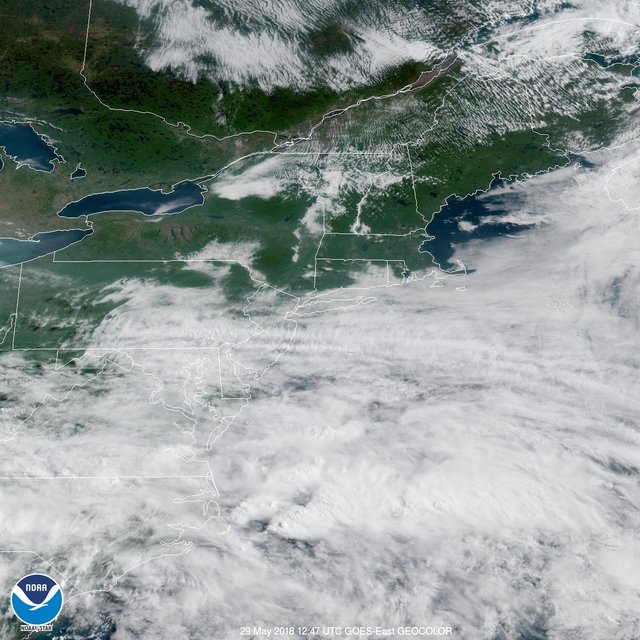
The dry cool air over New England made it as far south as NYC during the afternoon and you can see on the visible satellite picture who had a nice sunny Sunday and who didn't. Now we begin the march of clouds moving back northeastward as low pressure moves across the Great Lakes moves east kicking another low that has been stuck in Virginia since yesterday, northeastward and off the coast. Moisture to the south is beginning to move east northeastward so it won't be long before rain moves in. That should occur overnight into the Monday morning commute.
EASTERN SATELLITE
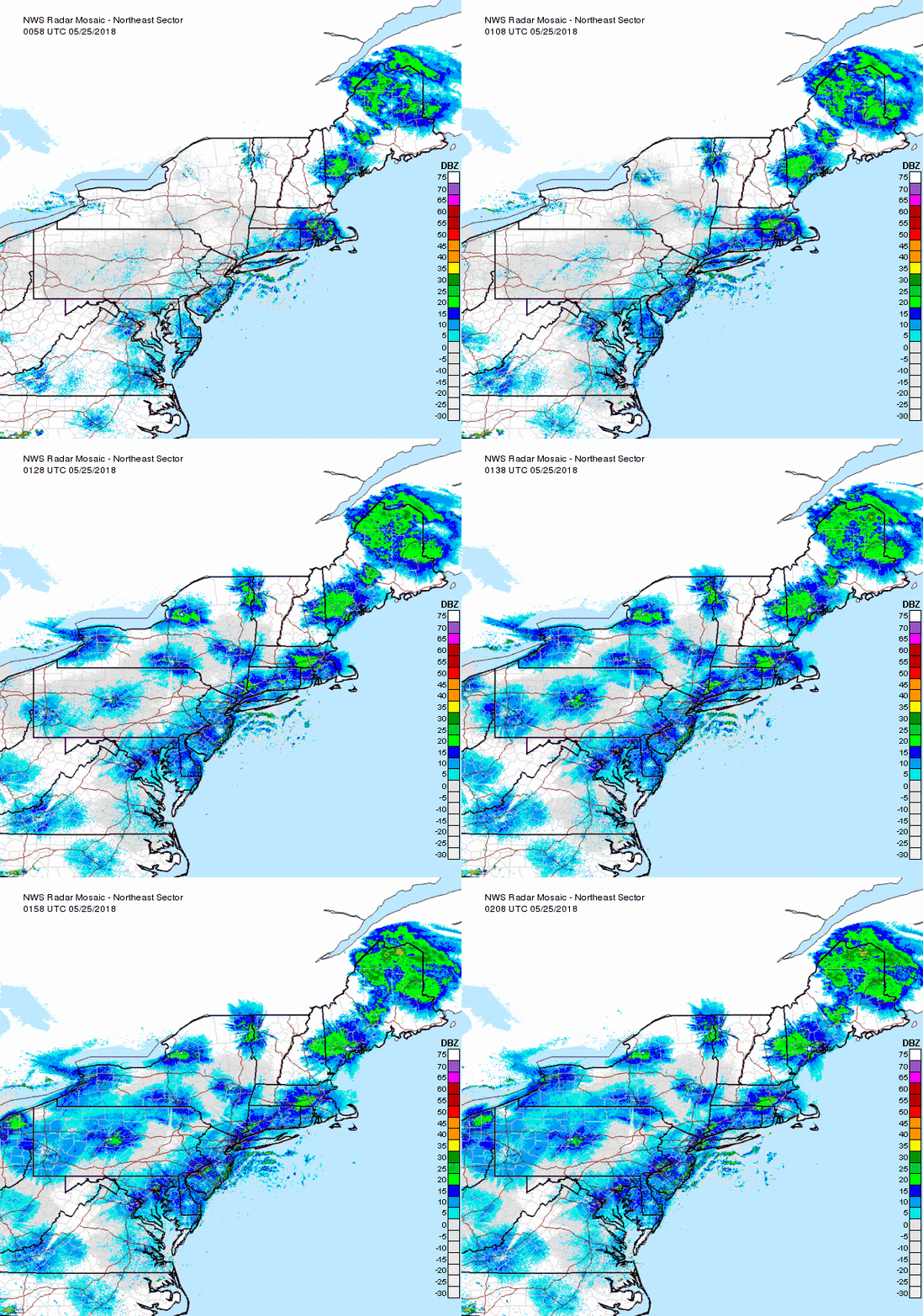
REGIONAL RADAR
The rain has been heavy and continuous across parts of Southern & Central Pennsylvania and we are also seeing some rain developing in the Southern New Jersey counties and all of this will be passing through much of the area from Eastern Pennsylvania to Southern New England.
LOCAL RADAR NEW YORK CITY
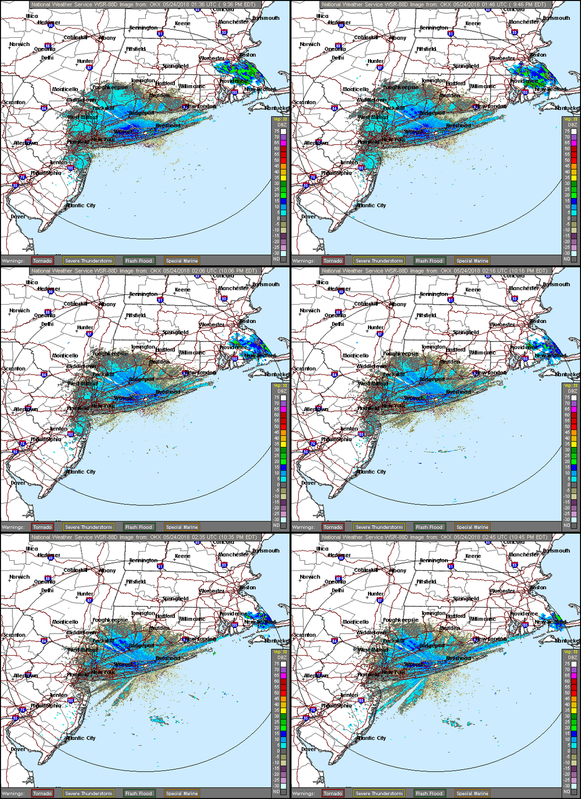
LOCAL RADAR PHILADELPHIA
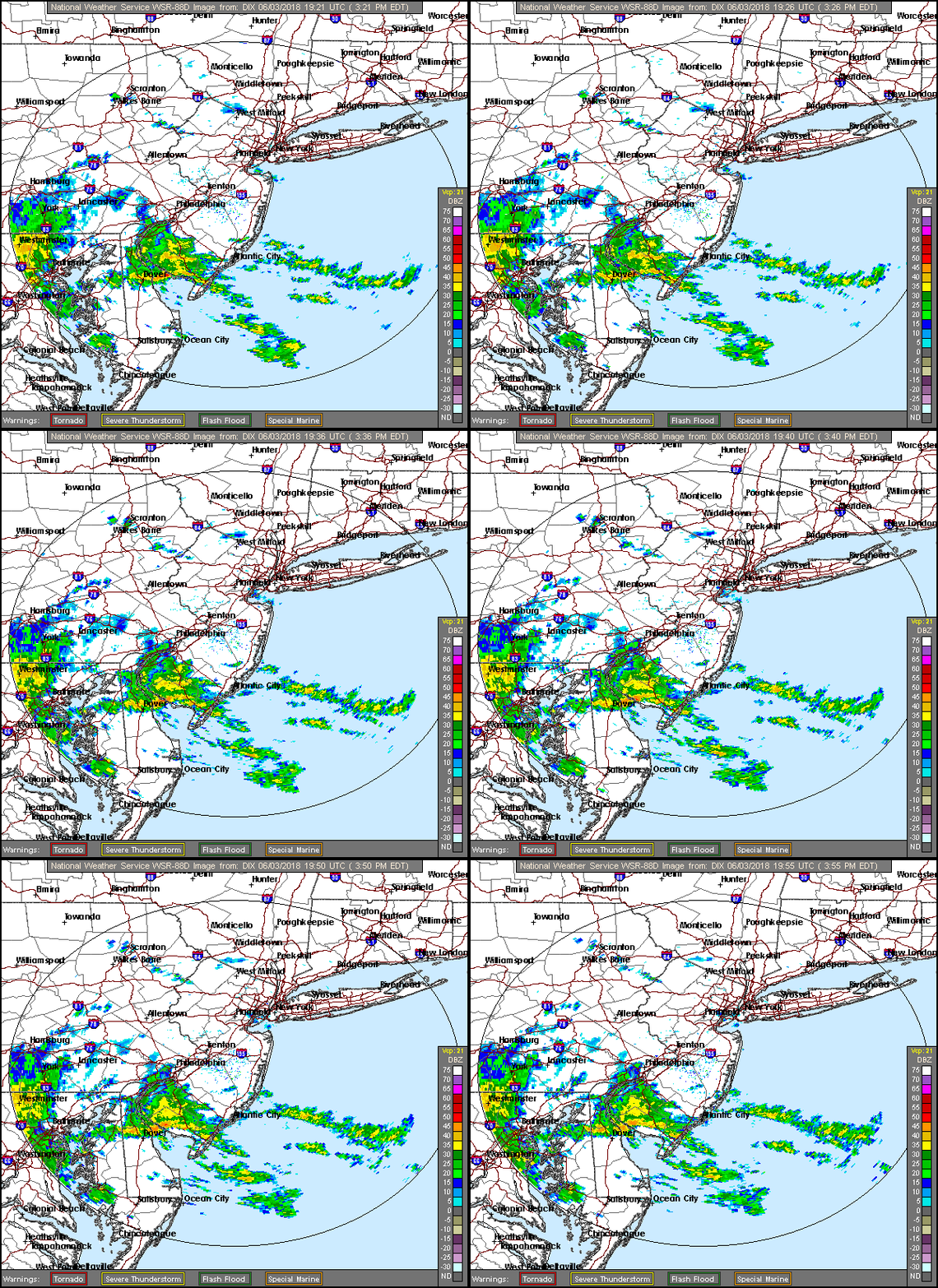
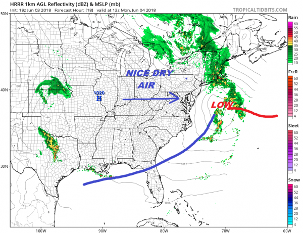
Most of the rain will be overwith tomorrow morning by 7 or 8am at the latest and even sooner in areas south and west of NYC. Weather conditions should improve on Monday with some sunshine developing as the day wears on with temperatures reaching into the 70s in most places. The HRRR model moves this system right along and most areas get a 1/4 to a 1/2 inch of rain overnight. Some of the rainfall amounts in Southern New Jersey will exceed an inch or so given the heavier bands of rain already showing up on the radar.
The air behind this system is very dry so Tuesday will start out with some sunshine. The next cold front arrives Tuesday night with some scattered showers or a thunderstorm late in the day or tomorrow early evening. Afterwards it seems like Wednesday and Thursday look dry with sunshine and highs in the 70s. Another cold front approaches on Friday with the chance for some showers and highs in the 80s. Then next weekend we will dealing with another frontal boundary stalled to the south and whatever complications go with it though at this point it is way too early to speculate on what it all means.
<iframe style="border: none; overflow: hidden;" src="https://www.facebook.com/plugins/post.php?href=https%3A%2F%2Fwww.facebook.com%2Fmeteorologistjoecioffi%2Fposts%2F10160293154820387&width=500" width="500" height="547" frameborder="0" scrolling="no"></iframe>

GET JOE A CIGAR IF YOU LIKE
FiOS1 News Weather Forecast For Long Island
FiOS1 News Weather Forecast For New Jersey
FiOS1 News Weather Forecast For Hudson Valley
NATIONAL WEATHER SERVICE SNOW FORECASTS
JOIN JOESTRADAMUS ON YOUTUBE!
LATEST JOESTRADAMUS ON THE LONG RANGE
<script type="text/javascript">
amzn_assoc_placement = "adunit0";
amzn_assoc_search_bar = "true";
amzn_assoc_tracking_id = "meteorologisj-20";
amzn_assoc_search_bar_position = "bottom";
amzn_assoc_ad_mode = "search";
amzn_assoc_ad_type = "smart";
amzn_assoc_marketplace = "amazon";
amzn_assoc_region = "US";
amzn_assoc_title = "Shop Amazon Via JOESTRADAMUS for anything. Just Use The Search Box";
amzn_assoc_default_search_phrase = "fishing gear";
amzn_assoc_default_category = "All";
amzn_assoc_linkid = "400feb49ec86e057a1495ab9f8e2ac47";
</script>
<script src="//z-na.amazon-adsystem.com/widgets/onejs?MarketPlace=US"></script>
Posted from my blog with SteemPress : http://www.meteorologistjoecioffi.com/index.php/2018/06/03/rain-moving-northward-overnight-weather-improves-this-week/
