Long Island Warm Sunday Record Highs Wind Advisory

Islip fell short of a record high today by 2 degrees. There was enough sun to get those temperatures to 60 which would have tied the record. The high only got to 58 thanks to the strong gusty winds from off the 40 degree ocean. Inland north of the L.I.E. we did see temperatures reach the 60s but we fell far short of the NYC high of 70. Clouds are around tonight and the winds are still rather strong from the southwest and they will only get stronger late tonight and Sunday morning.
SATELLITE


The radars right now are quiet however the regional radar is picking up showers and even a few thunderstorms moving into Western Pennsylvania. Those showers will move in here during the early morning hours before daybreak and they should be mostly done by 8 or 9 am at the latest.


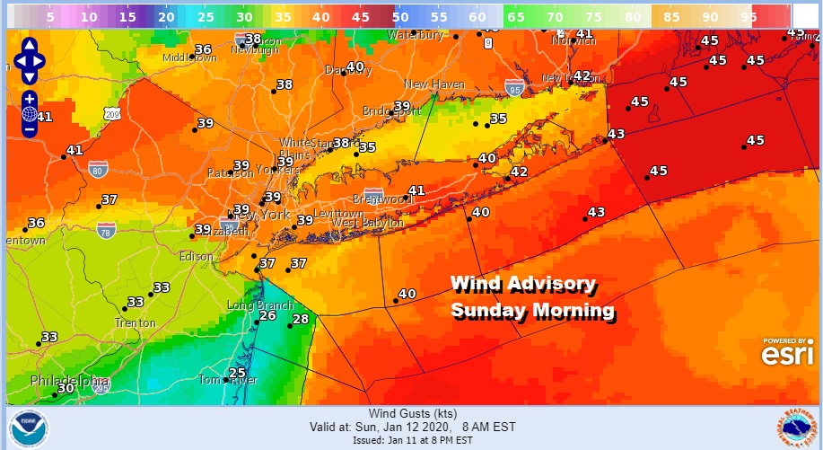
Those southwest winds will be howling tomorrow morning and into the afternoon. Once the rain is done we should break out into some sunshine. That will take temperatures up into the 60s and set us up for a record high. Winds will be 25 to 35 mph with gusts between 40 and 50 mph into early afternoon before winds subside.
At least we will have some sunshine for Sunday from mid morning and for the rest of the day. The winds will drop off and shift to the north and northeast for Monday and Tuesday bringing much cooler air in but still above average. Monday will be partly sunny with highs in the mid 40s.
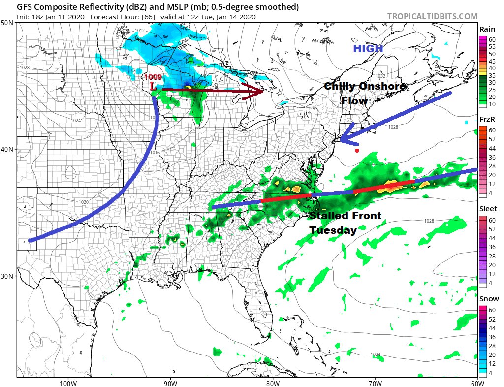
Tuesday brings clouds and an onshore flow. The cold front for Sunday morning stalls with a weak wave on it. Low pressure from the Great Lakes moves east. Highs Tuesday will be in the 40s. We could see a few showers Tuesday night. Wednesday brings dry air and some sunshine with highs in the 40s. Another cold front arrives Thursday with some showers. Behind it much colder and more seasonal are returns for Friday and the weekend. We will also likely see another strong storm system next weekend which could bring snow changing to rain on Saturday.
Please note that with regards to any tropical storms or hurricanes, should a storm be threatening, please consult your local National Weather Service office or your local government officials about what action you should be taking to protect life and property.
Posted from my blog with SteemPress : https://www.weatherlongisland.com/long-island-warm-sunday-record-highs-wind-advisory/
Congratulations @joewxman! You have completed the following achievement on the Steem blockchain and have been rewarded with new badge(s) :
You can view your badges on your Steem Board and compare to others on the Steem Ranking
If you no longer want to receive notifications, reply to this comment with the word
STOPVote for @Steemitboard as a witness to get one more award and increased upvotes!