Spring Like Boundaries Setting Up Mid Month
Spring Like Boundaries Setting Up Mid Month
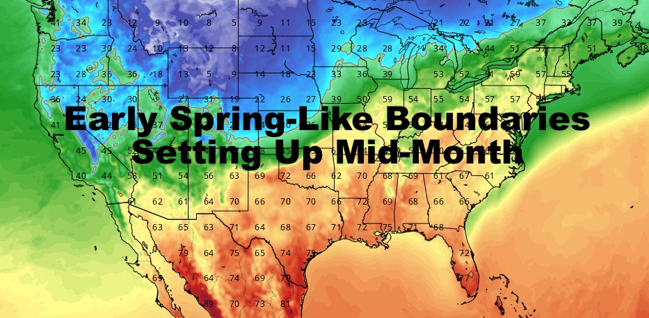
Good morning everyone and happy March! Things remain quiet, yet active out there, but no sign of any late-season snow as of now. The cold air is still trying to fight back as it has been the last few seasons late in the game; however, everything is beginning to break down and we should see some early spring-like boundaries setting up in a couple of weeks.
SATELLITE

Look for sunny skies and steady northwesterlies as cold air still filters in, but this is the last day of any cold for several days. Highs will be in the low 40's today, and low humidity will keep the static shocks going in your house.

Tomorrow, we change the narrative with milder air heading in. I'm thinking tomorrow will wind up being the mildest day, or at least feel the mildest with the lack of precipitation. We'll have early sun, then increasing clouds, highs 55-60 in most spots. (slightly cooler at the immediate shore)
Some scattered light showers move in tomorrow night, and we should keep those scattered, on & off showers in the area on Tuesday. Highs in the low to mid 50's depending on how much rain sticks around.

On Wednesday, I'm glad I played conservative with the numbers since some outlets were talking about near 70 temps. I don't see this playing out, and my original 55-60 degree forecast is even up in the air. It doesn't look like the timing of our front works out, and I think 50-55 is the best we do before temps sink into the 40's by sunset as winds increase.

Looking into mid-month and towards spring time, I think a typical pattern is beginning to set up. Big snows or at least the potential for it, usually increases in the eastern Rockies and towards Minnesota, Wisconsin, and the U.P. of Michigan. These types of vigorous systems surge milder air ahead of them, increasing the chance for severe weather on the front end in the lower Midwest/Gulf States.
This seems to be the case, and for us, well....we get the big teases and slow moving, stalled out dreck. Once in a while we get a bone thrown to us in the form of a very mild day if the timing of a front works out, but cooler, cloudier maritime air tries to fight back and this also looks like the case.
Typical early NYC spring, after an untypical winter, this is what I see so far. Stay tuned.
Please note that with regards to any tropical storms or hurricanes, should a storm be threatening, please consult your local National Weather Service office or your local government officials about what action you should be taking to protect life and property.
Posted from my blog with SteemPress : https://www.nycweathernow.com/spring-like-boundaries-setting-up-mid-month/