Showery Day Today Cold Air Arrives Thursday Night
Showery Day Today Cold Air Arrives Thursday Night
Good morning everyone. If you're up as early as I am this morning, we have some stars mixed in with the patches of clouds and a fairly mild early morning before sunset. That mild air is ahead of our next system today, representing a brief reinforcing shot of cool air into the area.
Our big story is Thursday into Friday, where a much sharper system will drop us from near-average Thursday, to unseasonably cold overnight and into Friday. If the precipitation is timed right and you're up as rain comes to a close, you could see our first few wet snowflakes mixed in. As stated yesterday, nothing major is expected here.
SATELLITE

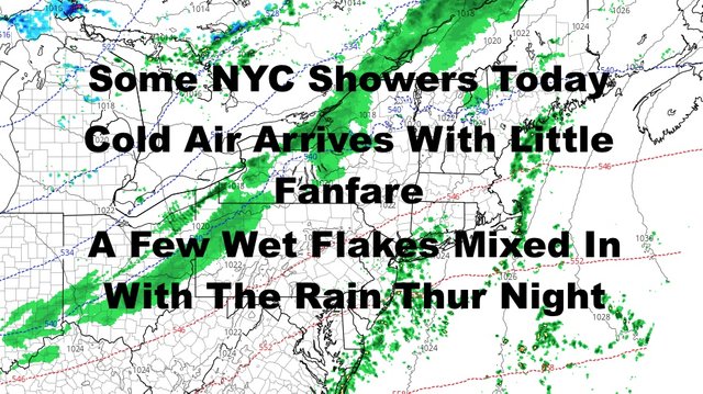
Patches of stars will be replaced with some patches of blue this morning as the sun rises. We could see some scattered showers late morning through mid afternoon, and highs will be slightly above average in the near 60 range.
We'll dip into the low 40's tonight, 30's away from the NYC area, then enjoy a sunny but cool day tomorrow. Highs near 50 tomorrow with a steady northwesterly flow.

Thursday and Thursday night remain our transition period, with clouds increasing throughout the day Thursday, then a chance of rain late. Rain will come to an end overnight as temperatures drop. If there's enough cold air mixed in before the rain ends, you might see a few splotches of wet snow on the windshield as you're driving.
Again, the big story to me is the cold and not the possibility of a very brief mix. We head down into the mid 30's overnight Thursday and the wind will pick up, then we'll have a windy and unseasonably cold Friday. Expect highs in the 40-45 realm and that wind will give it some extra bite.

Our weekend holds onto the idea of a split. Both days will be sunny and dry, but there will be a difference in the feel. Saturday remains unseasonably cold and breezy with highs in the 40-45 range again, then we quickly modify Sunday with upper 40's to low 50's.
In the long range, we continue to watch several shots of unseasonably cool to cold air possible during this 10-20 day period.

Please note that with regards to any tropical storms or hurricanes, should a storm be threatening, please consult your local National Weather Service office or your local government officials about what action you should be taking to protect life and property.
Posted from my blog with SteemPress : https://www.nycweathernow.com/showery-day-today-cold-air-arrives-thursday-night/