NYC Precipitation Departure Versus Cold Air Race Continues
NYC Precipitation Departure Versus Cold Air Race Continues
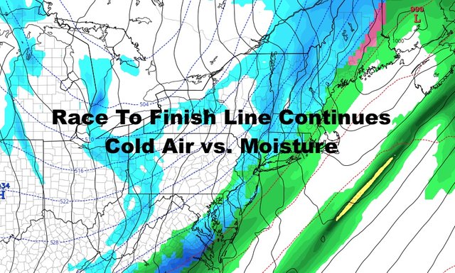
Good morning everyone. Rain and unseasonably cold air continue to march our way with a very definitive cold font. We continue to watch closely to see if we get some brief wintry precipitation before it all ends, and I'm glad I remained on the very conservative side, because things are looking unimpressive.
SATELLITE

This all seems to be playing out as expected in my book, and I'm glad I stayed the course compared to other outlets. The big story remains tonight's cold, and tomorrow with temps not getting out of the 30's.

Expect rain to be moving in shortly, then we'll start dropping those 50's into 40's; then low to mid 30's by sunset. We could still see a very brief period of mixing with wet snow, but I think for the most part, the dry air wins out and we either get nothing at all, or nothing prolonged.
Things will become blustery once that front passes and the cold air begins to rush in. Expect a nasty night tonight with temps in the upper teens to low 20's as lows. Teens will be widespread N&W of NYC, with some single digits well north; and Long Island will experience widespread teens as well.

We'll be sunny tomorrow, but it won't do much to help the situation. Look for blustery conditions to continue, and highs in the mid 30's at best.
The wind dials down tomorrow night and into Thursday, and we'll slowly start to come out of the very cold conditions. It'll still be well below normal, but light winds and mid 40's will feel nice compared to tonight and tomorrow.
Friday remains the nicest day of the week, with sunny skies and seasonal temps. However, a reinforcing shot of cold air will pull us back down into the upper 30's to low 40's on Saturday.

In the long range, a system still lurks for Sunday, but the timeline is looking more like a Sunday night into Monday thing. If all goes as planned, Sunday will be our transition day but remain dry. Expect clouds and sun as of now, highs in the 45-50 range.
We remain in a very active pattern with plenty of cold air available, but things may calm down a bit by month's end.
Please note that with regards to any tropical storms or hurricanes, should a storm be threatening, please consult your local National Weather Service office or your local government officials about what action you should be taking to protect life and property.
Posted from my blog with SteemPress : https://www.nycweathernow.com/nyc-precipitation-departure-versus-cold-air-race-continues/