An International Spotlight On Maps Around the World : A Look At Non-European Pre-Modern Maps
I co-wrote this spotlight with my boyfriend, Victor Lucas. He graduated in December 2015 from American University with a BA in International Studies. He had a regional focus on Asia and a specialty in Environmental Sustainability and Global Health. He also studied abroad at National Chengchi University in Taiwan. I just completed my degree requirements at American University in July with a BA in International Studies. I had a regional focus on Latin America and a specialty in Global Inequality and Development. I studied abroad at University of Auckland in New Zealand and at Universidad Adolfo Ibanez in Chile.
An International Spotlight On Maps Around the World : A Look At Non-European Pre-Modern Maps
You all have shown a lot of interest in maps over the past two days, so we thought we would do just one more post about them! The last two posts have talked about cartography from a completely Eurocentric perspective, which does the history of cartography a huge injustice...mainly because Asian and Islamic cartographic practices were far more developed than European ones from a far earlier period! In fact, the Chinese were creating relatively accurate geographic maps as early as the 4th century BC! Covered in this post are some examples of non-European maps from the pre-modern period.
To read our two previous posts, you can find them here and here.
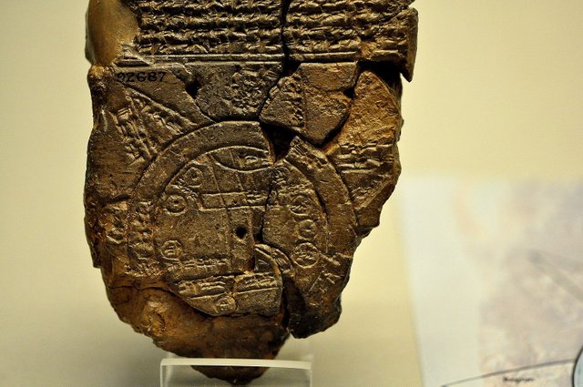
Babylon
This map, dated from the Babylonian Empire of the 5th century BC, was carved onto a clay tablet and depicts Babylon in the center with the world surrounding it. If you look closely, you can see two concentric circles, which represent the inner and outer edges of a body of salt water, so a sea of some kind. Parallel lines at the bottom are representative of the marshes to the south, and the line reaching Babylon from the north most likely represents the Zagros mountains. The smaller circles within the main circle most likely represent Babylonian cities. (Source)
Chinese Cartography
China's cartographic history is distinguished and extensive. It was probably the earliest part of the world to produce geographically accurate maps, the earliest references to which come in a story dating from the 3rd century BC.
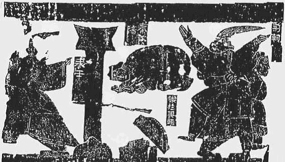
Background: The Story of Jing Ke
This reference, found in Sima Qian's "Records of the Grand Historian", tells the story of the assassin Jing Ke, sent by the Crown Prince Dan of Yan to assassinate the ruler of the Qin empire. It is said that at the time, handing another ruler a map to a province was the first step in diplomatically submitting to another power. So Jing Ke brought a district map of Yan painted on a silk scroll, rolled in a case with a hidden dagger. Supposedly, Jing Ke attempted to kill the Qin ruler, a plot which ultimately failed. (Source)
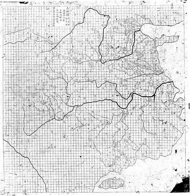
The Yuji Tu
The Yuji Tu was a map of China carved into a stone stele in 1137. It depicts China's coastline and river systems and was found in the Stele Forest of Xi'an.
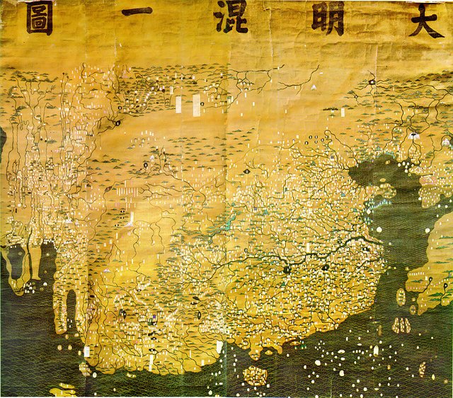
The Da Ming Hunyi Tu
The Da Ming Hunyi Tu is one of the oldest known maps of East Asia, depicting everything from Europe to Japan to Mongolia to Java. Dating from approximately 1390, it is also one of the earliest known Chinese maps to use extensive coloring. As was common in that period, China is placed at the center. It's size is quite distorted proportionate to the rest of the world, reflecting the Chinese view that it was the single most important part of the world. (Source)
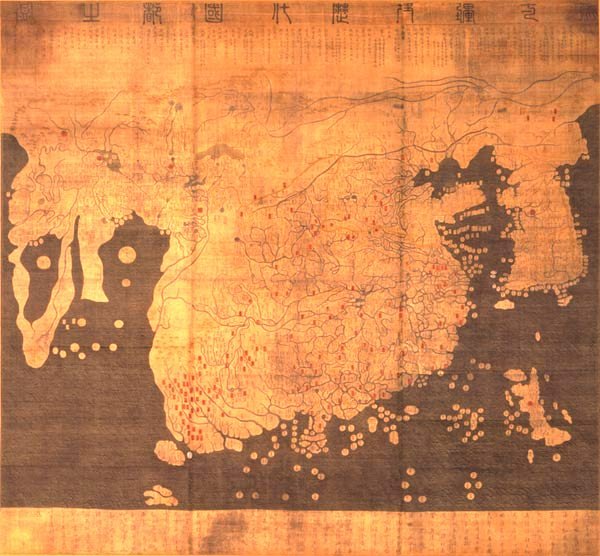
The Kangnido
A Korean map dated to 1402, the Kangnido (officially the Honil Gangni Yeokdae Gukdo Ji Do) is a "koreanized" version of the Chinese Da Ming Hunyi Tu. As with a lot of Korean science, art, and culture at the time, Chinese influences were taken and adapted to the Korean point of view. Similarly, just as the Chinese Da Ming Hunyi Tu depicted an oversized China as a result of China's bias towards it's own importance, the Kangnido shows an oversized Korea for similar reasons (although famous 14th century Korean scholar Gwon Geun argues that it was actually for practical reasons). (Source)
Islamic Cartography
As with early European maps, a significant portion of Islamic cartography made no attempt to depict a realistic geographic representation of the world. Instead, it created symmetrical representations that showed how Medieval Islamic scholars perceived the world. (Source)
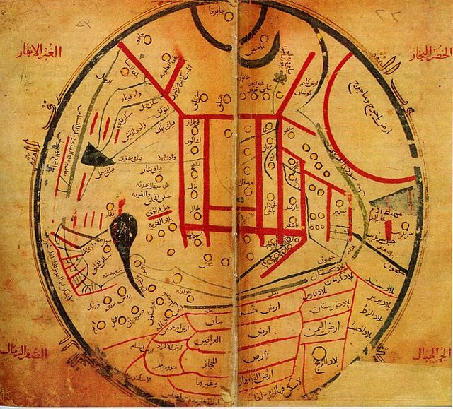
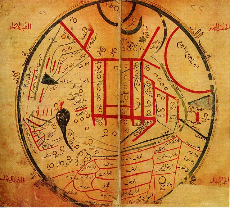
A Map in Mahmud al-Kashgari's Diwan
This is an unnamed map found in Mahmud al-Kashgiri's Diwan. This is the first known map depicting areas of the world inhabited by Turkish peoples. It is centered on his birthplace in Central Asia. (Source)
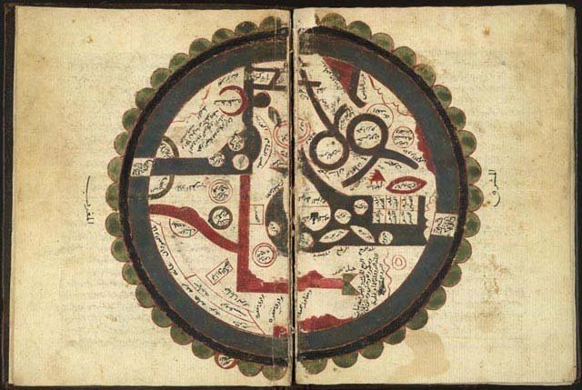
Ibn al-Wardi's World Atlas
This is another example of the use of symbolic mapping in Islamic scholarship. Ibn al-Wardi's world atlas is an amalgamation of Islamic knowledge of the Arabic world at the time. It includes the flora, fauna, population, and lifestyle. It once again makes little effort to create a geographically accurate map. (Source)
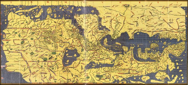
Tabula Rogeriana
The Tabula Rogeriana, or The Recreation for Him Who Wishes to Travel Through the Countries, was produced by the Arab geographer Muhammad al-Idrisi in 1154. It is one of the most accurate world maps of the era, and depicts parts of Africa, the Indian Ocean, Asia, and the Middle East. It is interesting to note that in this map, the South is at the top and the North is at the bottom. As you can see, the map is significantly more geographically accurate than contemporary European maps. (Source)
Conclusion
Cartography has an incredibly diverse and varied background that is certainly not limited to Europe. Although from the 15th century onward Europe most likely had some of the most accurate world maps, the Islamic world and China had similarly accurate maps dating back significantly further than European ones. We hope you've enjoyed reading this series on maps, since we certainly enjoyed writing it!
Loved this post! My girlfriend works in intercultural relations and has an "upside-down" map in her office. I still can't properly accept it, even though I know it's just convention I'm battling with. Then you have those Japan-centric maps, wow. Here's the best of both worlds:
... have you guys ever tried finding your home on one of these, but borderless?
Nice map
Ooh, and of course there's this compulsory watch:
Nice meme
Nice post
Thanks for another fantastic post. I'm always impressed by the aesthetic beauty of some of these old maps compared to new modern ones.
Thank you for your continued interest and wonderful feedback on this post series :-)
very informative, thanks!
Thanks for reading!
Very interesting. I am working on an article and am in need of a map of China during the Yuan Dynasty 1294AD -ish times. Just after the fall of the Song Dynasty when the Mongols took complete control of the county.
Love your posts, I always learn something from each of them:)
what a really interesting post - love looking at old maps
thanks for posting
I wish I could resteem this post, but I guess it's too old? If you love old maps, follow me!