Hallelujah! A breakthrough moment on the most complicated film of my life: Solar construction drone-lapse wizardry

Without wanting to get too excited as there are many different stages to this production which are yet to take on any kind of shape, the most important aspect of it was being able to build the film in Adobe After Effects (AE), a program I both love & hate for it's impossibly complex yet awesome powers.
I was struggling however, due to the default export format of the mapping program, our beloved JPG. No matter what I tried I couldn't import them into AE. I watched a few YouTube tutorials, hit the forums and followed the guidance... some of which led me to a kind of success and I was able to import PNGs made from the JPGs. However, this tripled their (already massive) file size and created the need for extra work in AE, cropping out the background of the maps.
While my computer is fast, it ain't that fast and the speed at which it functioned with these files was painfully slow... so I had to find another way.

Mapping a site which is too big for mapping!
Drones are limited now to a height of 400ft so a single shot looking directly down doesn't cover much ground.
Therefore, to map this entire site would take 48h of consistent work. Not just due to the multiple flights (requiring ten batteries) but the insane amount of images (over 2000) which would then need processing online.
To remedy this problem, I have been creating daily maps of the 'busy' sections of the site as it progresses. I do this using a mapping program which sends the drone up on a pre-set flight path and takes multiple photos which are connected together online to create the final map.
Here you can see a typical mapping flight path.
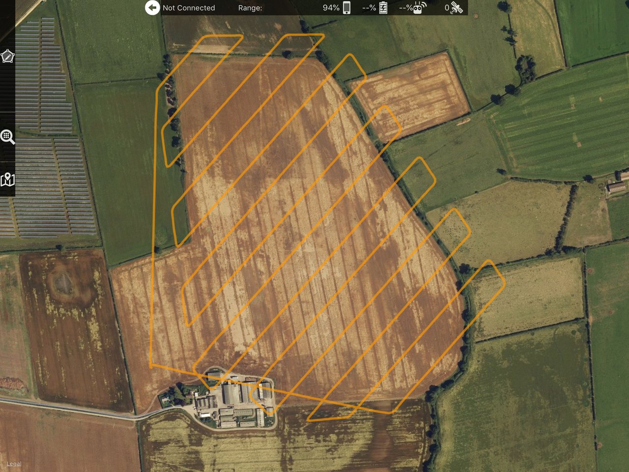
Once the images are 'stitched' by the online program (which takes hours due to slow internet speeds out here in the sticks!) I end up with a very high quality JPG which looks like this.

What I hadn't thought about was downloading the maps as GeoTIF files from the online program, which are huge files, most around 1GB. Unlike their JPG counterparts, after converting to PNGs they will do exactly what they are supposed to in AE, making the black background invisible.
Even thought the files are bigger in AE, they don't crunch my CPU the way the previous PNGs did because the background is naturally cropped out.
No doubt this sounds all very technical and probably quite dull for those of you who are not into this!
Basically
Over the last two months the site has gone from this...

To this...

The above image is a roughly put together composite of multiple maps, overlaying the google earth shot.
What now?
I have completed a beautiful opening sequence which for legal reasons i cannot show you yet. However, it's basically just an AE created time-lapse of the compound area as it goes from this...

to this...

AE Wizardry
Now that I know I can use these maps in AE as functional PNG files I'm going to have a go at making it appear as if the roads are expanding out across the site before any of the other bits arrived.
For those of you interested I will be using the Roto Brush Tool to get this particular job done.
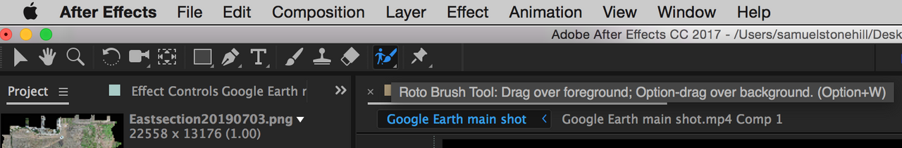
I should be able to isolate the roads as they are a different colour to the brown earth of the site, which will permit me to 'play' with them.
So, that's it for now.
Love & Light
Who is @samstonehill?

Sam supports @naturalmedicine because they are seeking to help us in ways which go far beyond money. Please come and join us on Discord

All content created for this account is 100% original (unless otherwise stated), produced by @samstonehill who invites you to use & share freely as you wish.

yeah man, progress. looks good!