On the Crater of a Stratovolcano: Mt. Cabali-an Sunday Hike - Life in the Tropics 05
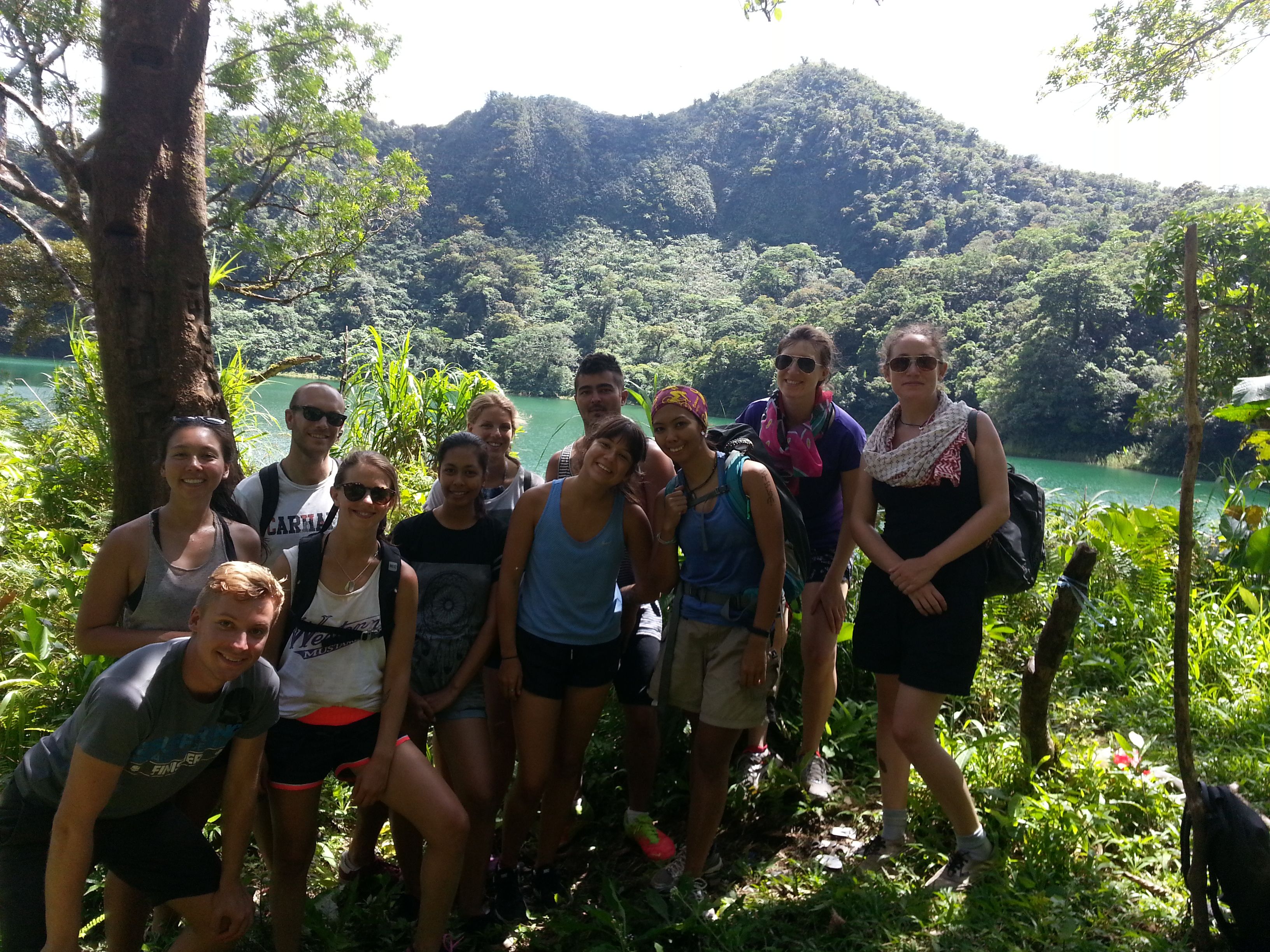
My dive surveying team taking a day off from work to have a break from the salty underwater world and visit the mountains
“The mountains are calling and I must go.” Yes, I am a sucker for good quotes from great mountaineers, especially from someone who goes by the name of John Muir. By April of 2017, I have been marinated in saltwater after recently learning how to work a SCUBA so it has been quite some time since I have last engaged in fresh flowing streams in a rainforests. I knew it was about time, the mountains were calling, and I was lucky I was with just the right set of people who were up for such adventure.
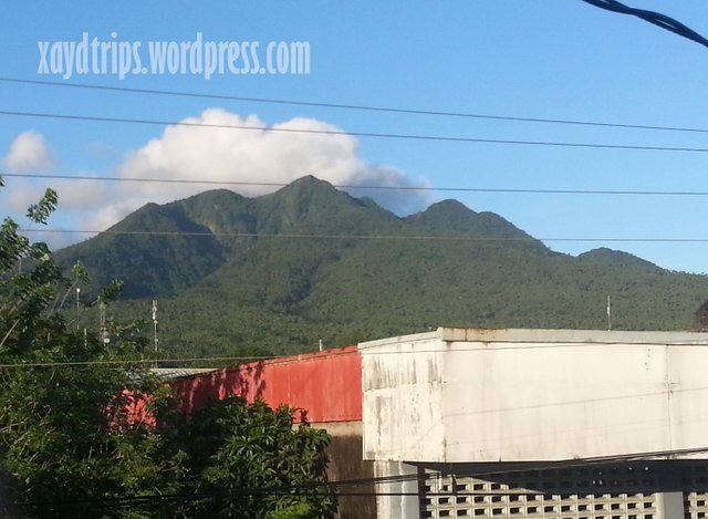
View of Mt. Cabali-an from the town center of San Juan, Southern Leyte
Mt. Cabali-an is a stratovolcano located in the town of San Juan, whose old name is also Cabali-an, in Southern Leyte and forms a solfataric belt with other known active volcanoes in the northern part of the island, Mahagnao and Cancajanag plus the geothermal site in Tongonan. If you live in this part of the country, an occasional earthquake should not surprise you. Because it was just a few towns away from where we were residing in Southern Leyte, and because my soles were itching to hike forest lines again, the Cabali-an trails became the subject of our Sunday, no-diving, degassing day.
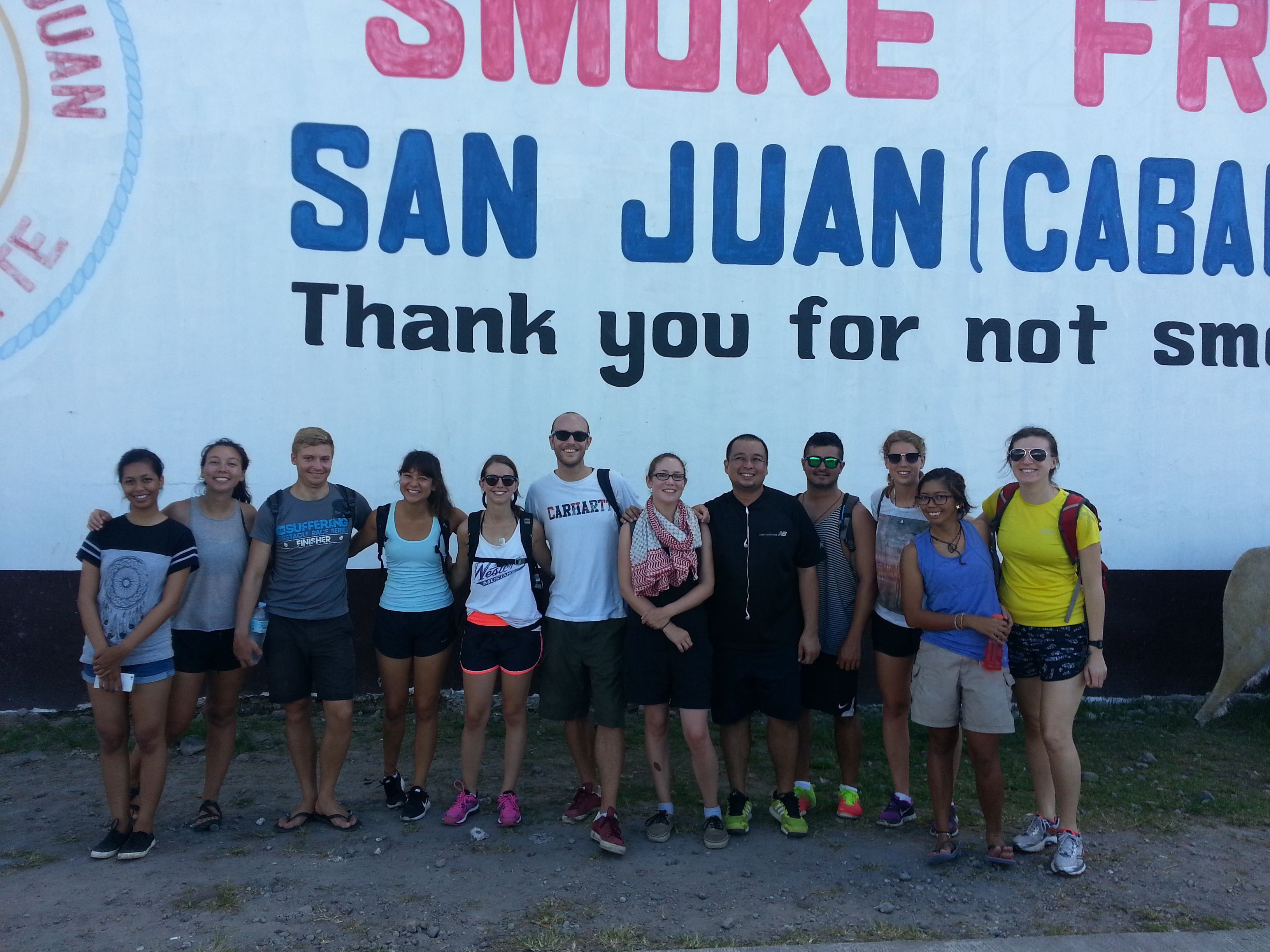
Fresh faces as we arrive at the town of San Juan (L to R: Jessa, Morgan, Connor, Ellie, Tyler, Toby, Hannah, Arnelle, Felipe, Ida, Xayd, Sarah)
There are a couple of ways to reach San Juan. From Tacloban, Duptours offers vans going directly to this town daily. From elsewhere, trace your way to Sogod or Lilo-an where buses traverse eastward to this town or if driving in a private vehicle, an intersection in the town of Abuyog is a better option. As for our case, since we were driving from Panaon Island, we headed first to Lilo-an and then followed the Himay-angan Road that passes through the town of St. Bernard and then finally, San Juan.
Because it wasn’t my first time to hike the volcano, I did most of the preparations for the trip – a courtesy call to the local tourism officer and tour guides, a van to take us to San Juan and back, and an attempt to set expectations for the hiking team (which I later realized I have done so poorly). We left our base at half past six with day packs filled with water, trail snacks, and lunch. A little extra for me was a sleeping bag and an earth mat that could make every awkward location a possible sleeping space (e.g. among the bushes or floor of a moving car).
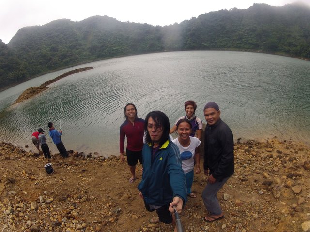
My first hike to Cabali-an’s crater lake in August 2015 back when I had super saiyan hairstyle 😀 (L to R: Kids fishing: David, North, Keenan; Ray, Victor, Joanne, Xayd, Jojo)
Arriving in San Juan by 08:45am, we were greeted by Mr. Arnelle Garrido, the municipal tourism officer who has pre-arranged local guides for our hike. After a short resupply of snacks and gummy worms, we headed to Brgy. Dayanog where we rendezvoused with our guides and motorbikes who will take us to the trail’s jump off point which was a few meters before a geothermal exploration site. This is when I start to fail with setting expectations. From two years ago, I could only remember that this was supposed to be an easy, rolling trail where a couple of kids aged 7, 10, and 11 managed to do the three hour hike with us. I totally missed out on how the motorbike ride fared.
We hopped on the motorbike, locally known as “habal-habal”, with two passengers each plus the driver, except for me and Connor where we had one of the guides as a third passenger. It was nine in the morning when we started the steep ride up the rocky road to the geothermal site. I say we chose our driver and bike well, as we were constantly ahead of the others despite having four people on board, and then falling off our bike only once (please don’t tell our moms) in a slow and funny way. The bike will have to cross a small creek, and if your driver is good enough and able to rev his bike through the running water, you won’t have to go down, walk and get your shoes wet. A lot of crazy things happened on that bike ride, including people losing their flip-flops on the ride (how that happened, I still don’t know), people managing to post Facebook statuses, and people clinging on to the person in front of them for dear life.
How could a lot of things not happen when it took us an hour to reach the jump-off point? Well, an hour for us plus half an hour more waiting for the rest of the five bikes to arrive. This is when people started questioning me for totally disregarding the intensity of the bike ride when I first described the trip to them. Honestly, I have just totally forgotten about it. Even my back was hurting so bad after that ride and I could only imagine what horror I have put people into, especially those who have never been on a rough road “habal-habal” all their lives.
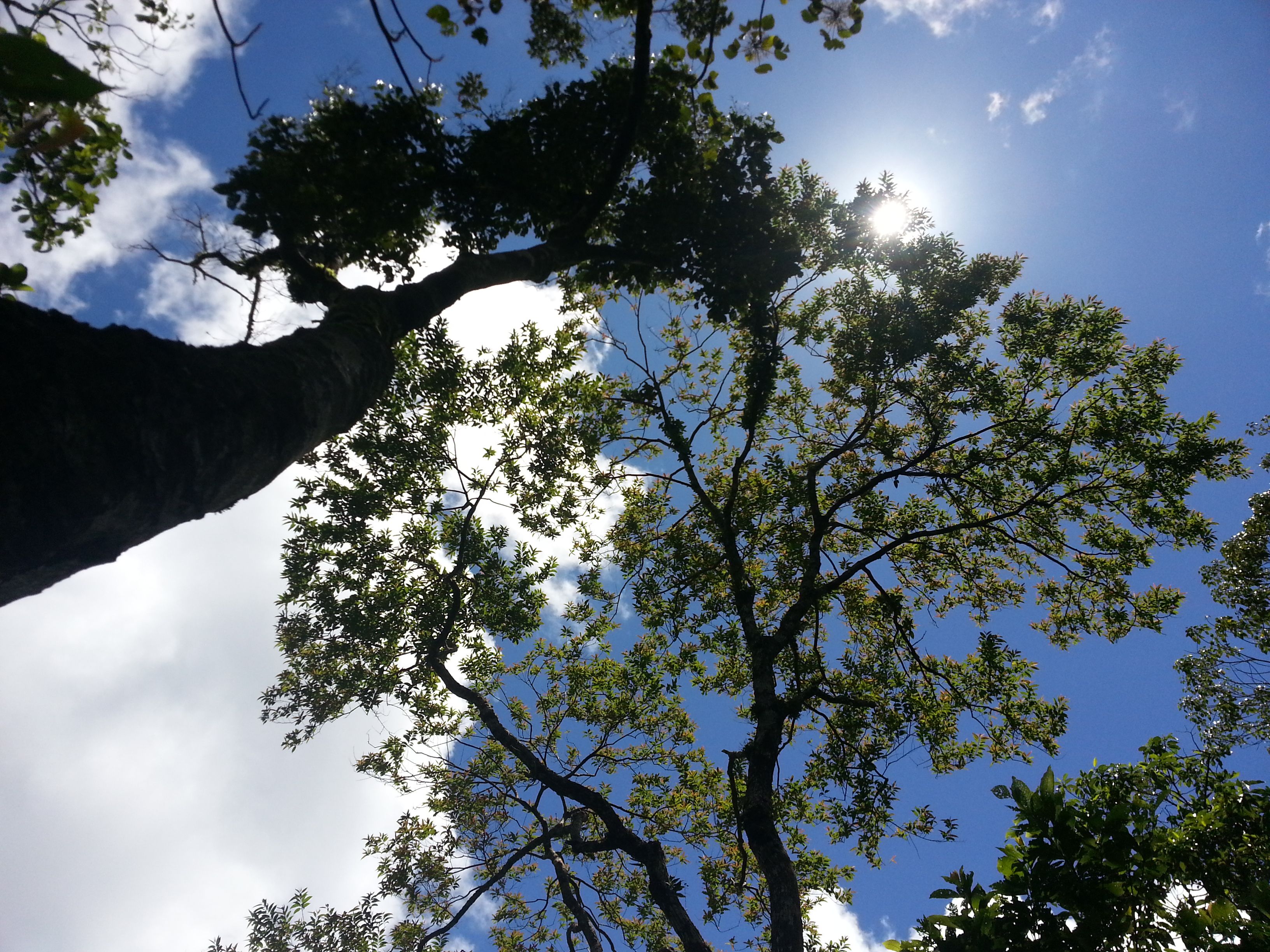
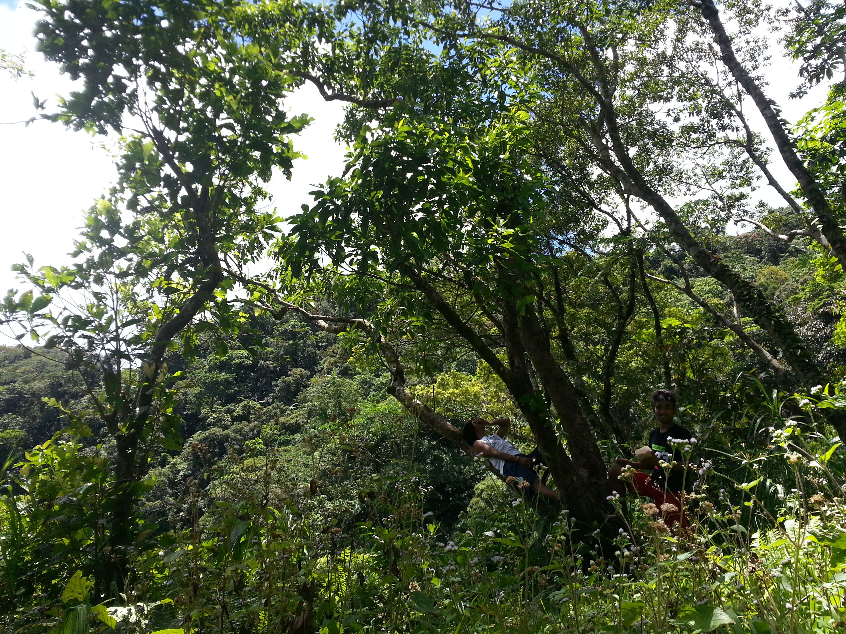
Tree canopies just enough to keep the trail cool in this sunny weather.
Finally, after rehydrating and topping up with gummy worms (and me apologizing for the downplaying the extremity of the trip), we started our hike at half past ten. The trail starts out steep with tall shrubs that could barely block the heat of the sun before it blends into the rainforest with mossy rocks and loamy grounds. The trees were draped in wild ferns, orchids, and vines while random birds harmonize with the sharp pitched drone sound of the “gangis”, an insect within the cicada family.
Halfway through the trail is a viewing deck that gives a 180-degree view of Cabali-an Bay and the lowlands of San Juan and St. Bernard. While the highest point of the volcano is at 945 meters above sea level, the viewing deck is one of the highest points that can be reached via established trail. From this point, the trail goes around the mountain ridge and sloping down into a more damp, still mossy trail. The path was laden with millipedes, some alive, some dead, and some, while alive, are curled up as if agitated. Because the trail lead, Connor, and the pacer, me, were both in a hurry to swim into the cold lake water, we reached the crater within one hour of hike.
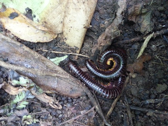
Millipedes everywhere!
The 500-meter crater diameter became a basin of fresh lake water since the last time it erupted some two centuries ago. Owing to the poor visibility and the silty bottom of the lake, we could barely see anything underwater save for the few small fishes that crowd towards the edges of the lake. This later becomes a never-ending debate of how the heck the fishes got there in the first place. With quite a change from looking at hills covered with palm trees everyday of the week, the perimeter of the crater treated us to a view of dipterocarps and montane trees. At 733 meters above sea level, we enjoyed the cool waters of the lake and swam ourselves hungry.
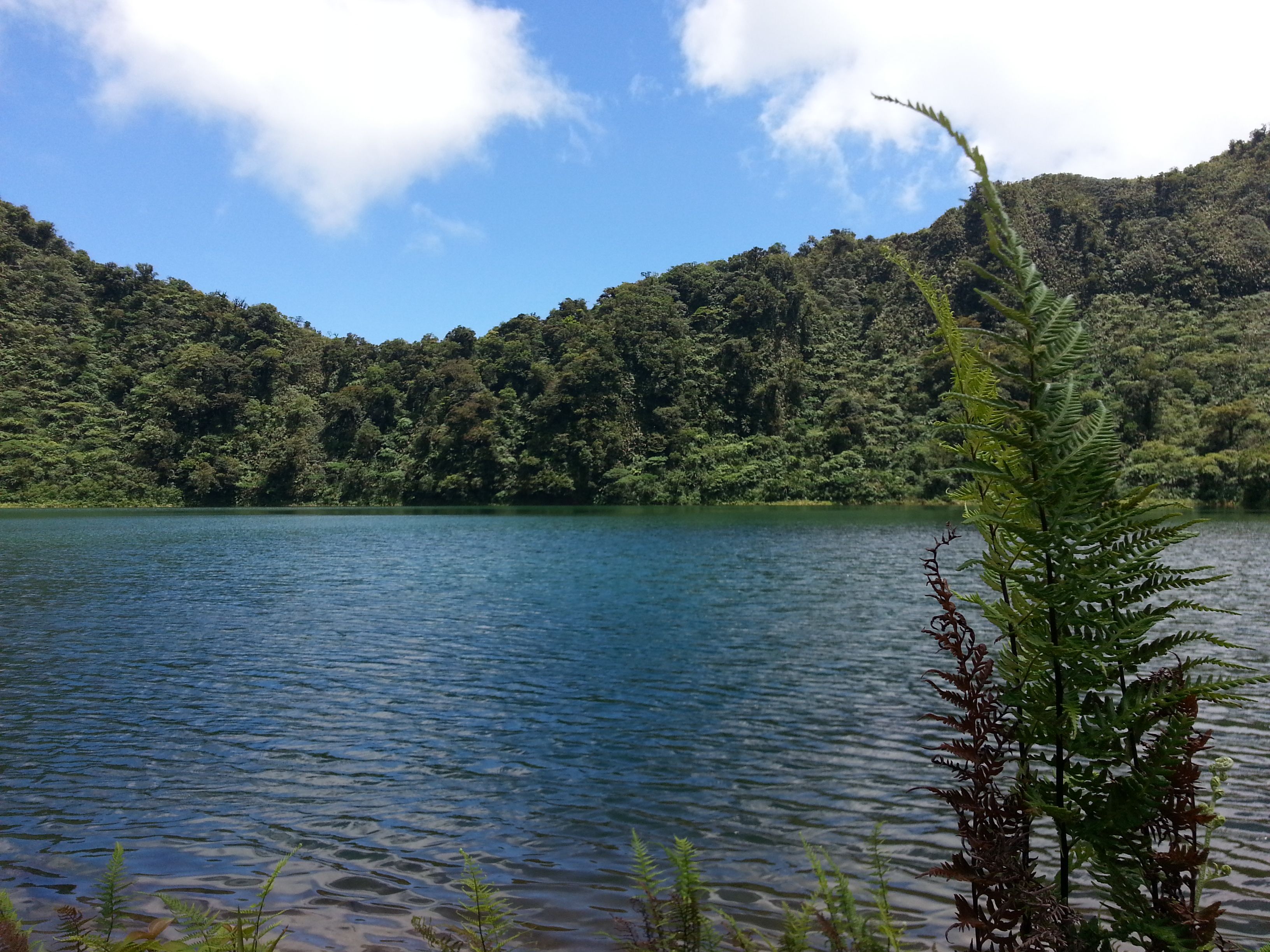
Lake water at Cabali-an’s crater.
Lunch comprised of fried rice from yesterday’s leftovers, bananas squished inside my backpack, and a can of spicy tuna that has been stashed in the kitchen for a while (you’ll never really know when a can of tuna would come in handy until you’re in the middle of the forest with not much choice). And what best comes after food? Of course, a nap. People would always question me why I take a large pack for a day hike, but the moment they see me sleeping comfortably on an earth mat with a comfy blanket, they start to get answers. So there I was, backing off a few meters from the lake and into the shaded tree line, lying in the bushes and appreciating the macro life aka spiders and enormous ants drifting past my face and disappearing into the blades of grass.
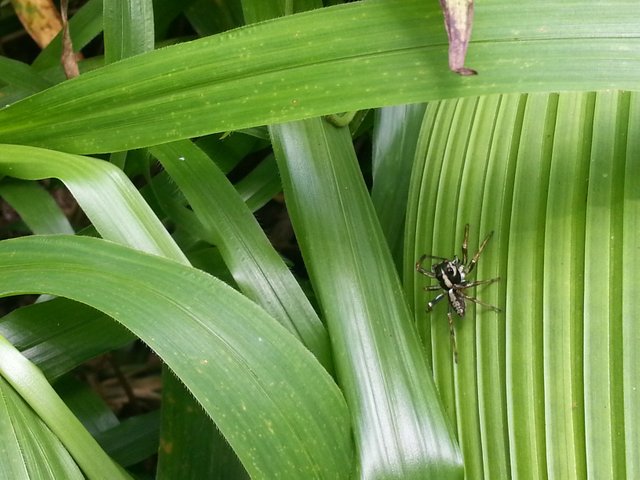
Macro-life.
Before I got too comfortable, I had to cut short everyone’s nap and asked them to start packing up and getting ready for the hike back. Sarah had the wonderful idea of picking up bits of rubbish that cluttered around the campsite area. Although very few climbers know about this hiking site, I am surprised by the amount of rubbish left in the area. Also, during the time I camped here two years ago, there was barely any piece trash anywhere. Talk of responsible tourism.
Our guides, Felipe and Mario, relaxing at the crater’s campsite.
We left the campsite at the crater lake at 1:45 pm and maintained almost the same pace we had in the morning. This time we reached the viewing deck and the jump off sites in a much lesser time. However, on the return, we had to walk the entire way back to Brgy. Dayanog covering the full one-hour motorbike ascent we had in the morning. There were some shortcuts of one-man trails on the descent and we passed the time by talking, sharing stories, and me making bad jokes and puns. It might have cut the time for a bit but the trail was still too long and rocky that somehow, after soaking my pair of Mizunos in the river and walking a few hundreds meters of loose rocks, all the bottom traction just tore itself away and giving my shoes absolutely zero profile for the final stretch of the hike. I may have slipped a few times before finally seeing our van parked on a paved road in the barangay, but all that really matters to me is that I got there quick enough to gulp a cold bottle of Coca-cola under the summer afternoon sun. It was 3:15 pm and the total hike back only took us an hour and a half. Not bad at all.
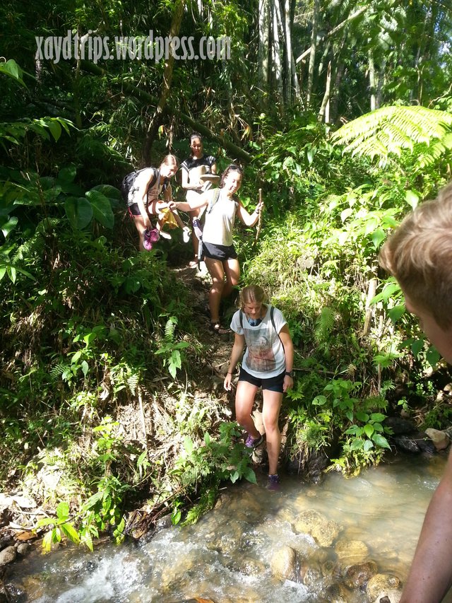
A little river crossing on the descent trail.
Starving is how you would describe us after the day’s hike. We headed straight to the town proper and sat in a cozy al fresco restaurant where a pitcher of iced tea was so cheap, we almost ordered one for each. We might have made impulsive choices of food but who’s to blame if you’ve just been walking six kilometers of forest trail and rough road? It was dark when we finished eating, so you can just imagine the amount of food involved. We started our two-hour drive back to base while I slept comfortably on the floor of the van after a beautiful encounter with a stratovolcano.
Itinerary
0630 – Depart Panaon for San Juan
0845 – Arrive at San Juan, Resupply
0900 – Arrive at Brgy. Dayanog, San Juan, Depart for geothermal jump-off site on motorbikes (200 php per head)
1000 – Arrive at geothermal site
1030 – Start hike to crater lake
1130 – Arrive at crater lake
1345 – Start hike back to Brgy. Dayanog
1515 – Arrive at Brgy. Dayanog
1600 – Early dinner at San Juan town proper
1830 – Depart from San Juan for Panaon
2030 – Arrive at Panaon
Guide fee: 500 php per guide, 1:5 guide to hiker ratio
To arrange your trip, kindly coordinate with the head of the Tourism Office, Mr. Arnelle Garrido at 09185408815.
This travel post was originally published at my wordpress page: https://xaydtrips.wordpress.com/2017/06/15/on-the-crater-of-a-stratovolcano-mt-cabali-an-climb-april-2017/
!steemitworldmap 10.281182 lat 125.216193 long Mt. Cabali-an Crater Lake d3scr
Follow me on the "Life in the Tropics" series for more nature encounters and adventures in the tropical Philippines!
Cheers,
@xaydtrips
wow :) I always want to go hiking on the crater. I hope I'll have a chance to go one day. Nice experience <3
I'm sure you will. There are lots of volcanoes all over Philippines to choose from! 😊
Congratulations, Your Post Has Been Added To The Steemit Worldmap!
Author link: http://steemitworldmap.com?author=xaydtrips
Post link: http://steemitworldmap.com?post=on-the-crater-of-a-stratovolcano-mt-cabali-an-sunday-hike-life-in-the-tropics-05
Want to have your post on the map too?