Mt. Pulag National Park - Hiking: Life in the Tropics 03
In light of the recent forest fires in Mt. Pulag National Park, I'm sharing my hiking story from when I climbed the mountain in 2014.
Luzon's ceiling
Nestled far north of Luzon mainland, Mt. Pulag is home to both a rich biodiversity and various indigenous groups living in great dependency of its forests. The mountain is not only known to be the highest mountain in the region but also probably the best landscape and scenery you can witness. It's also still the second highest mountain in the country at a scale of 2922 masl as declared by the DENR - although our altimeters declared Mt. Dulang-dulang to be more than 2950 masl when we visited the supposedly second highest peak April of this year.
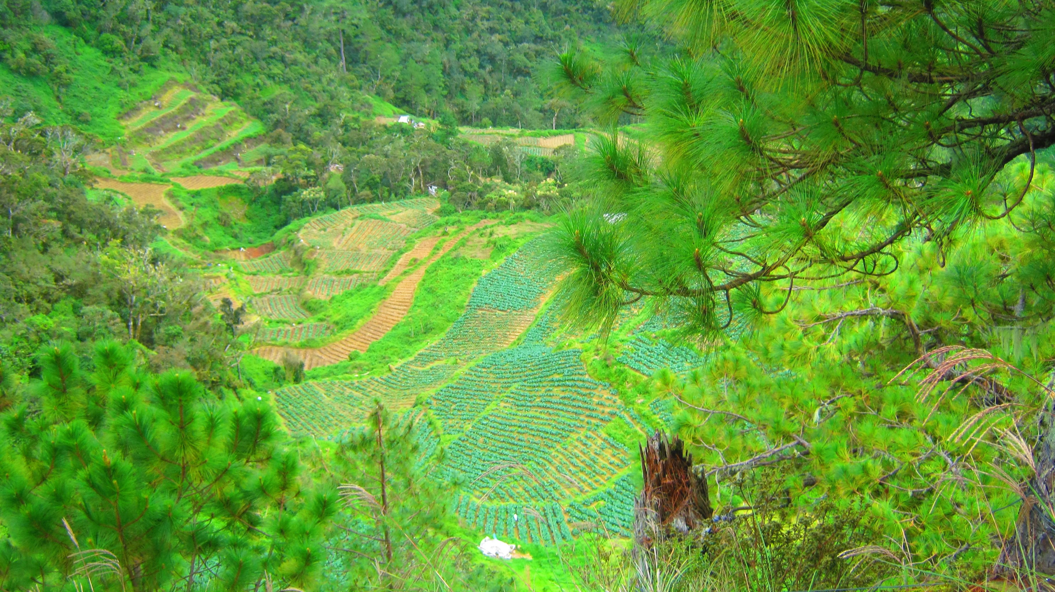
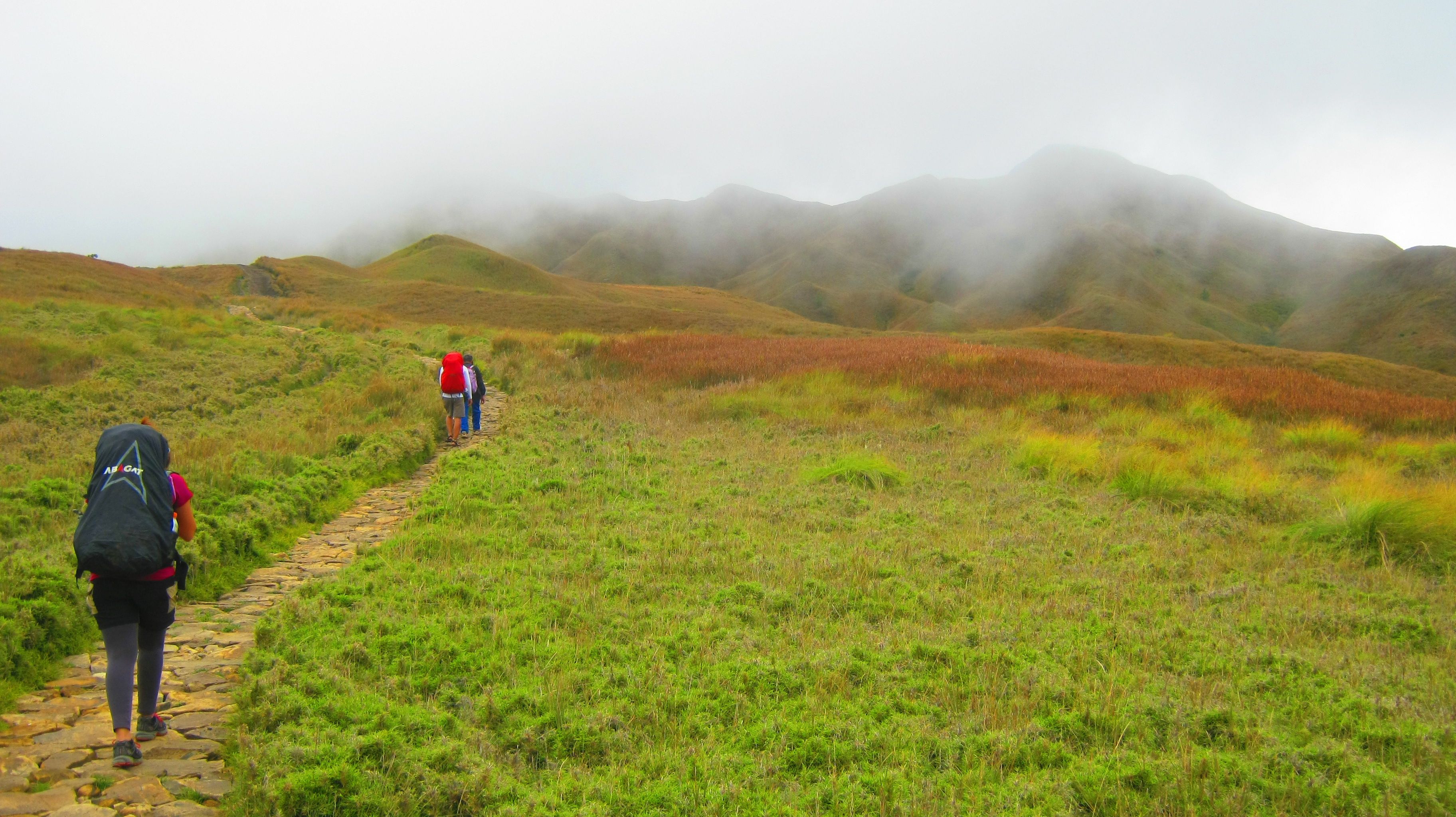
The farming community of Babadak.
We started out early from Baguio City, September 7, Sunday. Having an overwhelming costly breakfast at a carinderia at the Slaughterhouse terminal, we had a light meal to start the day and packed an even lighter lunch for when we hit the trails. We rode a van that was bound to take us to Bokod junction in Benguet. The trip from Baguio to Bokod took more than two hours of bright scorching sun, cool breezy wind, and a very limited sitting position to move about. When we finally reached the junction, we were greeted by motorcycle taxis or locally known as "habal-habal" drivers offering to take our packs and fastening them to their bikes even before we had arranged the fare. They asked for 350pesos to take us from the junction to DENR office nearby for registration where they will be waiting for us to finish the orientation and then take us up to the Babadak ranger station where we were to start our hike. This was a slightly elevated amount than usual since there was an on-going road construction where these bikes will have to take a long detour.
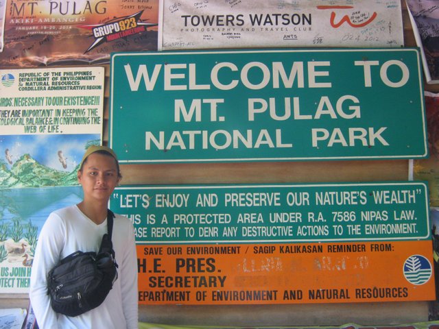
James at DENR office
Ambangeg trail is fabled to be the easy way up to the scenic summit of Mt. Pulag. They even refer to this as the "artista" trail since it can accommodate people with the endurance of a non-mountaineer. I decided to take this trail firstly because it was the only one that fit our flight schedules, considering a bloated itinerary. Secondly, I had to consider Ray's climbing experience since he has done only minor hills in Cebu. I wanted him to climb mountains with me in a way that he will enjoy the experience, not make him not want to climb again. Thirdly, we weren't after the trail, we were in quest of the well-known sea of clouds best seen at the summit.
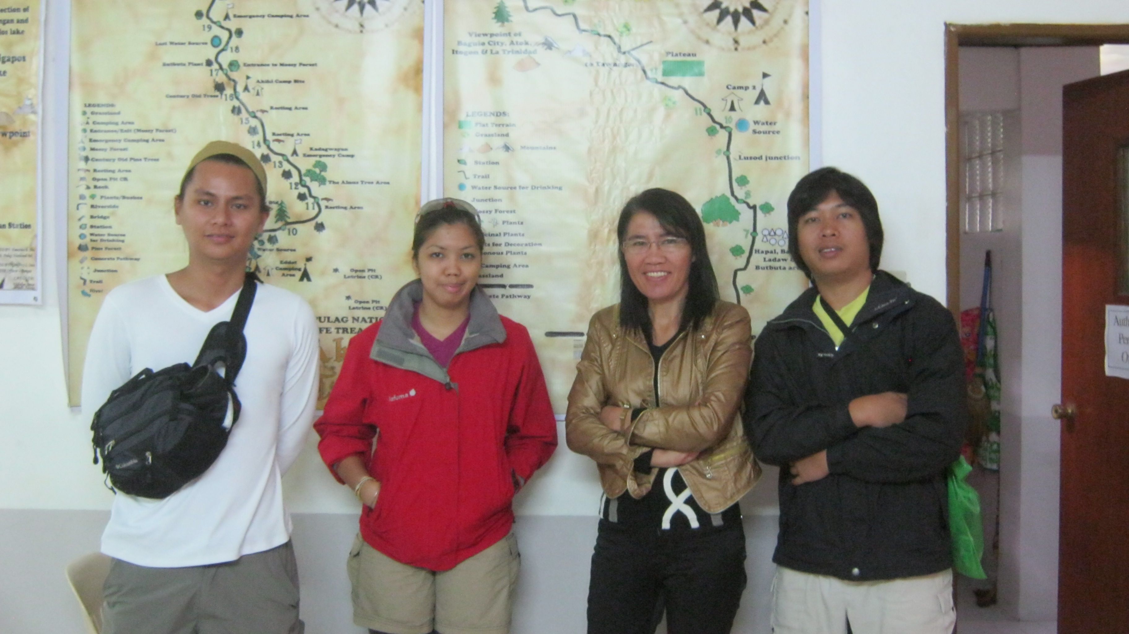
With Mam Mering, MPNP Park Superintendent
We met Mam Mering at the DENR office for the orientation where she acknowledged me as the winner of GiZ diversity photo contest - where I actually won this Pulag climb as a prize. She provided the rest of the park's house rules and geographic overview before we finally took off for the ranger's station some 30 minute habal-habal ride away. The ride alone made me feel I was home again, in the midst of the hills at the Ambangeg elevation overlooking a vast expanse of mountain ranges and farm patches.
Ray on the habal-habal detour spot.
Through the pine forests
We reached the ranger station to settle our guide fee and meet up with our guide, Kuya Fred, a sexagenarian whom we later learned was the oldest guide and we recognized him in one of the orientation videos given by Mam Mering. He was an aged but abled man, very soft-spoken and accommodating. He gave us good estimates of the trail stretches based on our pacing and gave us overviews of the trails we were passing.
The first segment of the trail was the pine forest, characterized by the abundance of the evergreens. Early through it, the dirt road cuts through patches of farmland that later from afar would look like a newly sewn quilt made from cuts of old fabrics with different patterns. Kuya Fred offered to take our photos every now and then since we figured we had ample time for photographs considering the distance to summit. We reached camp one and decided to feast on our over due lunch.
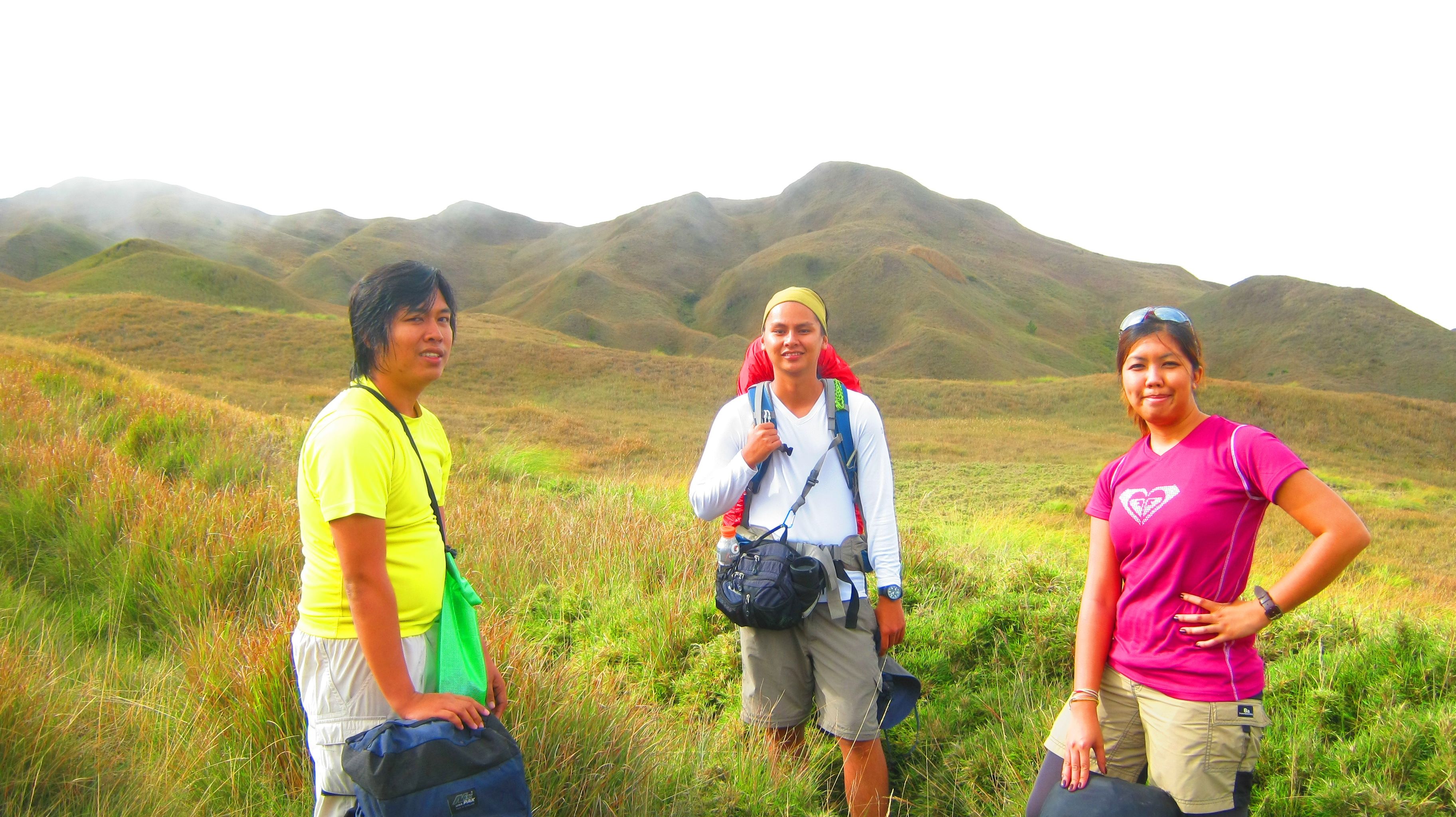
The team
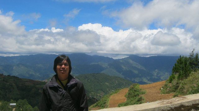
Ours was a three man team, each one coming from different parts of the country. James is currently staying in Baguio for training. He was based in Zamboanga City when we first met at the Kitanglad-Dulang Traverse early this year, and he owns a good share of stories of responding to victims of the recent war being an emergency medical technician for Red Cross. He is however originally from Dipolog City based on both personal account and Facebook profile. Ray was born and raised in Cebu City. He grew up in the hills of Bonbon. A Bosconian education graduate, he is now working as an electronics technician in Lapulapu City where he also currently resides. He has apparently been my adventure partner for the last two years and a great one at that matter.
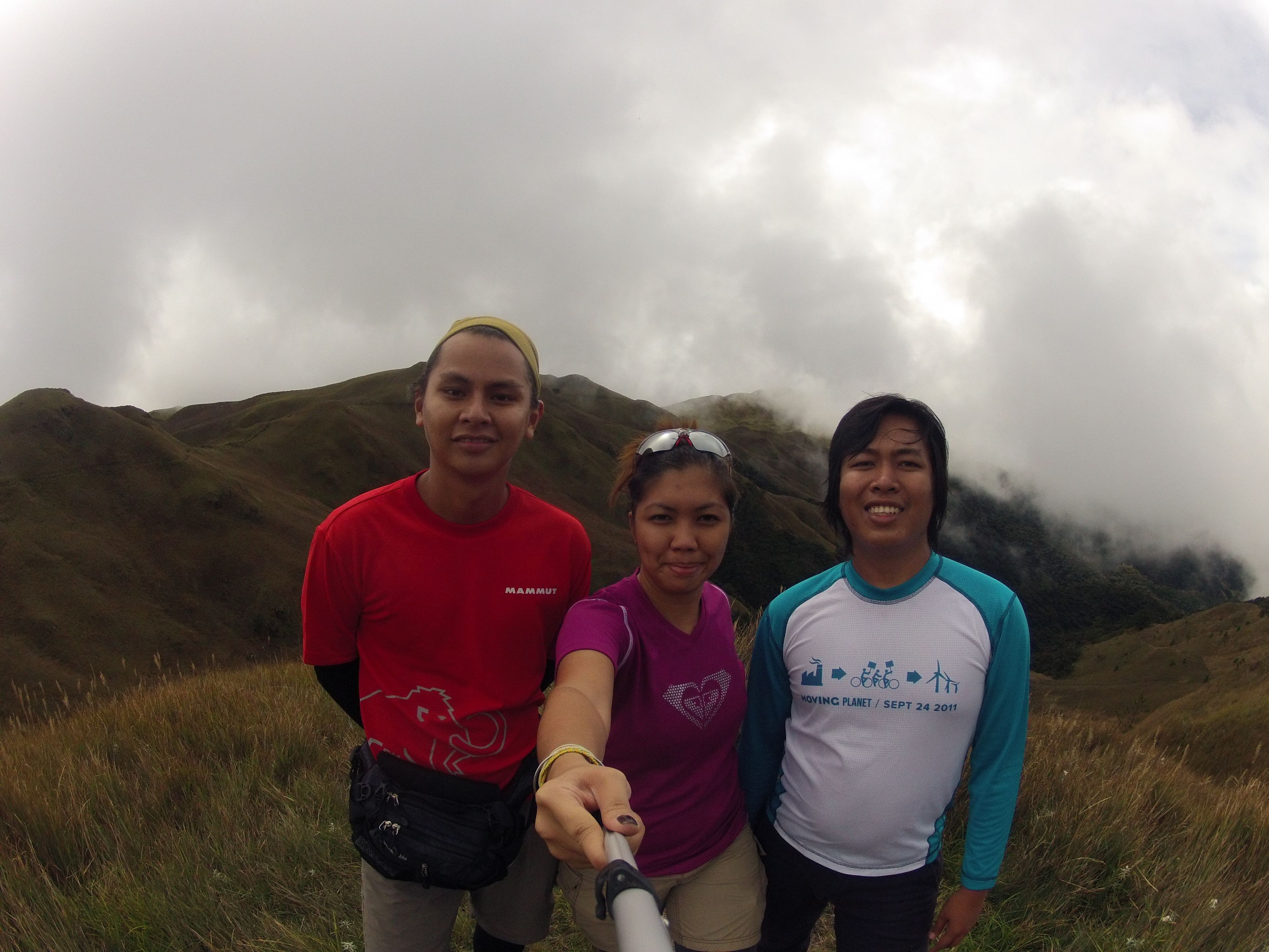
The team.
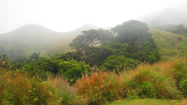
The mossy forest and the yellow brick road
The second segment would be the mossy forest, the vegetation slowly growing in as the lichens and mosses coat the trunks of trees. Ambangeg is referred to as the executive trail with the presence of an artificial foot path. This I would call the Yellow Brick Road in reference to my favorite childhood novel. The presence of the YBR seemed an eyesore to me at first, the same feeling I had with Kitanglad's metal rails. As a rain forest fanatic, I like to experience mountains in its most natural form. There is however a good logic behind these prearranged rocks seating on the soft mud. The volume of visitors to Pulag every year is overwhelmingly growing and without the yellow brick road, the trail would uncontrollably recline further, damaging a wider part of the land and vegetation.
Camp Two.
The mossy forest is a few kilometers stretch of rolling terrain slowly stitching its way to the highest point of the segment, known as camp two, a vast expanse of established campsite with designated latrines. It could accommodate hundreds of tents with all the annexes and extensions. Camp two is the boundary for the grasslands.
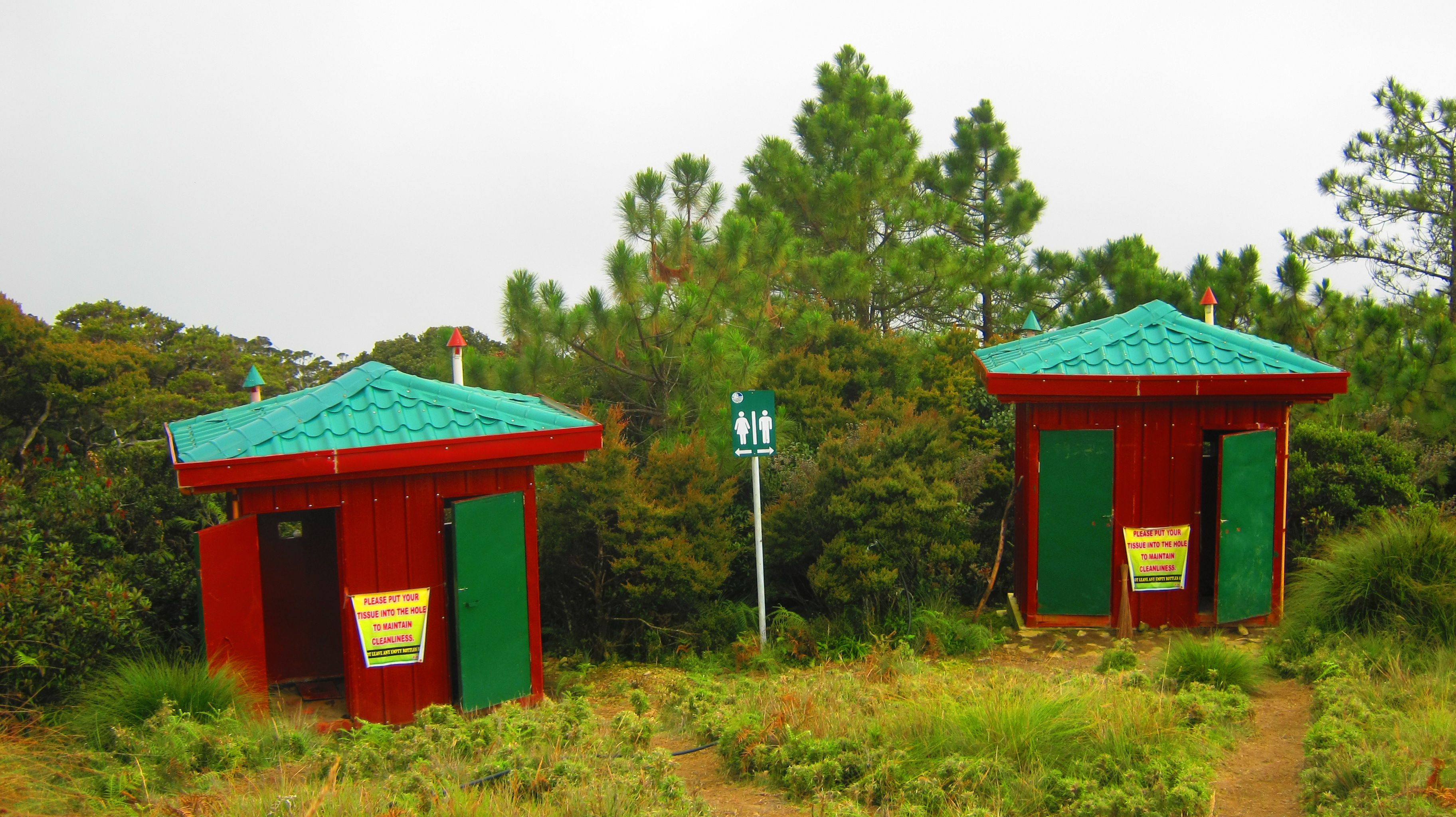
Designated latrines at camp two.
Of Myths and Legends
The grasslands are considered sacred grounds as many religious beliefs root from the area, the playground of the gods. The Ibaloi and Kalanguya tribes believe that the god Kabunian resides there along with their ancestors and anitos. There are many accounts on how the grasslands came to be, ranging from mythical to scientific. The most plausible could have been a bush fire that devoured the supposedly mossy forest and the vegetation never grew back up again save for the dwarf bamboos.
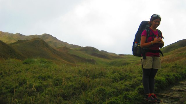
At the grasslands.
James was the faster paced climber following Mang Fred while Ray and I just tailed them at viewing distance. Almost four hours into the hike, we reached the last assault before climbing down into camp three or saddle camp. Camp three was usually the camp for those coming from Akiki trail. However we have decided that since Ambangeg is a rather short hike, we instead push to camp three where it'll be lot easier for us to summit early next morning and allow as the flexibility of visiting the peak more than once.
The "yellow brick road"
At the saddle camp
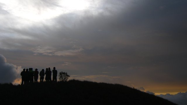
We set camp and nestled ourselves between two dwarf bamboo bushes that protected us from the wind. We were situated farthest from the guide's station while a group also coming from Cebu, along with their climb organizers from Luzon, hiking from Akiki, pitched their tents just between us and the station. I heard that familiar Cebuano accent and noticed familiar event or group t-shirt worn by some of them. Everyone was itching to climb the west ridge opposite the summit where the sun was just kissing the day away. We climbed up that ridge and watched the distant peaks I couldn't identify. I was in a strange land - a noob about Benguet geography, no knowledge of those peaks or what town they were in. Just there standing a midst the beautiful scenery fading into the horizon like an oil painting. The clouds lumped in thick fluffs and sometimes concealing the setting sun into an orange sky.
Tribu Padidit from Cebu
We were only given a few minutes to witness the final rays of the sun shining on the west face of the summit and as if in unison, the full moon rises.
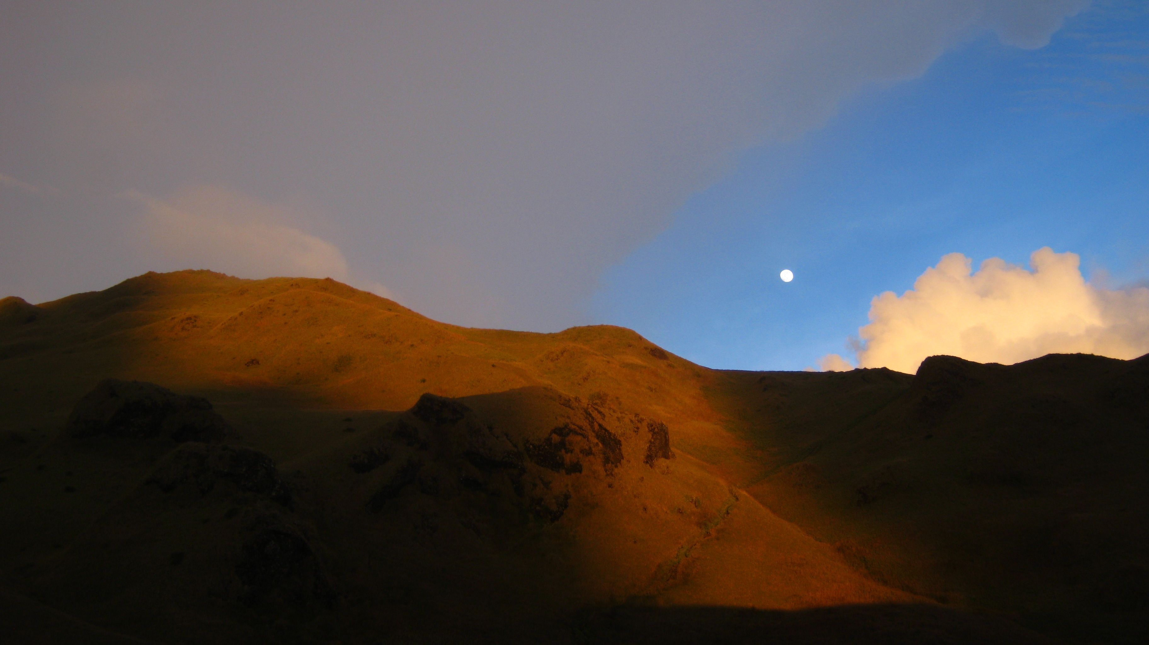
Moon rising, sun setting.
Back to the camp, we prepared our dinner, not quite palatable considering the novice cook that I am - we failed to bring salt and seasoning just because I have very poor culinary IQ. So we made do of what was cooked and enjoyed our dinner while anticipating for the cold to kick in. But it never did. The skies were clear and stars twinkled distinctly I could name a few constellations. We even spent a few hours of socials despite our group size, chatting over a few shots.
When we finally packed ourselves to sleep, I figured I couldn't use half the insulating gears I brought with me. There was no chill in the wind and only light drizzle which was probably just condensed vapor. I'd be sweating if I wore all my layers. Off to a comfortable night outdoors, we dozed.
To the summit
We woke up early next day to pursue the summit. The other group must have left ahead of us as the campsite has become serene. I had my jacket on as the wind was chilly, but a few minutes later I was sweating while climbing the steep trail up. It took around twenty minutes to reach the top and climbers coming from both camps 2 and 3 were already revved up to watch the fabled sea of clouds. It didn't show up at all.
There was only fog and a faint gleam from the far sunrise. We took some summit photos at the marker, and after an hour later decided that today wasn't our day to witness the sea of clouds. Back at camp, I crawled into my tent and I guess James did so too. It was Ray doing all the breakfast preps -- at home I do all the cooking, and that quite surprised me.
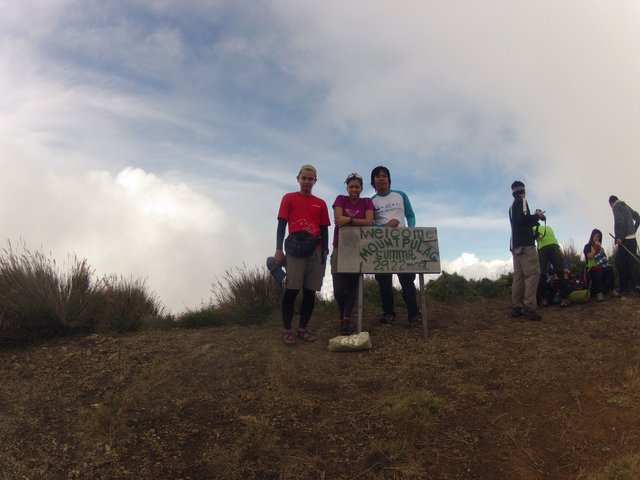
Visiting the summit the second time around before finally descending to Babadak. Cebu team, Tribu Padidit is partly shown here.
On acceptance and heading back
We broke camp at noon and took the trail that went around the summit. We stopped at the point where the trail was nearest the summit, eastward, and left our packs for another round of photo ops, this time with the sun high up.
Our mandatory team photo.
The group from Cebu was also there and we talked them into letting us ride with them back to Baguio. They were on an organized climb lead by Sir Ando, and they have got things planned out for them. On the other hand, we were just taking chances and waiting for things to happen. We speed walked the yellow brick road and into the community in Babadak ranger station. I don't think we even had lunch that day, just some junk food from the nearby store. We headed back to DENR where we logged out and purchased shirts for ourselves. A little later, the Cebu team arrived as well and the rain and wind has just started to gain strength. We hitched a ride back to Baguio which was quite fortunate for us since the chances of being able to commute was slim. The rain might have transformed into a typhoon, though I don't quite recall watching the news that day, but rocks were falling on the road on our way to Baguio and the fog was obstructing the view. We reached Rotunda safely that night and we are very grateful to our truly accommodating kababayans for the ride.
Budget Details per person:
Manila to Baguio via Victory - 455
Slaughterhouse Terminal to Bokod Junction - 100
Bokod Junction to DENR + DENR to Babadak ranger station (the drivers will wait for you while you have the orientation) - 350 (due to road construction detour, normally it would be around 300)
Entrance and Camping fee - 150
Cultural and Green fee - 80
Guide fee up to Camp 3 - 800 (1-5 pax)
Other useful details- (from MPNP Bulletin)
GUIDE RATES:
AMBANGEG TRAIL:
A. PHILIPPINE RESIDENTS
1 to 5 hikers
Camp 2 = Php 600.00 Php 120.00 per person
Camp 3 = Php 800.00 Php 160.00 per person
B. NON-PHILIPPINE RESIDENTS
1 to 5 hikers
Camp 2 = Php 800.00 Php 150.00 per head
Camp 3 = Php 1,000.00 Php 200.00 per head
AMBANGEG - AKIKI TRAIL
1-7 hikers = Php 2000.00
PORTER FEES: (Hatid-Sundo): 15 kilos or less
Camp 2 = Php 600.00
Camp 3 = Php 800.00
From PASu Emerita B. Albas: "The park management has been receiving complaints on some travel agents not giving the right service. Please make reservations to the park management at cell phone numbers 09196315402, 09199951316 or 09291668864."
Tours:
For organized climbs, you may contact Sir Ando Olaguera at [email protected].
!steemitworldmap 16.5978803 lat 120.8989248 long d3scr
Thanks for your time! Enjoy more tropical adventures by following my blog.
Cheers,
@xaydtrips
Congratulations, Your Post Has Been Added To The Steemit Worldmap!
Author link: http://steemitworldmap.com?author=xaydtrips
Post link: http://steemitworldmap.com?post=mt-pulag-national-park-hiking-life-in-the-tropics-03
Want to have your post on the map too?
It's a shame I haven't been there before the fire happened. Hopefully the forest could still be restored..
I am positive it will take less than five years for the grasslands to recuperate. By then, you should grab the chance to visit the mountain 😊