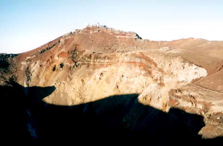
Fuji in japan
Fuji
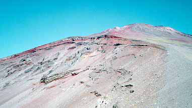
• Hiking time: 8 hours
• Estimated hiking distance: 7.5 miles
• Elevation gain: 4530 feet
• Topo Map: Topographical hiking map #31 or Geospatial Authority of
Japan Online Map
• Permit: None required
And so it was that, some four years later, I took a taxi to the Kyoto Central
Station and was soon speeding along at close to 160mph on the shinkansen
bound for Fuji City, about 200 miles to the east. The Kodama or limited
express (for Japanese trains of various degrees of expressness are given useful
identifiers) arrived exactly on time at 10.52am at Shin-Fuji station. There I was
met by my friend Yoshi Tsujimoto and one of his students, Masayuki Tanada,
who had promised to carry both of us oldies to the summit of Fuji. Or so we
teased him; in reality he was the very essence of quiet civility.
Trailhead
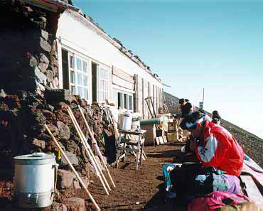
sacred mountain topped by a shrine. Pilgrims who begin at the base of the
mountain are aided by ten stations roughly equidistant along the climb to the
top. There are several routes up the mountain each with its own chain of ten
stations. However, these days most hikers with a less devotional objective, drive
as far as they can up the mountain. Roads on the north side and on the south
side climb to just over 7500ft where the fifth station, Go-gome, is located. The
most popular route is up the Kawaguchi-ko trail from the Go-gome trailhead
(7592ft) on the north side of the mountain. We followed the Fujinomiya trail
that begins at Shin-go-gome (7874ft), the new fifth station, on the south side.
Hike
It was mid-afternoon before we reached the large parking area at Shin-go-gome
and managed, somewhat fortuitously, to find a parking space. The weather
had been very cloudy and misty as we drove up to this point and we had
resigned ourselves to very limited visibility during the climb. But, as we readied
our equipment in the parking lot, we began to catch glimpses of blue sky and
sunshine above us. Buoyed in spirit we began our climb upwards from the
crowded fifth station at about 2.00pm. It is only a short way to the sixth station,
Roku-gome, the intervals between stations being quite irregular in places. The
sixth station also coincides with the tree line so that the terrain from here on
was everywhere volcanic rock strewn with ash and geologically recent ejecta.
We made steady progress up the rough and worn trail. Soon we were in bright
sunshine with an uninterrupted carpet of clouds below us. The famously regular
shape of Fuji was evident as the sun cast its shadow on the parchment of the
From Shin-Fuji station it is an increasingly tortuous drive of some two hours
through the town of Fujinomiya and up the lower slopes of Mount Fuji. You
start in the typically dense built-up area around Fuji City and Fujinomiya and
rise gently through crowded, rolling farmland. Soon, however, this gives way
to dense semi-tropical Japanese forest of low trees and a thick ground-covering
of bamboo. Higher up this forest begins to change with increasing numbers
of larger pine trees and a thinning of the bamboo. Eventually the bamboo
disappears completely to leave an attractive highland forest of firs.
Our goal was the highest point reachable by road on the south side of Fuji,
namely the mountain station of Shin-go-gome (“new fifth station”), high on the
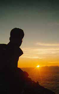
top of the clouds. But the bright sun also meant that we were soon sweltering
in the heat. We could see Shichi-gome, the seventh station, above us and it
seemed deceptively close. But it took a depressingly long time to get there and
we were struggling when we arrived at 10,000ft and Shichi-gome about 4.00pm.
Our plan was to climb some distance during the daylight hours and then to
find a place to stay the night so that we could climb the last part before dawn
the next day. In doing so we would be following the traditional timetable for
climbing Mount Fuji. The idea is to reach the summit in time to enjoy what
the Japanese call “goraiko”, the semi-mystical experience of viewing the sunrise
from the summit.
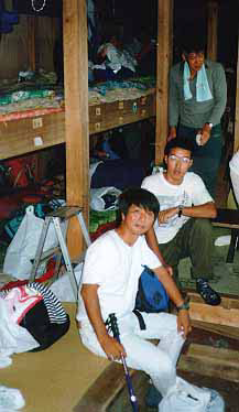
In theory it is possible to stay overnight in one of the many lodges on the
mountain; almost all the stations have such a lodge. They consist of three or
even four levels of shelves installed in a moderate, single storey hut. Hundreds
of hikers are packed in like sardines on these shelves equipped with heavy coverblankets.
As we were climbing toward Shichi-gome, we heard word that many of
the lodges were closing or had already closed for the winter. Shichi-gome lodge
still seemed open for business. But it was very small, already crowded and a
very long way from the summit for a pre-dawn hike. We decided to risk our
chances further up the mountain since we still had a couple of hours of daylight.
And so we pressed on. It was harder going now, both rougher and steeper.
We had to pause quite often to get our breath in the rarefied air and so, though
the large eighth station did not seem very high above us, it took a long time to
reach it. At one rest stop, we had confirmation of the rumors we had heard further
down the mountain. The lodge at the eighth station, Hachi-gome, was full;
the proprietor could not pack another single soul into his establishment. This
was depressing since we also had confirmation that all the higher lodges (mainly
those on the summit) were closed for the season. But almost immediately, we
had some more encouraging news. Apparently, there was another Hachi-gome
lodge just a short distance around the mountain. This was on one of the other,
less popular trails; apparently it was still open and even had some space left for the night.

