First Experience Climbing Mount Burni Telong 2,670 Mdpl
Climbing Mount Burni Telong at the end of 2015, is my first climb in Gayo Land. Mount Burni Telong is the 10th highest mountain in Aceh province. The height of Mount Burni Telong reaches 2,670 Mdpl.
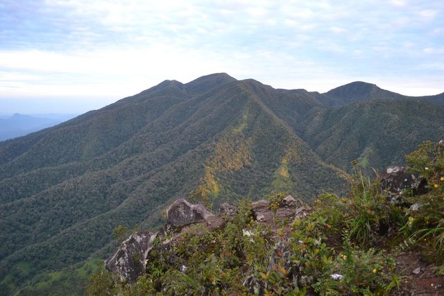
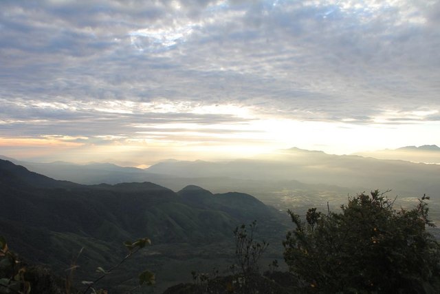
Mount Burni Telong is famous for the beauty of Edelwies field, which at an altitude of 2200 Mdpl can already be found shoots Edelwies plants around the summit path. Lucky as we climb Mount Burni the flowered eggs that can only grow in this plateau are in the flowering season.
Mount Burni Telong is located in Bener Meriah Regency. Our climbing route through Bandar Lampahan route, in Rembune Village. According to the information we get other than through this route can also go through Pante Raya Route, but Pante Raya Route takes a lot of time because Bandar Lampahan route is more often chosen by the climbers.
The route to the foot of the mountain begins with a journey from Simpang Lampahan (a journey from the city of Bireuen, intersection Lampahan on the left side of the road because this intersection has no name plank should be able to ask people around the location of Bandar Lampahan Hot Water Baths, this bath is more popular from any location in the city of Lamapahan). From the intersection Lampahan into the walk about 2-3 km. Although the road is asphalted, but enough incline drain calf muscles. As a sign that we have arrived at Rembune Village, there is a simple gate made of iron plate that reads Welcome to Rembune Village.
In Rembune Village, POS is available, which is managed by the village youth. In this POS every climber must leave the identity card and pay retribution as sincerely, generally the climber gives Rp. 5000- / person. For those who bring a motor / train can be entrusted in this POS. Even for beginners POS also provides a guide to help climbers to the top.
From POS Rembune if we go on a motorcycle can ask on the shuttle to the foot of the mountain, the distance is about three km. Five times I climbed Mount Burni Telong always arrived in Rembune Village on a dark day, the first at 9 pm, to two hours 6 am, I am always in the dark towards the foot of the mountain, maybe because that is also the population willing to take the foot of the mountain.
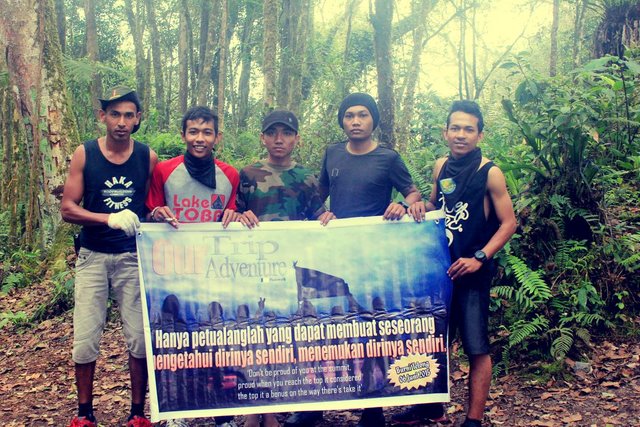
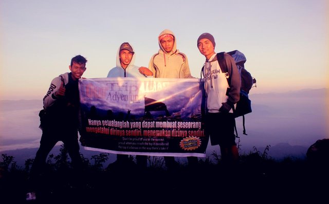
The first ascent in Tanah Gayo we do four, I (Andy), Helmi Saputra, Muhammad Heri and Musliadi. Because we did not know the climbing terrain, we decided not to climb directly that night, we still decided to stay at the foot of the mountain tonight.

Morning December 15, 2015, the air still feels so cold to us, people who are used to coastal weather, excitedly early in the morning, on a dark day we have finished breakfast. At 8 am we're done with packing. We were ready to start the journey.
The first fifteen minutes we will walk through the coffee plantation, the path here is still gentle, after passing through the coffee plantation, we will pass the vegetable garden, in this vegetable plantation we will not find the big trees. In the plantations that we pass this will often greet with the local farmers, even sometimes they first greet us. Gayo land people are really very friendly.
Past the vegetable garden, directly in the presence of a high-backed hill, the track is about 100 meters enough to force us to stop to rest. After passing through the hill, the journey directly into the jungle jungle, does not take long, just 10 minutes journey just sunlight is difficult to penetrate the shade of tree leaves in the forest.
The track trail for two hours still clear to follow, which is difficult when it comes to fallen tree lanes, here there is a Three intersection, to the right, to the left and from where we come. As we hiked long enough to circle in this intersection, we chose the path on the right, which after the ascent we know that this path is used for hunters of animals because that is the turning pat. For an hour we circled the path, finally we returned to the intersection of Three, and select the left lane, and it turns out we are smoothly following the path. At this point we did not find a confusing crossroads, we were smoothly trushing with the spirit of steel.
Four hours already we split the forest of Burni Mountain Telong, climbing, shrinking, hanging, jumping is the way to pass through the Burni Telong Mountain field. Naturally this path has a Vertical track because Bandar Lampahan route is open to speed up the distance to the top of Mount Burni Telong. So do not expect a lot of ramps, just enjoy it. It took us six hours to get to Shelter Camp, although tired, tired the jungle was different from the city's air, no matter what body, the air we breathe was cool and always refreshingly fast.
At Shelter Camp we set up a tent, we chose a camp site directly in front of the Summit track, for some reason that we were worried about the difficulty of finding the summit path at night. At three o'clock that afternoon at Shelter Camp the atmosphere of the forest is dark, nocturnal animals or night animals have sounded boisterous to entertain the jungle guests.
Because it was late afternoon, we were looking for wood for the fire, we hoped that before the curfew arrived we would be able to calm down inside the tent. Need to know, for climbers who want to find firewood in Burni Telong, you should not take the wood around Shelter Camp, other than the wood here is hard to burn because, Shelter Camp location is also already seen bald, so our advice just look for wood in the summit line. Along the path of summit many dry branches that can be burned, know the plants there grow on volcanic rock, so easy to dry and good for firewood.
One more survival tips on Mount Burni Telong, do not forget to bring enough drinking water supply from the foot of the mountain because the water source is not here. If to defecate, do not worry there are many bottles aqua tied-tree-lined around Shelter Camp. Water that is stored in aqua bottles in addition to defecation can also be used as alternative water, if necessary.
In the path of summit we will be spoiled by a dream hiker's dream, the eternal Edelwies. Yes, almost along the summit line can be encountered in this rare plant. In the hope that the climbers do not pick flowers, you will feel guilty in the future, just take a picture or selfie with a beautiful resident vulcano.
In the path of summit we will also find a Stone Cave, in this cave sometimes provide many logistics, such as rice, salt, sugar, coffee, potatoes and others. If there is a piece of resin wood, just take it to be a fire axis. The wood is red the smell is stinging. These logistics are abandoned by the usual climbers in the cave, they are lazy to carry the load while down so stay in the cave. If you want to be stamped in this cave, I suggest you have to bring Sleeping Bag and thick clothes, the air here is very cold, I never camp in this cave, while cold to not shiver for two minutes just hard, sleep can because blankets and jackets are not enough.
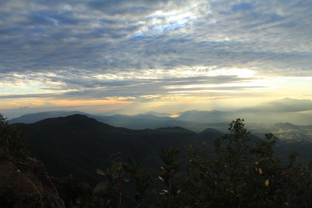
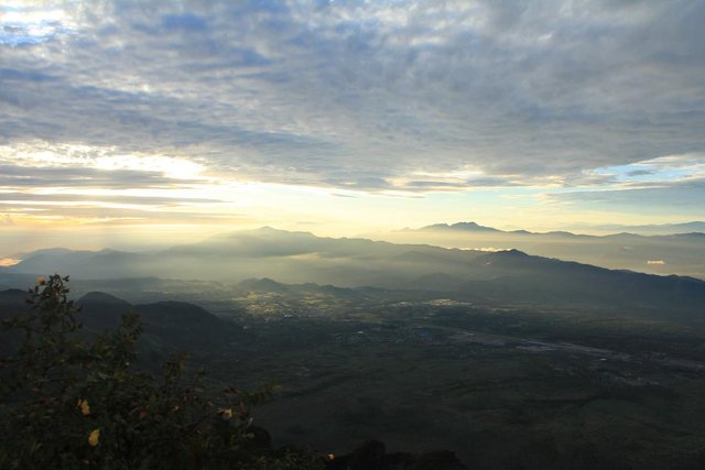
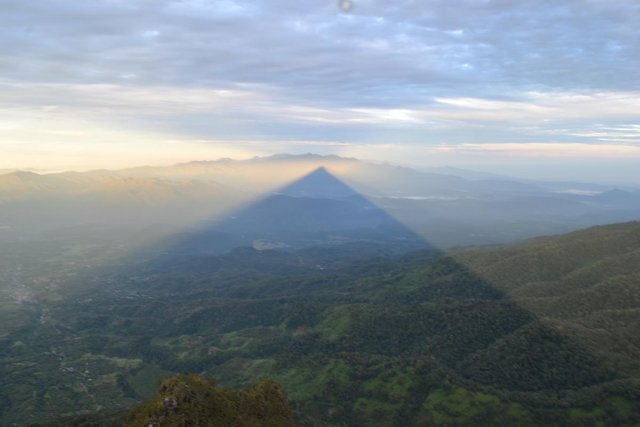
At five o'clock (05:00) we tread foot on the top of the mountain, with my gratitude prostration and kissing Gayo land at the summit of Mount Burni Telong Central Aceh, at an altitude of 2670 Mdpl.
Congratulations @alfiandy! You have completed some achievement on Steemit and have been rewarded with new badge(s) :
Click on any badge to view your own Board of Honor on SteemitBoard.
For more information about SteemitBoard, click here
If you no longer want to receive notifications, reply to this comment with the word
STOP