#Keureuto, Biggest Dam In Sumatra,
The presence of the Keureuto krueng (river) in North Aceh district is said to be the main cause of floods in the capital of Lhoksukon and surrounding areas several years ago. (Source).
This is because the Keureuto River Basin (Watershed) river that stretches in the region of Central Aceh regency in the upstream and in the region of Aceh Utara downstream and has a total area of catchment area of 916.31 km2 is the main river from 6 other tributaries.

The Keureuto River receives the contribution of water discharge from the Upper Krueng Keureuto River
(DAS 351.03 km2), Krueng Pirak River (88.85 km2), Krueng Ceuku River (82.25 km2), Krueng Peuto River
(276 km2) Aluleuhop (DAS 81,23 km2) and Alueganto (DAS 37.28 km2) as published in a journal written by Rizal Syahyadi who is a lecturer of civil engineering at Lhokseumawe Polytechnic,
In April 2012 ago, during the flood, hundreds of houses in three sub-districts in Aceh Utara District, Nanggroe Aceh Darussalam Province (NAD) were submerged due to high rainfall intensity in Gayo land area and overflow of Krueng Keurutoe.
Hundreds of flooded homes were in three sub-districts in North Aceh, Matangkuli sub-district covering Tanjong, Meuria, West Tempok, Alue Thoe, Lawang, and Hagu villages. Alue Thoe, while in Kecamatan Pirak Timu, floods hit Tanjong Serkuy Village, Meunasah Krueng, Rayek Pange, Pange, Bungong, Gelumpang, and Hasan Krung Kreh.
While in Lhoksukon sub-district, floods inundated the fish market complex area and several residents' houses in Kampung Baru and Dayah Village as reported in one of the national media. In December 2012, nine sub-districts in Aceh Utara regency were hit by floods due to overflowing of four rivers, Keureuto, Peutoe, Pirak and Pase rivers.
Nine submerged sub-districts, namely Paya Bakong Sub-district, Cot Girek, Lhoksukon, Matangkuli, Pirak Timu, Tanah Luas, part of Syamtalira Aron. Can you imagine how severe the floods that hit Aceh Utara in late 2012 ????
For example, the Secretary of the Regional Disaster Management Agency (BPBD) of North Aceh, Munawar said that there are 17 submerged villages in Sub-District of Matangkuli, Tanah Luas Sub-district with 13 villages and 14 villages in Pirak District. If one district of Matangkuli, there are 17 submerged villages, then what if there are 9 sub-district submerged during the flood of 2012 ago ???
- How many villages were inundated by the great floods in Aceh Utara then ???
- How many hundreds of thousands of victims caused by the big floods in Aceh Utara?
- How much material damage caused by the big flood in North Aceh at that time ???
The floods are bound to make huge losses, especially for people in North Aceh.
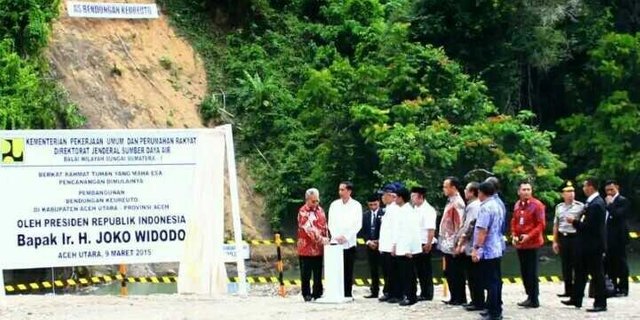
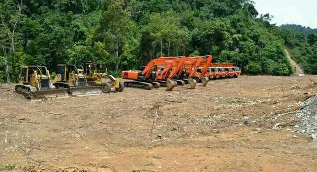
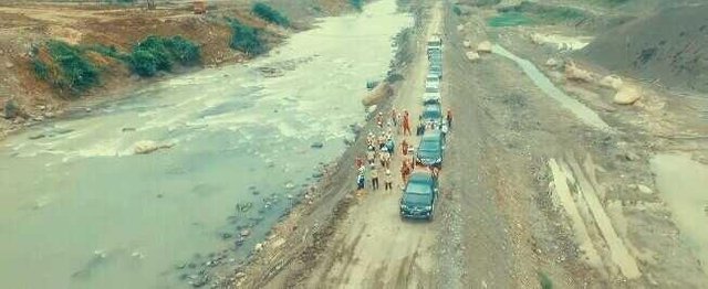
To prevent the occurrence of major floods, especially those that hit Aceh Utara and surrounding areas, the government took the initiative to build the dam as an alternative to overcome the annual flood problems that always hit in North Aceh, especially in the city of Lhoksukon and surrounding areas.
According to a spokesman for the Ministry of Public Works and People's Housing, Djoko Mursito, the Government's target with the construction of the Keureuto dam is to provide a special flood shelter of 30.50 million cubic meters capable of reducing and reducing flood discharge for up to 50 years.
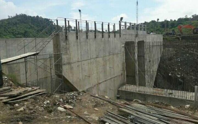
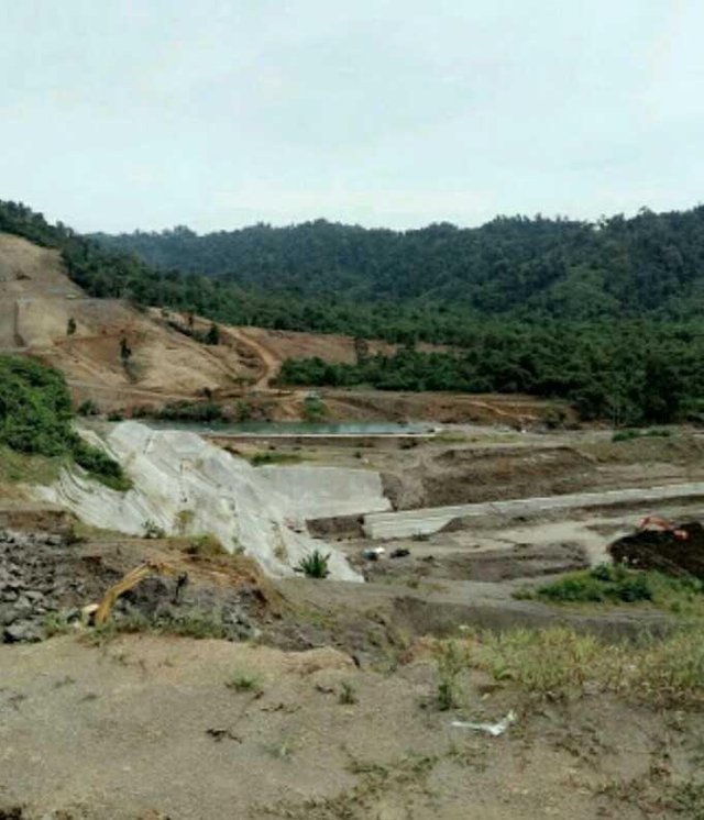
The Krueng Keureuto dam will have a capacity of 215.94 million cubic meters, with an area of 836.39 hectares. With the potential of the dam, it is estimated that the largest reservoir in Sumatra could be a hydropower that can produce 6.34 mega watt (MW), and this suffices enough electricity for North Aceh.
Krueng Keureutoe Reservoir is also planned to accommodate 4,438 hectares of Alue Bay irrigation water, and add irrigation water supply around Krueng Pase. Krueng Keureutoe Dam can also become a raw water provider for Tirta Mon Pase Water Company (PDAM) because it has a water capacity of 167 million cubic meters, with a puddle of 900 hectares.
The dam also serves for the provision of irrigation water (9,420 ha), raw water (500 liters / sec), hydroelectric power (6.34 MW) and other benefits, so as to improve the economy in Kabupaten Aceh Utara and Kabupaten Bener Meriah. In the process of building this dam, it is divided into three packages. Package I is done by PT PT Brantas Adipraya JO PT Pelita Nusa Perkasa, Package II by Wijaya Karya, and Package III by Hutama Karya JO PT Perapen.
Congratulations! This post has been upvoted from the communal account, @minnowsupport, by ipoen from the Minnow Support Project. It's a witness project run by aggroed, ausbitbank, teamsteem, theprophet0, someguy123, neoxian, followbtcnews, and netuoso. The goal is to help Steemit grow by supporting Minnows. Please find us at the Peace, Abundance, and Liberty Network (PALnet) Discord Channel. It's a completely public and open space to all members of the Steemit community who voluntarily choose to be there.
If you would like to delegate to the Minnow Support Project you can do so by clicking on the following links: 50SP, 100SP, 250SP, 500SP, 1000SP, 5000SP.
Be sure to leave at least 50SP undelegated on your account.