FIRST NYC FLAKES FLY EARLY
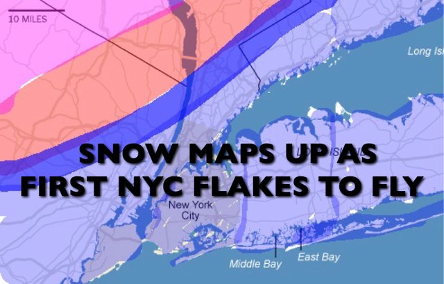
FIRST NYC FLAKES FLY EARLY
Good cold morning everyone. The first snowflakes of New York City are set to fly as everything is moving along faster than originally expected; which will time perfectly with cold air in place.
EASTERN SATELLITE

First off, we have a cold day unfolding here in NYC and an even colder night arriving. We’re in the mid to upper 30’s as I type and don’t expect things to budge much. If we’re lucky, we’ll go to 40, but most areas will sit in the upper 30’s. Freeze warnings are up for all five boroughs tonight as we go into the upper 20’s. Meanwhile, it’ll be relatively frigid outside of the heat island where low to mid 20’s will be commonplace, and even some teens well north and west of NYC.

That’ll help set the stage for tomorrow’s action as I said yesterday that timing was one of the key elements to this event.
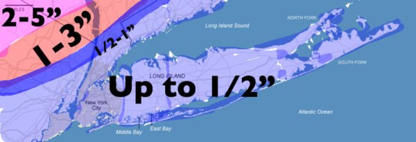
Expect sleet and snow to begin between 8am and 10am tomorrow. We may see some brief sticking early, but then temps will rise slowly throughout the day.
By late afternoon, we’ll introduce enough warm air to help make that mix more wet and bring in some rain too. That’ll help keep accumulations down throughout much of the area.
Areas upstate will be a different story as cold air takes a little long to recede. I’m thinking there will be a small belt of1” amounts just north and west of the NYC area, then higher amounts the further you go north and west.

Come nighttime, the frozen precip is all but gone and it’ll be a plain cold rain. That should go till early morning Friday and you won’t be waking up to any white ground, just the realities of mid November; highs in the low 40’s.
Relatively cold air hangs on for the weekend and we should see a sunny and breezy Saturday, with highs in the mid to upper 40’s. Then clouds increasing Sunday as a weak system approaches for Monday; highs again in the low to mid 40’s.
FiOS1 News Weather Forecast For Long Island
FiOS1 News Weather Forecast For New Jersey
FiOS1 News Weather Forecast For Hudson Valley
NATIONAL WEATHER SERVICE SNOW FORECASTS
JOIN JOESTRADAMUS ON YOUTUBE!
LATEST JOESTRADAMUS ON THE LONG RANGE
Posted from my blog with SteemPress : https://www.nycweathernow.com/first-nyc-flakes-fly-early/