A circular hike over the Pfaffenberg near Krems-Förthof
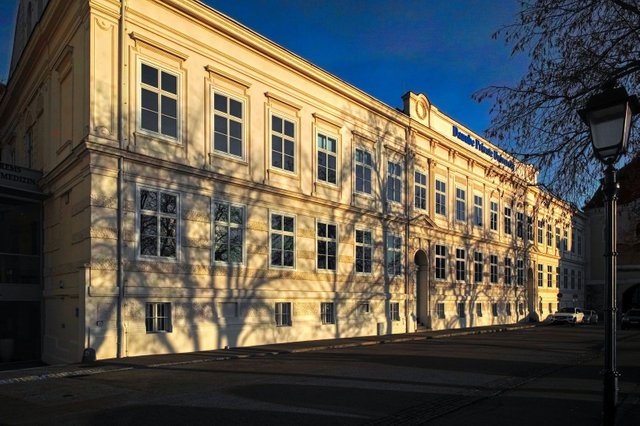
The circular hike that I am going to present in this story starts at the building of the Danube Private University (DPU) right next to the Linzer Tor.
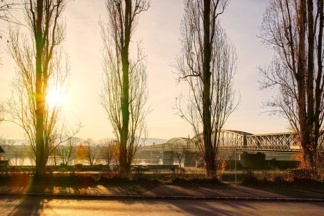
Then you walk straight forward in western direction and pass the bridge over the Danube river.
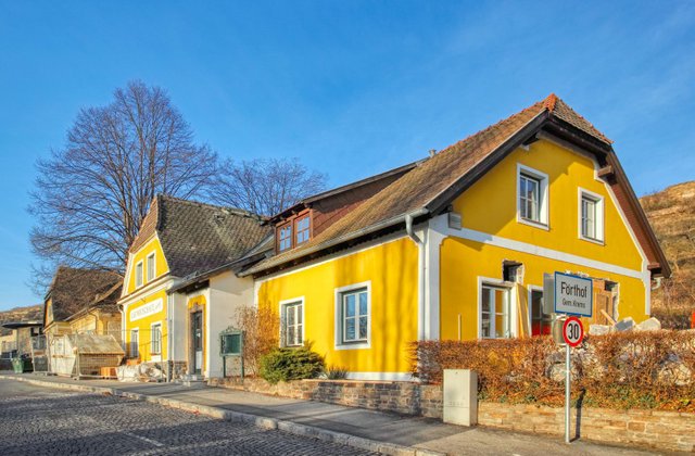
Now you come to Förthof that is the westernmost part of my hometown Krems an der Donau. The first building you see is a former restaurant which has been bought by the DPU earlier this year and is going to be transformed into a research center right now.
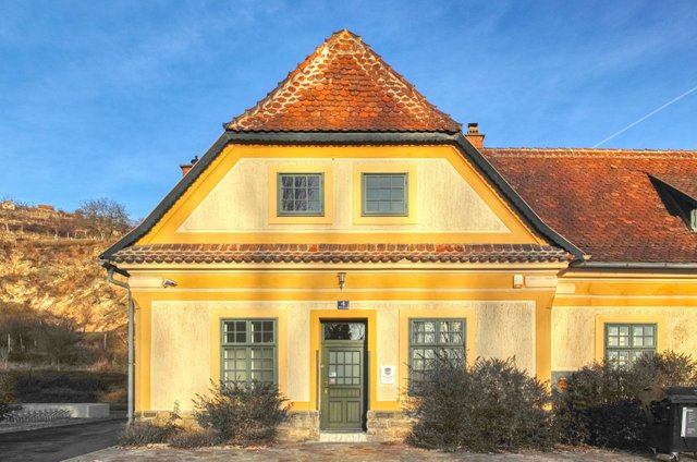
Then you walk along the former train station - which has also been bought by the University.
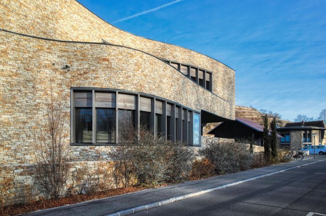
Finally you reach the new building of the DPU that has been designed by François Valentiny an architect from Luxembourg. Its facade is covered with dry stone walls so it looks like the terraces of the vineyards behind the building and thereby perfectly fits into the landscape.
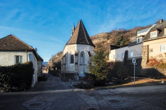
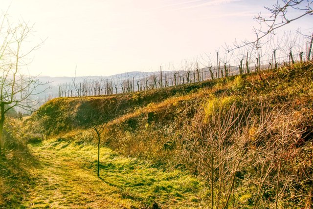
Right after the modern DPU building and right before the small gothic church you turn right and walk in northern direction. You cross the tracks of the Wachaubahn and walk upwards.
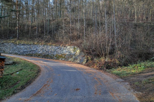
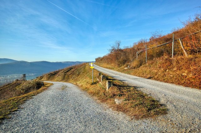
The way up is quite steep but after this left turn…
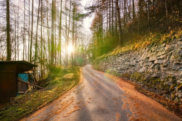
it's just some more meters to walk upwards.
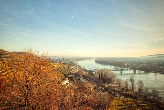
Then you can enjoy a beautiful view over Förthof, Stein and the Danube River.
You can also see the small, but very old town of Mautern an der Donau.
Here you can already walk down the path on the left side or you continue on the right side…
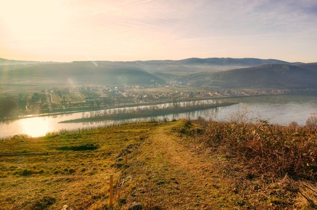
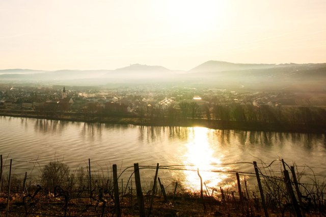
and walk down this grass-covered path. Here you have a beautiful view on the "Hundsheimer Insel", an island in the Danube river. Behind that island you can see the village of Hundsheim that belongs to the municipality of Mautern.
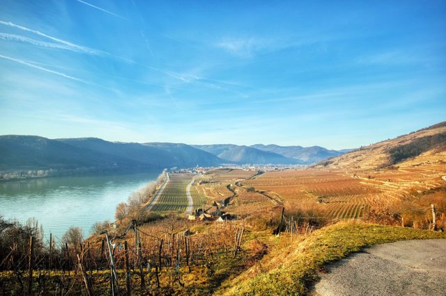
When you reach the asphalted way again, continue walking in western direction. Here you can already see Loiben, a village that belongs to the municipality of Dürnstein.
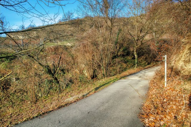
Right here, where the asphalt path ends in a gravel path, you have to turn left sharply…
and walk down this grass-covered path in southern direction.
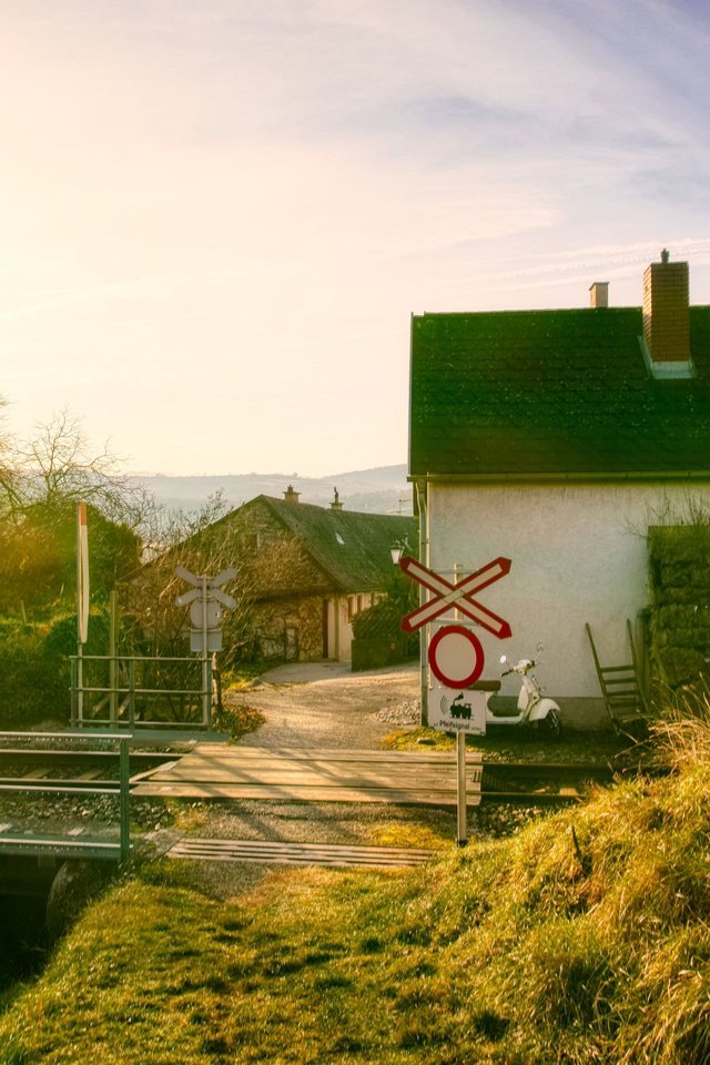
After this railroad crossing you reach the very tiny village of "Rothenhof", that is part of the municipality of Dürnstein.
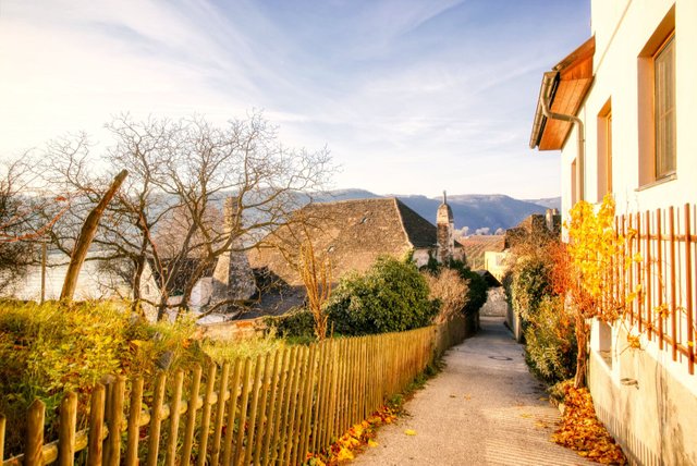
You walk through Rothenhof and finally reach the main street B3.
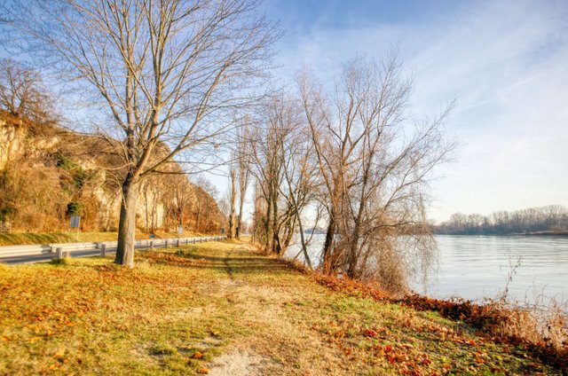
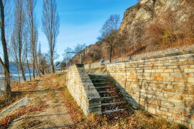
Cross the B3 and walk on the "Treppelweg" (towpath) along the Danube river in eastern direction.
Some hundred meters before Förthof you cross the B3 again and continue walking on the cycling path.
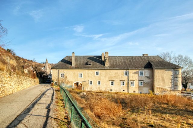
Finally you come to Förthof and walk through this small village. You pass the "Förthof", an old castle that has been built in the 13th century, but faced bigger conversions in the 16th century.
Right behind the castle you can see the church. From there you walk back to the starting point of this hike.
As you can see, it is a hike with very beautiful views. I needed about 1 hour and 15 minutes for this hike.
View this post on TravelFeed for the best experience.
You post has been manually curated by BDvoter Team! To know more about us please visit our website or join our Discord.
BDvoter Team
Congratulations, Your Post Has Been Added To The Steemit Worldmap!
Author link: http://steemitworldmap.com?author=schmatz
Post link: http://steemitworldmap.com?post=a-circular-hike-over-the-pfaffenberg-near-krems-foerthof
Want to have your post on the map too?
Hiya, @itchyfeetdonica here, just swinging by to let you know that this post made into our Honorable Mentions in Daily Travel Digest #714.
Your post has been manually curated and upvoted by the @steemitworldmap team to support your work. If you like what we're doing, please drop by to check out all the rest of today's great posts and consider supporting us so we can keep the project going!
Become part of the Haveyoubeenhere community: