Hiking Guide to the Shumak Trail, Siberia, Russia.
I recently realized that there is very little information in English about trekking in the spectacular area that I live in (Baikal region of Russia) apart from the Great Baikal Trail, so I decided to put together a hiking guide to the Shumak Trail using some photos I took this past summer.
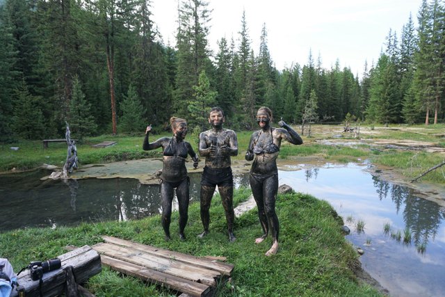
Shumak is the "sacred" valley of 100 springs, located in Buryatia (trailhead is about a 4 and a half hour drive from Irkutsk). There are literally over 100 springs that meet in this location. Most are meant for consumption, some are meant for your eyes, ears, nose or feet, and some you can bathe in. Each spring has a little sign with its 'healing property.'
Legend has it that Genghis Khan used to bring his army here to heal his warriors' wounds. People still come to Shumak for healing purposes, but the only way to get there is by helicopter or a 50 km trek through a 2,800 meter pass.
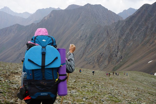
We did this trek 5 times this past summer with Syberia Top.
The season for this trail is only July and August. In June, the pass is still covered in snow (waste deep in some places), you might not be able to see the trail on the pass, you have to climb over loose rocks and boulders, walk through high rivers, and there may be avalanche danger. In September, you have a high chance of running into a snowstorm, and again, you may lose sight of the trail and can end up lost in Siberia.
In general, I would not recommend for people to do this trail on their own, but if you wish to do so, please do this in July or August and be prepared. Siberia is no joke! You can hire me as a personal guide or join one of our group hikes next year. See our English Facebook page or Instagram.
https://www.facebook.com/siberianadventures
https://www.instagram.com/syberia_top/
I recommend downloading an app such as mapsme, so that you can see the trail and your location while being offline.
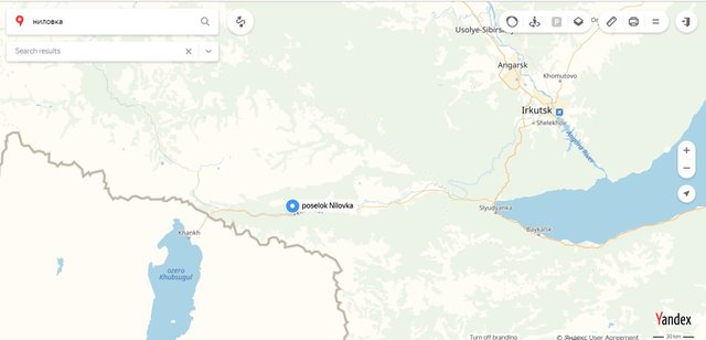
To get to the trail you have to get to poselok Nilovka, Tunkinskiy rayon, Republic of Buryatia, Russia 51.694445, 101.674198
I think there is a minibus that goes from Irkutsk to Nilovka.
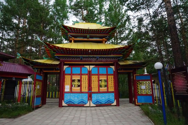
While in Nilovka, you can check out this Buddhist Temple:
From there you need to get to this spot:
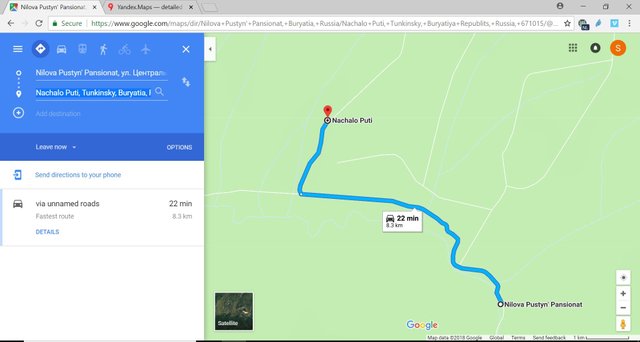
8.3 km down "unnamed roads" to "Nachalo Puti" (which means "starting point") :).
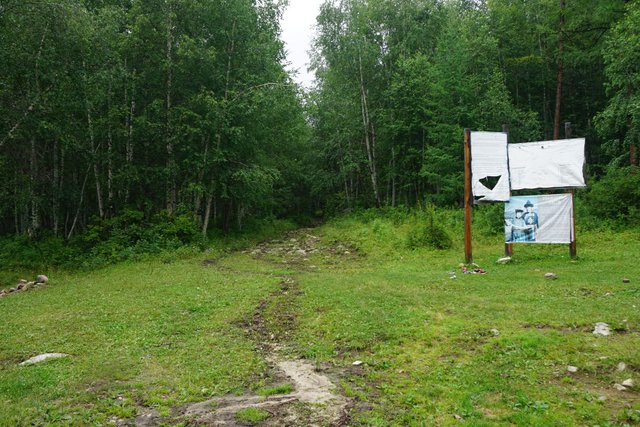
There, you can find a fence, a couple of houses (one with a cafe in the summertime), and a gazebo-type thing.
There might also be a a "zilla" truck that you can pay a lot of money to in order to drive you another 8km down a crazy dirt road.
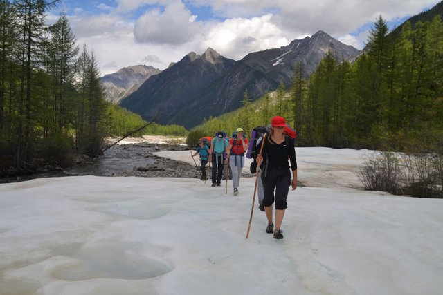
So, start at the only dirt road in "Nachalo Puti," to the right of the fence. You will walk down this road for a while, passing one cobble-stoned shallow river in the first 500 meters (it may be dried up or knee deep, depending on how lucky you are ;)). (And there may be more small rivers if that one is knee deep).
Follow the road. After 8 km or so, you will come to the end of the "zilla road" and you will see a wooden shack and some maps. There is a small trail directly across the road from those signs, which leads to a river. About a 3 minute walk to fresh drinking water.
*The water is spectacular and all over the Shumak Trail, so there is no need to carry a lot of water or a filter.
From there, go straight on-
Follow the trail through the forest. You want to look for a blue marker with three horizontal stripes.
Markers are few and far between, that's why I recommend getting an app that shows the trail and your location.
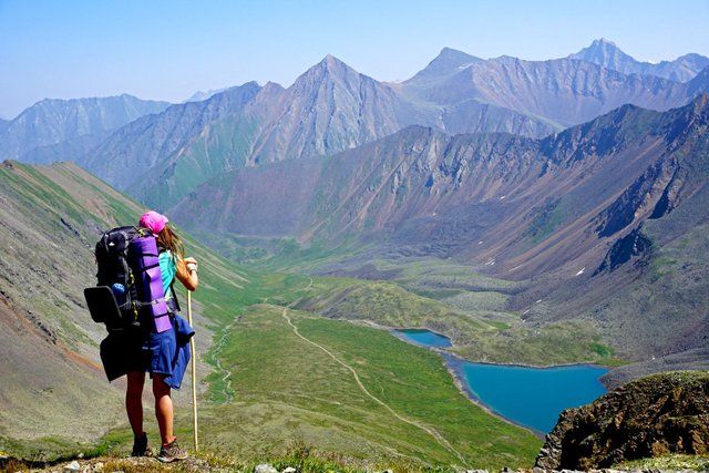
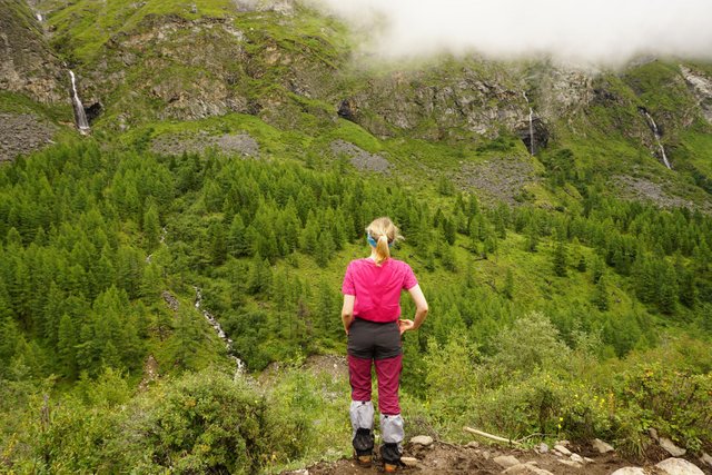
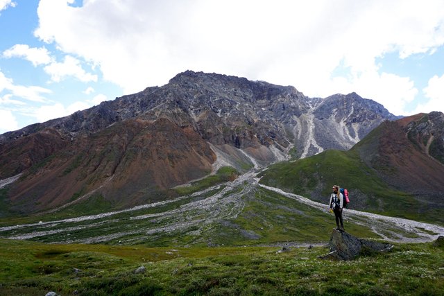
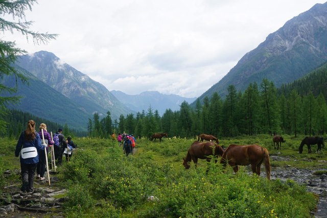
After about 6-7 km, the view will open up on your right.
In another 3-4 km you will see these waterfalls on your right:
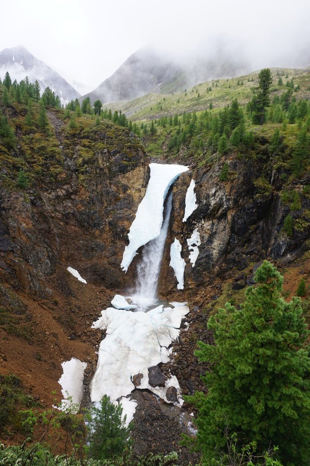
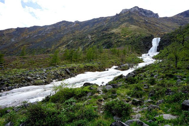
And then you will run into this waterfall (the picture was taken in June):
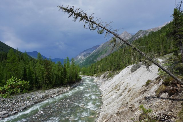
Follow along the path, keeping the river to your right for a few more kilometers before crossing it.
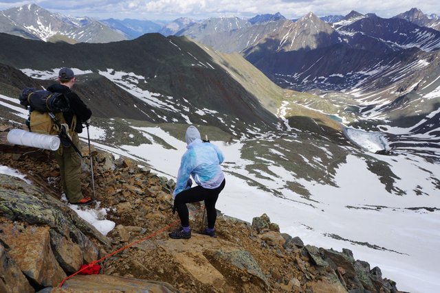
And here's where you would like to have a guide... If the river is low, you can follow the trail and hop across some rocks, if it's high, you will need to walk upstream and find a shallower area, then revert back (or climb a grassy hill) to find the trail again.
You want to cross the river when this mountain is directly to your left (at the safest spot)-
This is what the river looked like in June:
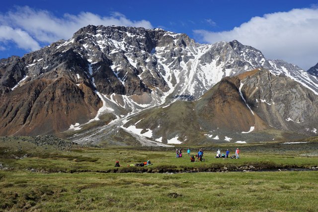
After crossing the river you want to walk up a small hill with the mountain from the above picture directly behind you. In about 400 meters, you will come to this lovely spot:
%204.jpg)
a%201.jpg)
We usually camp there on our second night. It gets quite cold there, hails quite often, and there is no firewood. So be prepared with warm clothes and a gas burner.
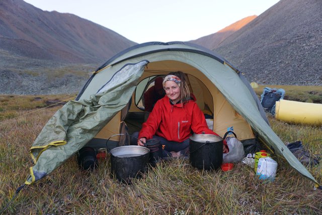
It snowed in this spot in JULY! I even made a snowman :)
And don't think that it will get any warmer for another 30 km or so!
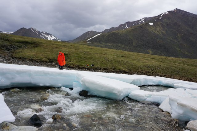
From there you will have to cross this river:
We usually hop over some stones, onto that island and then over some more stones. But there have been times where we've had to go upstream for another 200meters or so before crossing.
After crossing the river, it can get confusing as the trail and markers are hard to spot, but the most important thing is to keep this mountain directly behind you.
You can go around the first hill to either the left or right (we usually go right), after climbing the hill and walking straight for another 2-300 meters, you will see two small waterfalls. Climb the hill between those two waterfalls and follow the trail. From here on, it's mostly uphill until you go over the pass.
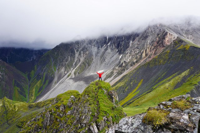
From the top of the first steep hill the view looks like this:
Keep on going straight with that mountain at your back. In another 3-400 meters you will be able to spot the pass and a clear trail which goes up alongside a stream.
In June, this part of the trail looked like this:
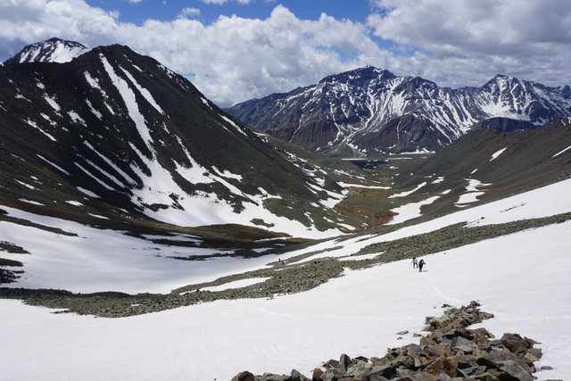
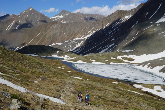
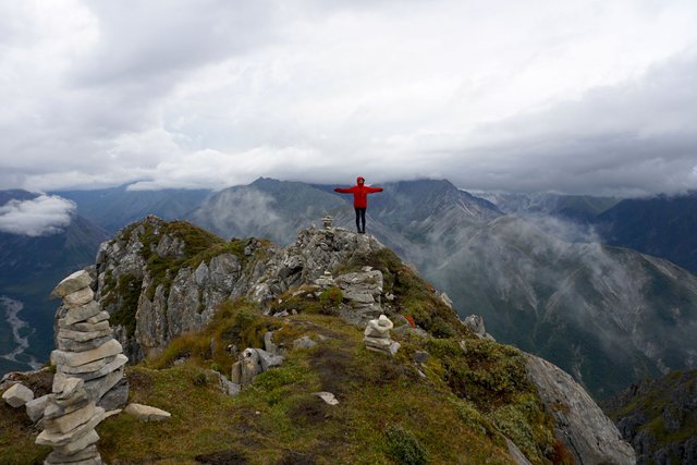
At the top of the pass you can see Lake Nogon-Nur :)
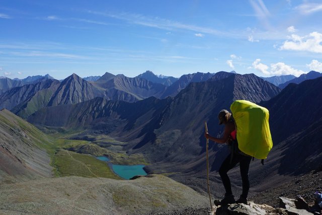
From the flags and pile of garbage (offerings for gods) at the top of the pass, there are two ways to get down. The easiest is to take the "horse trail" (I wouldn't recommend going the other way down, it's very steep and there are loose rocks). To find the horse trail, climb up the hill (to your left, looking at the lake), and look for the three blue lines.
From here, the trail is pretty clear and easy to see all the way down the pass and past the lake (for another 10-15km). Unless it's snowing of course... :) Or if there's still snow on the ground... Then there's not much I can help you with in this blog. Just head for that lake and don't fall off any cliffs, because there are a lot of those. Watch out for falling rocks and avalanches too.
The trail will take you down the pass, over a river, past the lake, down a hill, over another river, up another hill, down another hill, until you have to cross the river "Levyy Shumak" (Left Shumak). The river will be on your right. This can be a cobble-stone hop, or a dangerous crossing, depending on how lucky you are ;)
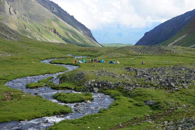
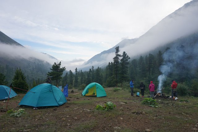
After you've crossed Levyy Shumak, look for the trail again, it goes up a small steep hill. Follow the trail for another 45 minutes or so and you will reach a waterfall. Walk for another 5 minutes and you will find a bunch of comfortable camping spots. We always stop here for the 3rd night.
After this, there will be another 5-6 hours of walking through little winding, bushy, super-mud trails. The worse part of the trek. There are lots of small paths that separate and weave back together, going alongside or on the bank of the river. So long as you keep the river to your left, you shouldn't get lost.
Eventually, you will reach Shumak! But it will be across the biggest river you will have to cross in the entire trek :D
You will know you're there because you'll be able to see a fence, some wooden houses, and wooden sculptures on the other side of the river.
Mapsme tells you to cross Levyy Shumak before you reach the intersection with Pravyy Shumak, but out of the 10 times I've crossed this river, I've only been able to do that twice. The water level is usually way too high to cross there. So you want to keep on going straight, cross over stones onto an island, then follow the path and look for a rope. Not sure how much trust you want to put into this old rope (better bring your own, and a harness). People die every year crossing this river, keep that in mind. If the water level seems too high, just wait it out, eventually it will come back down again.
Once you've crossed that river you're there! There are 2-3 temporary bridges which connect the "Russian side" and the "Buryat side" of Shumak. Buryat is the local ethnicity in this region. (Don't worry, those are just nicknames; Russians are allowed on the Buryat side and Buryats are allowed on the Russian side :)). The bridges may be lifted during heavy flooding.
The main lines of springs, healthy mud, mineral water bath, shop, and helipad are on the Buryat side; the radon bath, Buddhist temple (Datsan na Shumake on the map) and more springs are on the Russian side. Both sides have cabins that you can stay in for free (don't expect luxurious Swiss cabins :)). First come, first serve.
Helicopter rides back to Irkutsk are available once a week or so. Bring your passport and 15,000 rubles just in case you need to get a lift back to civilization.
The small shop in Shumak is open for 2 hours each day in July and August. It sells expensive food (like rice and chocolate bars) and some crappy goods. You can charge your phone/camera/radio/w/e there for 100 rubles if they're open. There's also a satellite phone and a shower that you can use if you pay a lot of money :)
And, of course, there are hundreds of springs to drink from! All different flavors and temperatures. Don't forget to bring a cup ;) Springs, baths and mud are free!
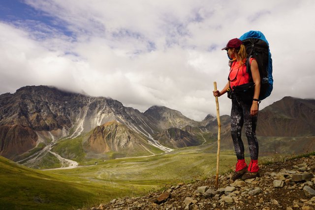
In short, Shumak can be a 50km walk in the park, a horror story, or the biggest adventure of your lifetime... All depends on your experience as a hiker, your equipment and, of course, the weather. Like I said, it can snow any month of the year, including July and August. The rivers can flood and the bridges can get swept away.
The benefits of going with us (apart from meeting all the pretty girls that you've probably noticed in the pictures :)) are:
We know the trail very well
We have all the necessary equipment
We cook pancakes :D
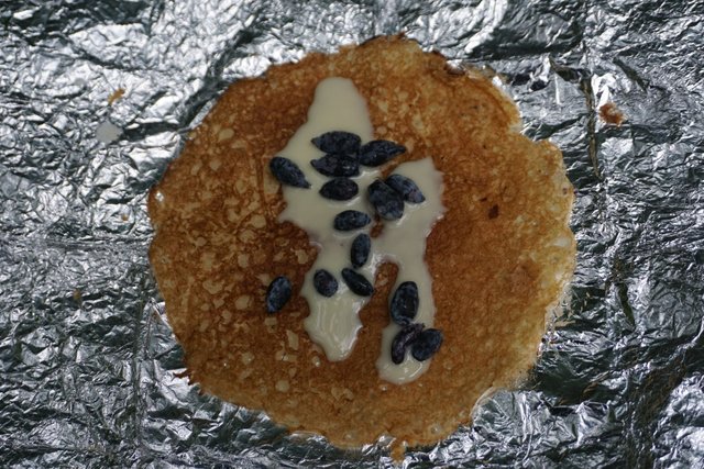
The best time for Shumak is August because there are mushrooms and many berries- blueberries, raspberries, blackcurrant, redcurrant, honeysuckle berries and more!
While in Shumak, we will also take you on mini-hikes, without your big backpack. Some of these hikes include:
Peak Trekh Kapitanov (3 Captains Peak):
Perevalniye Lakes:
a%2011.jpg)
Zolotoy (Golden) Lake + waterfall:
%201.jpg)
Mramornyye Waterfalls:
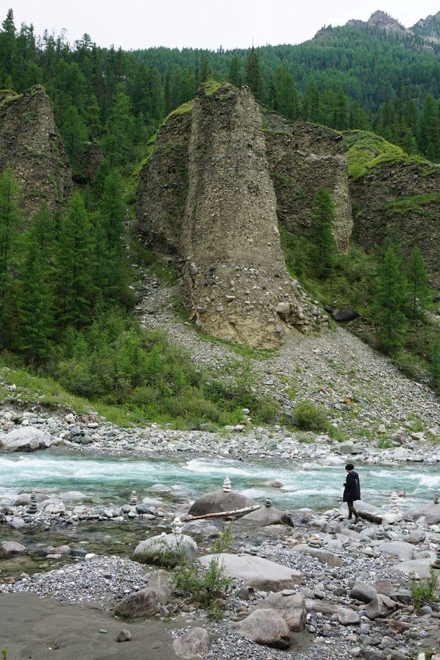
Stolby (Pillars):
Alright! I walked about 1000km and sorted through about 15,000 photos in the past two months to make this post, so I hope you enjoy it! :D
See more photos on my website or on social media-
https://www.bigworldsmallsasha.com/
https://www.instagram.com/bigworldsmallsasha/
https://www.facebook.com/bigworldsmallsasha
Also, big thanks to Artem, Katya and Dima for bringing me onto your team and showing me all these amazing places. You guys are awesome!
Follow us on Insta to see what else is off the beaten path in the Russian wilderness!
https://www.instagram.com/syberia_top_life/
Welcome to steemit! I follow your adventures on Facebook, so stoked to see you here! 💜
Thank you! :)
Congratulations @smallsasha! You have completed the following achievement on the Steem blockchain and have been rewarded with new badge(s) :
Click on the badge to view your Board of Honor.
If you no longer want to receive notifications, reply to this comment with the word
STOPDo not miss the last post from @steemitboard:
I'm putting this trinp in the list of things I wanna do. It seems... just... wooa.