Mountainbike Adventure Alpine Cross ("Transalp") Garmisch - Lake Garda | Mountainbike Abenteuer Alpencross ("Transalp") Garmisch-Gardasee
Dear Steemians,
actually I wanted to write my next contribution about my stay in Malta today, but when I looked through the photos I didn't want to do it anymore, because there are yellow or ochre-coloured buildings and landscapes or light blue seawater in almost every photo. Since I have planned several parts about Malta, I would like to post some mountain pictures for a change. A few years ago I went with some friends to the mountain bike classic from Garmisch Partenkirchen in Germany to Lake Garda in Italy.

🇩🇪🇦🇹 Liebe Steemians, eigentlich wollte ich heute meinen nächsten Beitrag über meinen Aufenthalt in Malta schreiben, beim Durchsehen der Fotos habe ich dann aber keine Lust mehr gehabt, da auf fast jedem Foto gelbe bzw. ockerfarbene Gebäude und Landschaften oder hellblaues Meerwasser zu sehen ist. Da ich über Malta mehrere Teile geplant habe, möchte ich zur Abwechslung wieder ein paar Bergbilder posten. Vor ein paar Jahren bin ich mit ein paar Freunden den Mountainbike-Klassiker von Garmisch Partenkirchen in Deutschland zum Gardasee in Italien gefahren.
The mountain bikers like to argue whether this adventure is called "alpine cross" or "transalpine". The official name I think is "Alpencross", in our group we have always called the project "the Transalpine". This involves crossing the main Alpine ridge from north to south. One of the classics is the route from Garmisch Partenkirchen in Germany (green flag on the maps) to Lake Garda in Italy (red flag). In the run-up to the race, we discussed several route variants, then decided on the stage locations and then booked accommodation in advance in each of the towns, as we had the route in August, i. e. in the main season. We drove the Alpencross in 6 days, in total it was about 500 km and 8000 meters of altitude difference. The route we have chosen is not the easiest, but also not the most difficult, i. e. we have sometimes chosen a detour over a mountain or saddle, even if we were able to avoid this obstacle in the valley.
![]()
![]()
🇩🇪🇦🇹 Die Mountainbiker streiten sich gerne, ob dieses Abenteuer nun Alpencross oder Transalpin genannt wird. Der offizielle Name ist glaube ich "Alpencross", in unserer Gruppe haben wir das Projekt immer nur "die Transalpin" genannt. Dabei geht es um die Überquerung des Alpenhauptkammes von Norden nach Süden. Ein Klassiker ist dabei die Strecke von Garmisch Partenkirchen in Deutschland (grüne Flagge auf den Karten) zum Gardasee in Italien (rote Flagge). Im Vorfeld haben wir mehrere Streckenvarianten durchdiskutiert, danach die Etappenorte festgelegt und dann in den Orten jeweils die Unterkünfte im voraus gebucht, da wir die Strecke im August, also in der Hauptsaison gefahren sind. Wir sind den Alpencross in 6 Tagesabschnitten gefahren, insgesamt waren es in Summe ca 500 km und ca. 8000 überwundene Höhenmeter. Die von uns gewählte Route ist nicht die Einfachste, aber auch noch nicht die Schwierigste, d.h. wir haben manchmal einen Umweg über einen Berg oder Sattel gewählt, auch wenn man dieses Hinderniss im Tal umfahren konnte.
We met on the first day in the late morning with 3 cars at the parking lot of the Kreuzeck cable car in Garmisch Partenkirchen. We left two of the cars in the parking lot for a week, the third car was our "supply vehicle", i. e. everyone had packed a bag with his clothes for the whole week, which was then loaded into the car. The first stage took us from Garmisch Partenkirchen to Ehrwald. At first we passed the Eibsee lake below the Zugspitz cable car, then we drove up to the Hochthörle hut and then down to Ehrwald.

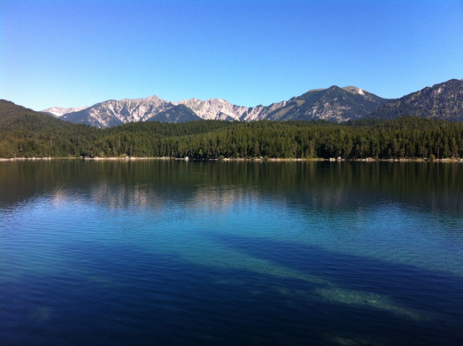
🇩🇪🇦🇹 Wir trafen uns am ersten Tag am späten Vormittag mit 3 Autos am Parkplatz der Kreuzeck-Seilbahn in Garmisch Partenkirchen. Zwei der Autos ließen wir für eine Woche auf dem Parkplatz stehen, das dritte Auto war unser "Versorgungsfahrzeug", d.h. jeder hatte eine Tasche mit seinen Klamotten für die ganze Woche gepackt, welche dann ins Auto verladen wurde. Die erste Etappe führte uns von Garmisch Partenkirchen nach Ehrwald. Dabei passierten wir zunächst den Eibsee unterhalb der Zugspitzseilbahn, und fuhren dann hoch zur "Hochthörle Hütte" und danach runter nach Ehrwald.
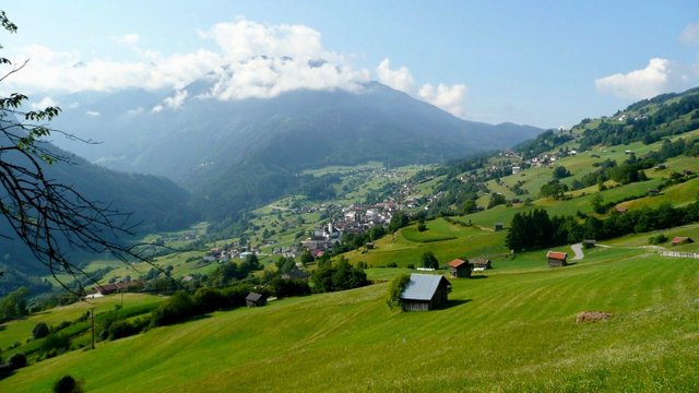
On the second day we went from Ehrwald to Imst. Instead of the comfortable route over the Fernpass, we chose a detour via the "Marienbergalm". After the rest in the mountain inn we went downhill via Nassereith and Tarrenz to Imst.


🇩🇪🇦🇹 Am zweiten Tag ging es dann von Ehrwald nach Imst. Statt der bequemen Route über den Fernpass, wählten wir einen Umweg über die "Marienbergalm". Nach der Rast im Berggasthof ging es fast nur noch bergab über Nassereith und Tarrenz nach Imst.
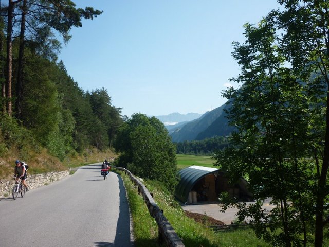
The third stage was a disaster. After a very modest night in a hostel in Imst, which is located within a traffic island directly next to the tunnel estuaries of motorway, highway and railway, we went directly over 1000 meters up to the "Venetalm". It would have been easy to avoid this climb, but when planning the route, the alternative of bypassing the mountain in the valley was somehow uncool. After the steep descent into the Pitztal, where 3 participants crashed at the same time, we went up to the "Pillerhöhe"again. Our supply vehicle was fortunately in the Pitztal valley and could pick up one of the crashed adventurers. During the ride up to the pass "Pillerhöhe" there were the first frustrations about the too ambitious routing. At the end everyone reaches the mountain restaurant at the pass, from where you have a wonderful view down into the Inn valley at Prutz.


🇩🇪🇦🇹 Die dritte Etappe war eine Katastrophe. Nach einer sehr bescheidenen Nacht in einem Hostel in Imst, welches innerhalb einer Verkehrsinsel direkt neben den Tunnelmündungen von Autobahn, Fernstraße und Eisenbahn liegt, ging es direkt über 1000 Höhenmeter hoch auf die "Venetalm". Man hätte diesen Anstieg auch bequem umfahren können, aber bei der Streckenplanung war die Variante, den Berg im Tal zu umfahren, irgendwie uncool gewesen. Nach der steilen Abfahrt ins Pitztal, bei der 3 Teilnehmer gleichmal stürzten, ging es dann nochmal hoch zur "Pillerhöhe". Unser Versorgungsfahrzeug war zum Glück im Pitztal und könnte einen der gestürzten Abenteurer auflesen. Bei der Fahrt hoch zum Pass "Pillerhöhe" gab dann die ersten Frustrationen über die zu ambitionierte Streckenführung. Am Ende erreicht alle das Bergrestaurant am Pass, von dem man einen wunderbaren Blick hinunter ins Inntal bei Prutz hat.
On the fourth day we went from Prutz always along the Inn uphill to Switzerland, and from there steeply uphill to Nauders and then on to the Reschenpass. Below the Reschensee was the finish of the fourth stage, where we had booked two overnight stays to schedule a day of rest. At the end of the day we also sat on a mountain bike and went around the Reschensee and made a side trip to a side valley.
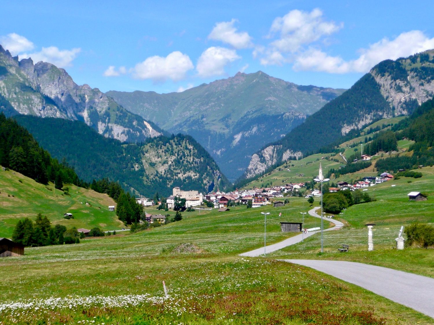

🇩🇪🇦🇹 Am vierten Tag ging es von Prutz immer am Inn entlang bergauf bis in die Schweiz, und von dort steil hoch nach Nauders und dann weiter zum Reschenpass. Unterhalb des Reschensees war das Ziel von der vierten Etappe, wo wir zwei Übernachtungen gebucht hatten, um einen Ruhetag einzuplanen. Am Ende saßen wir auch am Ruhetag auf dem Mountainbike und umrundeten den Reschensee und fuhren einen Abstecher in ein Seitental.
The penultimate stage started with a descent of about 30 kilometres into the Vinschgau valley. We rest on the cycle path through the apple orchards and vineyards. A friend of ours wanted an overnight stay on a mountain, so the day's destination was the "Bärenbadalm" high above the city of Merano. It was very clever of us to have a nice lunch in the valley in Naturns and then to ride the 1200 meters ascent. As with the "Tour de France", it tore the field of riders apart. The first were upstairs after 3 hours, the last after 6.


🇩🇪🇦🇹 Die vorletzte Etappe führte zunächst ca 30 Kilometer nur bergab hinunter ins Vinschgau. Wir rasten auf dem Radweg durch die Apfelbaumplantagen und Weinberge. Eine Freund von uns wollte unbedingt eine Übernachtung auf einem Berg, deshalb war das Tagesziel die "Bärenbadalm" hoch über der Stadt Meran. Es war sehr clever von uns, im Tal in Naturns nochmal ordentlich Mittag zu essen, um dann die 1200 Höhenmeter Anstieg zu fahren. Wie bei der "Tour de France" riss es das Fahrerfeld ordentlich auseinander. Die ersten waren nach 3 Stunden oben, der letzte nach 6.
The last stage was then only "Eyes closed and through", since another 100 km down to the Garda lake. The fact that more than 1000 meters of altitude difference had to be overcome didn't matter. First we crossed the Gampenpass and then passed the enchanting Molveno Lake. Late in the evening we arrived happily at Lake Garda. The next day we took the cars from Garmisch to Lake Garda and spent some nice sunny days there to relax from the "Transalp". If you liked the post, I will probably post more detailed articles about the individual stages. What do you think?


🇩🇪🇦🇹 Die letzte Etappe war dann nur noch "Augen zu und durch", da nochmal knapp 100 km bis hinunter zum Gardasee. Dass dabei nochmal mehr als 1000 Höhenmeter zu überwinden waren, war dann auch schon egal. Zunächst ging es über den Gampenpass, danach vorbei am zauberhaften Molvenosee. Spät am Abend kamen wir dann glücklich am Gardasee an. Am nächsten Tag haben wir dann die Autos von Garmisch an den Gardasee geholt und dort noch ein paar schöne sonnige Tage zur Erholung von dem Kraftakt "Transalp" verbracht. Falls euch der Post gefallen hat, werde ich vielleicht nochmal detailierte Beiträge zu den einzelnen Etappen posten. Was meint ihr?
@juliane
@juliane payed 10.0 SBD to @minnowbooster to buy a stealth upvote.
transaction-id fec986bc498b13a96fd415edb71c449cefb83336
@stealthgoat
Hört sich nach einer schönen aber auch anstrengenden Tour an ;)
Danke auch für die visuellen Einblicke!
Ja, war sehr anstrengend, aber auch sehr schön :-)
Ein sehr informativer und interessanter Tourenbericht mit schönen Fotos! Die Anstrengung hat sich sicher alleine schon wegen der traumhaften Gebirgslandschaft gelohnt!
Ja, die Anstrengung hat sich gelohnt, es war dann am Ende doch nicht so schlimm, wie ursprünglich gedacht. Wir hatten aber auch ordentlich trainiert im Vorfeld :-)
Perfect clicks, Man. you are a damn good photographer.
You are doing a great job
Bonjour.
Quelle magnifique photo !
C'est toi qui l'a fait ? Si oui bien joué ;)
Bonne journée l'ami :)
I agree on a commemt here, really nice photos!
Thanks for the post very informative.