Platform - Satellite Image Database Platform with API Access
Platform
Satellite Image Database Platform with API Access
Screenshots
 View Image | 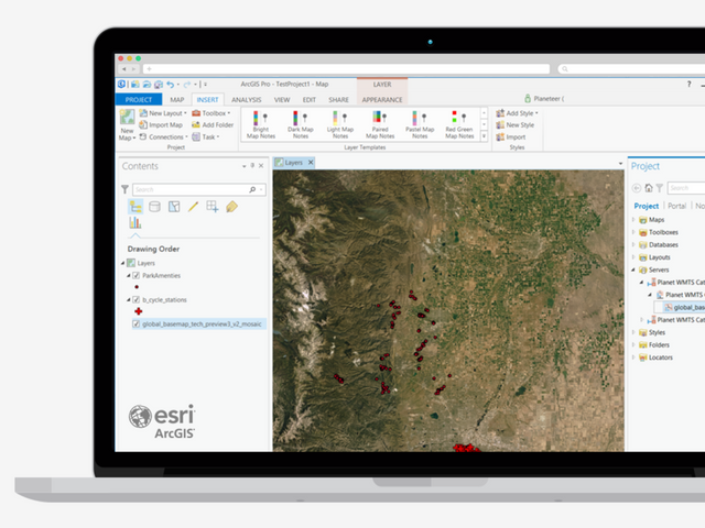 View Image |
|---|---|
Hunter's comment
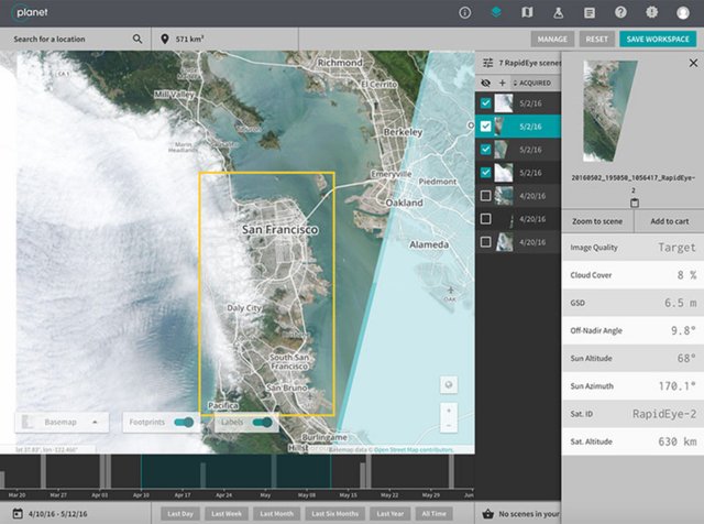
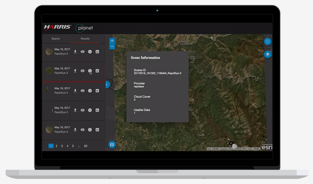
The Platform from Planet offers a satellite imagery platform for applications supporting the following key industries:
- Maritime
- Agriculture
- Forestry & Land Use
- Energy & Infrastrucuture
With it’s large asset base of earth imaging satellites, the platform processes terabytes of data daily to build a database of images with resolutions ranging between 75 centimetres and 3 meters that their customers can access easily via APIs.
The Planet platform offers the following speedy and affordable solutions to its client base so that they can consume the imagery data and derive essential insights for their operations:
- Fully-automated imagery processing
- Cloud-based access, speed, and scale
- API-first integration and download
- Ready to use with popular mapping applications including ArcGIS, QGIS, and Boundless
Images and video are from Planet
Link
https://www.planet.com/products/platform/
Contributors
Hunter: @acdevan

This is posted on Steemhunt - A place where you can dig products and earn STEEM.
View on Steemhunt.com
might be very useful for scientists. maybe they could even track the level of deforestation in different regions with it. thanks )
As the picture database I think it is very nice, but I need to have the altdatabase that it uses, I'll investigate. Very nice Hunt !
Thank you!
This will be a very useful source if I want to use the image that I will use for the GIS project, thanks for the hunt.
Hi @acdevan,
Thanks for your hunt. I’ve reviewed and approved it. The hunt is on.
Thank you!
Congratulations!
We have upvoted your post for your contribution within our community.
Thanks again and look forward to seeing your next hunt!
Want to chat? Join us on: