Muh Flat Earth, Again? Yes, Again
While posting something on Mike Church's Facebook page regarding the "young Earth" theory, The Flood, and climate change, the thread got derailed by people yammering on about gravity, geocentric models, and yes, even a flat Earth. After quite a bit of back and forth, I was getting tired of it all and so decided to examine the example being touted. So, here it is, copied word-for-word for the enjoyment of my fellow Seemit people.
Anyway, anyone who has completed freshman year of university should know how to put together a very basic rebuttal. So, here we go....
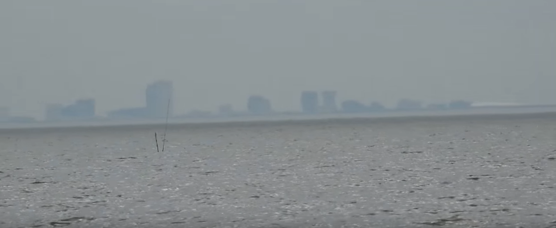
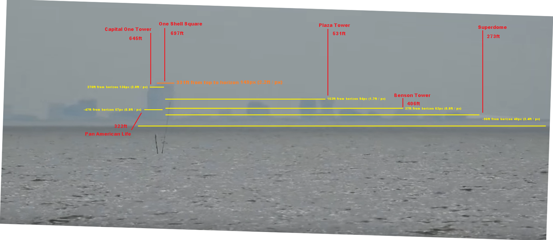
I analyzed this image captured from the following site to determine if building heights were constant across the entire image. Building heights were measured as the number of feet per pixel. If building heights (feet per pixel) were constant, the image had no atmospheric distortion and could be considered valid evidence for flat earth theory:
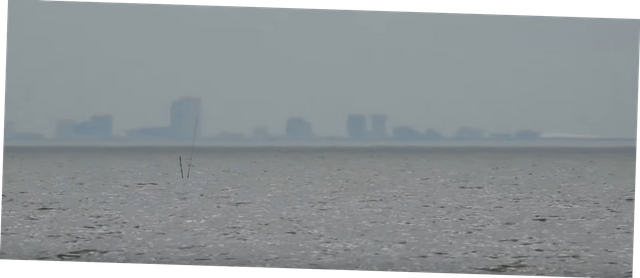
First the image needed straightened:
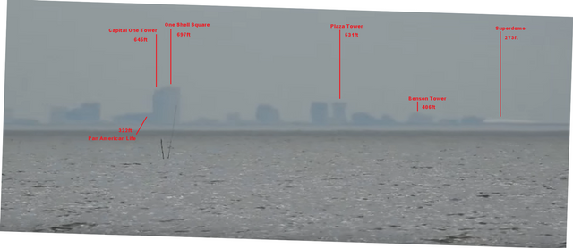
Next the defining features needed to be selected, as shown in the following image:

These features then needed to be identified and elevations recorded:
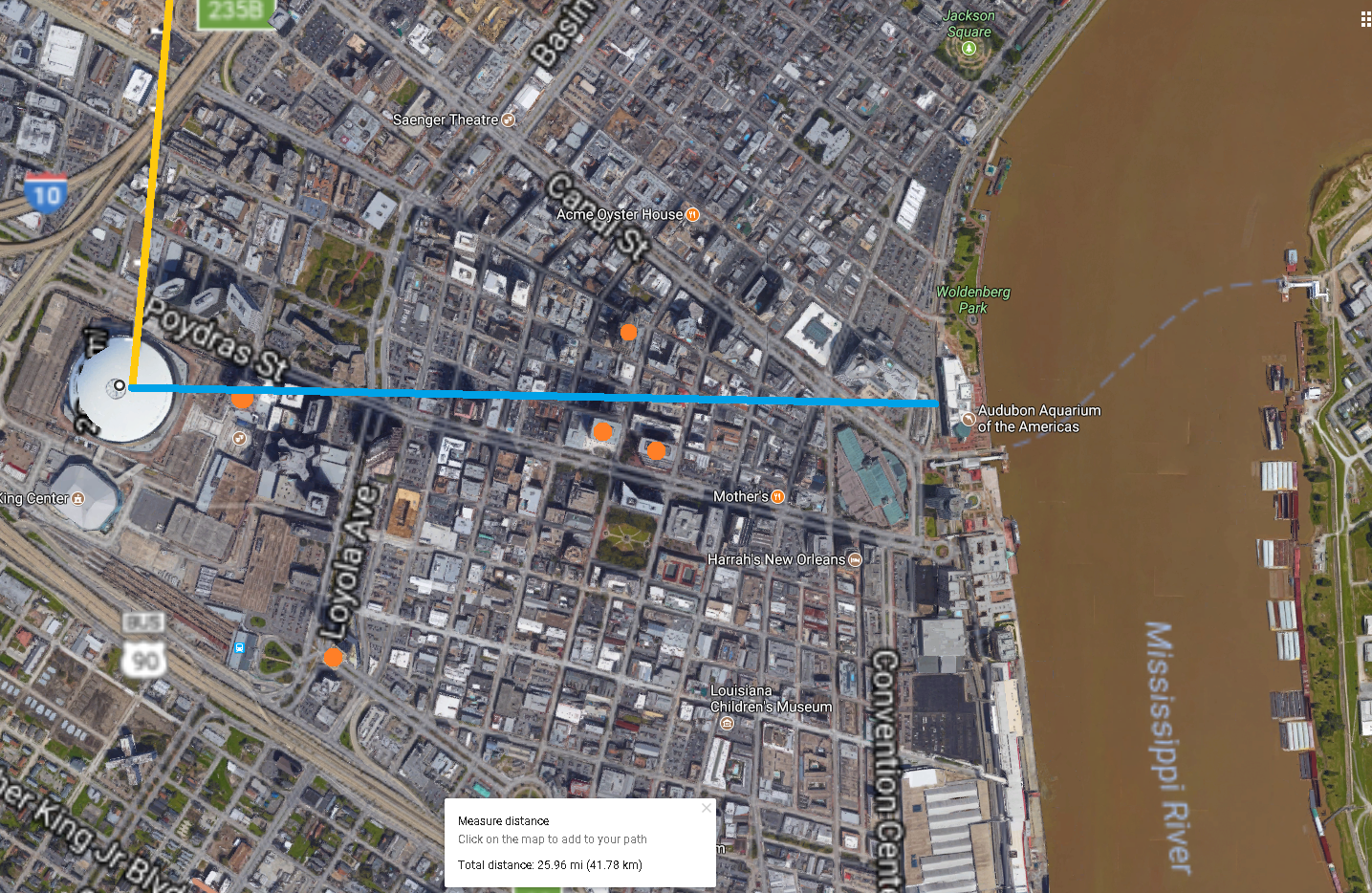
With this done, we need to determine if the camera is perpendicular to the features. The orange line coming in from the top is the vector to the observer. The blue line is a rough average of building positions on the Y-axis. We can see there was no significant angle that we would need to correct for:
We must determine how much of each feature is hidden below the horizon. This is about 369ft. Because all features generally fall along the same line, we can assume 369ft for all features:
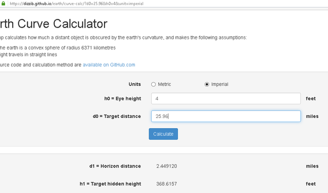
We need to pick a reference line for measuring pixels; this line is the bottom most yellow line. It matters not what reference we use, as long as it is level across the entire image. Now we can determine the number of feet per pixel along each feature's Y (elevation) axis. This is done by taking the feature height (found at the following website) and subtracting 369 (hidden height). This tells us how many feet SHOULD show above the horizon. If this number is negative, the feature should not show at all. This number is then divided by the distance (in pixels) from the top of the feature to the reference line. This is the ratio of feet per pixel. Now, if this ratio is relatively constant for all features, the image is not distorted by atmospheric conditions. If it is not relatively constant, there is atmospheric distortion:
https://www.emporis.com/city/101332/new-orleans-la-usa
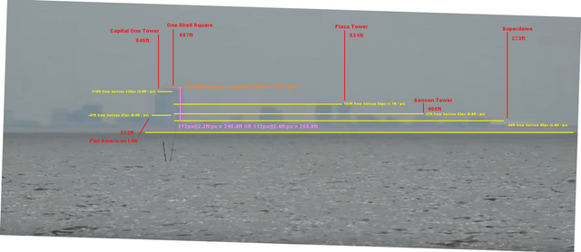
As we can see, this ratio is not constant across the image. As expected, the lower a feature's elevation, the further its ratio is from that of the highest feature. Finally, the difference between the heights of One Shell Tower and the Superdome is 424ft. If there is no atmospheric distortion in the image, this should be reflected by taking the number of pixels between the tops of One Shell Tower and the Superdome and multiplying them by the number of pixel per feet. As this image shows in pink, the distance between these two points is nowhere near 424ft. Ah-ha someone might say, "You've not accounted for the atmospheric distortion you claim is affecting the image. You are more than welcome to do that yourself; I've not done it because using the ratios of features at points between the tops of the Shell Tower and Superdome only makes the problem worse:
flat earth is flat. the artic could not have light 24 hours a day in summer or 24 hours darkenss in winter if the earth was a globe (hahah)