Job Shadow: Sneak Peak at mapping an Amusement Park [Career]
Presenting another inside look at one of my more interesting projects at my job. I do a lot of mapping work, which is made using aerial photos stitched together into a single, seemless ortho (top view) photo.
Think of this as a job shadow opportunity, in which I display some of the types of things you would never otherwise be able to see.
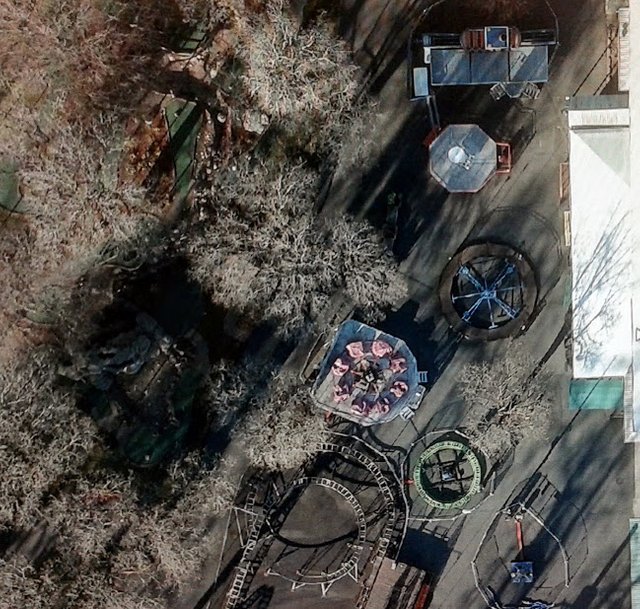
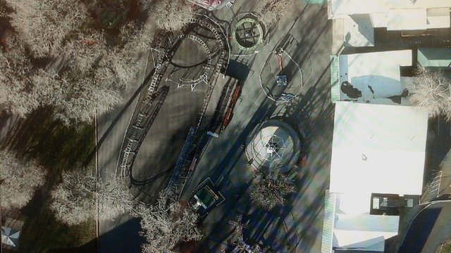
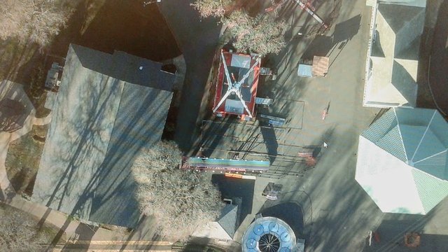
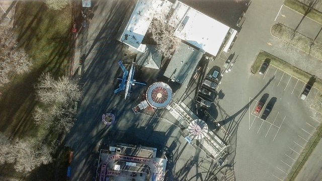
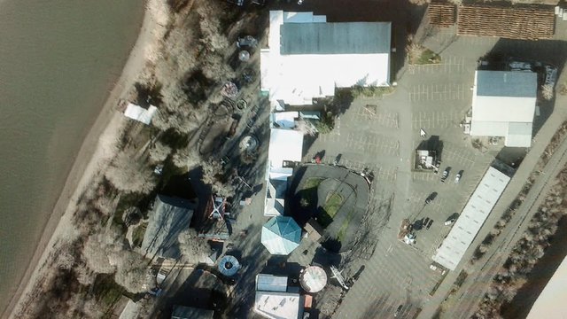
Today, I'm looking at an amusement park. In over ten years of working here, this is probably the most interesting site I've mapped. Typically I map rivers, rock quarries, disturbed forests, cities, farms, ponds, beaches, jetties, and so on.
This time I get a rare view of peppermint pinks, candy greens, stripes, tents, rides, parks, boats, and all kinds of eye candy with dazzling color clarity, high resolution, and perfect ortho rectification captured from hundreds of feet in up the air.
On these photos, which are low-res smartphone shots of my office computer monitor, you'll probably pick up on the faint RGB refresh lines, because they look like radial rainbows. Obviously the original images are much crisper, without these defects, and better colors. I did my best to improve the colors taken on my smartphone using google photos color enhancements, which are similar to my more advanced options available in the office.
Out of respect to our clients, I prefer not to post the originals, as that is the primary product they have paid to have made exclusively for their own needs.
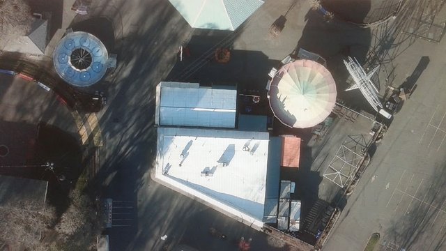
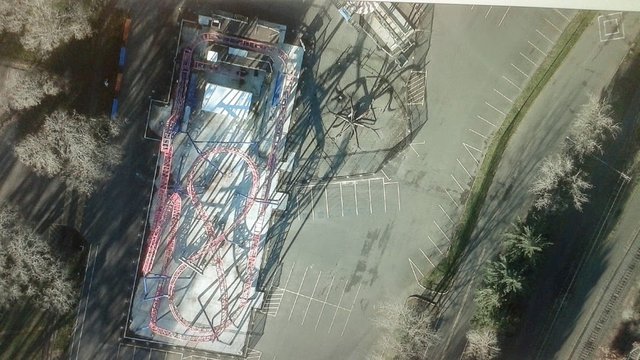
Lots of fun views of various rides. #Ferris-Wheel, #carousel, #roller-coaster, #big-slide, #dragon-swing, #octopus, and #squirrel-cage.
Locals will instantly recognize this amusement park for its family friendly riverfront picnic areas, marinas, rides, dance hall, and rollerskating rink.
I believe they even have a roller derby arena.
On the final images, I normally spend a lot of time tweaking the highlights, contrast, RGB values of the highs, mids, and lows (gamma levels), and also editing the orthos to remove mosaic lines. I challenge you to find a single photo where I blended two different photo angles together. Usually I mask the change through the trees or grass, where the fine branches and foliage blend with the feather blur lines made by the manual seam blend.
You can see that some of the buildings do not follow the same perspective lines and angles. This is evidence that photo was made using multiple photos, each taken from a different aerial angle. They have all been rectified to stretch across the same earth surface, so it looks like a perfectly normal flat surface to the eye.
Flat-earthers have no idea how much engineering work actually goes into making the earth appear flat like this. I dare anyone to make a flat ortho collage of a mile-wide area that looks flat without using GIS software that takes the curvature of the earth into account.
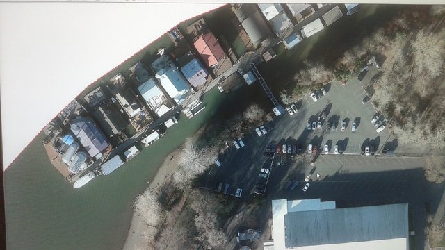
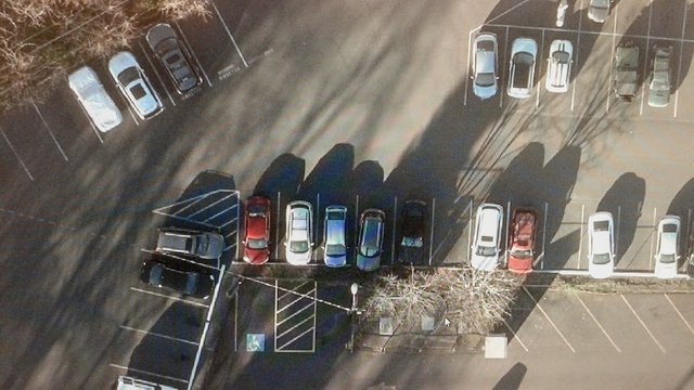
With the high resolution photos, cars are so clear, I almost have as clear a view as if somebody was standing 12 feet away from it. I can make out the model of vehicle, color, and measure its size to the nearest six inches.
This type of map would be a great way to find out which cars have over-stayed their welcome. It could also be used to check which cars are not parked very well. More likely, they could use this map to decide if the paint lines need to be repainted or adjusted to allow for more parking spaces or buildings to be constructed.
That's it. Did you enjoy visiting the park without having to put on a winter coat or buy tickets to actually be there?
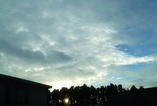
Let me close by sharing this late afternoon photo I snapped of the blue skies above our office after the work was done. I imagine the aerial photos were taken on a day like this, only a week or two ago. Sheets of puffy blanketing clouds often provide the best aerial photos because it blocks the sun from reflecting on the river and on shiny metal and white rooftops, providing what we call shadowless photography.
#maps #rink #photos #art #mapping #career #career-day #gis

Nice pictures. It seems these are the upward view of that picture
Indeed. Aerial photos from an airplane provide perfect a top-down view for making maps.
Very cool images @creativetruth Most of us only see views like this in video games lol Good to use winter shots to open up the view. We notice this time of year that views of the wooded areas really open up revealing things that are hidden most of the year.
It made me remember the times that I went to a fiesta amusement park, it is just very nice to go into such a place @creativetruth