Driving up Cone Peak near Big Sur, California
Cone Peak Drone Panorama
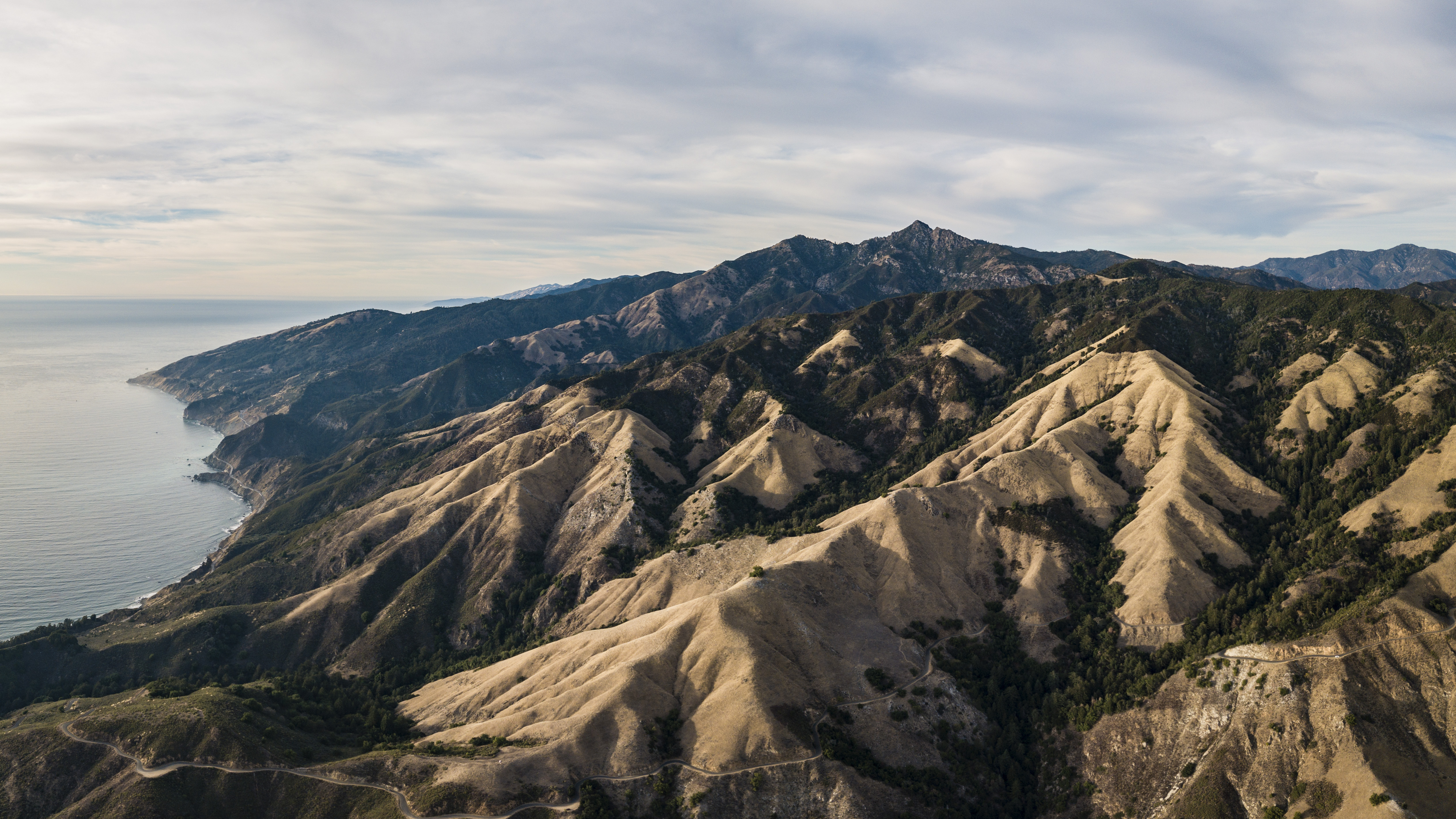
DJI Mavic Pro, 26mm, 1/640, f/2.2, ISO 100 [5053x2842]
A few weeks ago I was driving down the California coast near Big Sur and decided to take the backroads up to cone peak. My van is on the same pull out in the following 3 shots.
Van on a pull out
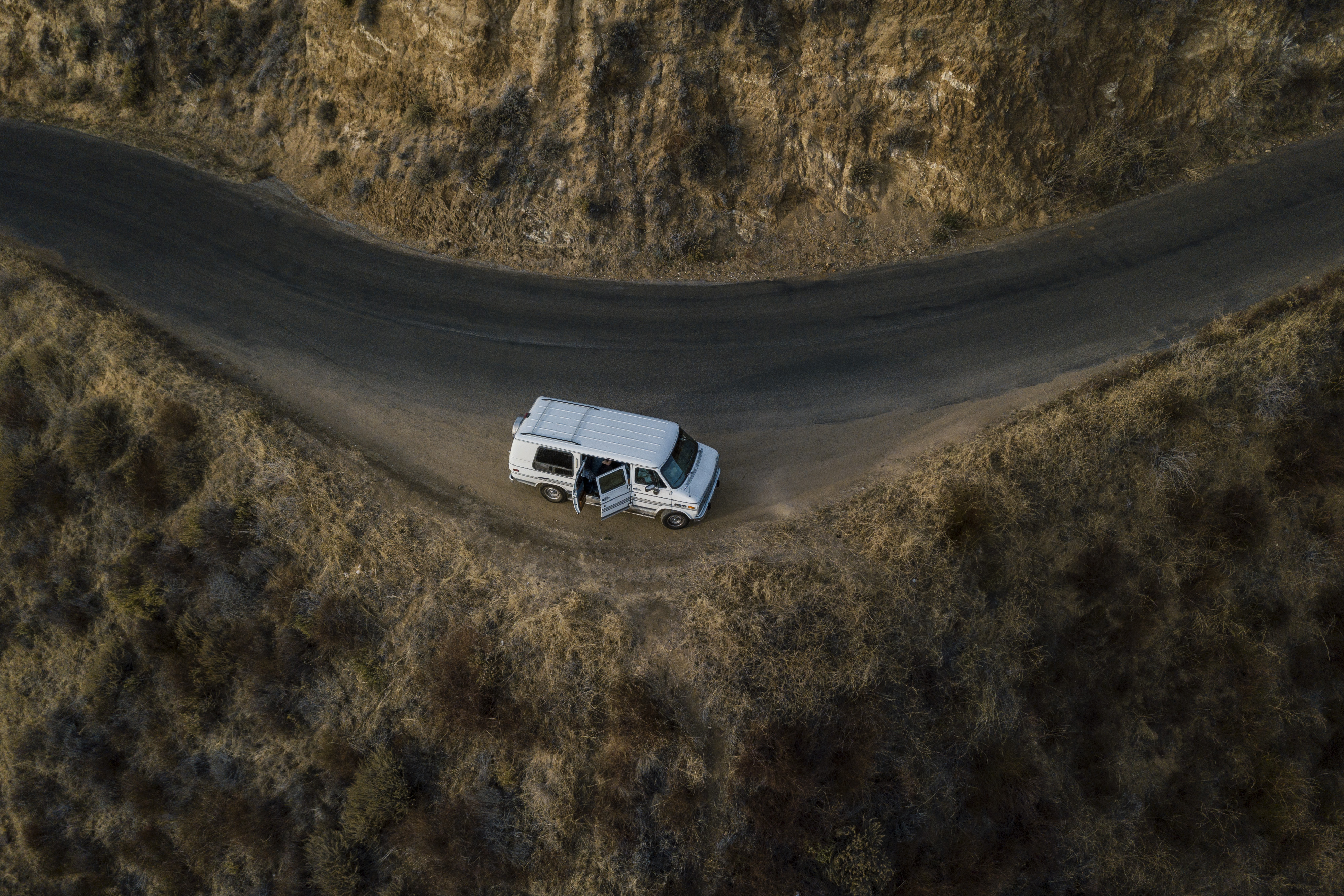
DJI Mavic Pro, 26mm, 1/1250, f/2.2, ISO 100 [3992x2662]
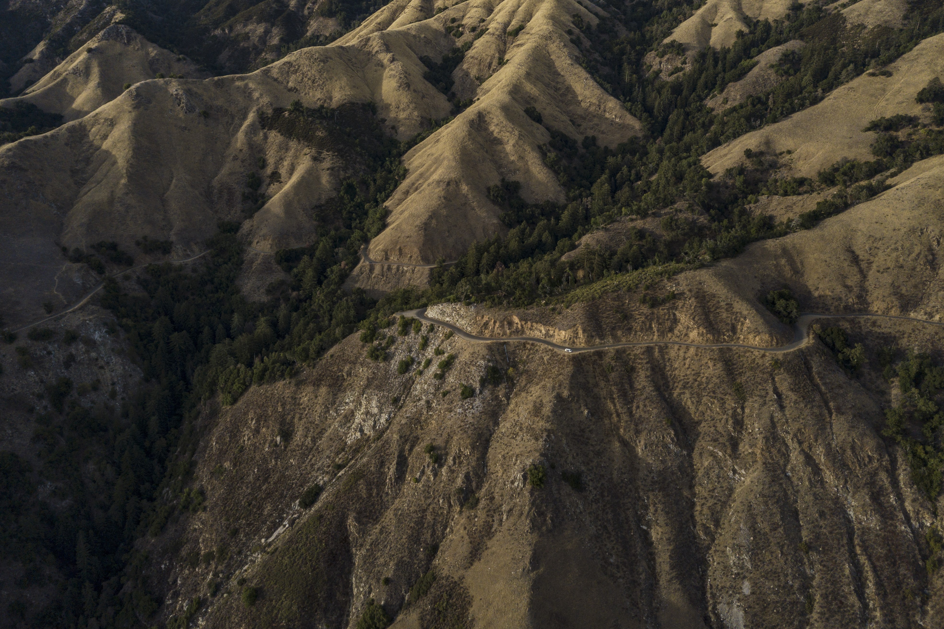
DJI Mavic Pro, 26mm, 1/1250, f/2.2, ISO 100 [3940x2626]

DJI Mavic Pro, 26mm, 1/640, f/2.2, ISO 100 [5091x2864]
I was loosing sunlight quick while on the way up the mountain so I had to pull over and fly the drone before getting all the way to cone peak. Golden hour was in full effect during this drone flight, here is a shot of the ridge leading up to cone peak.
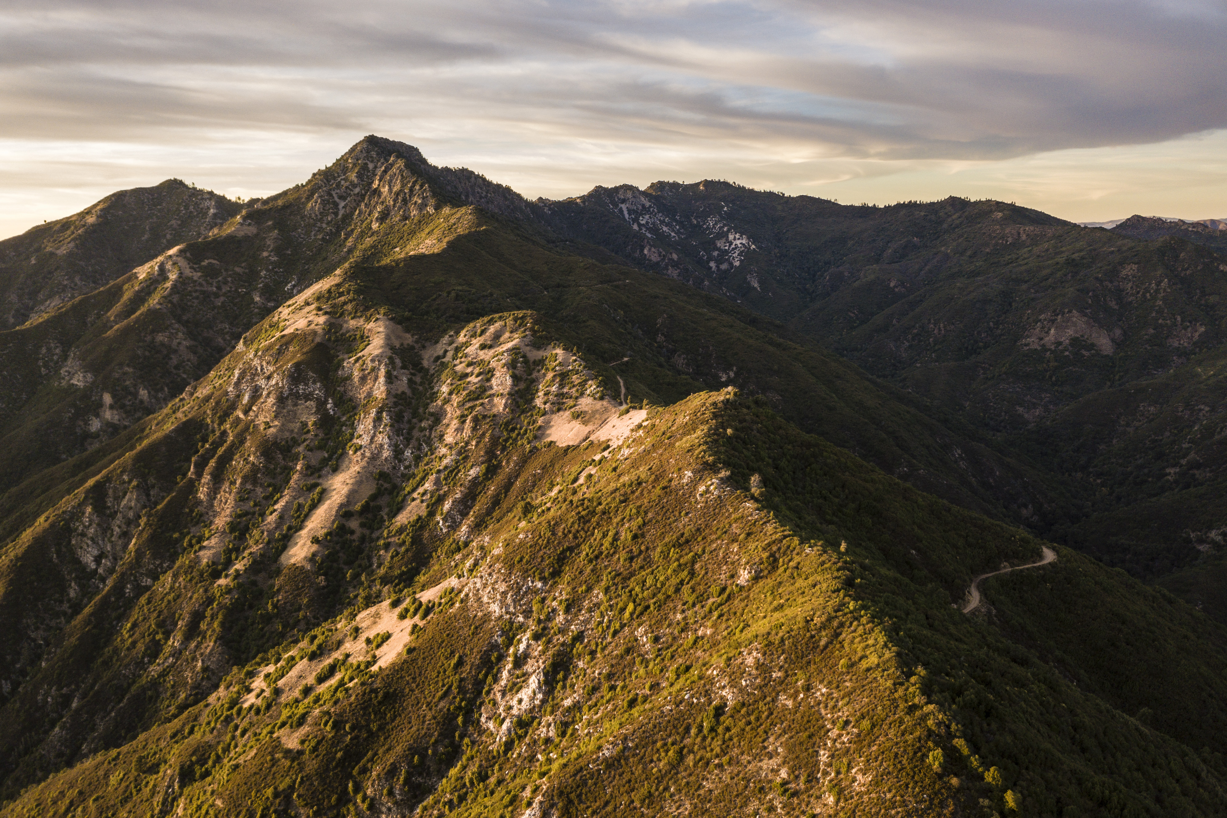
DJI Mavic Pro, 26mm, 1/120, f/2.2, ISO 100 [3992x2661]
Unfortunately I was not paying attention to my drones battery level and was forced to do an emergency landing on the ridge. There was no road or trail going up this ridge, it was really steep and the sun was in the process of setting. I scrambled up hastily in an effort to get to my drone before dark. I didn’t have cell service so there was no map details on my phone, it just had the GPS dot for me and the GPS dot for my drone on an otherwise blank map with no landmarks or anything to orientate yourself with. I forced my way through thick brush trying to bring my dot closer to the drones, at times having to belly crawl underneath the brush and other times climbing up small near vertical rock faces. I eventually lost all my sunlight and I wasn’t making as much progress I was would have liked. It felt like I still had a ways to go and I was unsure already about getting back down this ridge in the dark. I started to think even if I found the drone I didn’t bring a case or anything to carry it back with. I decided to call it for the night and search again in the morning. I was having a hard time retracing my steps as it was now just about pitch black. The sun was completely set and the moon had yet to rise. Luckily I did at least grab a headlamp on my hasty rush up this ridge. I kept finding myself looking over vertical drops that just seemingly went down into a black abyss. I must of climbed up one of those, but there was no way I was going down that way so I decided to cut across to the other side of the ridge to see if it had a more reasonable slope. I came across a small opening in the brush and I couldn’t believe my eyes, my drone was sitting right in front of me! I was no where near where my phone was telling me it was, but there it was! I couldn’t believe it, I grabbed my drone and proceeded to go down the ridge. It was super sketch, I basically just found a spot with a lot of thick vegetation and slide down on my ass grabbing on the vegetation to slow me down. I did a good job protecting my drone but ended up gashing my leg open on a sharp stick in the process. I eventually made my way down and back to the van.
I was a bit shaken and warn out from everything so I neglected to set my alarm and ended up sleeping in well past sunrise. I drove further up the road until I got to the dead end, checked out the view then drove back a bit to the cone peak summit trail head. I flew my drone one more time and then hiked up to the summit. The view was amazing but by the time I got up there the light was no good and I knew I wouldn’t be able to do the view justice with my camera so I didn’t attempt it. I will end this post with a couple shots from the morning drone flight.
Cone Peak Summit Lookout Shelter
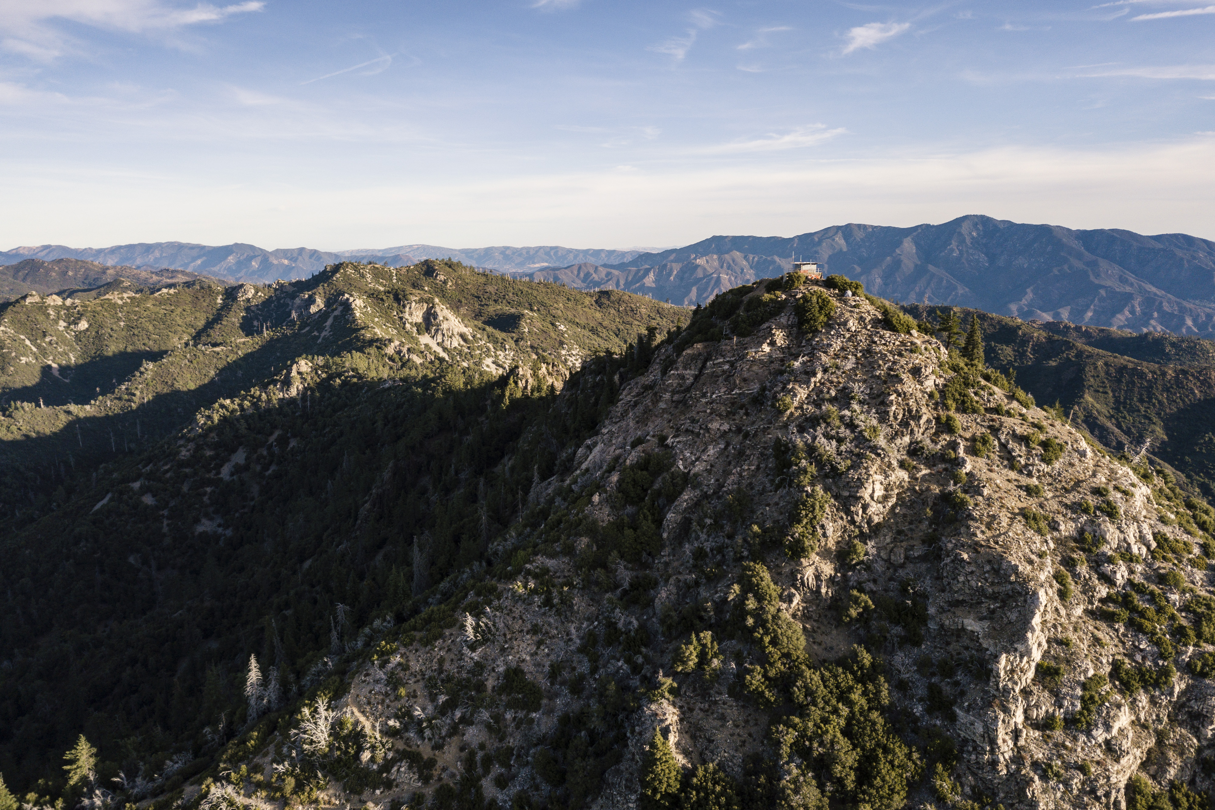
DJI Mavic Pro, 26mm, 1/800, f/2.2, ISO 100 [3992x2662]
View to the South
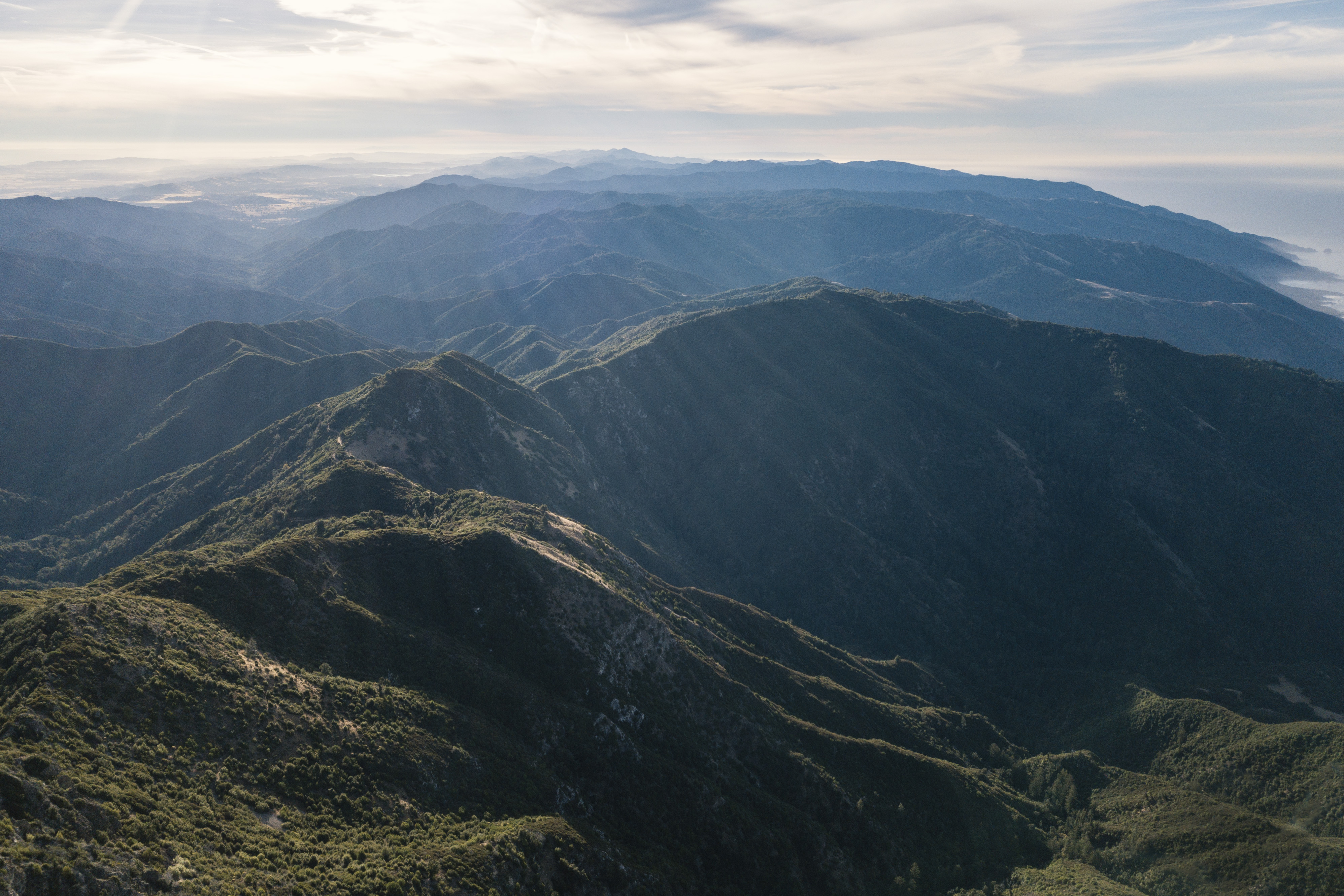
DJI Mavic Pro, 26mm, 1/1250, f/2.2, ISO 100 [3992x2661]
Congratulations, Your Post Has Been Added To The Steemit Worldmap!
Author link: http://steemitworldmap.com?author=fivealive55
Post link: http://steemitworldmap.com?post=driving-up-cone-peak-near-big-sur-california
Want to have your post on the map too?
Congratulations! This post has been upvoted from the communal account, @minnowsupport, by Fivealive55 from the Minnow Support Project. It's a witness project run by aggroed, ausbitbank, teamsteem, someguy123, neoxian, followbtcnews, and netuoso. The goal is to help Steemit grow by supporting Minnows. Please find us at the Peace, Abundance, and Liberty Network (PALnet) Discord Channel. It's a completely public and open space to all members of the Steemit community who voluntarily choose to be there.
If you would like to delegate to the Minnow Support Project you can do so by clicking on the following links: 50SP, 100SP, 250SP, 500SP, 1000SP, 5000SP.
Be sure to leave at least 50SP undelegated on your account.
Awesome and breathtaking shots @fivealive55
Thank you!
Dear @fivealive55,
Your story attracted our attention and we would like to introduce our tag #archisteem that could provide you with some extra support. For your information, we are currently running the project – 1001 Places to Remember. Your content is a fit for the project and could be qualified for the 10 Steem reward biweekly contest.
It would be great if we can have this story of yours included in the project. If you agree, please reply to us.
Do drop by and take a look :) Hope to see you around soon.
Stay tuned and Steem on!
@archisteem and team
Thank you for your interest in my post, go ahead and include it in your project!
Great! You are most welcome @fivealive55, Steem on :)
This post was shared in the Curation Collective Discord community for curators, and upvoted and resteemed by the @c-squared community account after manual review.
@c-squared runs a community witness. Please consider using one of your witness votes on us here
Thank you!
Please join the community and become a photomag curator in the @c-squared discord server and vote for the @c-squared witness here .
Thank you! I will hop on this discord it sounds like a sweet project!
Great shots! So glad you were able to recover your Mavic so you can post more! And just so you get it back. Maybe the Universe's reward for sharing these fantastic photos with us to appreciate.
Yeah I know, I had already lost my first Mavic Pro to the SF bay so I was super happy to be able to recover it this time. I really need to pay more attention to everything when I'm flying! I tend to get lost in composing shots.
Hiya, just swinging by to let you know that this post made the Honorable Mentions list in our daily Travel Digest. Please drop by to check out all the rest of today's great posts and consider upvoting the Travel Digest if you like what we're doing.
Awesome thank you!
Congratulations! Your high-quality travel content caught our attention and has earned you a partial upvote. We love your hard work and hope to encourage you to continue to publish strong travel-related content. Thank you for using #travelfeed
Learn more about our travel project on Steemit by clicking on the banner above and join our community on Discord.
Sweet! Thank you!