Paragliding at Hat Creek Rim, California
Hat Creek Rim is a Northern California paragliding site just north of the Mt Lassen volcanic park (Lassen is an active volcano) and south of Mt Shasta. It is a 2,000 foot high ridge running miles north and south with pretty easy access up a well-maintained access road. Along the top of the rim runs part of the famous Pacific Coast Rim long distance hiking trail. The Hat Creek river in the valley floor below has some of the finest trout fishing in the state, if not country and there are camp sites all along it.
Although technically you can fly at Hat Creek during the day during the summer the wind generally turns early and howls until an hour or two before sunset. If you're in the air when it turns on you're going to be in for one wild ride to the east - into the back of beyond. Your next road is about 40 miles away over rugged volcanic terrain so good luck!
If you play it safe and fly like the locals then you'll show up about 2 hours before sunset and play the waiting game for the wind to die down to what you consider safe for launching. Usually, the will be some variation in wind speed so there is always the possibility of launching in a lull and getting up high and away from the terrain ASAP. However, it can be a bit of a gamble if you're first and your high wind launch speeds are not up to scratch. If you're more timid then you can easily wait until conditions are more mellow at the expense of some air time.
If you launch early you are virtually guaranteed some quality ridge soaring - that 2,000' almost sheer rim will have you high above ground in no time. On better days there is a genuine "glass off" with boyant hot valley air lifting up and allowing you to boat far away from the rim and across the valley with ease. Time to chill out, enjoy the view, take some photos and enjoy the moment! You can fly until sunset with pilots often landing in dusk and still struggling to come down.
For more information about flying at Hat Creek Rim see the Hat Creek Rim pilot's association website
Below are some photos by me from several years of visits to Hat Creek Rim. A traditional time to visit is the 4th of July weekend - there is almost always a big crowd of pilots there with several fly-ins of PG and HG pilots converging. As I mentioned there are lots of camp sites in the valley along Hat Creek, you can also dry camp in either of the LZs, and some people will camp at launch for additional solitude and a fantastic sunset and sunrise view.
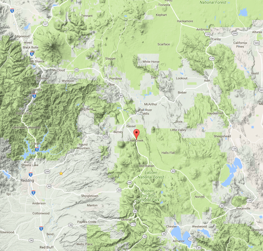
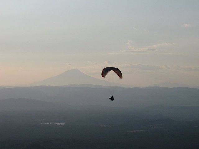
A couple of times I've been there when nearby fires created a lot of smoke - it makes for a fragrant flight and interesting sunsets. Here is a view of the northern extent (the rim runs north-south) in a smokey year:
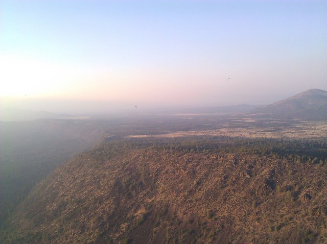
and here is the same view on a clear year...
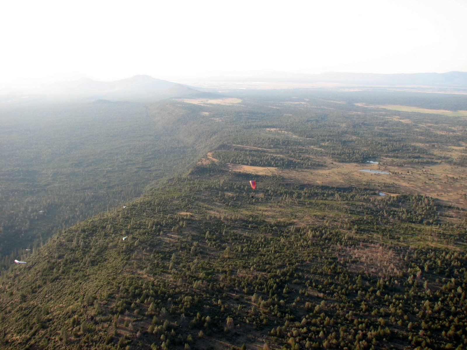
this is over the back - nothing but trees and lava out there
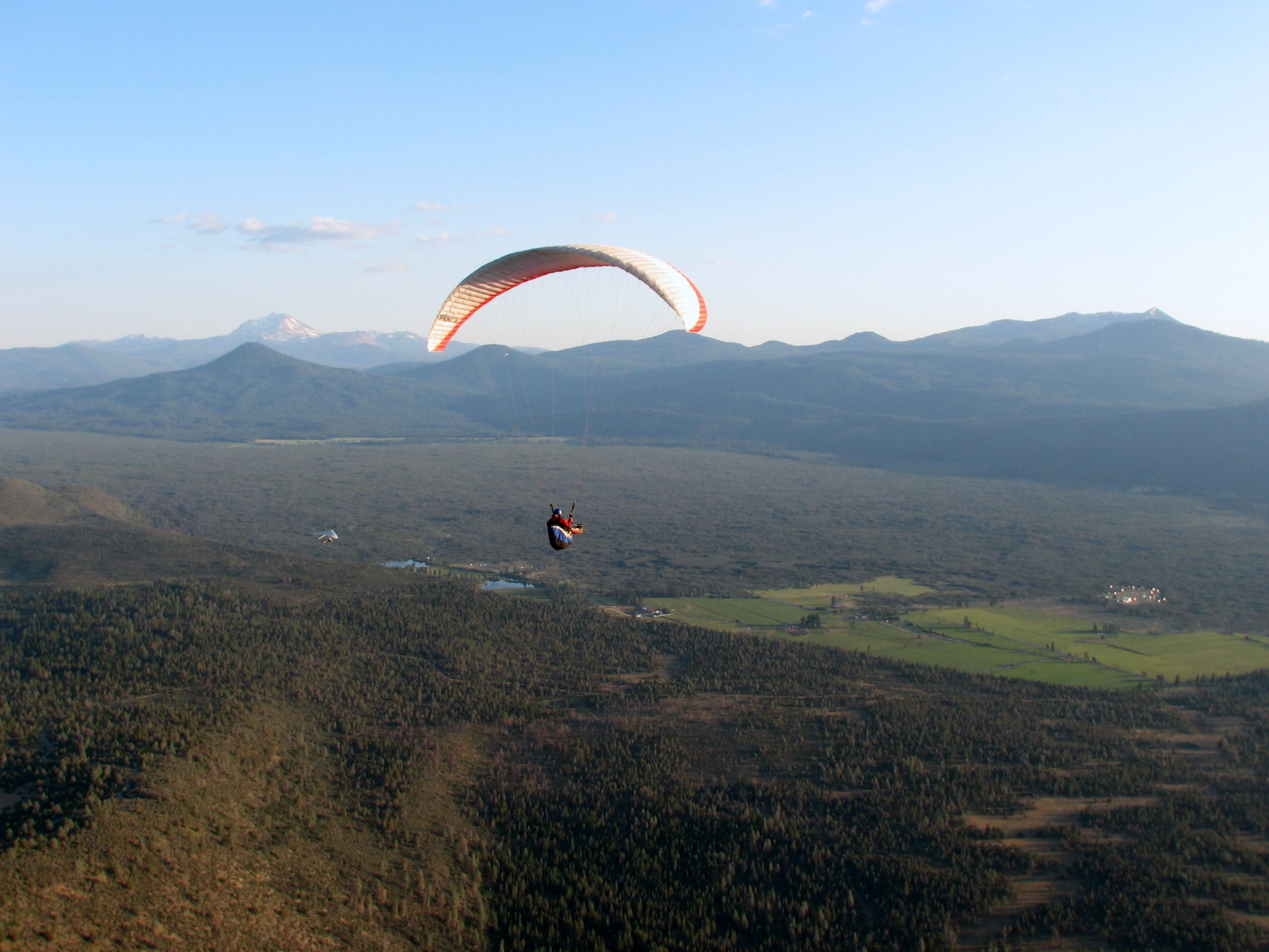
and here is to the south with a pilot in front of Mt Lassen which is about 10,000' high
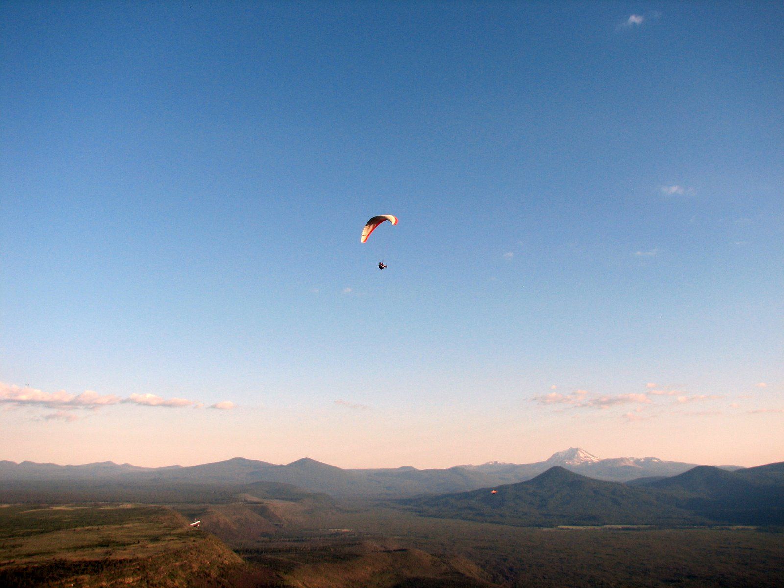
and look the other way and you have the massive Mt Shasta at 14,000'
In the valley below there is an array of radio telescope dishes which are dedicated to the SETI project. It's remoteness and below the horizon location blocks out many terrestrial radio sources. I believe the project is partially funded by Paul Allen the Microsoft billionaire. More info at the website
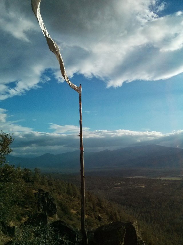
This is one of the many launch streamers - you're usually waiting around for them to calm down a bit
And this is a bunch of pilots (and my feet) over the rim looking East.
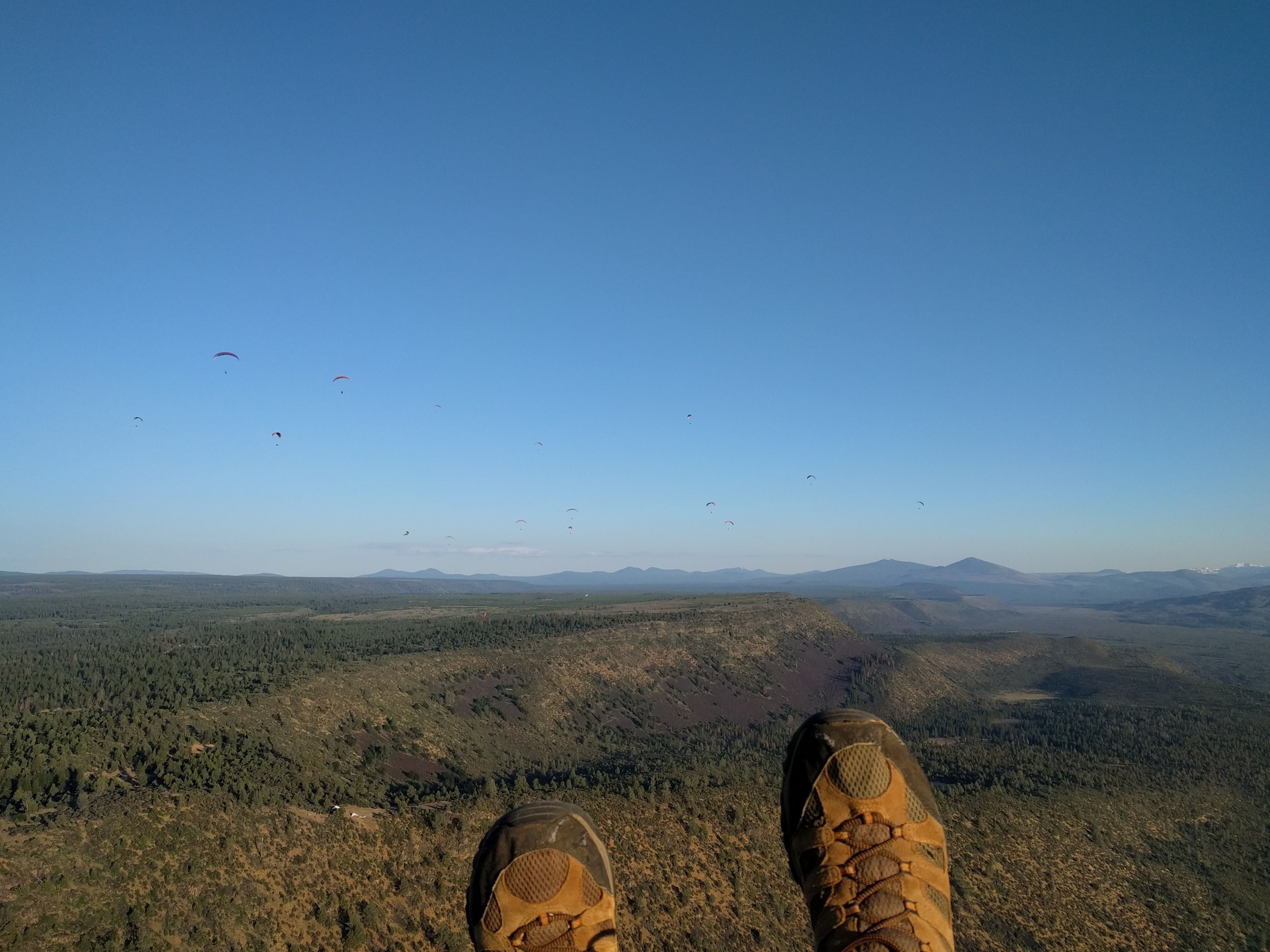
Here are a lot more pilots - including some hang-gliders over Mt Lassen with the moon at the top. Maximum altitude that day was about 7,000' - launch is at 4600' I think.
.jpg)
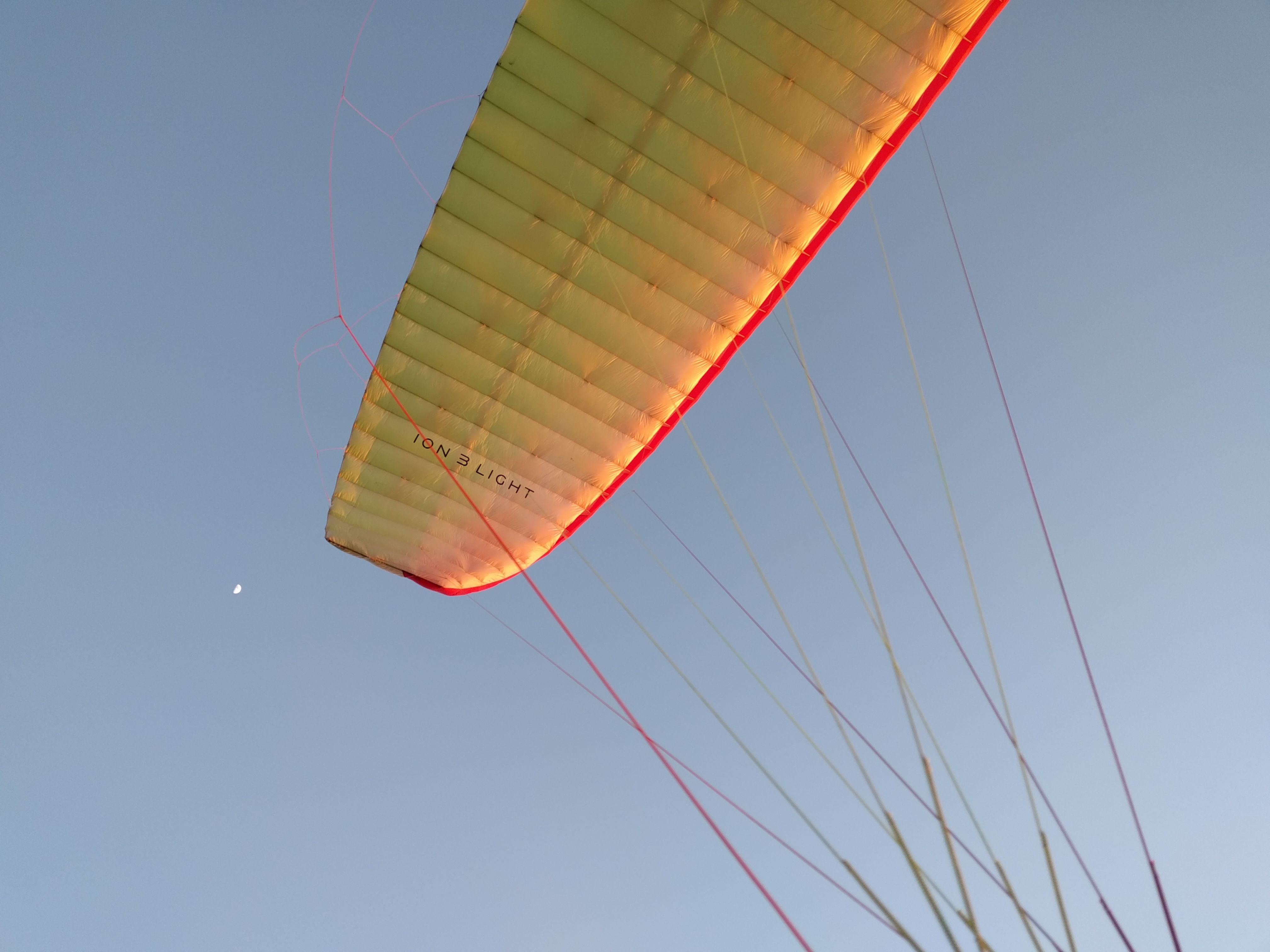
Flying at sunset gives nice lighting - here is my wing tip and the moon
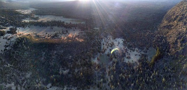
And here is a glider heading into land - there are many wide open spots including one on a 1:1 glide from launch which you can't see here. If you really wanted you can fly out and there is another drop off of a least 500' that gets you to the valley floor however there is a lot of wet pasture there with cows and power lines.
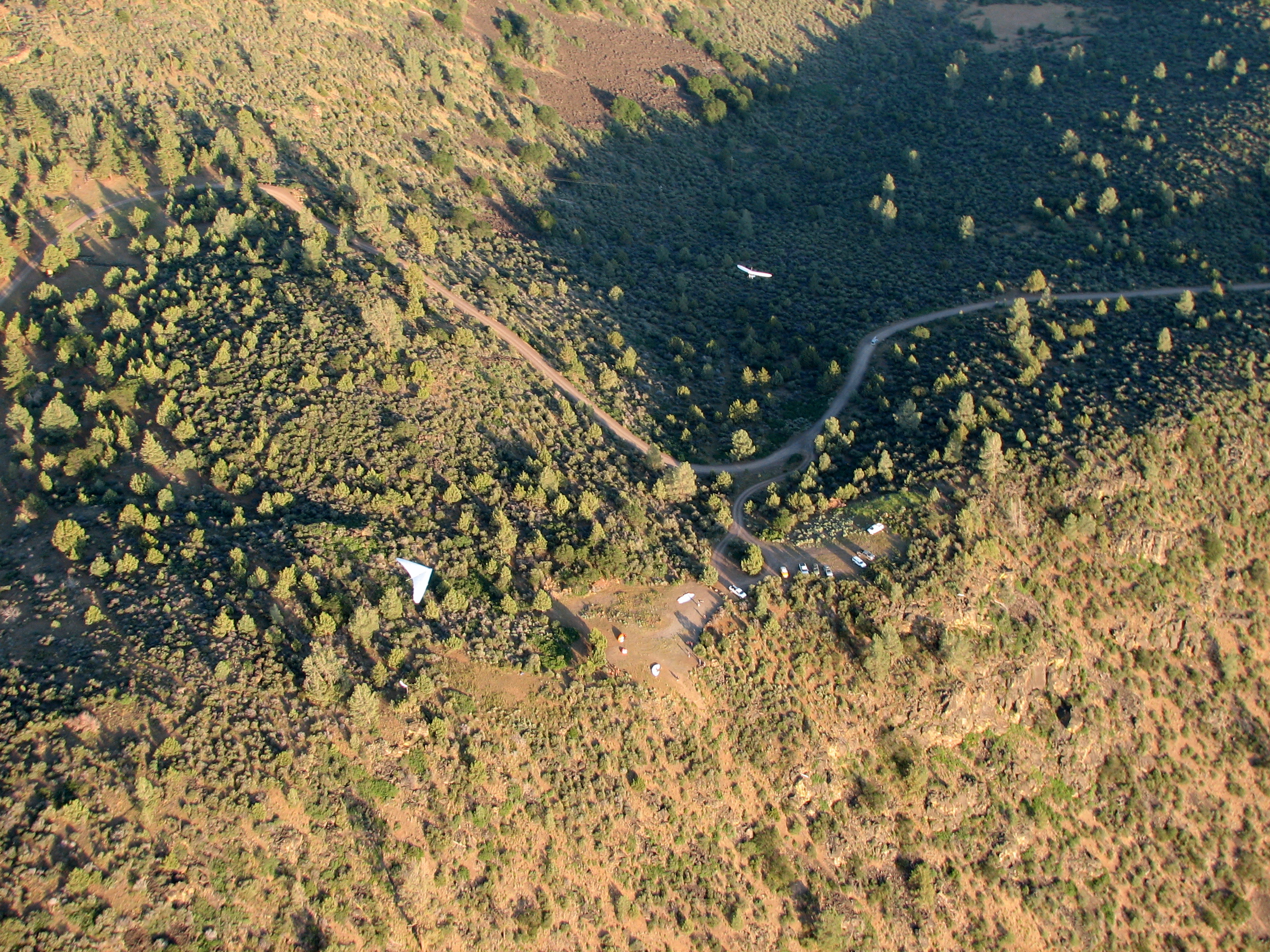
This is a view down to launch - lots of parking, a porta-potty, a now wide open space with much room for glider prep (but unfortunately not a lot of shade). Just to the left of the main launch is another steeper but quieter slope used by paragliders who don't want to wait in line with the HGs and prefer less of a peanut gallery watching.
Well that's just about all I have to share. Feel free to hit me up with question about Hat Creek Rim flying in the comments. Hope you enjoyed the site intro!
That's an epic looking ridge...................... it puts UK ridges to shame :)
I have to agree - but hey, it's America, everything is bigger, even the people! I remember when I thought hiking up to 3,500 feet at Mt Snowdon was EPIC-ly high. But hey, we have nothing like this decorating our ridges :-)
That was the way the first paraglider's pilots knew what direction the wind was going. They used the "wind barb" on the native...

Due north at 20 nuts.
LOL. If you launch now you're going to get hammered!
Hahahaha!
LOL, ancient culture............... always good for a laugh ;)