Hurricane Dorian Update Storm Surge Discussion
Hurricane Dorian Update Storm Surge Discussion
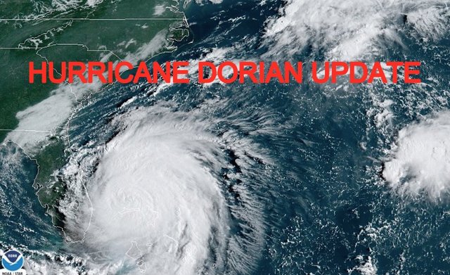
Good afternoon everyone. Hurricane Dorian has been downgraded to a Category 2 Hurricane, and I can't stress enough that while the winds may not be as destructive, the storm surge prospect has not changed. In fact, it's slow speed and extra time over open water, will make matters worse for some.
Discussion

Hurricane warnings remain for areas north of Palm Beach in Florida, and extended northward to St Augustine. Storm surge warnings remain up for these areas as well. As you head up towards the Georgia coastline, storm surge warnings have been issued, and this extend all the way into SC, then storm surge/hurricane watches posted as you head towards Myrtle Beach and northward.
Do not let your guard down because the system is weakening. Most of it is because of upwelling and less fuel available. However, all of that water it has piled up, won't magically disappear. It is on the move and onshore winds will help push all of that water in. The storm surge in some areas could be potentially life-threatening, and at minimum, will do property damage. A hurricane's biggest killer, is storm surge, not wind.
Once Dorian is truly on the move, landfall or a very close brush of near-center, will be possible somewhere along the northern coast of SC or NC; especially the Outer Banks. Somewhere up the coast, someone will experience not only the storm surge aspect, but some of Dorian's strongest winds available at that point.
The closest brush will begin to happen is it gets into SC territory; somewhere around very late night Wednesday night to early morning Thursday. By Thursday late afternoon/evening, we expect it very close to the Myrtle Beach, SC area; then off to the races towards Wilmington and the Outer Banks of NC.
Again, be guided by your local officials and OEM. They know how your specific area will handle a storm surge of this size and where inundation will or won't occur. For areas of Northern FL, GA, SC, and NC, there is still time to prepare and/or evacuate. Please head the warnings posted in your area.
Please note that with regards to any tropical storms or hurricanes, should a storm be threatening, please consult your local National Weather Service office or your local government officials about what action you should be taking to protect life and property.
Posted from my blog with SteemPress : https://www.nycweathernow.com/hurricane-dorian-update-storm-surge-discussion/