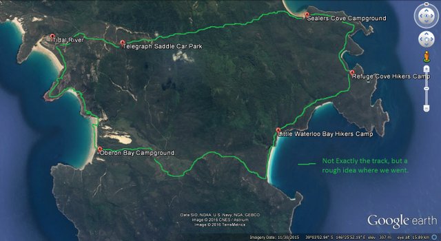
Tidal River to Oberon Bay to Little Waterloo Bay to Sealers Cove (via Refuge Cove) to Tidal River – Wilsons Promontory
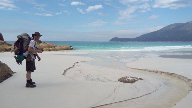
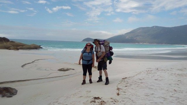
Me ready to leave Little Waterloo Bay
I’d wanted to visit the area for decades, but even though it is close to being in my backyard, this was my first time to Wilsons Promontory. It took my daughter and her partner to organise the trip, had they not done so it may have taken many more years to get there.
Wilsons Promontory, The Most Souther Point of Mainland Australia
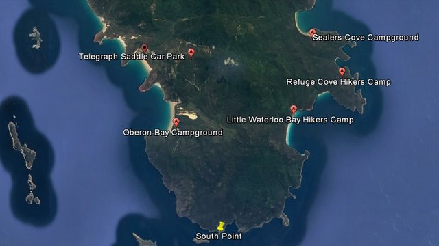
Image from Google Earth
Friday
The three of us arrived at Tidal River camp grounds late on the Friday night, set up camp, made our dinner. It was pretty windy but still nice and warm.
After dinner the other two went for a walk and I decided to step a few metres away from our campsite for a tree free view of the stars. Next thing I knew there was a noise from a few things toppling over near our tents. I dismissed it at first, thinking it was just the wind, then I noticed something having a go at our food bag. A wombat looking for an easy meal.
It was a sneaky thing. While we set up our tents it was eating some grass, giving us a false sense of security. Sneaky thing.
Saturday
After a nice 7.6 km hike from Tidal River, and with camp set up for the night, Oberon Bay offered great swimming in the waves. Beautiful clear blue water and sets of terrific waves meant some body surfing was in order although a board would have been a lot of fun.
Swimming At Oberon Bay
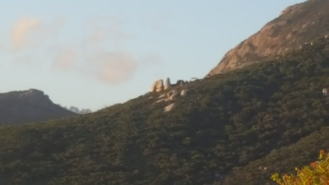
There is a lovely big nice sandy beach surrounded by great scenery at Oberon Bay. Large boulders decorate the mountains, or Hills as our Canadian friend called them (LOL) having an almost Easter Island feel about them.
Looking Like Easter Island
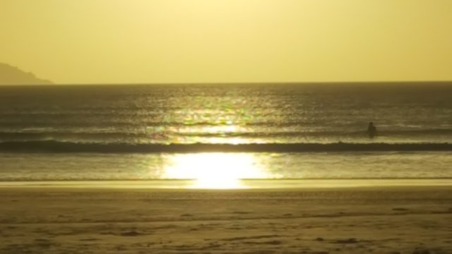
We watched the Sun set over the ocean which I posted about separately, the other day.
Sunset over the ocean – Oberon Bay, Wilsons Promontory, Victoria, Australia
Sunset From Oberon Bay
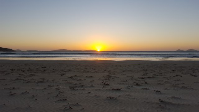
YouTube Link: youtube.com/watch?v=8smMLiH8lmY&t=14s
Sunday
Setting off around 11 am, we crossed the park over to the East side, up and down the mountainous terrain over various types of track. The reward was reaching Waterloo Bay. It’s lovely blue water and pure white sand was a welcome sight indeed.
After a short break and enjoying the beach, we hit the track once more for the rest of the hike to the Little Waterloo Bay campsite.
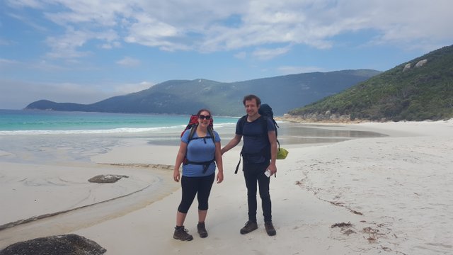
My Daughter and I - Little Waterloo Bay
My Daughter and her Partner - Little Waterloo Bay
With camp set up and another visit to the beach, we settled in for the night, enjoying a big cook up on our portable stoves.
Monday
Big hike today, just over 13 kilometres, probably the toughest hike of our trip. From Little Waterloo bay to Sealers Cove via Refuge Cove.
We had a nice break at Refuge Cove, taking time to cook up a nice lunch. We were joined by a fellow from Canada, out on holiday. He had camped close to us the night before at Little Waterloo Bay and we all got a long pretty well and our hiking team of three was now four.
My phone had gone flat by this time and didn’t get any more photos, not that I took many altogether, but it would have been nice to capture some of the views enjoyed on the way to Sealers Cove.
We made it to Sealers cove just on Sunset and had just enough daylight to set up our tents. We cooked our dinner in the dark and made it an early night for the big hike back to the car the next day.
Tuesday
After breakfast and packing up our stuff into our backpacks, we set off on the big hike back to the car park at Tidal River.
From Sealers Cove, the track is a nicely made wooden path for the first couple of kilometres. It winds through luscious greenery, tall tree ferns and over the swamps. At the end of the wooden path, the track becomes a rocky climb up into the mountains.
It was mostly uphill from there with only a few short downward paths to break up the hard work of carrying all of our gear on our backs up the rocky paths. The last couple of kilometres to Telegraph Saddle car park was a nice easy path and mostly downhill.
Once we reached Telegraph Saddle car park, the rest of the hike was a 3 kilometre walk down the road, all downhill to the car park at Tidal River.
Our Travels - (Google Earth Screenshot)
The car was a welcome sight, we said our goodbyes to our new friend and set off on the long drive home.
Photos taken using my Samsung Galaxy S6.
I hope you enjoy.

For more information about Wilsons Promontory see these links:
Visit Victoria
Parks Victoria

*Powering Up 100%*

Edited to fix links & add new signature.
wow.. I want to back packing like this
Cheers.
I can't recommend doing it high enough.
Life long memories are created getting away from everything for a while.
It's also a great feeling surviving for a few days with everything you need on your back.
Wow!! What an amazing place! :D Would love to be able to travel there one day :)
I hope you do get a chance to go.
It is well worth the travel.
Great views, lovely beaches, great walks & the stars at night are awesome.
BTW: More photos with links to full size images at http://thorhammaraxx.com/steemit/wilsons_prom_2017/